When Doug and I wanted a place to hang out in peace and quiet for a little while after the bustle of Colon, we thought –let’s try the Chagres! It’s a river (fresh water!) running through a jungle, with not too difficult an entry in the right conditions, just around the corner from Colon and all its associated activity, Panama Canal, and otherwise. As usual, I liked it hugely. I’d still be there if Doug hadn’t insisted on leaving, and everything we own would be fresh-water clean.
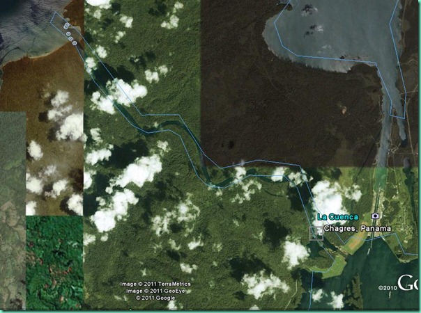
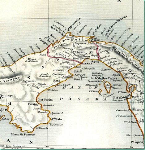
This Google Earth image is pretty choppy, but you can see the Rio Chagres outlined in blue and running diagonally across the page. Maybe it looks better on a decent-sized monitor? The mouth of the river and Fort San Lorenzo are top left, the dam and spillway and lake at bottom right, near the set of three locks. Just off the top center of the image is Shelter Bay Marina and off top right, the main breakwater for the canal anchorage. From the old map (courtesy of inadiscover.com) you can see what they had to work with in the beginning. Reminds me a little of some of our charts, especially the typeface.
gGOOGLE EARTH, HISTORIC MAP
When the Panama Canal was built, it was this river that was dammed to enlarge Gatun Lake and ease the transition up ?85 feet? from the Caribbean side. In fact, I’ve read that Chagres is the only river with outlets on both oceans, although I think that’s counting using the other set of locks as egress. It was the major highway for the Spanish conquistadors moving their treasure from the Pacific side to the Atlantic. When Henry Morgan the pirate went to Panama City to raid Spanish coffers, it was the Rio Chagres that he used as a highway. Later on it was something of a short-cut for those seeking, and returning from, the California Gold Rush. I imagine there was a good deal of rowing involved.
Now that we’re here, however, things have calmed down considerably. We entered at Fort Lorenzo and eventually motored all the way up the more=or-less consistent-width channel to almost within sight of the Gatun Lake spillway, about six miles away, 30 or 40 feet deep all the way. During our entire stay we saw one handful of local fishing boats and pangas, two yachts up at the end, a fast-flying flotilla of military persons, 2 men on a trail, and that was it – way more monkeys than people inhabit the river I saw. It’s all protected park land; if you can believe what you read online it is protected because they need to conserve as much as possible of the 200+ inches of annual rainfall for lock operation. They’ve learned that water just runs off from the developed land. The new canal, by the way, is being cleverly engineered to conserve its water; a good thing, because every locking of the present canal uses 52 million gallons. Or something like that!
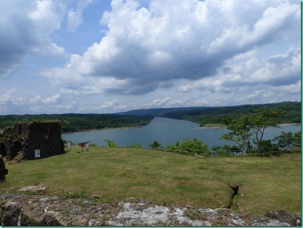
Here’s how the Rio Chagres looks from the fort, San Lorenzo, which the Spanish last re-built around 1750, to protect the treasures it was attempting to remove from the continent. The US fortified it during World War II to protect the Canal. These days it’s just the usual semi-inscrutable collection of cannons and ruins, weed-whacked to blankness. We pedalled up here from Shelter Bay Marina on our bicycles one morning and later had a joyride downhill toward home, plus howler monkeys, frogs spawning in puddles, free ice-cold water from a cruise-ship tour bus, and a little overheard rifle-range practice. This land was once, (?from the 1950s?)in the US era, and apparently still is, used for jungle combat training.
PHOTO LOOKING UPRIVER FROM THE FORT
To the left, there’s a dock with road access, popular with fishers. Partway upstream, and well inland, you can (with super zoom, maybe) see the top ‘bar’ of a big crane, which is said to be part of the Smithsonian’s jungle canopy research project. Too bad we couldn’t figure out how to get there by foot. From the river the bushwhacking required looked very intense, even if you could keep track of where you were and were going. (no GPS satellites pierce the vegetation)
Although, I gather that once you find the rainforest proper, the understory is actually clear, even airy, with the bulk of the activity in the canopy. This from a book I’m reading and enjoying, Tropical Nature by Adrian Forsythe, available in Kindle format, and recommended for anyone near Central American tropical forests.
We anchored near the fishing dock for a few hours. Doug wanted to check out the wreck on the beach just outside the river mouth.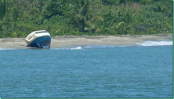
PHOTO REMAINS OF CIELO ON BEACH
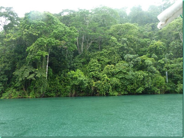
This wreck dates from December 2010. There was so much rain here at the end of the rainy season that the Panama Canal was actually closed to traffic for a day or so, for the first time ever, I gather because of the amount of vegetation in the water. (By comparison, this pleasant little rain shower wasn’t even a drop in the bucket, but the monkeys always howl when they start to get wet.)
RIO CHAGRES RAIN FOREST IN RAIN
The Canal Authority sometimes lets excess water out the spillway, first sounding a siren to warn the fishermen who congregate on the rocks and shoals immediately downstream. This wrecked boat wasn’t flushed all the way downstream by spillway water, but I gather he was either anchored or trying to anchor at the mouth and just couldn’t withstand the forces against him. Doug took a few tools just in case, but the boat has been neatly but very thoroughly stripped.
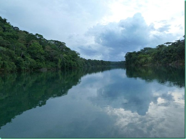
We spent a couple very pleasant days where the river makes a ninety-degree turn and we could have views in both directions.
RIO CHAGRES DOWNSTREAM VIEW
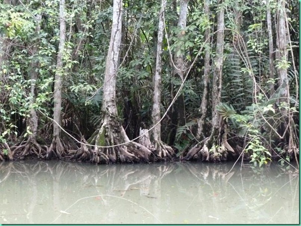
By dinghy we explored several little streams that meandered in from somewhere, looking for the one with the waterfall, but the pleasure of that was in the search, not in the realization.
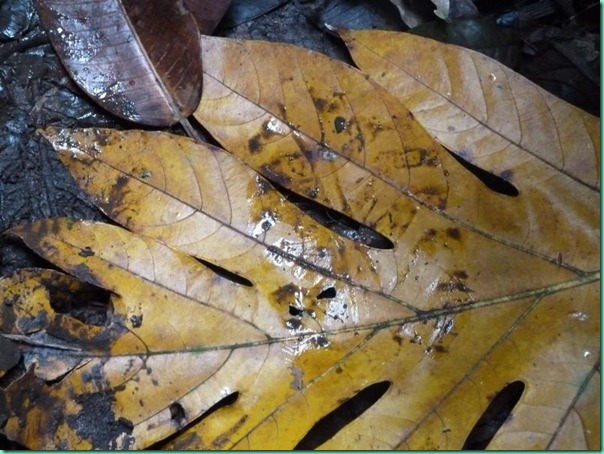
CREEK BUTTRESS ROOTS
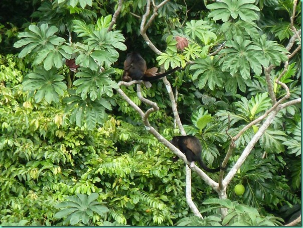
This corner was popular with cicadas and/or frogs (hard to know what we were listening too, but it lasted all day!), howler monkeys and shrieking lorikeets; very occasionally we could hear a discordant ship’s horn from the lock or lake a couple miles off.
HOWLER MONKEYS IN BREADFRUIT TREE
Needing to make a parts order we eventually went up to the end of the river ourselves, where there were two other yachts in residence. Having heard of theft issues at the little public landing, we rowed the inflatable there, and we did notice that no one left motors on their boats, and that the boats themselves were heavily chained and locked. So the dangers of the rainforest seem primarily human. Also, from the end of the river the soundscape was a little less ‘jungly’ and more along the lines of very occasional dumptruck tailgates bouncing and buses without mufflers, plus there was the sodium vapor loom of the lights of the Gatun lock.
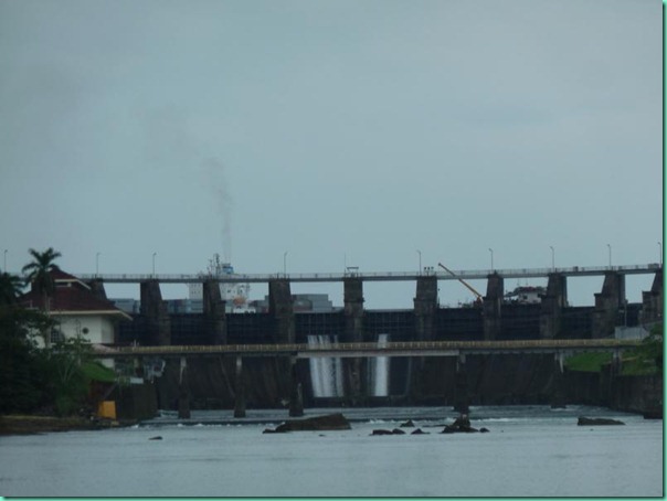
GATUN SPILLWAY DAM CONTAINER SHIP REPAIR BARGE HIGHWAY BRIDGE ROCKS
However from the dam end of the river we could have taken a bus back to Colon, only a few miles away, for supplies! And I actually did communicate with the outside world briefly: I sat near the side of the road (actually, in the parking lot of the defunct Tarpon Restaurant – there are tarpon in this river too – we saw scales as big as my palm in some fishing places). My laptop was on my knees and the cell phone modem dangled from a branch, with the two bars of service I needed to order some boat stuff for ocean shipment from Florida to Panama City. I’m still giddy at being able to do this, but need to remember to check for ants before sitting or leaning on anything! And I apologize to anyone whose email I should have answered right then and there…it was the ants!
No swimming because of the one crocodile I saw one time, but it was BIG. When the climate got hot and breezeless, Doug poured buckets of water on himself; I have a big sponge for controlled dribble.
We went for a hike on a trail that turned out to be the remains of a railway built by the French at the end of the 1800s in their unsuccessful canal-building attempt. It was level and may have gone all the way back to the river mouth, but we didn’t go that far, thinking we’d be unlikely to notice any difference in landscape between here and there. There was plenty to gawk at already!
My ongoing reorganization scheme will eventually lead to some online albums, but for now, I’ve got to get caught up with places we left a month or more ago!
Isn’t the Chagres a wonderful place… Where do you go to next?
Watch out for those ants!