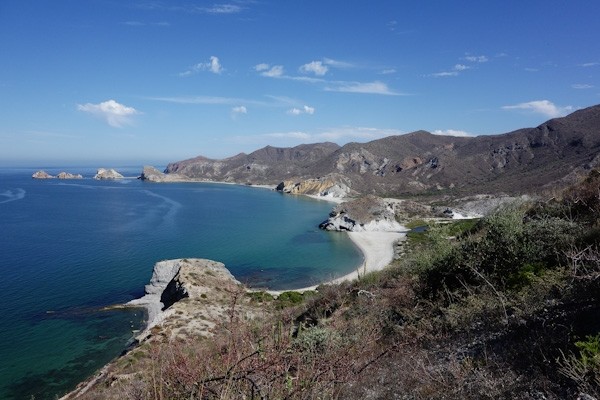
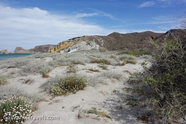
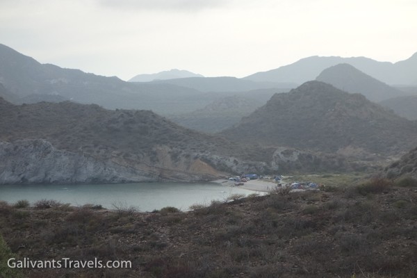
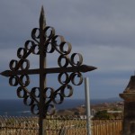
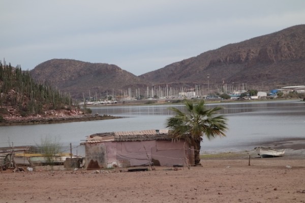
One of the nicest places we sailed to in 2015 is the bay called San Juanico on the Sea of Cortez. On the chart it’s also called Punta San Basilio and lies about 26 22 N, 111 25.7 W, halfway up the Baja California peninsula. This is not to be confused with San Juanico the surfer/fisherman town at Scorpion Bay on the Pacific side. Please see the Photo Gallery at the bottom of this post – more pictures than words this time!
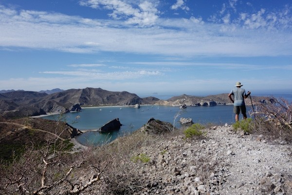
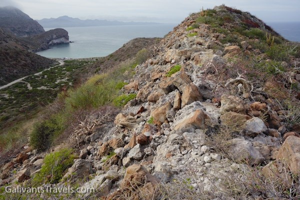
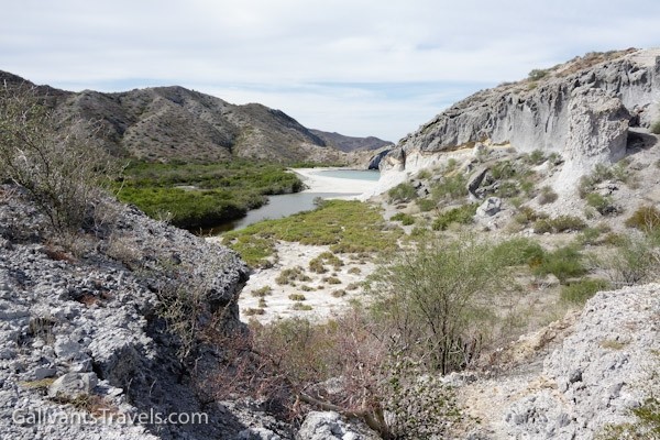
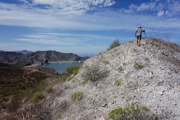
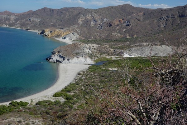
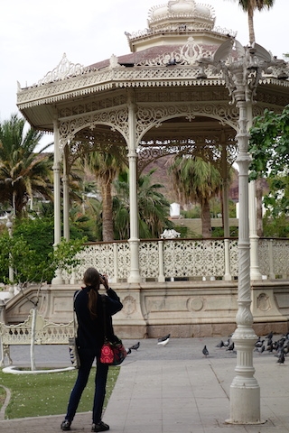
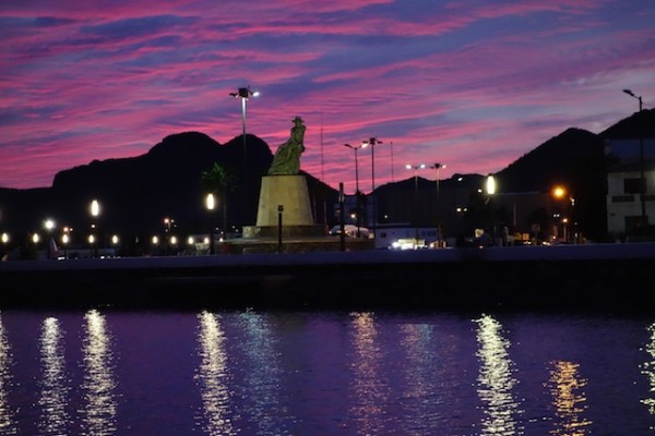
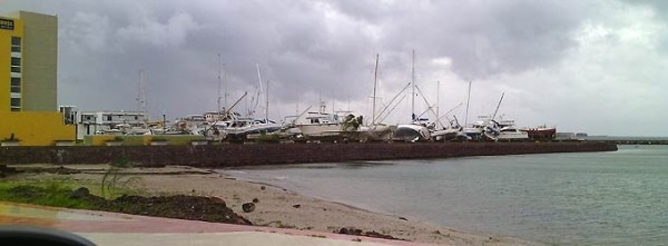
Looking north over San Juanico bay and anchorage from the ‘ridge trail’ above the south shore.
Squint or zoom and you’ll see a couple of empty houses on the far shore, fancy by some standards (swimming pool!) but realistic in terms of the ten or fifteen miles of dirt road that separate this spot from the highway, and the thirty or so beyond from Loreto, the nearest town.
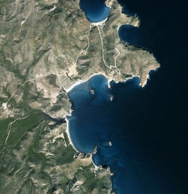
Here’s how it looks from the sky, courtesy of Google Earth.
San Juanico by Google Earth. The houses are where the dirt road comes in from the north. The main estuary comes in about 9 o’clock and the ranchito, a small estuary and the ridge trail about 6:30.
You might see a couple of RV or pickup truck campers on the beach. Only the relatively intrepid people make it this far. The smart ones come year after year and stay for weeks on end, driving out occasionally for water and supplies. It’s muuuuy tranquilo here.
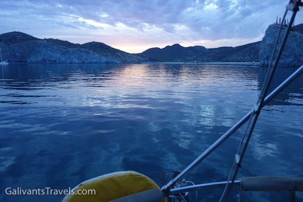
But for the most part San Juanico is visited by boaters like us. It’s one of the better anchorages, with protection from the prevailing winter northwesterlies and the summer southerlies. Although, I can testify that an uncomfortable swell can and does roll in around that northeast point when the winter winds are up.
You can walk along the roads, or on some trails along the estuaries or atop one of the ridges. If you try to walk all the way to the highway (and don’t bake or desiccate first) you’ll pass a small encampment where a family sometimes has vegetables to sell. We also heard of a place with petroglyphs but never stumbled upon it. Maybe next time…
Between the hikes and the beaches and excursions by dinghy for fishing and whale-watching, you won’t even notice that there’s no word from the outside world. It’s as distant as the occasional con-trail overhead.
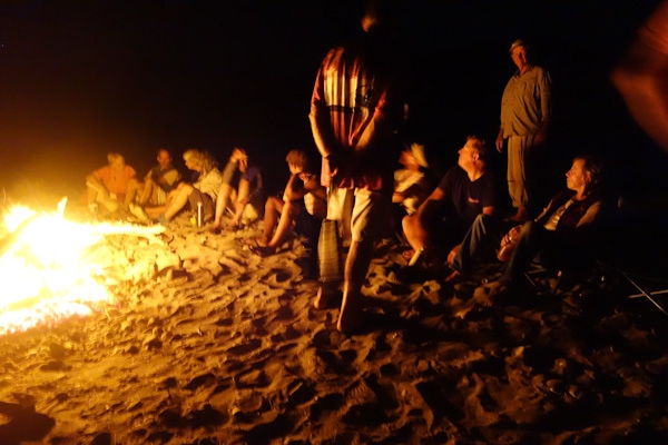
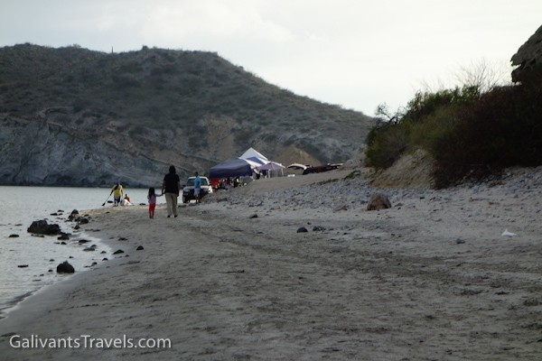
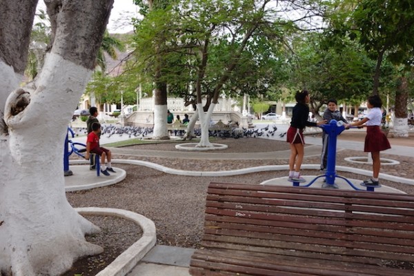
Our second visit coincided with Easter week, Semana Santa. The handful of RV people had gone back north. They were replaced by Mexican families, from Loreto and beyond, celebrating what must be the biggest holiday week of the year. Fishing, popup sleeping tents, shade tents, kids playing in the sand, it was all great to see.
By the end of the week they too were gone.The beach again belonged to the seagulls, the bay to the yachts moving north toward their summer homes.
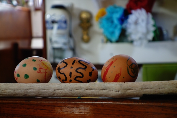
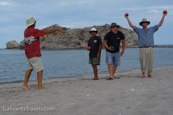
Easter eve beach campfire.The cardon cactus has a wood-like frame, and stands in for driftwood.The Easter Chicken visited Galivant.The bocce champions.
San Juanico Photo Gallery
So without further ado, let’s look at some pictures of the bay and the land around it.
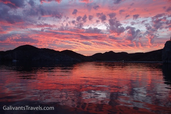
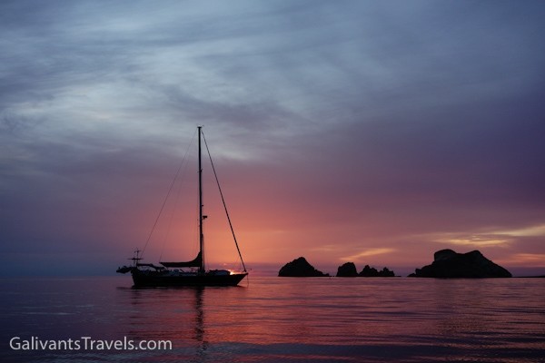
Sunsets have endless variety. Cool…
to vivid.
Sunrises also nice.
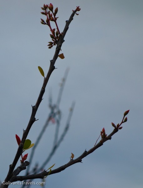
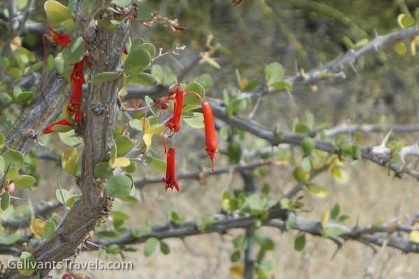
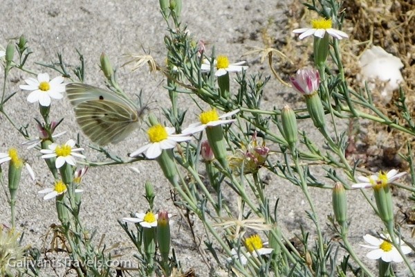
Flowers in surprising places.
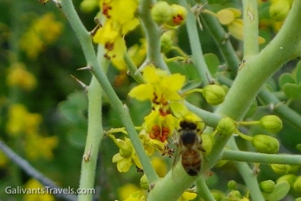
Honeybees love this yellow flower.
It’s a picture of the butterfly, but aren’t the flowers nice too?
Portrait-worthy still lives everywhere.
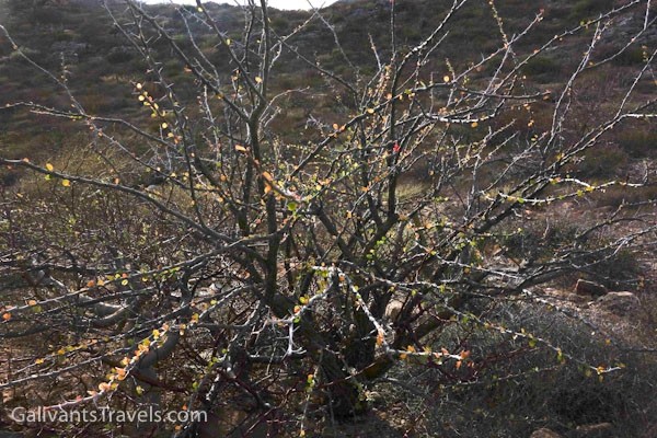
It’s a tree, a cool looking tree, with a name. But I don’t know it.
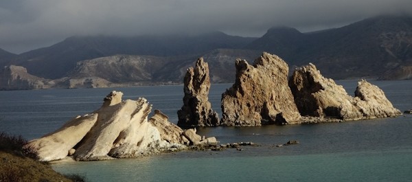
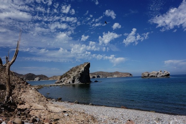
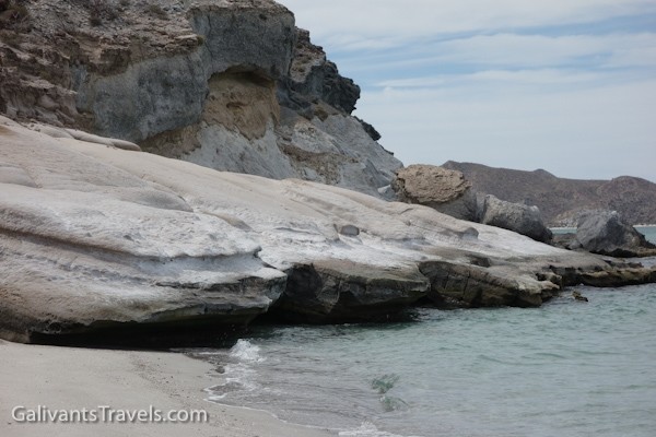
A rocky ridge overlooking Playa Ramada, Punta Pulpito on the horizon.
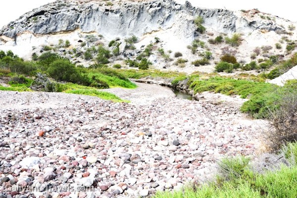
Behind the south side beach, the arroyo is stony with a small wet pool and a bright white cliff. Here we saw a long skinny snake chasing a gecko, until they saw us and both vanished.
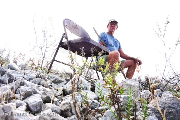
Mirador Rober even has seating. My chair is empty because after several attempts at self-portraiture, I realized I still had titanium dioxide on my nose and lips.
Estuary goes further inland than we went.
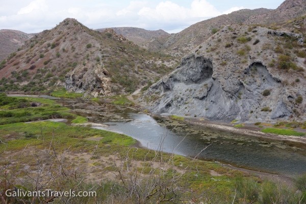
An brackish estuary behind the beach.
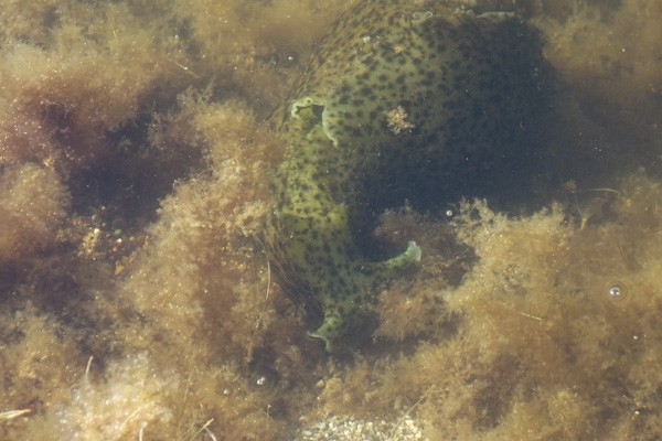
Whatever this is (?sea cucumber family?) lives in the estuary and grazes on the vegetation with enthusiasm.
The estuary again.
Low tide, Galivant in the background
Looking north over San Juanico bay and anchorage from the ‘ridge trail.
A spot on the ridge trail where something has fallen away. We started a new trail about ten feel inland
South side.
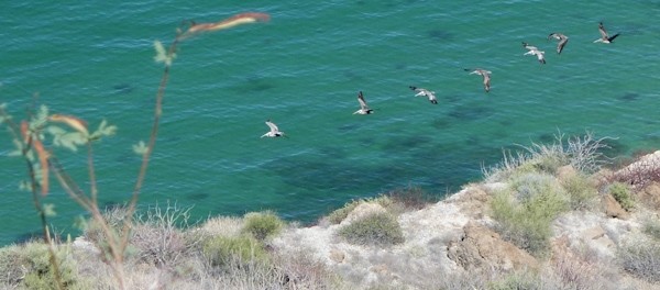
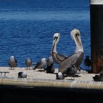
A line of pelicans coming in for a landing.
A small eroded hill on the edge of an arroyo
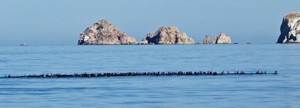
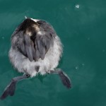
Raft of, I think, eared grebes. We saw the dark shape of this shoal of birds from up on the hill as it shifted around. The formation always stay tight, but the color would shift as they dove en masse. Back down in the dinghy we went to check them out.
I always let Doug go first to roust up the rattlesnakes, if any.
Better without a caption!!
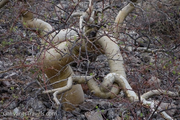
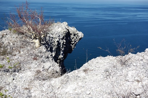
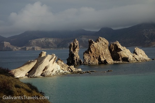
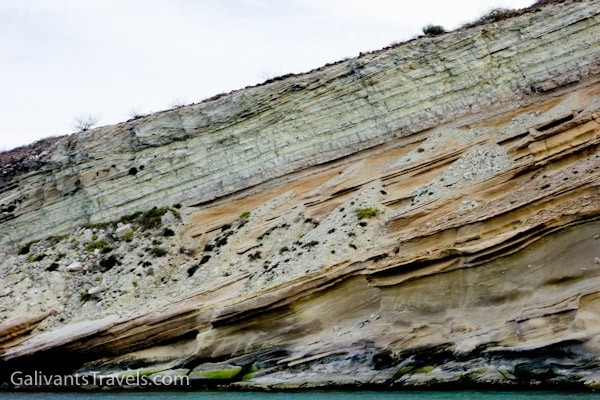
A lot of geologic movement has taken place on this coast over the eons.
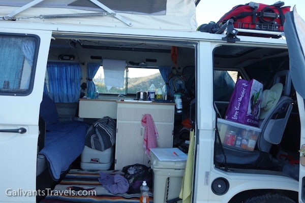
Inside a VW camper.
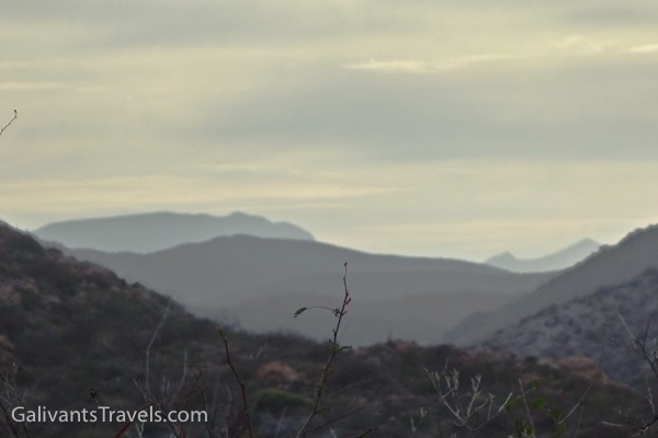
Mountains upon mountains into the sunset. Hard to imagine that anyone has ever been to some of them.
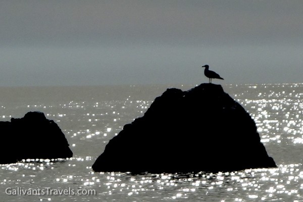
Seagull in silhouette.
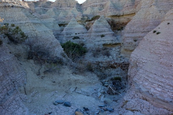
Rock strata and erosion piles.
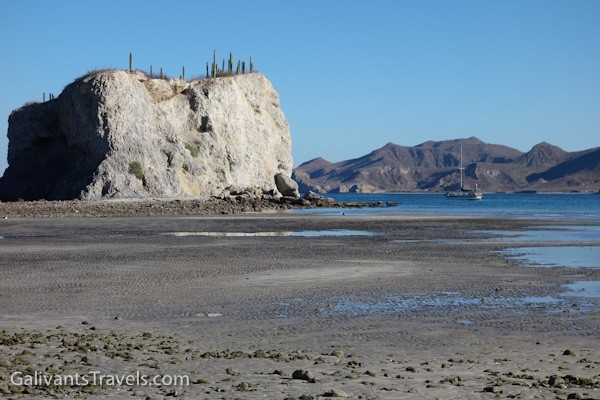
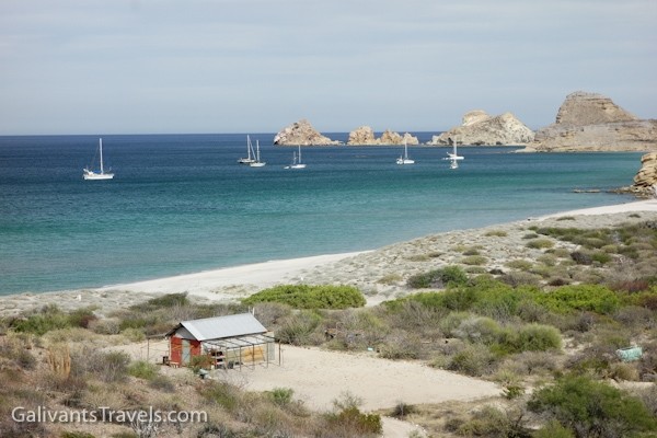
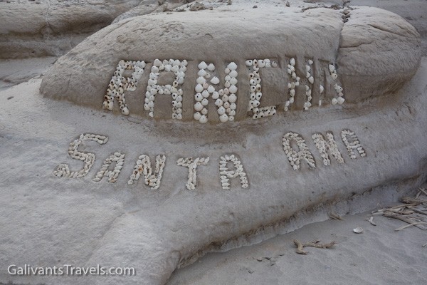
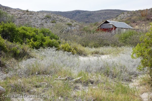
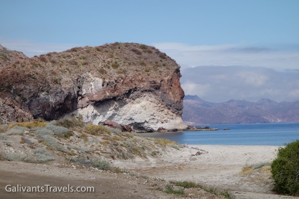
Ranchito Santa Ana and the south-side anchorage
What a nice sign! The shells are nailed into the ?sandstone. Making use of the materials at hand.
Along the dunes at Ranchito Santa Ana
Ranchito Santa Ana
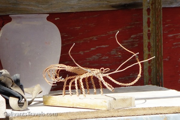
Wire lobster on the shelf outside the ranchito.
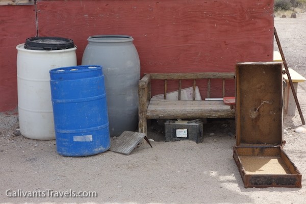
The essentials of life off the grid.
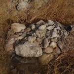
Rock formations redux.
The headland on one side of Playa Ramada.
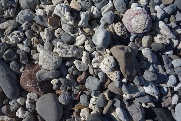
No sand on this beach, just stones, plus some old coral from a previous geologic age, eroded down from one of the many curious layers.
The smaller estuary and the arroyo beyond.
Newly graded road comes here. What next?
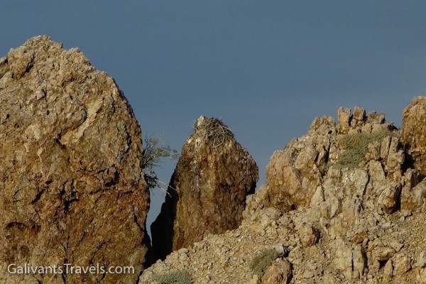
Ospreys nest on the pinnacles.
Semana Santa brings happy families to camp on the beach.
Looking roughly SW across the bay.
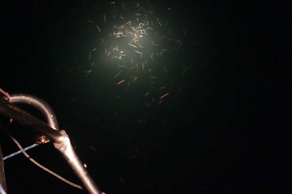
What we see in the water at night.
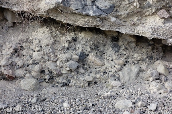
The little black dots are obsidian, very sharp volcanic glass, also known as Apache Tears.
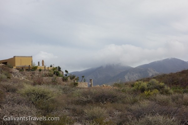
Whoever might live here will really enjoy the ever-changing views.
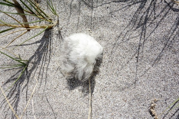
The skin and feathers of ?eared grebe. We saw several of these, no bones, no guts, just clean dry feathers and skin blowing along the beach. What eats the rest?
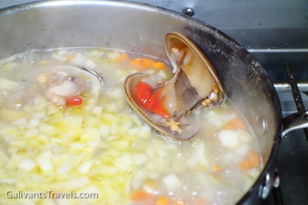
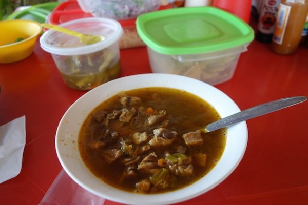
Chowder with fresh-caught ‘chocolate’ clams.
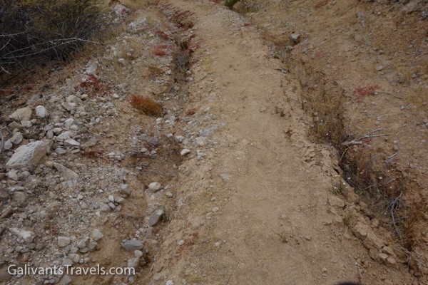
Rut Road! When it rains, it sometimes rains torrentially. When these roads become impassable, they stay that way for a while.
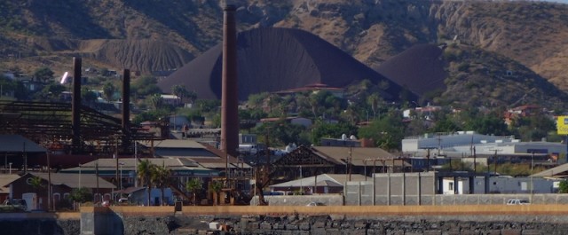
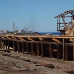
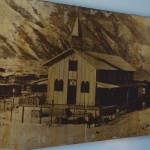
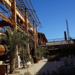
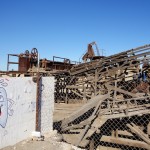
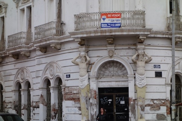
Santa Rosalia is unusual among the towns of Mexico, because it was designed and built from scratch, mostly from wood, more than a century ago, by the French, specifically by the French mining empresa Compagne du Boleo. Plus, all the mine’s industrial buildings were right in town. And they still are, deteriorating scenically to this day. For some reason, century-old dereliction is more appealing than the modern type.
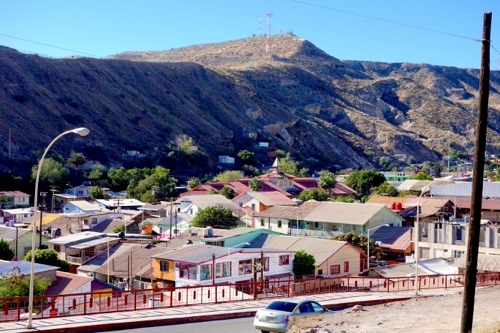
From up on the Mesa Frances you can look down on the entire town.
The Compagnie du Boleo to Minera Boleo
The story is that a local rancher, José Villavicenio, found a “crumbly blue-green rock” which assayed out to very pure copper, a boleo.
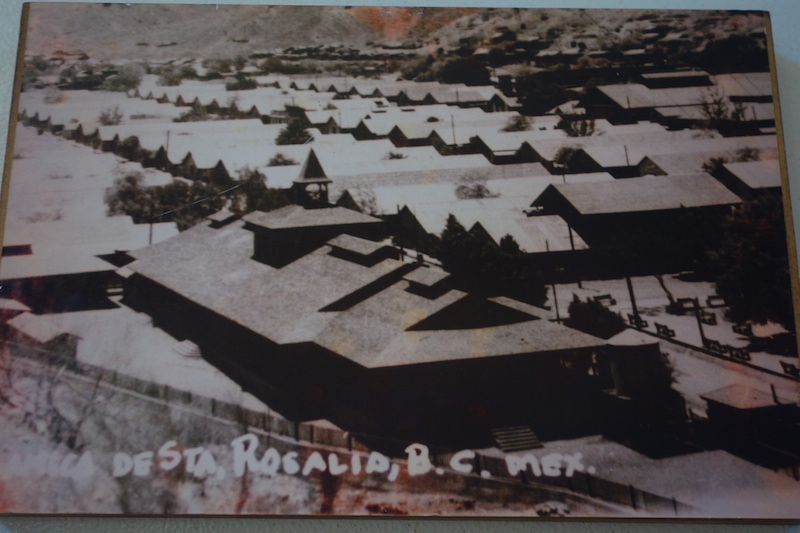
Housing for the workers was built in the arroyo, while the mine officials lived on the plateau above, called the Mesa Frances
So, with the encouragement of the Mexican government, the Boleo Company created the town of Santa Rosalia out of nothing, and brought in 6,000 souls to run the port, smelter, railway, and mines.
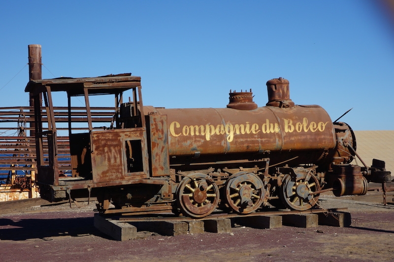
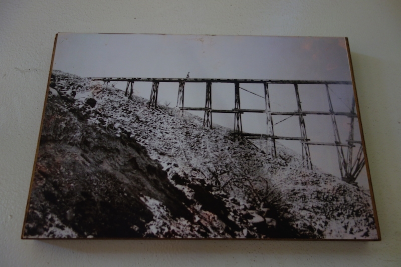
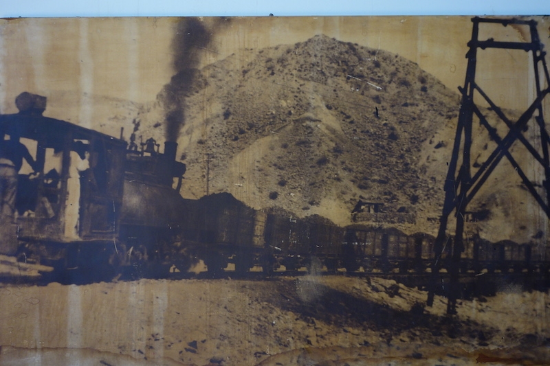
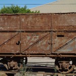
One of the seven original locomotives. Old machinery and ore cars can be found in various places throughout the town.
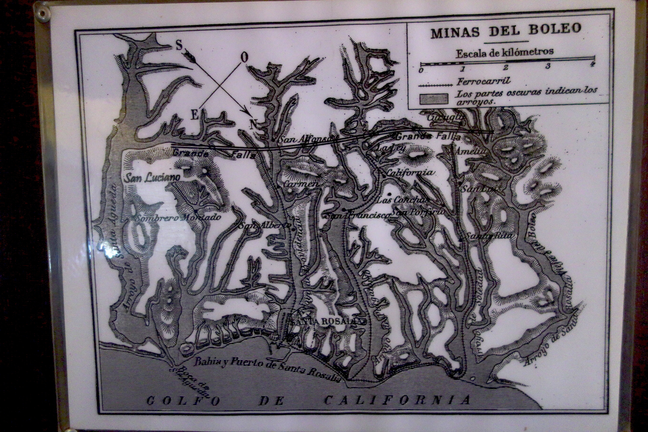
There were numerous tunnels in the four arroyos.
Mining took place in four arroyos, named Inferno, Purgatory, Solitude and Providence, the arroyo where the town was located. (An arroyo is a steep-sided gully cut by running water in an arid or semiarid region.)
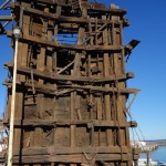
A slowly collapsing tower ?for loading? dominates this corner of the waterfront.
By the way, most of this quick overview is based on the writings of Graham MacIntosh in his entertaining book Journey with a Baja Burro written in the late 1990s, and Joseph Wood Krutch, The Forgotten Peninsula, published in 1960, and on the reader boards at the Boleo Museum, which were not in any way improved by my sketchy translations and imperfect memory of them.
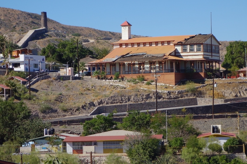
Compagnie du Boleo headquarters, accounting offices and storeroom, now a museum.
Eventually there were 370 miles of tunnels and 25 miles of railroad track, 7 locomotives I think, and over a hundred ore cars.
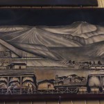
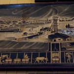
Timber bridge over arroyo, courtesy of Boleo Mining Museum.Locomotive and ore cars courtesy of Boleo Mining Museum
The company closed in 1954. Wikipedia says a government-owned company took it over and ran it with the original technology (!) until the 1980s, when it just became too impractical.
In addition to interesting-sounding mineral-ites, “even turquoise”, MacIntosh says there are old dolls, miner’s lamps, broken pottery and the like lying around settlements that existed at some of the mine entrances. We started out on our bicycles for an inland excursion, but between a surfeit of rocks and ruts on the dirt roads and a deficit of space on the highway, we gave up.
Nowadays there is a Korean-Canadian consortium ramping up for renewed production of zinc sulfate, copper, cobalt and manganese. In early 2015, we heard that operations had finally commenced on an open smelter several miles north of town. The proposed underground operations have perhaps hit a snag or two, but hiring is taking place.
The gist of the sign is that if you’re interested in working at the mine you can attend a 2-day presentation. The first day explains what goes on in the underground tunnels. The second day they take you to the tunnels and show you around.
Surely conditions will be better than those for the workers at the turn of the century.
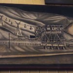
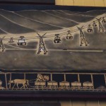
This is fourth panel of a nice four-part mural at the Boleo Musem. The others are in the gallery below.
In addition to conditions in the tunnels, somewhere I read that between 1900 and 1910 some three thousand lives were lost because of gas explosions and poisonous vapors from the smelters.
Another dawn for the deteriorating industrial buildings along the waterfront, most of which have been there for at least a century. Connecting the two chimneys you can see the ‘Great Wall’ of Sta. Rosalia, an on-the-ground chimney built to move noxious smelter fumes away from town ..
In an attempt to solve this problem, an “extension chimney” was built from the smelter downtown to a new chimney higher up.
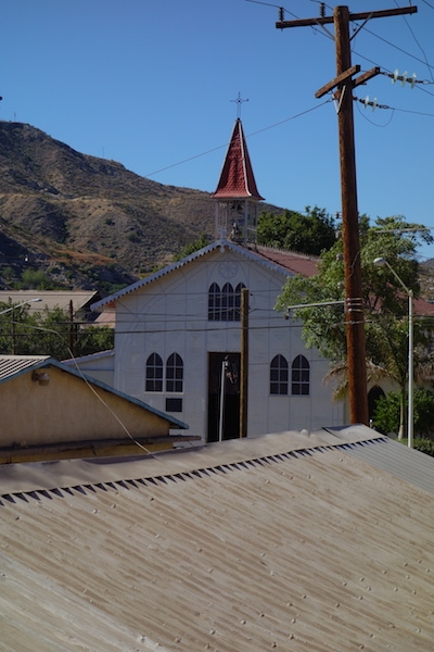
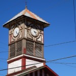
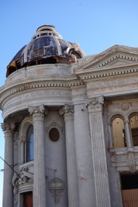
Church, named for Santa Barbara, reputedly designed by Charles Eiffel of the Paris Tower fame, prefabricated in Europe and assembled in place.
An often-mentioned attraction in town is the Eiffel (as in Tower)- designed church, remarkable perhaps not for its delicacy and grace, but for its prefabricated utility. The story goes that the women of town wanted a church; a mine official found this one languishing in a warehouse somewhere in Europe and sent it over. I like that it is named for Saint Barbara, patron saint of miners. And Santa Rosalia was a religious hermit who lived in a cave on Mt. Pellegrino, Palermo, Italy, and died there in 1166.
No one comments so much on the beauty of the design as on the curiosity of the structure.
Meanwhile, in today’s Santa Rosalia, home to almost 12,000 in the 2010 census, many of the accommodations built for the workers still exist, including the Mutualist Progressive Society and a nicely sky-lit market. There is a ‘celebrated’ French bakery, but the bread, sadly, is not French. Government agencies seem to have appropriated the nice wooden bungalows of the managerial class in the Mesa Frances, while down in the arroyo some of the wooden houses have grown comfortable under the shade of a surprising number of trees.
I’ll bet all this shade is welcome when the heat of summer comes around.
There has been architectural ‘re-muddling’ of course, but also some maintenance sensitive enough to pattern the new concrete walls to match the former wood siding. There is also some curious re-roofing that looks like sprayed on closed-cell foam with a heavy coat of paint for sun protection.
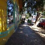
Side street in old town
Hurricane Odile
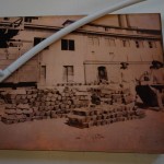
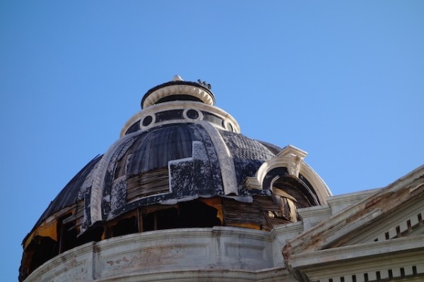
It was the mine office, now the museum, and victim of Hurricane Odile. That’s the “Great Wall” climbing towards the chimney on the hill.
Hurricane Odile, September 2014, lifted a number of roofs, including parts of the Boleo museum. And it killed the Korean manager of the mine and his assistant when their car was carried by a torrent of water into the harbor.
Another casualty was one of the two marinas in town. By all reports this place was ‘funky’ and nearly derelict, but ‘fun’. But to the distress of the half a dozen or so boats tied there when Odile’s winds and rains came through, the docks broke apart, pilings broke or crumpled, and not a boat went unscathed.
An especially sad story is that of Gold Eagle, formerly a well-tended wooden 1977 Murray Peterson schooner.
It must be heartbreaking for the owner of this vessel, who spent years in its restoration, to be faced with this now.
There is a campaign to raise funds and help him get the boat to a better situation, such as a place where repairs could proceed. If you Google around you’ll find more about the troubles he had even after the storm. https://fundrazr.com/campaigns/5ssRf
Gold Eagle aside, Santa Rosalia felt like a reasonably prosperous place. There was traffic, often consisting of late model pickup trucks. There was a gym with people exercising, a store selling clothes for dogs. There were even a couple ‘fancy shops’ selling things like lamps and other home decor items, and stylish clothing.
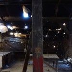
Entropy in Action
It’s perverse of me I know to admire the aged and falling-down industrial plant. I can’t recognize what anything was, but I like the big pieces of lumber, the lacy roofs, the rust, the skeletal frame remains of ??? – all so atmospheric. I’d like to integrate it into a cool hotel. It would take a billionaire, I guess, an interested and well-connected one, and a town that needed such a hotel. In the meantime, I guess it will just sit as is, awaiting developments.
The breakwater was originally made from mine tailings, but has clearly undergone many changes.
The ferry between Guaymas and Santa Rosalia runs a couple times a week, an all day or all night trip, There are passenger cabins and space for cars, but not too many, I’m guessing.
The other Santa Rosalia
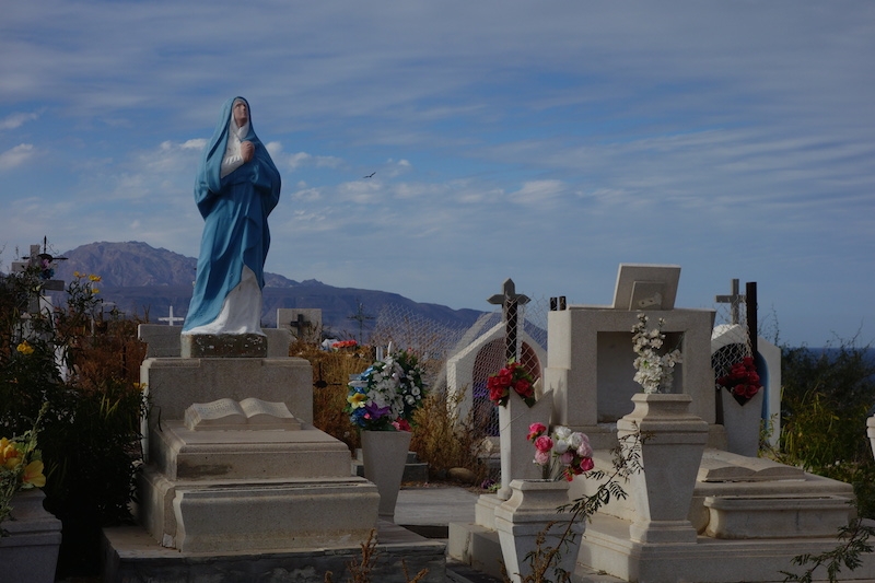
No visit to town for me is complete without a visit to its shadow town, the cemetery. I was looking for graves of some of those thousands who died in the mine’s early days, but there were none, at least none with headstones.
The cemetery in Santa Rosalia is above the town on a mesa overlooking the sea. I’m not sure if this section is older, or just poorer. In the distance, San Marcos, an island where gypsum is mined.In Santa Rosalia there is a large cemetery atop the mesa opposite the managerial Mesa Frances, with a variety of tombstone styles.
We did meet people who disliked Santa Rosalia. For one thing. apparently the town dump is on the main highway, the first thing you see coming by road. Not everyone is a fan of falling-down mining equipment. However, for me, I suspect that when I finish with Baja California I’ll still agree with Graham MacIntosh, who finds Santa Rosalia to be its most interesting town.
Well, what do you think?
Here’s a gallery of photos that didn’t fit into the post. More to follow perhaps. I’m also still working on the map plug-in, but for now, Santa Rosalia is about halfway down the Sea of Cortez side of the Baja California peninsula.
Copper ingots for shipment to Guaymas and points beyond.
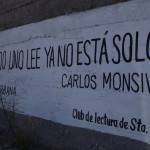
The Club de Lectura has posted aphorisms like this throughout the town.
I think it’s an eared grebe, sleeping.
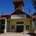
A nice town library, though not too many books. When I asked why Mahatma, the clerk tapped her head to indicate that he was very ‘mental’.
From our sailboat-centric point of view, Guaymas has a lot going for it, despite a relative dearth of ‘pretty’ or ‘colonial’ or ‘quaint’. The Snapshot Gallery at the end of this post may tell you more about the Guaymas that we have come to appreciate and feel comfortable in.
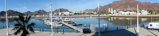
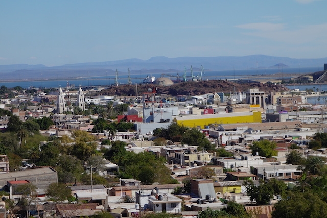
View over central Guaymas towards the port
It’s a working city with plenty of parts and services, if you can make do with not-yacht stuff. And if you can’t, well, shippers deliver to Arizona, only a few hours/250 miles away on the Tufesa bus. I would say it is also a city of entrepreneurs and small businesses, some rising and some waning. As befits a port city, there are numerous skilled mechanics and welders and machine shops lurking behind those unmarked doors.
Probably you could have anything done, if you could find someone to tell you where to look. Can’t get the right sized zincs? The guy at the foundry down the road (really? there’s a foundry there?) will custom mold them for you this afternoon. It’s another advantage of being in a place with a fishing fleet, with people who both know how to do things, and how to improvise. You just have to be clear in your mind what you want.
A Thumbnail Sketch of Guaymas
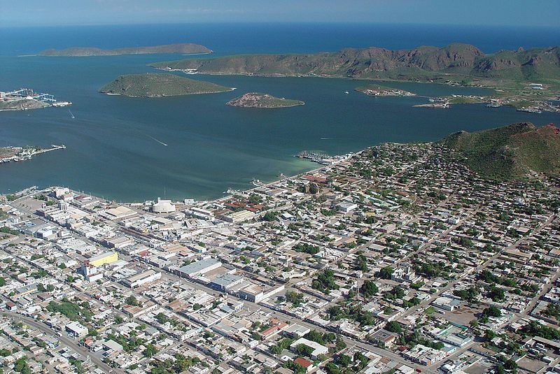
The downtown Fonatur Marina and the main port are just beyond the left end of the picture, and the shipyard Guayma Marina Seca, to the right, but you get the idea, I hope. Photo courtesy of Wikipedia-Guaymas-Sonora.
One thing that makes Guaymas tick is its port, the main port of the state of Sonora. The port serves a fishing fleet; the fleet serves some canneries, and of course seafood is on the menu everywhere. Ships move Pemex (the government oil company) products around, bring in coal for the power plant, trans-ship grain and other agricultural products, plus copper, gypsum and other extracted resources.
Googling around I find reference to potential port expansion, and hopes of closer commercial ties with Tucson and beyond using the existing rail line and more containers, plus a plan for Guaymas to take up the slack as California ports suffer from overcrowding. The harbor will need some dredging in spots but it has a fine natural location.
Guaymas is also touted as a city with a manufacturing tradition, and its backers are proud to mention an industrial park, Roca Fuerte, as a “better choice for offshoring than China”. They mention competitive pricing, that location again, and strong connections with the local community, leading to low rates of employee turnover and absenteeism.
On the outskirts, as the highway north goes through town, you’ll find what you find everywhere these days, the chain store sprawl zone, albeit in somewhat smaller boxes. Walmart, (and the Mexican supermarket chains, Soriana, and Ley), Autozone, Home Depot, Burger King, McDonalds, they’re all in a jumble out there. On my personal map of north Guaymas is the ice plant, just before the airport, and the turn off that will take you on the back road along the water, or the road via Miramar, if you want a more natural view.
A very short and possibly inaccurate history
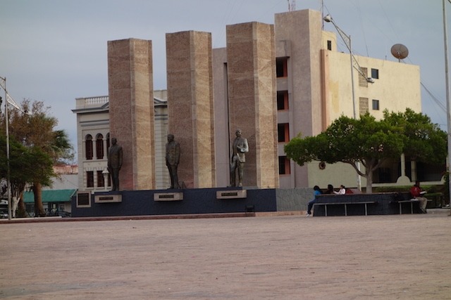
This area was first explored in 1539 but it sounds like there were only occasional small settlements, for example, in 1821, “one house, occupied by a thief.” Then the pace picked up, to the point of battles with Americans in 1846 and French in 1865-66. Mexico’s history is complicated, and told by those, generally, who won, or at least lived to fight again. But three of Mexico’s presidents did come from this area, and are memorialized in a large, and largely empty, plaza near the waterfront, centro and marina.
Three of Mexico’s presidents were from this area and are memorialized here. It’s a wonderful public space but seems for some reason underutilized.
In the late 1800s…
A monthly steamer visited from San Francisco, and “quality goods” came from Germany. [Don’t they still?] I’d like to know more about this German connection. The mayor of Guaymas has a German name. And the music all over the country sounds like Bavaria, full of accordions and tubas and a yodel-y, oompah, polka-ish sound.
Wikipedia tells me that there were a number of Catholic Germans in Texas who sided with Mexico during the Mexican-American war of 1848 and resettled in Mexico afterwards. The Emperor Maximilian I brought in some German settlers around 1865. Later President Porfirio Dias and the German Prince Otto von Bismarck conspired to bring more Germans, mainly to the south (coffee plantations we saw). A wave of Mennonites came to some northern areas in the 1920s. [Wikipedia says that by their community rules, the men may speak Spanish, but the women must continue only in PlattDeutsch – I wonder if this is true?] And finally, there was a lot of German immigration during and after World War II.
So maybe that’s why so much music around here sounds so German (and the beer is good!) Now, back to regular programming….
The Santa Rosalia Connection
The railway line construction began in 1880; in the night, across the bay, you can sometimes hear the whistle blow. Eighty miles across the Gulf of California in Santa Rosalia, copper production began in 1885; that copper was shipped to Guaymas and thence overseas.
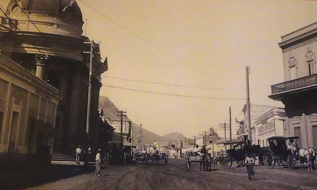
Guaymas in its early days of vigor, looking west up Avenida Serdan. This is still the heart of ‘centro‘. There’s more of everything now (horse power in a different form).
“In 1890, the population of Guaymas was 10,000. These people were proud to live in a city with modern services: electricity, telegraph, urban railroad and especially a communication with the principal ports of the world across big shipping companies. The economy of the port was of great importance.” (from puertodeguaymas.com.mx)
Av. Serdan is still a main commercial center. This photo taken looking the same way as last century’s, a couple blocks further on.We’d like to see an ‘architectural angel’ swoop in to rescue this building, and a couple others. Pronto! Good thing they don’t get much rain here or it would already be gone.
So Guaymas is a working city, with an economy whose reasons for being have little to do with the visitors/tourists, except as they need support in the satellite town of San Carlos. We visitors are barely a blip among the (possibly) 150,000 metropolitan inhabitants. The fact that people hardly notice us may be my most favorite thing of all about Guaymas. It’s a real relief not to be the lynchpin of the economy. And yet, look lost or ask a question, and you’ll almost invariably be met with a smile and real help. We’ve become quite comfortable here!
What about San Carlos?
San Carlos, a half hour bus ride to the north and west is much more a gringo zone. When we crossed the international border, San Carlos is where they assumed we were coming. There are two marinas with dry storage yards, and a nascent resort town with hotels, restaurants, curio shops and the other sundry accoutrements. There’s a big RV park; but I’ll bet most of the visitor population lives in the several housing developments (aka ranchitos ) you can see spreading back into the hinterland. To me they look kind of mono-cultural, but at least they’re not in Alberta!
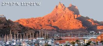
Looking over San Carlos Marina toward the scenic Tetakawi “Goat Tits” (literal translation) mountains. Photo courtesy of siesta realty.com
Of the San Carlos area, the Lonely Planet guide said something to the effect of “beautiful desert-and-bay landscape presided over by the dramatic twin-peaked Cerro Tetakawi” and “full of norte-americanos from October to April.” Somewhere else I read that these winter people only spoke English and didn’t bother to exchange their dollars for pesos.
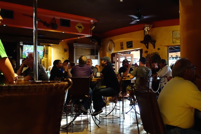
We are them, I guess. We went to Hammerhead’s, a sports bar in San Carlos, several times as U of Alabama moved towards the (US) national collegiate football championship; spent pesos alright, but spoke English. And fit right in. But Alabama didn’t.
The national collegiate football semifinals drew a partisan crowd at Hammerhead’s sports bar in San Carlos.
When I repeated the remark, I was tartly reminded that many norte-americanos also did their best to support the economy and numerous of them supported good works, in particular the local orphanages and animal shelters. Point taken.
A friend who likes to play basketball pointed out that he looked in vain for courts in San Carlos. Finally he realized that basketball courts are usually at the schools, and there are no schools in San Carlos because the locals mostly live in Guaymas and take the late bus home.
Enough of the lecture. Here are some random photos of Guaymas over the course of several months.
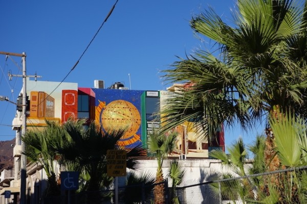
Modern and colorful.
Less modern but nice.
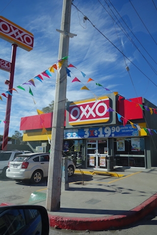
The Oxxo chain of convenience stores has thousands of stores, often a block from one another.
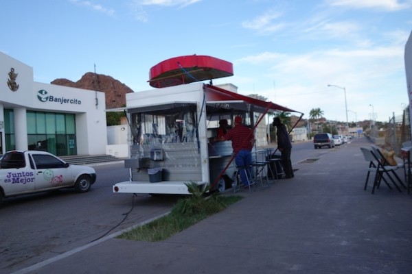
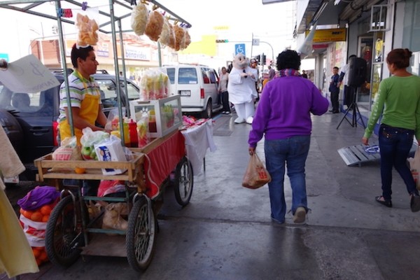
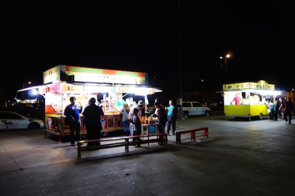
Neighborhood food stand
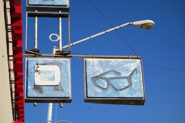
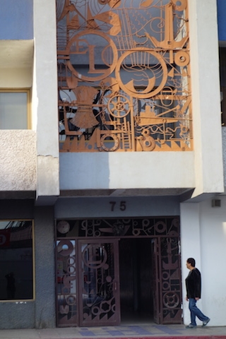
A very neat gate and ?frieze? of metal parts.
Desert-appropriate columns
The ice plant seems to be open all the time.
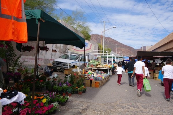
Wednesday market downtown
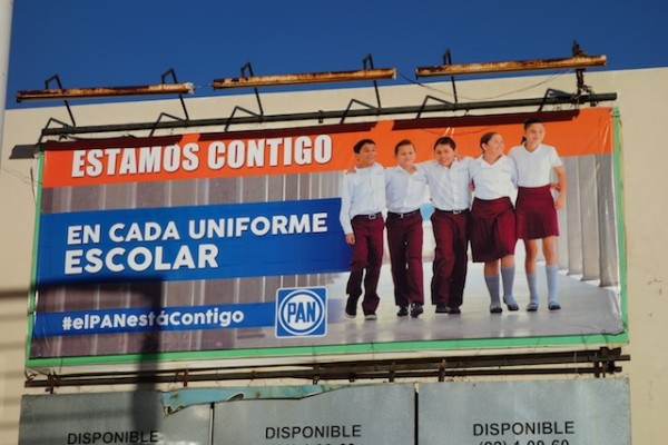
The PAN political party wants each student to have a uniform.
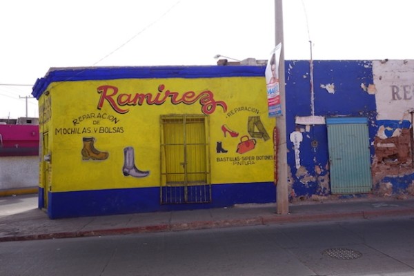
No question what they sell here.
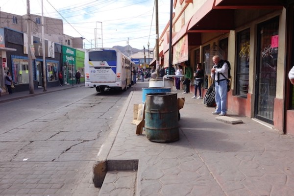
Bus stop road, temporarily empty.
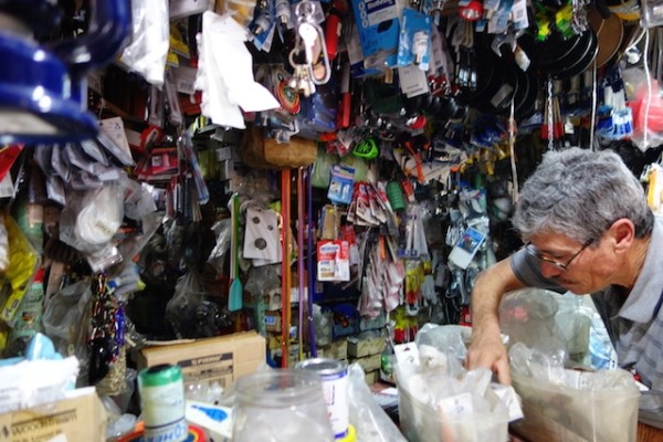
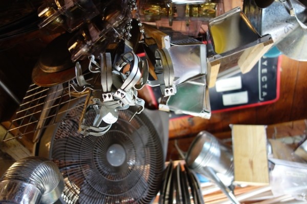
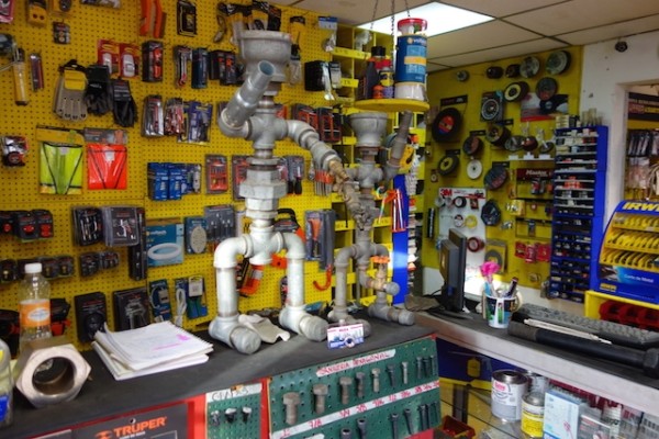
A real hardware cave.
Coyote traps, rat traps, and plenty more hang from the ceiling.
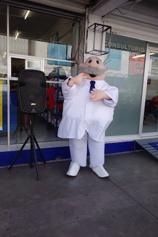
The Farmacia Similar has a friendly dancing mascot.
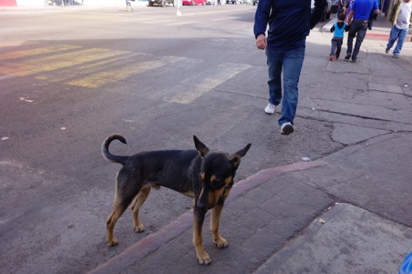
Just another street dog.
Antonio the fruit-coctail guy.
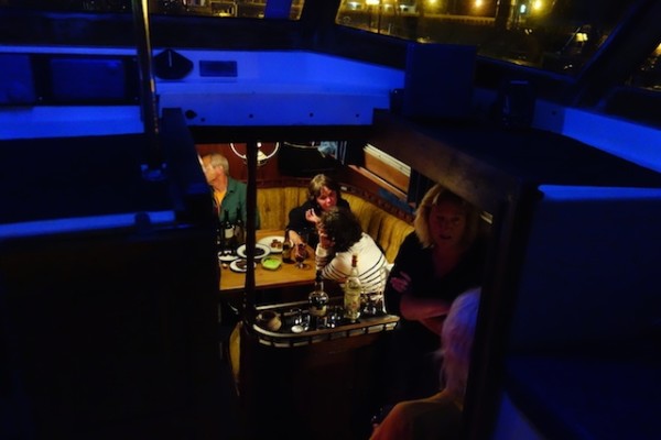
A cozy evening affair.
Local favorite features manta-ray.
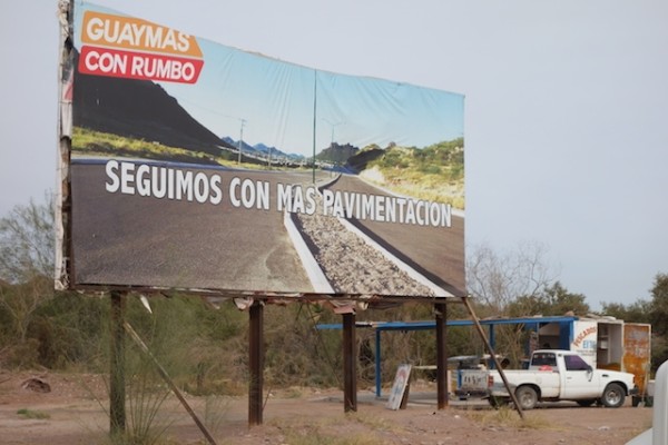
Politicians promise paving, and it’s sorely needed.
A lovely bandstand in the park near the church.
Was a bank, could be yours.
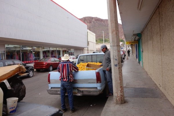
It’s the season for oranges.
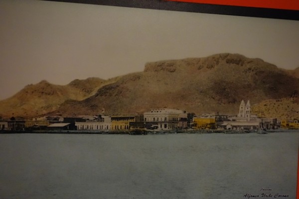
Probably the early 1900s.
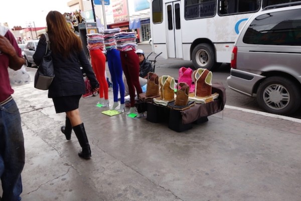
Shrimp sellers outside the supermarket; muy barato, señora!
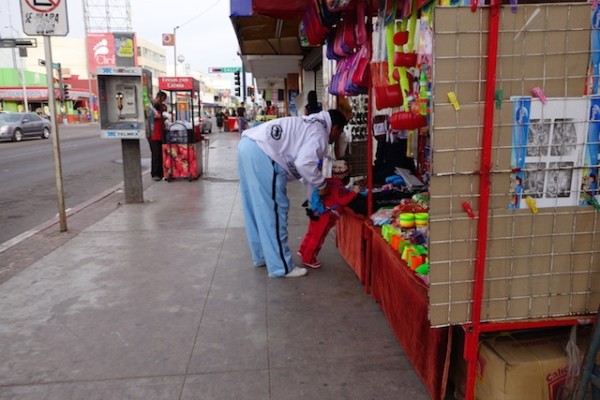
Sidewalk vendor.
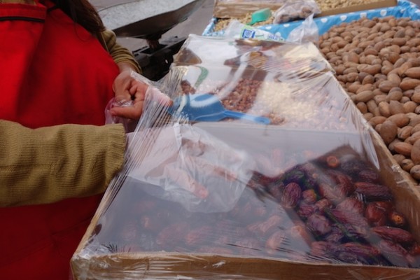
Dates from the interior for sale during the holidays.
On the malecon one night, but usually it’s pretty quiet.
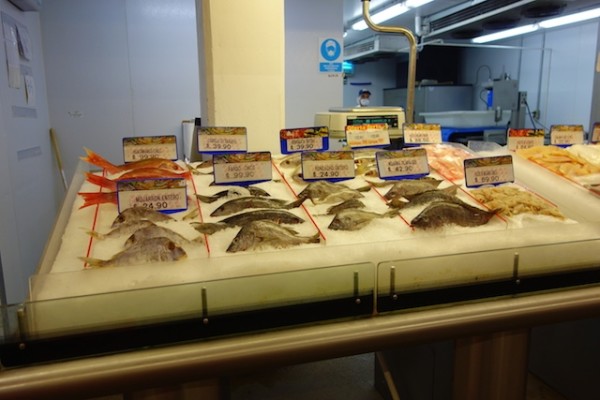
Seafood display at the Ley supermarket
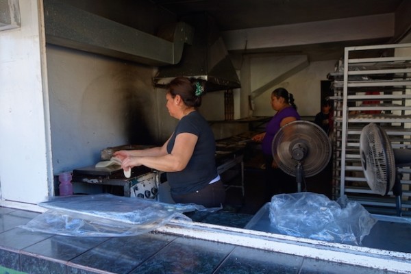
Tortilleria El Concel, a finely tuned operation producing an excellent product.
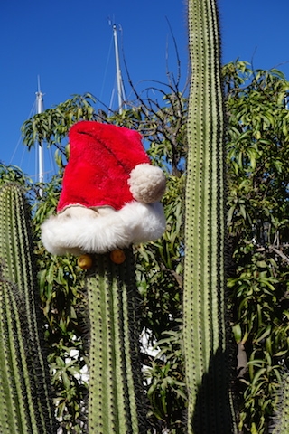
Feliz Navidad.
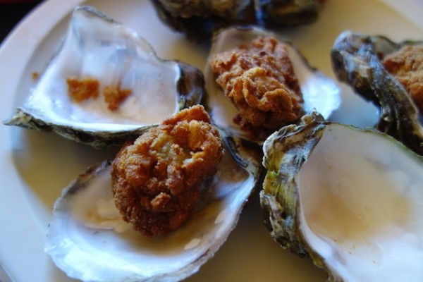
Locally farmed oysters nicely fried and presented.
The fisherman’s monument. I have never seen a fisherman hold a fish so loosely and tenderly as this man does.
How about these parts guys?
Bench on the malecon, and a couple who didn’t chose to use it.
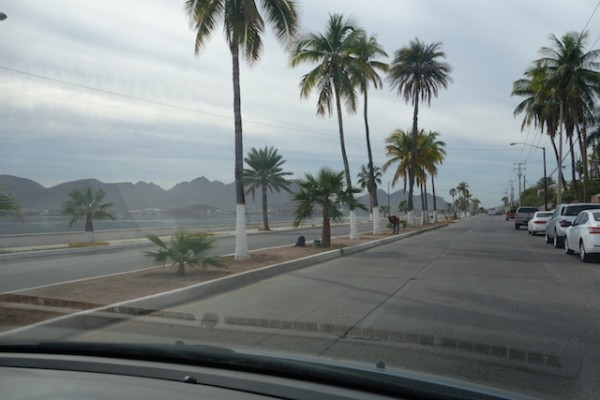
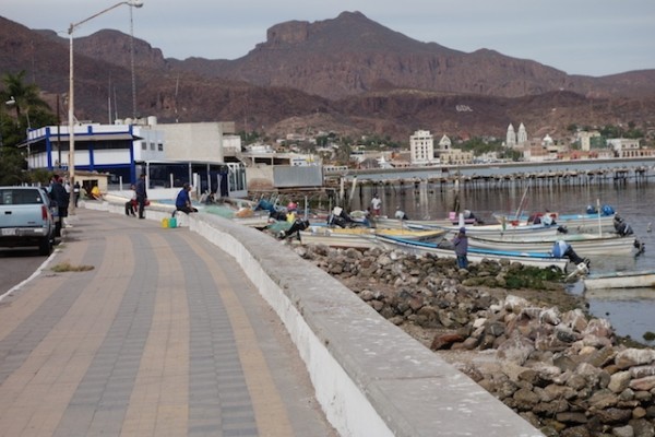
The waterfront road from centro to Marina Seca
Waterfront road from Marina Seca approaching town, passing a small fishing fleet
Looking across the bay towards Marina Seca
This shoe shine man caught me looking at the shoes on his feet and told me "I do them last!"
Shined shoes by the shoe-shine man.
Old museum photo of Guaymas waterfront
School children in the downtown park.
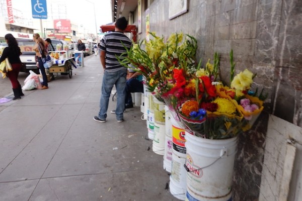
Flowers sold along Av. Serdan
Sidewalk booths along Av. Serdan
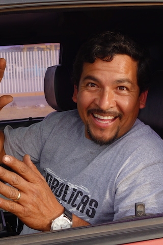
Our favorite mechanic, Omar Garza.
This damage to the waterfront near Fonatur Marina may have been a result of torrential rains following a storm in ?2010.
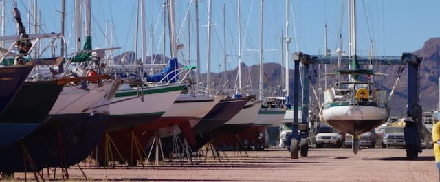
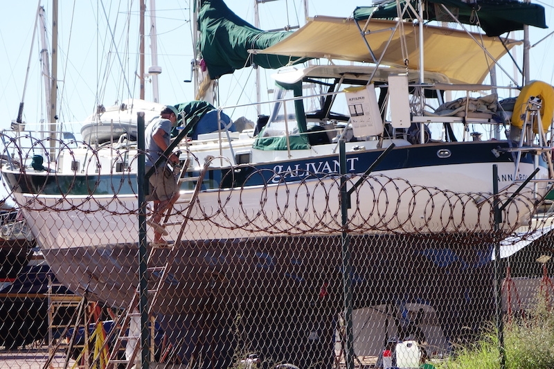
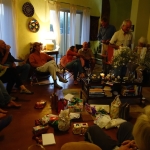
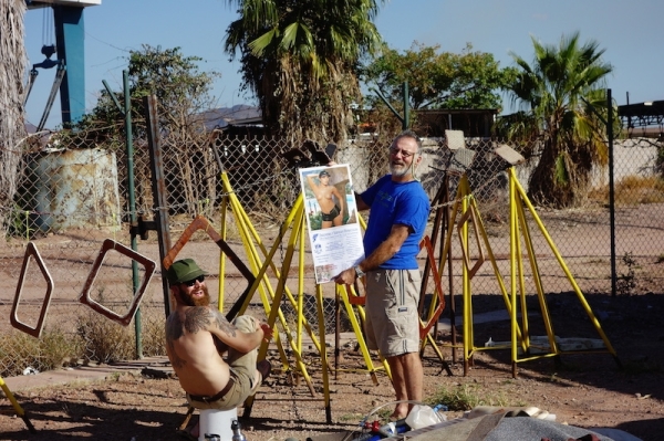
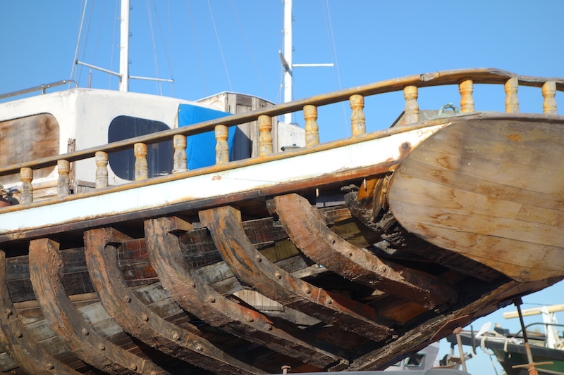
Living on the hard, which is to say, on the boat while it is out of the water, is like a cross between a refugee camp and a trailer park, according to Doug. I think of it as a peculiar gated community, or maybe a half-way house, twixt life ashore and life afloat. Some of us get launched in a couple days, while others have been here for months, even years. We inmates can and do leave the premises from time to time but often remain quite near our cells, often at arm’s length.
Ten steps up, ten steps down, but look at that shiny paint!
There are some issues related to our hovering home, mostly to do with plumbing. The nicer bathroom is 500 steps away, a five-minute walk, or a two-minute bike ride. Plan ahead! There are showers, and the hot water heater is turned on, hallelujah. In June, 104 degrees, you’d like to have a water cooler instead. Whatever the season, water conservation is mandatory, and the taps in the yard are turned off overnight.
For drinking and cooking water, we’re hauling 20-liter garafons up the ladder. Hector Manuel, the two-toot, blue cap water guy (as opposed to the siren water guy whose garafons have yellow caps) honks past daily. We wash up with the marina’s non-potable water, which we dispense to ourselves via a garden sprayer. The main advantage to peeing into a milk jug (via a folding funnel for those of us lacking extension tubing) is that there is no flushing required.
Watch, and you’ll see most everyone at some point in their day leaves the boat with a roll of toilet paper, a milk jug or a bucket. The genteel among us put the jugs and paper in bags, but if not: Don’t look at that jug. Especially don’t glance into the bucket. The lucky folks are the ones with the composting toilets aboard.
Doug’s purple glove is being passed from boat to boat, to be used for that last little dab of bottom paint under the keel where the blocks were.
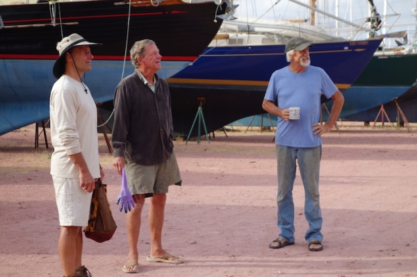
There is a goodly amount of opinion-sharing, information-exchange, and just plain bull-shooting. On the plus side, there is almost always someone with the tool, the experience, the address or directions, the microballoons, the software, the great idea, a few ounces of sympathy or a shred of information. The Boat-Yard Mind is a powerful thing, and so is its toolbox.
Need a hand with something? Here you can get a dozen.
The social life is good
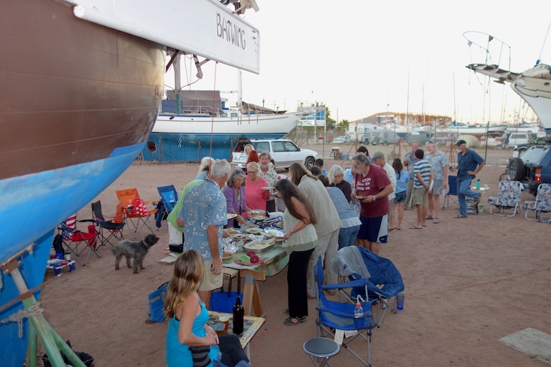
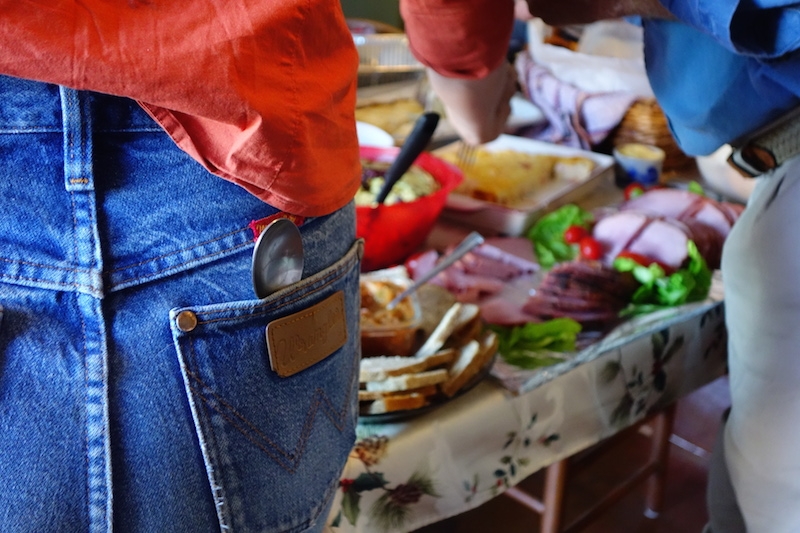
Pot luck dinners are the go-to event for every occasion. We’ve had birthday parties, pre-launch parties, Christmas and Thanksgiving of course, even a December 21 Solstice party.
We’re newbies to Mexico cruising, but one of the first things we’ve learned is that everybody brings their own chair to a gathering. There are no fallen palm trees around here, no driftwood, and apparently, not too many willing to stand up, except for the food line.
Thanksgiving potluck dinner, and weren’t we all thankful for something!
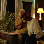
The Christmas pot luck dinner featured plates of good food and and a white elephant “under-50-pesos or something off the boat” gift exchange. The rules were a little complicated, but someone could chose the gift you already had rather than unwrap something unknown from the stack. The bottles of tequila and wine all made the rounds several times. We also had music from our resident troubador.
Goofing Off? Who, Me?
All work and no play..or is it the other way around?Machine shops the world around use the same calendar.
Problems worse than ours
There’s always someone with a bigger project or a worse set of problems than ours.
It’s a reminder that Marina Guaymas is a shipyard, not a fancy marina. We’re here to get ourselves ready to leave, not to loll about on beach chairs! But it really helps that the marina staff is friendly and helpful. “If you’re happy, I’m happy” says Arnulfo the yard manager, and he means it.
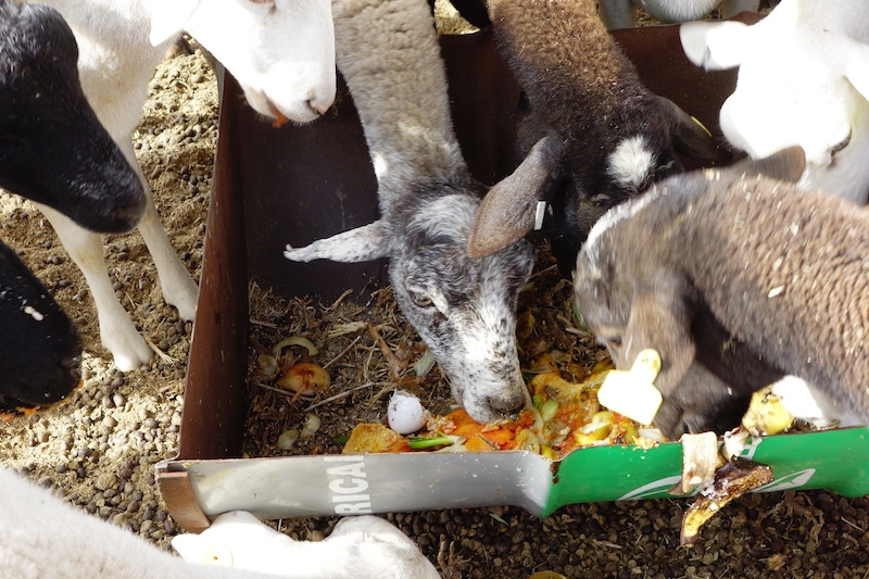
Sheep Eat Our Garbage!
In their own gated communities around our perimeter are a couple dozen sheep whose diets we are encouraged to supplement if we’d like to. There are some loose sheep in the other part of the yard too. Watch out for ‘Pinto’ the butting male! He’s a bruiser.
Their tails are down, their ears are big, so these are definitely sheep, despite their long legs.
They don’t like egg shells or garlic cloves, but it seems like everything else is edible, including squeezed out limón and grapefruit peels.
Every so often…
Someone escapes.
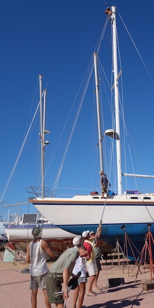
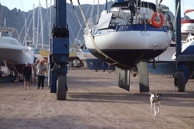
Here it’s a sister ship to Galivant, the Valiant 40 Salish Sea, making her stately procession to the travelift slip.
Best of all
We’ve made a lot of friends here. Maybe it’s due to adversity, or the common bonds of boatyard life, but really, it’s been a lot of fun.
One of the things we like best about cruising is that we get to spend time with people we wouldn’t have even met in our other life.
We Splashed!
We’re spending the first weekend of the New Year of 2015 in the water. The yard was fine, but I’m pretty sure we’ll be liking this floating stuff better. Un feliz, saludable y próspero año nuevo a todos.
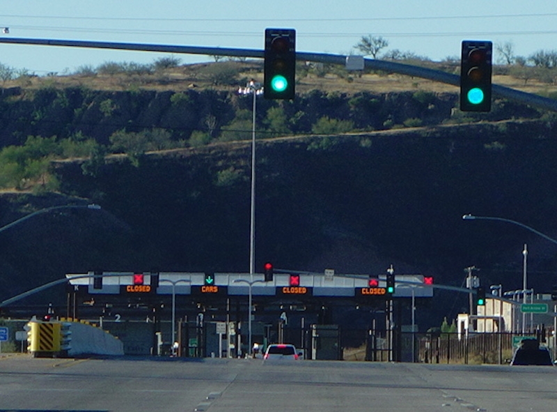
This is the border crossing, leaving US of A. The border crossing entering Mexico is kind of confusing, and not the time to be taking photos. But at first, I didn’t know which one this was!
Slightly Nervous
Driving across the border into Mexico at Nogales was something I’ll admit to being a little concerned about. After all, there has been a lot going on recently. We had never done it before. With the back of the car full of stuff, how would we get through customs without getting an evil eye cast upon us?* Was it true that the paved roads fell abruptly a foot to the desert without any shoulder, that we would break an axle if our white-knuckled attention wavered, (or anyone else’s attention either)? What if we inadvertently break some traffic law and face the police? If we see someone broken down, should we stop and help?
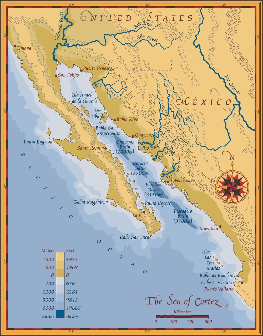
Guaymas is halfway down the mainland side at almost 28N, as are Tampa-St. Pete and Corpus Christi. Nogales is about where Arizona’s southern boundary takes a jog to the northwest. Map courtesy of desert museum.org.
Don’t Worry, Be Happy!
Well none of those things happened or even came close to happening on the Arizona-Sonora interface. In retrospect such concerns seem almost laughable, as is so often the case. A life lesson I keep re-learning: worrying doesn’t help!
The Mexican entry traffic lanes have red or green lights, supposedly randomized. We got the green light and just kept moving. Going through about 8 AM probably helped, since all the lights were green and hardly an agente was stirring! About 19 kilometers further on is another stop wherein one pays the immigration fee, and buys car insurance for Mexico, or an import permit, if the car is going beyond Guaymas/San Carlos area.
The toll road (Highway 15) had its moments as it changed from a divided to a shared roadway between construction cones, but it was an uneventful drive on a decent road. There are some ‘off-label’ uses of the left-turn signal to learn. On the truck in front of you it means, not “I’m pulling out to pass something now”, but instead “It’s clear for you there behind me to pass now.”
We were back at the boat at lunchtime, none the worse for wear. Back in the land of limon and aguacate, tortillas and fish tacos, sunshine and smiling faces. Hooray!
The original yard of Marina Guaymas to the left, and the new storage yard to the right. There’s a big shrimper workyard at the waterfront end of the road.
Nor had any of the dreadful consequences of summer in the desert near a hurricane zone befallen Galivant on her perch in the Guaymas Marina. We were told: Your interior woodwork will dry out and crack, you’ll get dust sifting in everywhere, ants and bees will invade, the jackstands will wash out in torrential rains if a hurricane comes. We saw people stuffing their thru-hulls with steel wool, putting wool hats atop their wind instruments, wrapping their winches and plastic bits with with enough aluminum foil to roast a bull.
Well, we did cover our winches and windlass, put shades in the hatches and ports and leave our Colombian greenhouse-cloth awning in place. When we got back the boat was just as we had left it, or cleaner thanks to a bit of rain over the summer. And we were well-looked-after by Gabriel, Arny, Andrés, Roberto and the guardiáns.
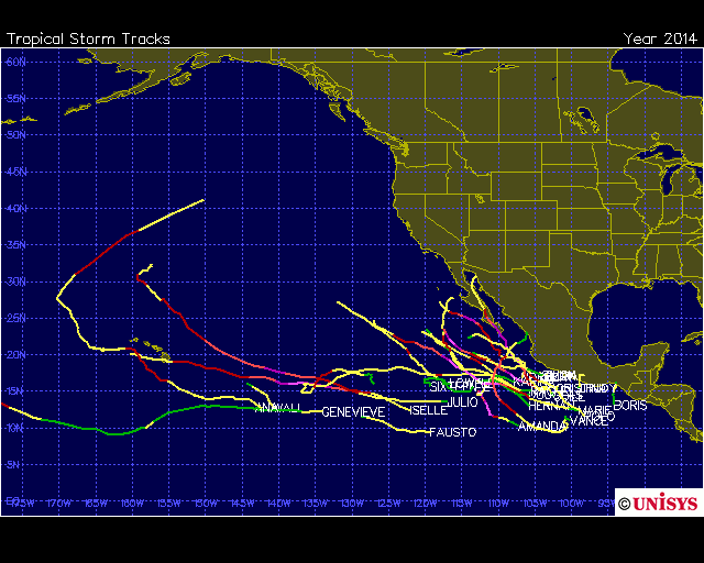
The hurricane season in the Pacific ran nearly through the alphabet in 2014. The actuaries recommend staying north of 27N, which here means Guaymas or San Carlos.
Hurricane Vance maybe was the one who gave us our washdown. Not everyone was so lucky. Further south, at Cabo San Lucas, on the tip of the Baja California peninsula, they took a big hit from Hurricane Odile in mid- September. In La Paz, Odile’s 125-knot gusts took lives and ruined buildings. Lives were lost in the anchorage as well; and boats sank and were blown ashore. In one of the haul-out facilities, Atalanta, they fell like dominoes.
We couldn’t quite make ourselves comfortable with leaving our boat for the season in any marina we saw in La Paz. Sometimes it’s good to listen to those little voices in your head.
Get Back to Work
We’ve got plenty of work ahead of us. We’re getting a paint job, and transmission repairs, just for starters. Guaymas is a good place for both things. It’s a port city of several hundred thousand people but I am still studying what exactly makes it go.
We like moving ourselves through the world with public transportation. However we have a car of our own here and it certainly does make errands easier, the marina being a bit out of town. Until now I hadn’t fully appreciated its secondary use as a rolling storage shed. You should see the stuff we’ve got stacked in the back, like winter clothes and empty canning jars, and tools that haven’t earned their keep.
The temperatures are pleasant, highs about 80, overnight into the low 60s, or even into the 50s, at which point the coconut oil needs to be spooned out of its jar. Close the hatches! Where are my socks? Humidity is in the “Goldilocks’ mid-ranges. The sun shines almost all the time but the sun index is down to 6. The hours of night exceed those of day, 0700-ish and 1730-ish. The water temperatures are dropping into the low 70s if the satellite image is to be believed. We’re in Mountain Standard Time.
It might be better to be floating, but that will come, mañana.
Nice to remember why this car is really in the boatyard!
* Although, despite our bicycles and paint, we were real lightweights compared to some. You should have seen the mountains of stuff that came back on other cars, backseats crammed, roof racks heaped and trailer hitch carriers flowing with fluttering tarps.