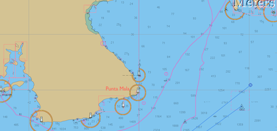
While much of the world was awash in Christmas wrapping paper and the rest snarled in daily routine, the two souls aboard Galivant were at sea, making their way around Punta Mala, Panama, moving towards Costa Rica from Las Perlas, a trip of about 175 nautical miles which took us a day, a night and a day, basically, of sailing. Our track is the one going off the page to the west (left); the other is our inbound route from the Galapagos back in August.
As you might guess by the name of it -Bad Point, Evil Point- there are some issues.The winds can be accelerated to a howl there and the seas contrary, and short and steep, while the tidal current will most likely turn on you at some point during the trip. Add a lot of shipping traffic bound to and from the Panama Canal, plus seemingly-oblivious fishing boats, and you’ll be on high alert during this particular passage.
Rounding Punta Mala
However, we had a pretty good time of it. There was just enough wind, and it was on the quarter, which is our best point of sail both in terms of speed and comfort. Within an hour of leaving we had the gift of a “just-right-sized” mahi mahi in the fridge, caught on a sparkly lime green plastic squid that looked much like the mahi herself. The dry season in Panama seems to have begun, so those piles of clouds overhead for months, (the dark ones spewing lightening and rain) were nowhere in evidence.
Our Christmas day was glorious and bright, and the night even better, so, so, SO many stars, and brilliant constellations strewn on carpets of them. Then, for a different perspective, the heavens offered up “half a moon for half a night”. All in all, it was a fine way to spend the holiday.
In the wee hours of Boxing Day though, someplace off Punta Piedra, the next point around from Punta Mala, we did run into a patch of ‘devil water’ with rude and unsynchronized seas tossing us about. It didn’t last that long, thankfully. Sturgeron, my favorite seasickness remedy, also serves as a magic placebo and calmative.
What shipping lanes?
We passed probably two dozen ships in the vicinity of the point. We couldn’t guess how far in or out we should be to avoid them and there seems to be no traffic separation scheme. As a sailboat sailing, we supposedly have the right of way, but our 13-meter little peanut shell, even at eight knots of speed, would be as nothing to a class A 500-foot steel box laden with thousands of shipping containers and moving at twenty knots. We try not to lose sight of that essential fact.
So we just maintained our course and speed, and kept our eyes peeled, with both of us in the cockpit much of the night ready to change course or slow down. At one point we had a ship 2 miles to port and another 3 miles to starboard, which sounds farther than it looks from the deck of a small boat! But thanks to the technological marvel that is AIS we could see that the starboard ship had actually altered his course 12 degrees and would clear us easily.
AIS, The Automatic Identification System (AIS) is an automatic tracking system used on ships and by vessel traffic services (VTS) for identifying and locating vessels by electronically exchanging data with other nearby ships, AIS base stations, and satellites. So says Wikipedia.
The information comes to us via a VHF antenna hooked to an AIS receiver and display unit. We can usually see the vessels’s name, course and speed, destination, the closest calculated point and time of approach, and monitor their changes. That sure takes some of the worry out of being close!
The fishing fleet around here is distinctive. They don’t appear as AIS targets because they are not required to (less than 300 tons and not carrying passengers); but they do flicker and sparkle sometimes, as if they are carrying blue party lights in the air behind them. We always assume that the fishing boats are fishing, not watching, but this close to so much shipping I’ll bet even they keep their eyes open.
Isla Cebaco, Western Panama
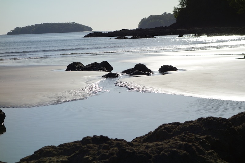
With the excitement over, but the weather still clean and sparkling, if a bit scarce of wind by sunrise, we continued on around the third point of the peninsula, Punta Mariato, and into an anchorage on the southwest end of a big, seemingly empty but conveniently located island called Cebaco. 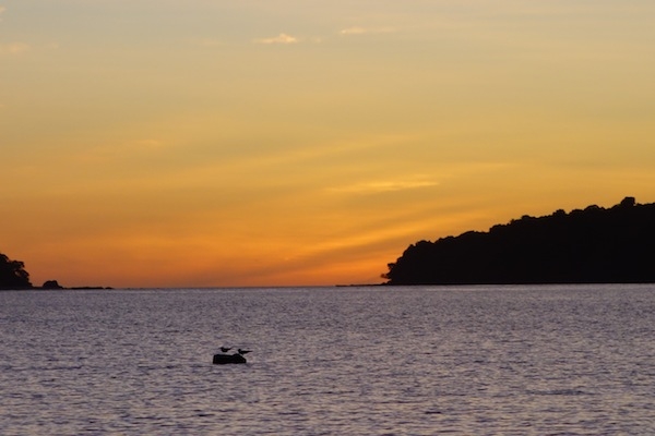 Right where you would chose to anchor there are about a dozen moorings. When the world sees the wisdom of making Doug its emperor, there will be no more of this kind of thing, I can assure you. Not knowing anything about the moorings, we can’t use them, with no one on them, they’re just a waste/inconvenience/hazard, and they make it hard for any but the cognoscenti to find a sheltered spot to stop. Hard, but in this case not impossible – there is good bottom and enough room in these conditions (northerly winds, no southwesterly swell) to anchor to shoreward of them and that’s what we did.
Sportfishing Club
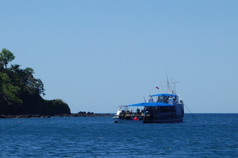 Then, as if to confirm that the solstice, or the holiday season, or the close of the calendar year, really does include the start of the dry season, the next morning the fuel barge arrived. After a brief chat with the captain we learned that this part of the bay is owned by the Cebaco Bay Sportfishing Club, and this their vessel provides re-fueling for sportfishing boats traveling between Panama City and Costa Rica. They rent out the moorings, provide accommodation aboard for 14 people, and have a bar and kitchen both on board and ashore.They will be there until November; their busiest time is around Holy Week. Sounds like they might like to expand the operation to include more facilities ashore, while keeping the land ‘natural’, but the signs for the environmental impact statements date from 2010, so there’s no rush!
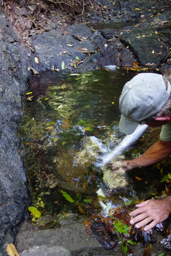
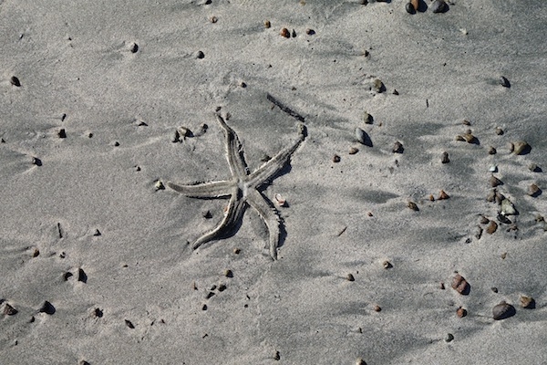
‘You’re welcome to walk around ashore, go to the waterfall, help yourselves’ he said, and so of course we did. A very small waterfall but it was enough to overflow their storage tanks down the hill, so we took a nice outdoor shower, walked the beach, checked out the property, and smelled the evocative springtime aroma of newly flowering trees. It’s nice to be in Western Panama!