Random notes on Pacific Mexico


strong winds blow across the isthmus into the Gulf of Tehuantepec

Weather is always on our minds

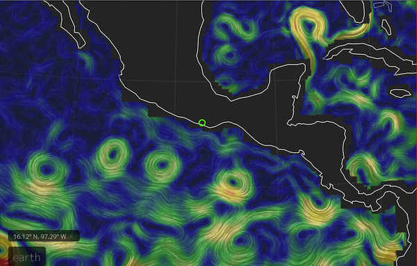
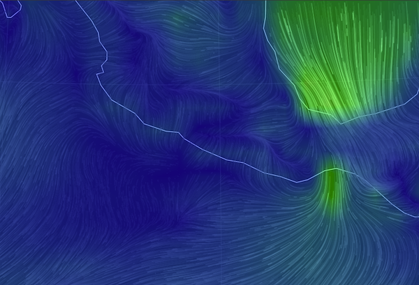
My new favorite weather website is this  earth.nullschool.net/#current/wind/surface/level/orthographic, a graphic representation of the actual winds being reported, available for the entire globe. In this picture of southern Mexico, the big green part is the tail end of a cold front passing through the US with a tail extending across the Caribbean. The small green is where those winds have funneled through the Chivela Pass across Mexico into the Gulf of Tehuantepec.

…especially Tehuantepeckers

The next day’s NOAA weather forecast for a 90-mile swathe of the golfo is INCLUDING GULF OF TEHUANTEPEC…N TO NE WINDS 30 TO 50 KT. SEAS 12 TO 17 FT. This kind of weather is a regular feature of the winter months. In fact, according to one of their blogs,  NOAA issues more gale and storm warnings for this area than for any other, except during hurricanes. They (the ‘fleet mind’) say small craft like us should negotiate the 240-mile crossing area around its edges, with “one foot on the beach”  or “close enough to hear the dogs bark”. But we were approaching this area at the end of its heavy season, had a four-day forecast for light winds, so we mainly motored straight across, and right into the marina in Huatulco to buy more diesel fuel.

And you can also see in the null school.net image, there’s not much wind elsewhere. That’s been the situation for most of our trip towards the Sea of Cortez and Baja California from Panama throughout the early spring of the year. (But not all of it: Too much wind, or not enough). Sometimes there’s an onshore breeze in the afternoon and offshore at night, but lots of lulls and opportunities to motor, against the current too.  Here is a picture of ocean currents, also from nullschool. I could watch  for hours; better than TV!
ocean currents off Mexico nullschool
We’ve had our new engine for four years now but we have put at least thirty percent of its hours on in the last six months. And we’re darned grateful to be able to motor, considering the alternatives.

Ship Traffic

When we’re underway we always have our VHF radio tuned to Channel 16. I heard a ship, the container-carrying Maersk Wolfsburg, call another ship on to ask what conditions he had seen in the Gulf of Tehuantepec. “Force 4, in advance of a much bigger blow being forecast” was the answer.  It’s the first time I’ve heard big ships talking with each other to exchange information not directly about course changes. I figured they just steamed through all weather no matter what.

Our computer keeps track of each ship it has seen, and doesn't delete them when they are no longer 'targets'.

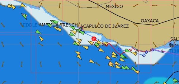
OpenCPN, our computer’s navigation program,  keeps track of each AIS ship it has seen, and doesn’t delete them when they are no longer ‘targets’, leaving the screen cluttered with ‘ghosts’. There’s more traffic than we would have known, but we never see more than one or two, if that, at a time.

Then a couple nights later, I heard my first Mayday. It was another container ship, reporting a man overboard, and giving the position. We were about 150 miles north and not in a position to do anything. Then it transpired that the MOB position was estimated, since the person had been missing for two hours. And then the Mexican Navy broke in and there were no further transmissions. Google tells me nothing more. For me it was a somber watch, dark and moonless,  on the edge of windy and rough for us in a 40-foot boat,  and for a man in his skin, well…..

What else could go wrong?

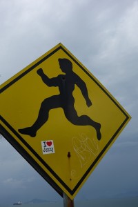
running man sign
Not the official warning sign, but the message is the same.


We were in a small bay outside Huatulco when we heard of the tsunami alert following the earthquake in Chile April 1. Thankfully, nothing materialized here, but we did get to think of what might happen and what we could do, not that we have any real answers to either question. Except, move to higher ground probably won’t be an option.

We also heard a report from a sailboat at anchor in Acapulco during one of  two recent  big earthquakes there, one a 7+. Anchor chain rattling and grumbling, palm trees swaying, a small rockslide or two is what you first notice, they say. That boat (sorry, I didn’t get the name) up-anchored and left immediately, fearing tsunamis. Probably I’d still be scratching my head!

But I did read a bit more about the earthquake warning system in place for Mexico City, which is situated on jelly-like landfill and has suffered greatly from past terremotos. http://www.economist.com/blogs/economist-explains/2014/04/economist-explains-14

Many of the earthquakes take place inland in Oaxaca along the intersection of the North American plate and the Cocos plate. Seismic waves move 7000 miles an hour, but the alarms are almost instantaneous, giving the folks in Mexico City at least a chance to get out of buildings.

 Not all anchorages are good anchorages

In fact, there aren’t that many all-round good anchorages on this coast. The surf/swell/surge from all that open ocean to the southwest is a constant feature. You know it’s not going to be great when the most prominent comment is about the surf spots nearby. We like to be enclosed and protected, but we’re getting used to the open-ness and the rocks, sort of.

One night we shoe-horned ourselves into an anchorage in Puerto Angel, something we won’t be doing again unless the harbor is somehow enlarged or emptied. All night long we moved between the rocks on one side and the rocks on the other side, but managing to stay clear of the moored boat 20 feet away. There was a big surge  in the harbor, and a very steep beach, so as I peeped out the porthole I had the distinct feeling that I was already halfway down inside a vortex, ‘down the gurgler’ as the Kiwis say, and I didn’t like that!

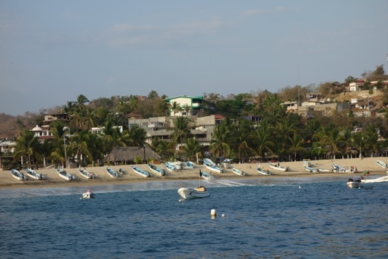
The beach is very steep and the local boats motored and surfed their way up it.

The local boats without  moorings just surfed a wave with their outboards full on until they hit the beach and, they hoped, kept going up.

And not all charts are good charts, except the iPad’s charts

We do carry some paper charts, although of course the electronic ones are a bit more convenient. Coastal charts like the one above with the AIS ghosts are off by a mile or more. By their offsets, we’re usually on the beach when anchored. I would have gagged on the words not too long ago, but I have to admit that our best charts and our most used close-to-shore navigation interface come from the iPad. The iNavX’s Navionics-based charts seem mainly accurate, and the charts from the top-notch Mexican cruising guides Pacific Mexico and Sea of Cortez (by Shawn Breeding and Heather Bansmer) can’t be beat.  These harbor charts can be downloaded thru the iNavX app (Blue Latitude Press), and the waypoints are also available as a separate download.

Dolphin Feeding Frenzy

Saving the best for last:  one day we saw this fantastic dolphin feeding frenzy, or party, or whatever it was. There were at least five hundred (guessing!) leaping, twirling, splashing, dolphins moving back and forth on both sides of us for twenty minutes, until a message came in from somewhere else and they moved on.

dolphins leaping


We were lucky to be part of the party as we sailed silently through. And if I’m lucky one of these days, I’ll be able to upload the video too.

Stars for Christmas at Punta Mala and Cebaco, Panama

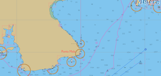
Open CPN chart of track around Punta Mala Panama

While much of the world was awash in Christmas wrapping paper and the rest snarled in daily routine, the two souls aboard Galivant were at sea, making their way around Punta Mala, Panama, moving towards Costa Rica from Las Perlas, a trip of about 175 nautical miles which took us a day, a night and a day, basically, of sailing. Our track is the one going off the page to the west (left); the other is our inbound route from the Galapagos back in August.

As you might guess by the name of it -Bad Point, Evil Point- there are some issues.The winds can be accelerated to a howl there and the seas contrary, and short and steep, while the tidal current will most likely turn on you at some point during the trip. Add a lot of shipping traffic bound to and from the Panama Canal, plus seemingly-oblivious fishing boats, and you’ll be on high alert during this particular passage.

Rounding Punta Mala

However, we had a pretty good time of it. There was just enough wind, and it was on the quarter, which is our best point of sail both in terms of speed and comfort. Within an hour of leaving we had the gift of a “just-right-sized” mahi mahi in the fridge, caught on a sparkly lime green plastic squid that looked much like the mahi herself. The dry season in Panama seems to have begun, so those piles of clouds overhead for months, (the dark ones spewing lightening and rain) were nowhere in evidence.

Our Christmas day was glorious and bright, and the night even better, so, so, SO many stars, and brilliant constellations strewn on carpets of them. Then, for a different perspective, the heavens offered up “half a moon for half a night”. All in all, it was a fine way to spend the holiday.

In the wee hours of Boxing Day though, someplace off Punta Piedra, the next point around from Punta Mala, we did run into a patch of ‘devil water’ with rude and unsynchronized seas tossing us about. It didn’t last that long, thankfully. Sturgeron, my favorite seasickness remedy, also serves as a magic placebo and calmative.

What shipping lanes?

We passed probably two dozen ships in the vicinity of the point. We couldn’t guess how far in or out we should be to avoid them and there seems to be no traffic separation scheme. As a sailboat sailing, we supposedly have the right of way, but our 13-meter little peanut shell, even at eight knots of speed, would be as nothing to a class A 500-foot steel box laden with thousands of shipping containers and moving at twenty knots. We try not to lose sight of that essential fact.

So we just maintained our course and speed, and kept our eyes peeled, with both of us in the cockpit much of the night ready to change course or slow down. At one point we had a ship 2 miles to port and another 3 miles to starboard, which sounds farther than it looks from the deck of a small boat! But thanks to the technological marvel that is AIS we could see that the starboard ship had actually altered his course 12 degrees and would clear us easily.

AIS, The Automatic Identification System (AIS) is an automatic tracking system used on ships and by vessel traffic services (VTS) for identifying and locating vessels by electronically exchanging data with other nearby ships, AIS base stations, and satellites. So says Wikipedia.

The information comes to us via a VHF antenna hooked to an AIS receiver and display unit. We can usually see the vessels’s name, course and speed, destination, the closest calculated point and time of approach, and monitor their changes. That sure takes some of the worry out of being close!

The fishing fleet around here is distinctive. They don’t appear as AIS targets because they are not required to (less than 300 tons and not carrying passengers); but they do flicker and sparkle sometimes, as if they are carrying blue party lights in the air behind them. We always assume that the fishing boats are fishing, not watching, but this close to so much shipping I’ll bet even they keep their eyes open.

Isla Cebaco, Western Panama

With the excitement over, but the weather still clean and sparkling, if a bit scarce of wind by sunrise, we continued on around the third point of the peninsula, Punta Mariato, and into an anchorage on the southwest end of a big, seemingly empty but conveniently located island called Cebaco.
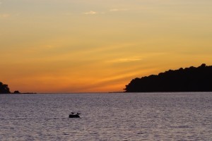
Cebaco sunset with gulls on mooring
Right where you would chose to anchor there are about a dozen moorings. When the world sees the wisdom of making Doug its emperor, there will be no more of this kind of thing, I can assure you. Not knowing anything about the moorings, we can’t use them, with no one on them, they’re just a waste/inconvenience/hazard, and they make it hard for any but the cognoscenti to find a sheltered spot to stop. Hard, but in this case not impossible – there is good bottom and enough room in these conditions (northerly winds, no southwesterly swell) to anchor to shoreward of them and that’s what we did.

Sportfishing Club

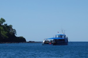
Cebaco Bay Sportfishing Club fuel and party boat Then, as if to confirm that the solstice, or the holiday season, or the close of the calendar year, really does include the start of the dry season,  the next morning the fuel barge arrived. After a brief chat with the captain we learned that this part of the bay is owned by the Cebaco Bay Sportfishing Club, and this their vessel provides re-fueling for sportfishing boats traveling between Panama City and Costa Rica. They rent out the moorings, provide accommodation aboard for 14 people, and have a bar and kitchen both on board and ashore.They will be there until November; their busiest time is around Holy Week. Sounds like they might like to expand the operation to include more facilities ashore, while keeping the land ‘natural’, but the signs for the environmental impact statements date from 2010, so there’s no rush!

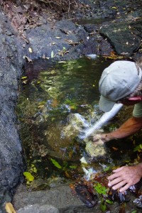
Cebaco Clearing the water collection filter
Here’s Doug cleaning the strainer upstream of the little waterfall. There were tiny tadpoles and crayfish too, appropriate to the size of the reservoir

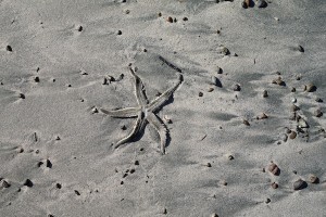
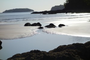
‘You’re welcome to walk around ashore, go to the waterfall, help yourselves’ he said, and so of course we did. A very small waterfall but it was enough to overflow their storage tanks down the hill, so we took a nice outdoor shower, walked the beach, checked out the property, and smelled the evocative springtime aroma of newly flowering trees. It’s nice to be in Western Panama! dead starfish dancing across sand beach low tide Cebaco

Colon anchorage, Club Nautico

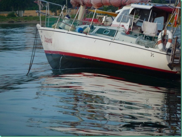
From the water, Colon, Panama is an interesting place to be, especially if you’re interested in ships. At most hours, day or night, something is moving through the harbor.   Sometimes it’s crew boats, maybe 40 feet long, but moving through at about 40 knots (the Resident Exaggeration Detector has flagged this number). About 40 times a day we all roll  insanely. To be fair,  there are a few crew boats who slow down, maybe to watch what happens.We’re watching them too!

PHOTO DRAGONWING ROLLED BY CREW BOAT

P1090227_thumb1

One of our neighbors came home to find his galley stove thrown out of its gimballs.  *

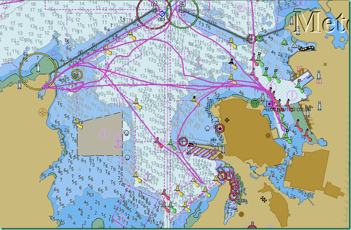
SCREEN SHOT OF COLON HARBOR CHART

image

The Club Nautico anchorage is a pretty compact piece of water,  between some semi-derelict commercial boats along a piece of waste ground,  and the red channel markers for the container- and car-carrier port called Manzanillo. Ninety percent of the time it’s actually a pretty good anchorage. What I like is the constant port activity – ships are coming and going all the time.

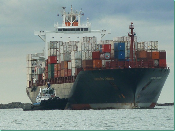
PHOTO CARGO SHIP

P1040611

From our perch in the cockpit, we see them waiting at the breakwater,  until the pilot boat comes, then, the tug  joins them, and they slowly progress down the aisle of buoys. Will this one  be turned around and pushed into one of the slots just opposite us , or is it’s spot under the other set of cranes further down the quay?

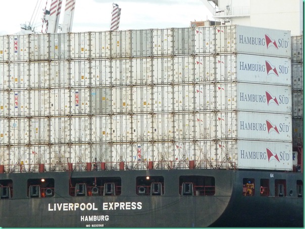
PHOTO WALL OF HAMBURGSUD CONTAINERS ABOARD LIVERPOOL EXPRESS

P1040632

Cranes slide into place, and the containers are clamped and lifted, shuffled and stacked. One ship is entirely offloaded. The next leaves within the hour. It’s not just containers either; we saw one shipful of brand new buses. We haven’t a clue what’s going on, which gives us endless theoretical headroom. Only the choreographer knows for sure. But who is the choreographer of this ballet of titans?

Having read recently that  Panamax ships with 13 containers across the stern can be carrying 5000 to 7000 containers, the main question is:  how do they make sure the one they want is where they can get at it?  What specialty design education teaches that kind of organization? Also, What’s in all those containers?  And, imagine, the new SuperPanaMax ships carry 9000 containers. How can a sniffer dog keep up? Cruise ships in St. Thomas have small boats constantly patrolling their seaward sides. But here, with many more ships, there seems much less visible security. This kind of meditation, and a pair of binoculars, keeps us occupied for hours. I’ve got more pictures than any one needs of  colorful containers, and industrial machinery – can’t say why it fascinates me so.

Down the channel, near the Colon 2000 shopping center and the big duty-free zone is shipping on a different scale. I wish I knew what was going on here, beyond all the appliances being stevedored out of trucks and on to this small ship.

PHOTO APPLIANCE LOADING, CARMEN II

.P1040674P1040671

As for Club Nautico itself:  there is no club, only an office that wants $5 every day we park the dinghy, and never has change. Also in the fenced and guarded compound are  a pretty good seafood restaurant, a small marine/fishing store,  a fuel dock, and docking for one of the  crew-boat services.   In the several days we’ve spent here we’ve been in the company of less than a dozen other boats; there’s not space for too many more. You could probably walk to Colon 2000 where there is a super-something-supermarket, but the cab drivers won’t let you!

PHOTO, VIEW TOWARDS SHORE NEAR CLUB NAUTICO

P1040676

Once upon a time, on the other side of the Colon peninsula, there was a Panama Canal Yacht Club. It was a funky but eminently functional place that, half a dozen years ago, was bulldozed overnight by the juggernaut of the Panama Canal Authority, who apparently needed another container parking lot.   You can still anchor at the Flats, and watch the ships passing to and from the locks, but there seems to be nowhere to land a dinghy. You can anchor outside Shelter Bay Marina; not sure what arrangement you’d have to make to use their facilities. That leaves Club Nautico as the best anchoring option.

For a slip in a marina,  you’ll  find yourself at Shelter Bay Marina. This is a fine facility, and getting better all the time. Located in a  sheltered bay (!)  at the top of the harbor breakwater, where the US military once kept patrol and maintenance boats, they have nice new docks, good electric, speedy wifi, a pool, small hotel, a restaurant much improved in recent months. They have a popular haulout, but not much in the way of skilled labor, and a storage yard with some ‘boot camp’ type rules, but this may change as the new, boater-friendly manager John Halley, ex-Club Nautico Cartagena smoothes out the user interface.

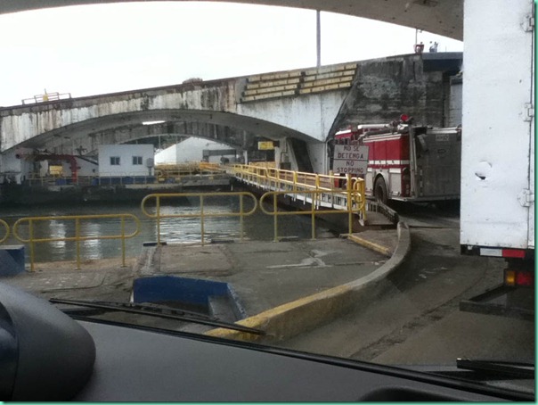
The downside is that Shelter Bay is half an hour from town on a marina bus; shopping or looking around can be a rushed experience or an expensive taxi ride home. The bus crosses canal locks, which means that sometimes you can get caught on the wrong side and wait another half hour or so as a ship locks through.

PHOTO ROAD CROSSING CANAL

IMG_0136

Also,  It costs a bit more than I’d care to spend, particularly to be so far out of town.   But it’s the only game in town for hauling and storage, although a new marina at Green Turtle Bay near Nombre de Dios on the way to the San Blas, is said to be getting a travelift soon.

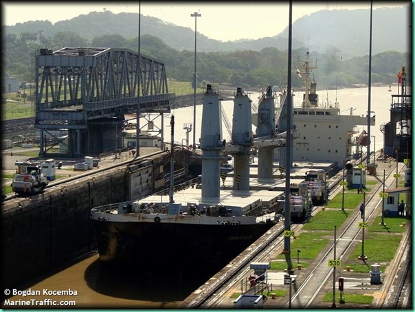
When we first  got our AIS** , one of the first ships I remember seeing  was the Henriette Schulte bound for Manzanillo, wherever that was. So, it was fun to see the same Henriette Schulte being escorted to a dock just across from us, and now I know where Manzanillo is. Then we saw Simon Schulte  out in the anchorage. So I Googled and learned  that there are nearly 100 other ships in the Bernhard Schulte Ship Management family, (several are quite new); plus a pin-up -(ship centerfolds?) type photo of Simon Schulte in locks of the canal, courtesy of the webcam at MarineTraffic.com. It’s gotten five votes, by what standard, I wonder.

SIMON SCHULTE from Panama Canal WEBCAM

SIMON_____SCHULTE

Another sight familiar in the canal transit season for yachts is the Arrival of the Tires. When they land on a neighboring yacht, like the roulette ball landing on their number, we know that tomorrow we that boat might be seen on the webcam. Those tires are cheap insurance against an encounter with the canal walls, and the stock in trade of one particular agent.

GALENA ATTIRED FOR CANAL TRANSIT

P1040604

Maybe it will be our turn one of these days.

*gimballs: our stove is suspended on ‘pins’ on each side so that it can remain level when the boat rolls

**AIS (Automatic Identification System) is a nifty piece of technology. Ships are now required to broadcast certain details, name, dimensions, destination, course speed and other navigation data, and with our VHF antenna and a display unit we can read it, plus be alerted to their presence up to 13 miles away by a perimeter alarm.