Gulf of Chiriqui and Western Panama

Bahia Honda's view of the mainland of Western Panama

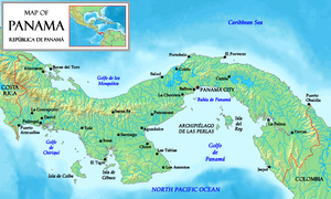
Once around Punta Mala and the Azuero peninsula, we found ourselves in the Golfo de Chiriqui, which runs to the Costa Rica border at Cabo Burica. The Gulf is about 130 miles across, and contains several islands and island groups, including two national parks.

map of the Gulf of Chiriqui and Chiriqui Province Panama
Gulf of Chiriqui and Chiriqui Province Panama from Punta Burica to the Azuero Peninsula

Map western Panama and Golfo de Chiriqui Google

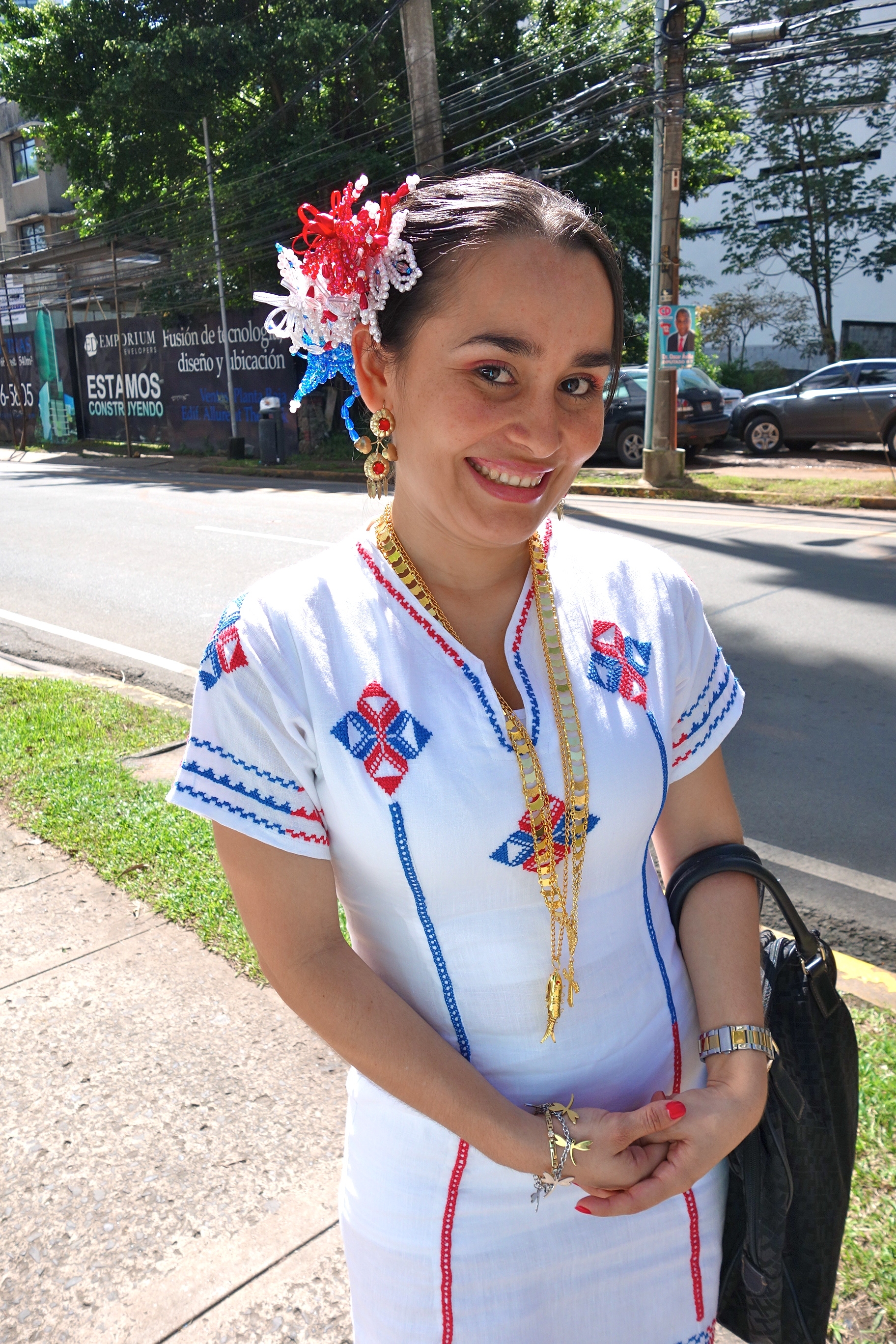
For a backdrop to this pretty coastline, you get the province of Chiriqui, described as the most diverse province of the already diverse country of Panama. The seaside mangrove forests yield to the coastal plain, the foothills and then the mountains of the Cordillero Central, and Volcan Baru, highest in the country. A number of rivers run down from the rain forests, sometimes via whitewater rapids, to end between the little volcanic cones and other bits of geological crumple beyond the shores of the Golfo. Top it all with the blue skies and puffy white clouds of the dry season, add slanting equinoctal light at sunrise and sunset and you’ve got a lovely and very lightly travelled cruising area.

What’s on the mainland of Western Panama

We knew from our inland travels that the Panamerican Highway runs mainly along the foothills of the Cordillero. Highways turn off towards the cooler higher lands. The resort town, ‘outdoor adventure capital’,  and coffee fincas of Boquete, and the vegetable and flower producing center of Cerro Punta, all lie in that direction. So does  the Volcan Baru, highest point in Panama and home of the  national bird, the amazing quetzal, plus a wealth of other birds, both rain forest natives and seasonal migrants. There’s a large national park, Amistad, which is shared with Costa Rica, full of hiking trails and wondrous sights. I’m a big fan of Western Panama’s Mountain Highlands, and in my birdwatching, bicycling, rafting and hiking incarnations hope to return there. But right now, we’re sailing, or motoring, as has lately been the case.

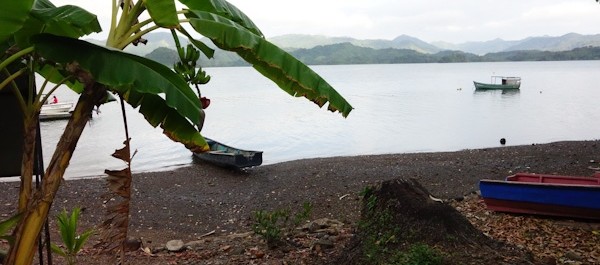
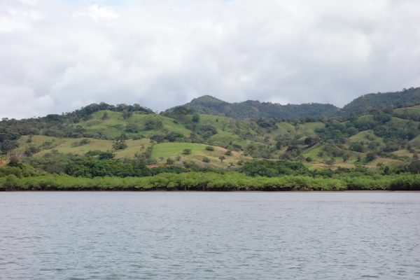
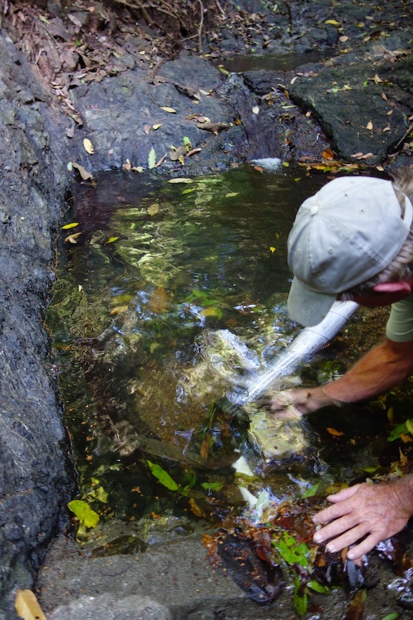
Along the shores of the Gulf, however, there are not many roads, or many towns, or many cruising boats either – we never saw another until we got to Boca Chica. A lot of the seaside is low-lying mangrove, split by rivers too shoaled or barred to be available to us unless the tide is just so. There are a few small towns, but the people who live here do so very quietly, it seems, getting around by cayuga and horseback, fishing and tending their crops. Here’s what it’s like a small way up the Rio Santa Lucia.

20140102 cleared land Rio Santa Lucia

Out in the Golfo de Chiriqui

And then there are the islands in the Gulf of Chiriqui. The largest is Coiba, once a prison island. “Do not under any circumstances pick up people in the water, and take precautions when anchoring there or at nearby islands” says our Zydler Panama Cruising Guide from  2001, and the occasional incident proved they really meant it. I like the story, however apocryphal, that the guards locked themselves in at night. It was a feared and ill-reputed place.

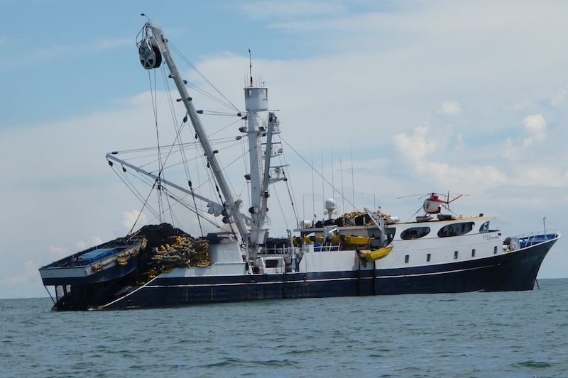
Now it’s a national park and reserve, said to be eighty-some percent first growth native forest, and described in superlatives, unique location unaffected by El Niño conditions, rare and unknown species, healthy coral, etc. (http://en.wikipedia.org/wiki/Coiba). I’d have loved to visit, but we heard that park permits were a superlative $100 per day for the boat plus an undetermined amount per person per day,  although some negotiation might be possible. So we went mainly to lesser bays and islands around the shoreline. Sport fishing boats and long-liners like to fish near Coiba’s protected waters. Coiba has several smaller attractive islands in its vicinity, also part of the park.

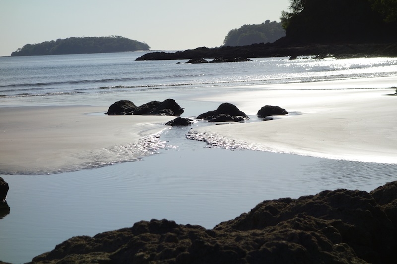
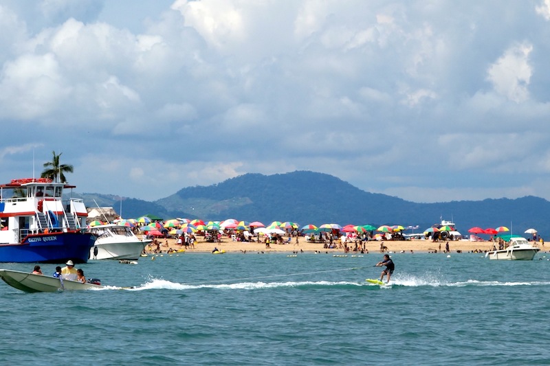
Other popular island groups are the Islas Paridas and the Islas Secas near Boca Chica. Some of these are also in a national park, but fees are lower. Sandy beaches, warm clear waters, palm trees, what’s not to like? At this time of year, the dry season months of January and February, and into March, the southwesterly swell is quiescent, and the strongest winds, if there are any, may be from the north, spilling over from the Caribbean. Anchorages that would be uncomfortable, or even untenable, in August or September, are available now, and bays open to the north might not be. It’s hard to know what to expect when there are surf spots right around the corner!

08 North, 082 West

Go away, seagulls, and take your droppings with you
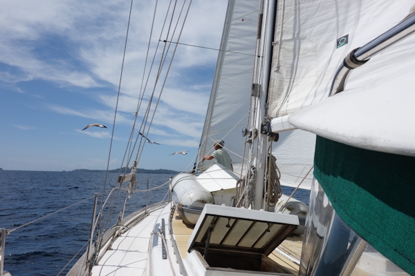
There are people in this world who try to visit, or otherwise collect, the geographic points where latitude and longitude lines intersect. This photo is for you, to be filed as what the world looks like at  8 degrees north of the equator, and 82 degrees west of the Greenwich meridian. Those are the Islas Secas rising ahead, and Doug on the foredeck trying to discourage a seagull gathering.

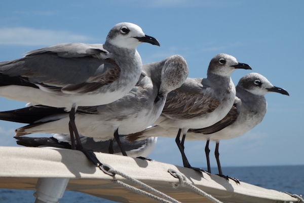
Instead the gulls moved practically into the cockpit, and fouled our rain collection awning.

4 seagulls in quarter profile

Then there is Boca Chica

Boca Chica is one of the riverine gateways to the second largest city in Panama, which is David, itself the commercial gateway to the Mountain Highlands. David is well inland, on the Panamerica highway, and a normal person wouldn’t even think of approaching it from the water. But it is possible to weave your way through a tangle of sandbars, rocks and mangrove islands that, via several different channels, eventually leads to David’s small port town of Pedregal.

Boca Chica entry channel at low tide viewed from Boca Bravo restaurant

“I sure hope this chart is right” said Doug, as we were anchoring to wait for a higher tide, peering towards a bunch of rocks in a side channel which were about to disappear as the tide rose,  that were not on our main chart. Of course, you  know you wouldn’t be reading this if we hadn’t made it into Boca Chica totally uneventfully by following the red line in our cruising guide by the estimable Eric Bauhaus. We never saw less than 12 feet when there was just six feet of tide in, so we theoretically could have made it under most any circumstances. We don’t seem to have anchored atop the wreck of the sunken sailboat, and at the low tide the other day we located the four reefs we’d been visualizing ten feet under. We weren’t going on to Pedregal, so didn’t need to pass under the 60-foot nearly-invisible power line, or avoid the awash-at-low-tide clump of rocks cleaving the channel into a modest maelstrom just beyond.

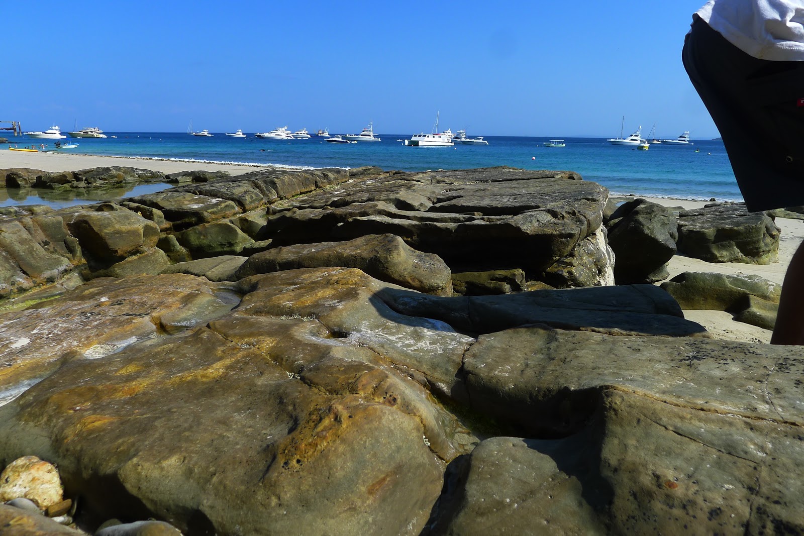
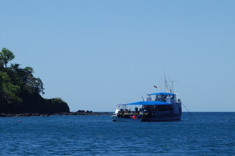
And so life could be kind of sweet in Boca Chica. There are a few hotels of character on the waterfront (Boca Brava, Seagull Lodge), along with a couple fishing establishments. Sport fishing seems to be the major form of tourism along this coast, and boats such as these will go out every morning40 or 50 miles to Coiba or another special spot.

2 sport fishing boats at the weighing station Boca Chica Panama

Boca Chica the pueblo is pretty small: two docks,  a tienda and a half, a school and a church or two, plus a smouldering land fill now containing a trash bag of ours. It connects by road to the Panamerican Highway and David an hour away. It connects to cell towers, Claro and Movistar, but not Digicel. In the plaza/park hung a handwritten notice signed by the mayor indicating that anyone found inebriated there over the Christmas holidays would be locked up overnight.

DSC08406
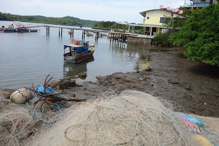
There is even a boat and storage yard, (this is not a photo of it, but rather of the Boca Chica waterfront) operated by Carlos Spragge. If you have your own trailer you can be hauled out there. Or you can take a mooring. Or dry out on a grid. This place is full of surprises.

Where the Surf Meets the Turf

One of the most surprising things we ran into was a cattle swim. Fifty or so animals had been brought by truck to a holding pen on the mainland. They were about to be sent to the island across the way, Boca Brava. At slack low tide, vaqueros on the island herded three vacas into the water, and a lancha mostly running backwards, outboard motor toward the cows, ‘encouraged’ them towards the mainland. Those three were the ‘tourist guides’ for the animals who were being moved towards ‘better grass’ on the island. Together the entire herd was driven back into the water and swam across. The head honcho in one lancha swung his lariat while someone in the repurposed water taxi prodded  with a pole to turn a reluctant participant. Cows can swim!

cattle herded across river to Boca Brava

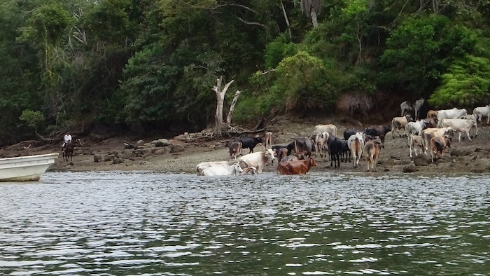
The jefe of the caballeros was a talkative and friendly chap. Later someone asked me if  I had bought property from him. Seems like a rancher’s dream might be to sell some ‘appreciated’ land to someone whose dream would be living alone off the grid on an island facing the ocean. He’s seen it happen before. However, I already live that way, and when I weary of the view, my island (Galivant) can move. I did quite like the view in Western Panama, but it’s time to turn towards Costa Rica.

Stars for Christmas at Punta Mala and Cebaco, Panama

Open CPN chart of track around Punta Mala Panama

While much of the world was awash in Christmas wrapping paper and the rest snarled in daily routine, the two souls aboard Galivant were at sea, making their way around Punta Mala, Panama, moving towards Costa Rica from Las Perlas, a trip of about 175 nautical miles which took us a day, a night and a day, basically, of sailing. Our track is the one going off the page to the west (left); the other is our inbound route from the Galapagos back in August.

As you might guess by the name of it -Bad Point, Evil Point- there are some issues.The winds can be accelerated to a howl there and the seas contrary, and short and steep, while the tidal current will most likely turn on you at some point during the trip. Add a lot of shipping traffic bound to and from the Panama Canal, plus seemingly-oblivious fishing boats, and you’ll be on high alert during this particular passage.

Rounding Punta Mala

However, we had a pretty good time of it. There was just enough wind, and it was on the quarter, which is our best point of sail both in terms of speed and comfort. Within an hour of leaving we had the gift of a “just-right-sized” mahi mahi in the fridge, caught on a sparkly lime green plastic squid that looked much like the mahi herself. The dry season in Panama seems to have begun, so those piles of clouds overhead for months, (the dark ones spewing lightening and rain) were nowhere in evidence.

Our Christmas day was glorious and bright, and the night even better, so, so, SO many stars, and brilliant constellations strewn on carpets of them. Then, for a different perspective, the heavens offered up “half a moon for half a night”. All in all, it was a fine way to spend the holiday.

In the wee hours of Boxing Day though, someplace off Punta Piedra, the next point around from Punta Mala, we did run into a patch of ‘devil water’ with rude and unsynchronized seas tossing us about. It didn’t last that long, thankfully. Sturgeron, my favorite seasickness remedy, also serves as a magic placebo and calmative.

What shipping lanes?

We passed probably two dozen ships in the vicinity of the point. We couldn’t guess how far in or out we should be to avoid them and there seems to be no traffic separation scheme. As a sailboat sailing, we supposedly have the right of way, but our 13-meter little peanut shell, even at eight knots of speed, would be as nothing to a class A 500-foot steel box laden with thousands of shipping containers and moving at twenty knots. We try not to lose sight of that essential fact.

So we just maintained our course and speed, and kept our eyes peeled, with both of us in the cockpit much of the night ready to change course or slow down. At one point we had a ship 2 miles to port and another 3 miles to starboard, which sounds farther than it looks from the deck of a small boat! But thanks to the technological marvel that is AIS we could see that the starboard ship had actually altered his course 12 degrees and would clear us easily.

AIS, The Automatic Identification System (AIS) is an automatic tracking system used on ships and by vessel traffic services (VTS) for identifying and locating vessels by electronically exchanging data with other nearby ships, AIS base stations, and satellites. So says Wikipedia.

The information comes to us via a VHF antenna hooked to an AIS receiver and display unit. We can usually see the vessels’s name, course and speed, destination, the closest calculated point and time of approach, and monitor their changes. That sure takes some of the worry out of being close!

The fishing fleet around here is distinctive. They don’t appear as AIS targets because they are not required to (less than 300 tons and not carrying passengers); but they do flicker and sparkle sometimes, as if they are carrying blue party lights in the air behind them. We always assume that the fishing boats are fishing, not watching, but this close to so much shipping I’ll bet even they keep their eyes open.

Isla Cebaco, Western Panama

With the excitement over, but the weather still clean and sparkling, if a bit scarce of wind by sunrise, we continued on around the third point of the peninsula, Punta Mariato, and into an anchorage on the southwest end of a big, seemingly empty but conveniently located island called Cebaco.
Cebaco sunset with gulls on mooring
Right where you would chose to anchor there are about a dozen moorings. When the world sees the wisdom of making Doug its emperor, there will be no more of this kind of thing, I can assure you. Not knowing anything about the moorings, we can’t use them, with no one on them, they’re just a waste/inconvenience/hazard, and they make it hard for any but the cognoscenti to find a sheltered spot to stop. Hard, but in this case not impossible – there is good bottom and enough room in these conditions (northerly winds, no southwesterly swell) to anchor to shoreward of them and that’s what we did.

Sportfishing Club

Cebaco Bay Sportfishing Club fuel and party boat Then, as if to confirm that the solstice, or the holiday season, or the close of the calendar year, really does include the start of the dry season,  the next morning the fuel barge arrived. After a brief chat with the captain we learned that this part of the bay is owned by the Cebaco Bay Sportfishing Club, and this their vessel provides re-fueling for sportfishing boats traveling between Panama City and Costa Rica. They rent out the moorings, provide accommodation aboard for 14 people, and have a bar and kitchen both on board and ashore.They will be there until November; their busiest time is around Holy Week. Sounds like they might like to expand the operation to include more facilities ashore, while keeping the land ‘natural’, but the signs for the environmental impact statements date from 2010, so there’s no rush!

Cebaco Clearing the water collection filter
Here’s Doug cleaning the strainer upstream of the little waterfall. There were tiny tadpoles and crayfish too, appropriate to the size of the reservoir

‘You’re welcome to walk around ashore, go to the waterfall, help yourselves’ he said, and so of course we did. A very small waterfall but it was enough to overflow their storage tanks down the hill, so we took a nice outdoor shower, walked the beach, checked out the property, and smelled the evocative springtime aroma of newly flowering trees. It’s nice to be in Western Panama! dead starfish dancing across sand beach low tide Cebaco

Meanwhile, Back In Panama

DSC07744It’s the month of November when Panama’s calendar is larded with ‘fiestas patrias‘; such as independence from Spain, and independence, or ‘separation,’ from Colombia. Each holiday gets an associated long weekend, and  some fireworks and music. Even the Panamanians will tell you not to count on getting much done in November.

I noticed this girl on the street, and so did most everyone else, including drivers who honked their horns and men in the back of trucks who shouted compliments.  She thanked me for asking to phot0graph her. No, no, I Thank You! Isn’t it nice to see someone so well put-together for a holiday?


And then there are these people, also put together for their holiday, you might say:

Cemetery on Taboga Island

It’s  the Day of the Dead, or on Taboga, or the weekend of the dead, since family members don’t seem to come specifically for the cemetery. Despite the island having been inhabited since 15XX, the oldest tomb I saw was from 1910. There’s no food set out, no parties, and we were the only visitors I saw, but there was plenty of fresh paint and the finest in artificial flowers, plus that special contemplative atmosphere.

Taboga cemetery red flowers

graves at the cemetery Taboga Island Panama


scenic view of Taboga bays and village


We have had the boat on a mooring at Isla Taboga, about five miles offshore of Panama City, while we did some travelling.  I gather that there  once were a number of US military and/or canal facilities on the island, but there’s not much  of that left now. The rubble upon which the road is based is full of ceramic tiles from, I’m guessing, those demolished US facilities.

Chuy and Susan, at  tabogaislandmoorings, have a nice little business for most of the year looking after boats for absentee owners on their sturdy moorings in 50-60 feet. Galivant is the sailboat closest to the ferry dock.

The water is pretty clean and warm, but the anchorage has been rolly recently so it’s hard to scrape growth off the bottom of the boat. Instead we took a hike to the cross atop the hill for a look at the scenic vista.

Taboga Panama beach scene with waterskier

Down at the beach on the first November holiday weekend, people were doing the usual beachy things in a low-key way.  There were modest parades in the village ( population 500 people, Susan guessed); mainly illustrating the inordinate popularity of the snare drum.

This beach, most of which is the sandspit extending to a little island, entirely disappears on the higher tides, so the chairs and umbrellas are  constantly moving. Signs warn against swimming there at the height of the tide, due to the stong current.


Taboga Island Ferry waiting ling on holiday weekend

It took four full ferries to get the visitors back to the mainland on Monday afternoon. Luckily, it’s less than an hour’s ride, and there are three boats available.

Galivant left the next day for the fruits and vegetables of the Big Smoke, Panama City. On the way into town we passed this fishing vessel, the purse-seiner Taurus Tuna, registered in Venezuela. With Taurus‘s tiny helicopter on the cabin top and a big net and net-setting boat on the stern, any tuna will be lucky to escape. When I Googled for factoids about this vessel, I found various information sites offering up its vital numeric statistics (78 meters, 1800 Gross Metric Tons), but nothing that interested me as much as a YouTube video forbidden to me by my present internet connection, which purported to describe this vessel in some kind of confrontation with  sportfishers off Costa Rica in 2011. I wonder…

Tuna fishing vessel named Taurus Tuna at anchor in Panama.

My interest in this tuna boat was piqued by a tour I was given 20 years ago aboard a larger US tuna fishing boat of the Zapata fleet out of San Diego I think it was. So much was astonishing about the vessel; what I most remember was that an entire whole ungutted tuna the length of a baseball bat, and the width of a telephone pole, was flash frozen and being pitched into the storage freezer within five seconds of emerging from the net.

Later we saw the canning process in Pago Pago, Samoa, might have been a Chicken of the Sea plant. The workers were mostly women in rubber boots being paid a dollar an hour; the ‘spring water’ was actually from a Samoan ‘spring’, and the waste from the plant contributed to less than salubrious conditions in the harbor. At the time I thought ‘it must cost a lot to ship those empty cans out here; too bad they can’t make them smaller for shipping’ and now it’s done – lo and behold, the  flavor-fresh pouch! I still buy tuna, although less than I used to, and am surprised to find here that they sometimes add vegetables like peas and carrots, as if to make it a balanced meal in a can.

Panama City itself still seems like a boom town; so much is happening on the skyline, and there’s so much traffic and noise that it’s hard to imagine how it once was, or might be. The glitzy parts of town have that veneer, however I wonder about their water  and power supply, and parking, and their sewage disposal, for starters. Building codes and  planning seem very loosely enforced but I guess things will work out about as they generally do.

cityscape construction site along cinta costera

Panama City, cityscape, highrises, rooftops, Cruiser Casa view

Here we have yesterday’s  structure pushed aside to make room for something else, but what? A luxury tower, with some lucky views toward  the ocean and the green ribbon of waterfront park that the Martinelli administration hopes will be  one of its crowning achievements? And some unlucky views into the neighboring tower’s bedrooms?

Now that we have migrated back to Panama, temporarily, and to a new blog home, I’ll be working to get a handle on uploading images and resolving the various glitches of my blogging career.

Just because the next post may say Ecuador, doesn’t mean we’re not still in Panama! But we’re planning to move towards Costa Rica and Nicaragua.

Panama Pacific Equinox

P1150631
You could say we got out of Panama City just in time but, actually, we got out a bit too late. There was a nice wind opportunity, another of those North American cold fronts with a long tail trailing over the Isthmus of Panama, enough to blow the palm fronds sideways. But we weren’t done with town stuff like chasing down parts and supplies until the last day of that weather, so only got as far as the Perlas islands.

Now, for the last fortnight, the GRIB files, computer renderings of predicted winds, show big blanks all along our route to Ecuador. What wind arrows there are lie featherless (less than two knots) and scattered  every which-way. There are by now probably a couple dozen boats in the various Las Perlas anchorages hoping for that first breath of wind comes before they use up all their trans-Pacific groceries. There’s at least one Galapagos-bound boat (heard him on the radio) who has been happily drifting with the current for a week now, and reports sighting sea lions and sleeping whales.
Image
We celebrated the first day of spring anchored south of the main island of Contadora. Although dreaming of daffodils and dogwoods, I made do with a faint haze of flowers on the few trees that aren’t deciduous and/or desiccated now at the end of the dry season. The Intertropical Convergence Zone shifts around us, making for interesting skies; they sometimes look watery but aren’t, yet. At times there has been even been mist and dew, enough to wipe out the horizon, and cover the deck, a free-fresh-water wipe down. At other times, the ITCZ is ‘indiscernible’.
P1150645
After the serious work of getting the city grit off the boat, we took a dinghy cruise/fish troll over to the island of Mogo Mogo in search of a lime tree we’d heard about. Instead, we got waved off and whistled away by people shouting ‘Survivor Island, Survivor Island.’ It seems that a Russian edition of Survivor is being filmed right now. There’s a line of yellow caution tape strung along the shrubbery as far as the eye can see, and some structures around on the south side beach. Someone really desperate could probably flag a passing fisherman or even one of the yachts anchored at Chapera.

We also took a walk around Contadora, and found a lovely beach on the east end with a beached ferry boat and a semi-derelict resort.
P1150657

Not sure about the ferry, but the resort developer reportedly died, and his wife was apparently unable to pull together all the building liens and financing to complete the project. Someone is working on part of it now though, and it looks like the Survivor people have a little ‘studio’ round back.

P1150671

We’ve been calling Panama City the Big Smoke because it’s a charming phrase we once read in a Pidgin language dictionary, referring to cities in general. But these days in Panama it’s not really a joke. We had been getting bits of ash landing on the boat from hillsides being burned. In fact, Panama City lost its electric power a couple weeks ago when farmers lit a cane field that happened to be right under one of the  country’s three main transmission pylons.

This time though, the smoke wafting through the anchorage smelled like man-made substances burning. Turned out it was the always busy Allbrook Mall, the largest mall in the country, which serves as the main bus terminal for provincial buses besides. The Madison/Conway store was badly damaged, and 60 neighboring stores were closed for smoke damage. Either there are no sprinklers installed in the mail, or they did not work. But no injuries or deaths were reported.IMG 5018
A day or two later  the Diablo Rojo (Red Devil) buses were, as scheduled, taken off the road, leaving the entire city, as planned, reliant on the fancy new Metro buses.  It’s part of Panama’s design to become a player in the World-Class City tournament. The Diablo Rojos are recycled US school buses, often exuberantly painted. You can fit three people in the seats on the left, two on the right, which makes maybe seventy sitting down and maybe not that many, but lots, standing up. Watching them unload is sometimes like watching the clowns piling out of the VW at the circus – how many more can there be?The fare is 25 cents, and the buses are usually full especially during rush hour. But they are old, uncomfortable, often poorly maintained, and considered to be dangerous.

The nice shiny new Metrobuses carry about 35 sitting, and I think I’ve read 60 standing. You need a preloaded magnetic card to pay; the fare except on certain express routes is still 25 cents. I’ve read that 300 Metro buses replaced 700 Diablo Rojos, but some of the coverage degenerates into remarks about corruption and cronyism so it’s hard to say what’s really going on.  The construction of the subway which has so many roads torn up or closed down is another headache and it is rumored that the subway opening has been postponed from October until next February. Panamanians are generally patient people, habituated to spending hours in lines, even for the simplest store checkout, but they want to get home at the end of the day! After a week, the transit people urged patience and announced plans to put signs indicating where the various buses were headed in heavily traveled zones like Cinco de Maio.
Cerropatacon 1 150 100Plus there’s a another fire now, this time at a large landfill, wafting toxic fumes over the city, closing schools and sending folks to the hospital. Friends in the anchorage report that half the skyline is obliterated at times. They have some kind of foam fire stopper coming in from the US and also are using explosives to tame the flames. I read it online! Photo courtesy of newsroompanama.com

Googling around, I also found that none of these stories are new – big fire at the Mall back in 2009, riot police have been called in the past for bus problems, and the trash fires are a recurring phenomenon. The economy may be booming here with GDP running near ten percent, and of course the estimated five billion dollars being spent on the new Panama Canal locks and associated upgrades. Still, it seems there’s a lot of catching up to do before Panama can claim world-class status, or achieve half of what their role model, Singapore, has managed.P1150495
In our smaller world, now relocated in the clean clear air of the Perlas islands, the boat projects continue. I ‘m aware that a lot of these maintenance issues we’ve foisted upon ourselves by not leading simpler lives, but so far the balance is still in favor of the amenities!  We’re getting really experienced at taking the water maker out as we chase down a pesky leak on the high pressure side. Some new engine parts arrived and have been applied with, so far, good results.
.Doug in forepeak
Lubricating the anchor windlass is not one of  Doug’s favorite chores.
Getting city-fertilized growth off the bottom and the propellor is more pleasant now that the water has warmed some. Big splurge on a new aluminum-bottomed dingy (more appropriate for dragging across beaches in this land of double-digit tides,) but it needed an intricate fitted cover (‘chaps’), the making of which ate almost a week of my life. Software and computer issues spring eternal. Pressure canning ‘Meals Ready to Eat’ like beef stew, chicken soup, pre-cooked beans, and what may be a lifetime supply of kimchi.
Plus my brother Curt came and we got to be tourists and entertain the locals for a little while. Here Curt makes his own raspado ice drink.
P1150518
And we really enjoyed our visit to the Panama Canal Museum at the Miraflores Locks, especially the simulation from the bridge of a ship passing thru. I can’t upload that video, so here instead is the bulk carrier Rosalia D’Amato, presently enroute from California to Tianjin Xingang, at an average speed of 12.2 knots,  according to marine traffic.com. I wish I knew how to find out what Bulk they’re carrying.
IMG 5246
So here we are, waiting for that light northerly wind predicted for the end of the week. Surely there’s one more northerly weather system left in the season! Then we’ll be moving towards Puerto Amistad, Bahia de Caraquez, Ecuador, 35 miles south of the equator, at an average speed of – well, we would hope for 5 or 6 knots, and the chance to travel there in a straight line, but neither is guaranteed, or maybe even probable.
P1150698
In the meantime, there are nice rocks on the beaches, which I photograph instead of taking them home like I used to do!
P1150715
And we’re catching some fish which I photograph, then eat.
That’s the report from Panama on the cusp of the season. The Pacific is living up to its name.

Las Perlas of Panama

A lowish tide on Contadora, and more people than you usually see in the
other islands of the Las Perlas group.

Las Perlas, an archipelago thirty-some miles southeast of the city, is a great change of pace from Panama City. So far it’s been curiously, blissfully, quiet out here.  With some fancy groceries from Riba Smith, enough wind and sun for decent power generation, a few friends passing through, and even, in the northern part of the group, a tolerable internet connection, I could sit out here for weeks!

That’s us, near one of those islands near the middle
of the Golfo de Panama, Archipelago de las Perlas.

But first a comment about the weather. Since the middle of January we have been cool – actually sleeping under sheets, stuffing dish towels in the dorades (air-scooping ventilators), and starting the day in sleeves. One day last week-bam- the water temperature dropped ten degrees, to about 70 – one anchorage reported 63!  It’s been like the Chesapeake on a fine autumn day, even down to the partially-leafed trees, with squadrons of pelicans and boobies replacing flocks of geese.

This time of year, the InterTropicalConvergenceZone, that band of weather around the equator where the northerly and southerly trade winds meet, well,  the monsoon, as some call it,  retreats  from 8-10 degrees North latitude down to an area closer to the equator. Northerly-quarter trade winds fill in as they do in the Caribbean. The effect is to blow the warm  clear tropical water out of the bay. In its place comes an upwelling of cool, plankton-laden water, and later on, in places, red-tide algae growths. We get cooler water, cooler air and not much chance of rain. These conditions, I gather, may persist through March.

The currents also increase, and given that the tidal range in the last spring tide was 16 feet*, there’s a lot of water being stirred around. Visibility through the plankton is down to about ten feet. So it’s definitely not diving weather, and swims are abbreviated. Considering that our tank water on the boat is the same temperature as the water we float it, even showers are feeling brisk, unless we help them along with some extra heated water. On the plus side, such bioluminescence means that the light show in the toilet bowl at night is very nice. 

Surprising how pretty the skin of a fish,
this one a mackerel, can be.

Sailing over, we even saw a pair of whales, or maybe they were whale sharks, and literally dozens of rays flying out of the water and landing with a splat. And we broke our fish-less spell with a nice pair of mackerel (sierra they’re called here) in the six-pound range. Not everyone is lucky enough to get a fish-weighing scale for Christmas!

Now, the pearls of Las Perlas. Something about this place favors, no,  make that, used to favor, oysters growing pearls. When Vasco Nunez de Balboa came here in 1513 he took pearls away by the basketful. The natives only valued the meat, and within two years they (they natives) were wiped out, not in a nice way. Then, according to the brief histories in Wikipedia, slaves were brought in to continue the harvest. One of these slaves, in the 1600s, found one of the largest (55 carats), perfectly symmetrical, pear-shaped pearls in the world, known as La Peregrina. He gave it to the Spanish governor and was freed, or so the story goes. 
The first owner thereafter was the Tudor Queen Mary. Then it passed through the Spanish royal family for a couple centuries. Richard Burton bought at auction for  $37,000 and gave it to Elizabeth Taylor as a Valentine’s gift (good bidding, Richard!). Last year Sotheby’s sold the  necklace from which it dangles for $11 million in a sale of her  ‘effects’ ( rarely has that word seemed so appropriate!)
photo courtesy Goldsteinjewelers.com

There are no pearls to speak of here now. There aren’t enough oyster shells for buttons, a companion industry, and there’s no oyster meat industry. It seems that what might have recovered after heavy harvesting was wiped out in some kind of ‘blight’ earlier in the 20th century. Maybe that’s why there’s no commercial pearl-culture industry either. The more questions I come up with, the less I know!

photo courtesy Wikipedia Sub Marine Explorer

Then, there is the mysterious submarine mentioned in the local bible, the Cruising Guide to Panama by Eric Bauhaus, which can be seen on the beach at Isla San Telmo. It was once thought to have originated in World War II, but the real story is more interesting. It was a Civil War-era submarine, built by Julius Kroehl, specifically for pearl diving. It went down to around 100 feet, and was pumped full enough of air so that two hatches on the bottom could be opened for harvesting the oysters. 

Unfortunately, there was insufficient understanding of how high atmospheric pressure might affect people. Or, as Wikipedia tells the story (Sub Marine Explorer):

After construction, the Sub Marine Explorer was partially disassembled and transported to Panama in December 1866, where she was reassembled to harvest oysters and pearls in the Pearl Islands. Experimental dives with the Sub Marine Explorer in the Bay of Panama ended in September 1867 when Kroehl died of “fever.” The craft languished on the beach until 1869, when a new engineer and crew took it the Pearl Islands to harvest oyster shells and pearls. The 1869 dives, with known depths and dive profiles that would have inevitably led to decompression sickness, laid the entire crew down with “fever”, and the craft was laid up in a cove on the shores of the island of San Telmo.

Read all about it here at http://en.wikipedia.org/wiki/Sub_Marine_Explorer
By the way, Galivant is just about the same length and width as this submarine, just a little less dense!

The Panamanians who can afford the very nice, pricey facilities at the yacht clubs and marinas in Panama City generally own fancy sport-fishing boats, not sailboats. Why so many? Why here? Turns out that we are in a special area, with lots of bait fish and lots of ‘sport’ fish in the convergence areas between the currents and the seamounts. Some black marlin approach 2000 pounds and a long-standing world record was a black marlin of 1560 pounds. To set a record, the person in the fighting chair must be the only person who works the fish, no handing it off for a trip to the toilet, or for any other reason. I’m told the 2000-pounders have been verified because they show up as by-catch in fishing nets. Personally, I don’t get it about sport fishing, and I’d like the fish to stay unthreatened. But it’s big business around here.

photo courtesy Tropic Star Lodge

 Some of the Survivor shows were filmed in the Las Perlas islands. I don’t know much about the show, except it seems that they don’t wear many clothes, so I guess it wasn’t filmed on one of the islands noted for no-see-ums (biting midges). Another of life’s little mysteries is why these bugs thrive on some islands and not on others.

The most developed island, Contadora, has, by right of its convenient location, airstrip, and a bit of upscale development, been used for South and Central American summit conferences. The south side has a number of private moorings and seems to get busy on weekends. There are a few hotels, and restaurants, good roads for the golf carts, a small grocery, some nice houses behind gates and walls, and the beach is lovely.

The rest of the islands are pretty empty and low key, a few small villages and a few fancy houses here and there, but very little development. How long can that last? Work started on a pair of marinas at Pedro Gonzalez. Continuing rumors about a ‘new Contadora’ with houses, condos and ‘community amenities’ on Viveros. A big island, San Jose, (‘bigger than five nations’ said the ad) was for sale for $311 million dollars in 2011, a world record at the time. But for now the Perlas islands are the epitome of tranquility – just the spot for fishing, boat projects, reading. I like it here!

*that’s 16 feet of difference between high and low in the space of six hours. Watch where you’re going and how you anchor!
For my oyster- (and pearl-)loving friends, here’s interesting three pages (with pictures!)  about the evolution of the trade: http://spo.nwr.noaa.gov/mfr612/mfr6122.pdf