A Holiday, and a Reminder of Why

Dressing ship in honor of Benito Juarez at the Navy Base at Guaymas
Dressing ship in honor of Benito Juárez at the Navy Base at Guaymas

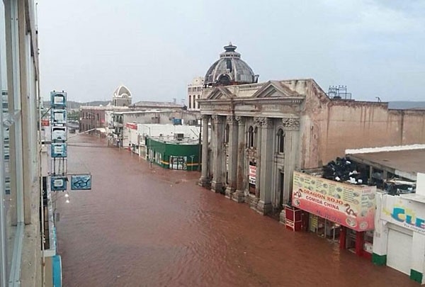
Merging onto the Modern Highway

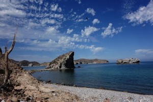
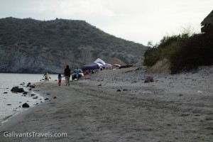
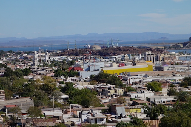
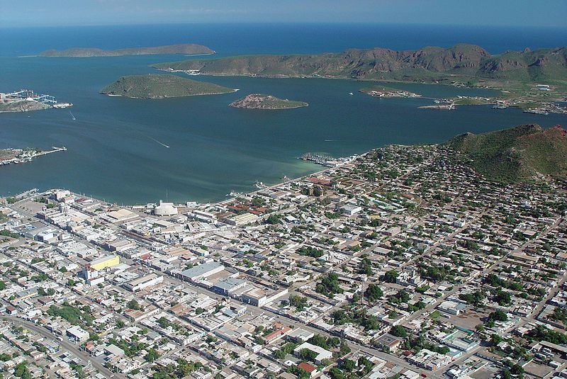
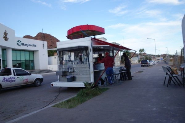
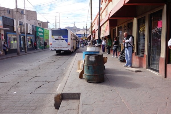
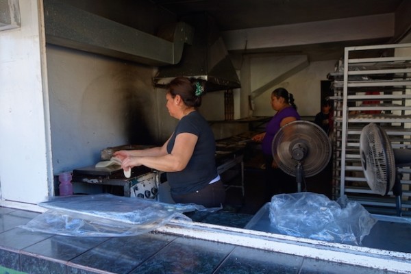
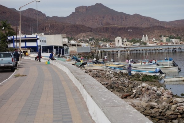
We arrived back in Guaymas on the weekend of the vernal equinox, taking advantage of a break in the winter’s persistent northwesterly winds to make a jump north. Now, instead of a peaceful life in the isolated anchorages of Baja California, we’re in the throes of the 21st century. Excited to use the internet, but not about some of the news it brings. Excited to see our car, at least in its role as bodega/storage shed, but we can’t get the doors open because the battery is dead. It makes me think back to a line from a book I’m reading about the 1930s adventures of a young couple who traveled from California to Panama in a kayak.

"Machineless men, dwelling outside the currents of time and change, the faces of the villagers of Punta Duro reflected the peace and contentment that came from being presented with no problems beyond their capacity to solve." From Enchanted Vagabonds, by Dana Lamb. 1938, Harper and Brothers

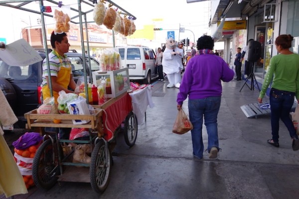
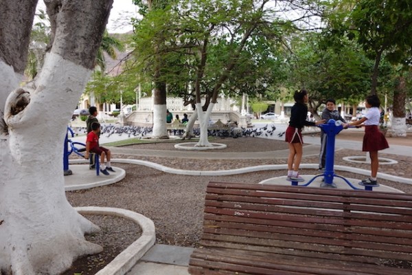
We were raring to go out and see if we had the capacity to solve our problems and thereby reacquire peace and contentment on Monday , but whoa! Slow down! It’s a holiday! Honoring Benito Juárez, on March 21, this year is a holiday that segues neatly into Semana Santa, the Holy Week bookended by Palm Sunday and Easter, probably the biggest vacation week of the year in Mexico.

Overheard on the radio: “The beaches are already filling up and they’ll be so packed by Thursday that you’ll think there’s no more space. Then everybody else will come.”

Back to Benito Juárez:

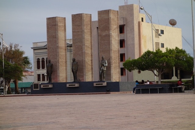
I’d venture to say that there is not a town in Mexico that does not have a street named after Benito Juárez. And there he is on the twenty-peso note. He was president during tumultuous times in the 1860s. But why else would he be called Mexico’s Abraham Lincoln?

The most used piece of currency in Mexico is the 20-peso note featuring Benito Juarez. It's plastic, not paper, with secret codes embedded.

The most used piece of currency in Mexico is the 20-peso note featuring Benito Juárez. It’s a durable kind of plastic, not paper, with secret codes embedded. Each bill in Mexico is a different color, and some are different sizes too, making them easy to tell apart.

So I read about him on Wikipedia. I’m trying to keep my summary short and sweet, but these were very confused times in Mexico and some hard-to-imagine things occurred. Kind of like current events.

Importantly, Benito Juárez was a indigenous Mexican, not Spanish, but Zapotec, born in 1806. His parents were peasants who died when he was young; he was a shepherd and farmer until he was 12, when he walked to the city of Oaxaca to go to school (and learn Spanish). An acquaintance who was impressed by his intelligence arranged for his education.

Eventually he became a lawyer, and in his 30s, a judge, and in his early 40s governor of Oaxaca and the husband of a 20-years-younger white woman, which was notable considering the prevailing racism and social stratification of the era.

220px-Juarez
Benito Juárez with his sister Nela (right) and his wife Margarita Maza (left), 1843. Photo courtesy of Wikipedia, Benito Juárez entry

Meantime, the Mexican War with the Americans was taking place; Juarez was exiled for several years and worked in a cigar factory in New Orleans. But he returned as the Liberal party regained power. In this Reform Period, an effort was made “to create a modern civil society and capitalist economy based on the model of the United States. The Ley Juárez (Juárez Law) of 1855 declared all citizens equal before the law and severely restricted the privileges of the Catholic Church.” (Wikipedia)

Juarez, as interim president of the country, headed the liberal side in the  turbulent Mexican civil war known as the Reform Wars through the late 1850s.

He was eventually elected president in his own right in 1861 but the country’s infrastructure and economy had been badly damaged by the wars; Mexico defaulted on debts owed to England, Spain and France.

So France, with the support of the Conservatives from the Reform Wars, invaded, and Napoleon III installed the Hapsburg duke Maximillian as Emperor of Mexico. Juárez  ran a government in exile in Chihuahua until 1867 when the French were finally defeated and Maximillian executed.

Juárez won election twice after that, once ‘clean’ and later ‘widespread controversy and fraud’. He died of a heart attack at the age of 66 while reading the newspaper at his desk.

The period of his leadership is known in Mexican history as La Reforma del Norte (The Reform of the North), and constituted a liberal political and social revolution with major institutional consequences: the expropriation of church lands, the subordination of the army to civilian control, liquidation of peasant communal land holdings, the separation of church and state in public affairs, and also the almost-complete disenfranchisement of bishops, priests, nuns and lay brothers, codified in the “Juarez Law” or “Ley Juárez”. Wikipedia, Benito Juárez.

His life did overlap Lincoln’s, and parts of their life stories and political agendas have substantial similarity, and reforms worth fighting for, so I guess it’s a viable comparison. But in one way they were quite different, Lincoln being notably tall and lanky, and Juárez ‘peaking’ at only four feet, six inches tall.

UPDATE: I’ve found a way better write-up here: http://www.mexconnect.com/articles/274-mexico-s-lincoln-the-ecstasy-and-agony-of-benito-juarez

The author commented that Lincoln in one sense was lucky to have been ‘martyred’ at the height of his success and thus spared the frustrations and disillusionment of Juárez’s last five years.

I can’t help but try to imagine how the wild and wooly events of Mexico in the 1860s would be described by today’s journalists and commentators. And wonder where the likes of today’s politicians and plutocrats would have found themselves in the 1860 landscape. There’s a bit more analysis of Juárez’s legacy from Wikipedia as a footnote.

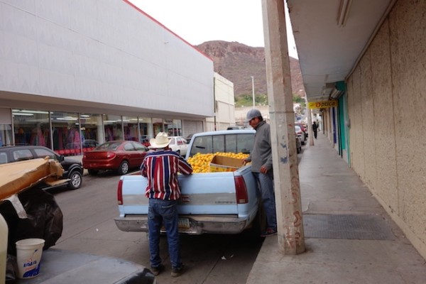
While banks are closed today, I don’t think Diá Benito Juárez is a retail shopping extravaganza, at least not here in Guaymas and not at the battery store. I do hope that everyone is making the best of the day!

Sailboat sinks after hitting a whale

Because, on a more somber note, we are also thinking about a friend whose sailboat sank beneath him this week, after he hit a whale in the pre-dawn darkness. In twenty minutes, from his dinghy, he watched his very well-tended pride and joy sink in thousands of feet of water, thirty-odd miles short of Guaymas.

The good news is that the safety net we don’t want to count on but secretly do, consisting of an EPIRB (Emergency Position Indicating Radio Beacon) and the person or institution it notifies (in this case Canadian authorities and through them the Mexican Navy) – that system worked exactly as it should.

Our friend was safe ashore very quickly. He did have insurance, and had prepared himself well for the voyage by having his ditch bags and liferaft ready in the cockpit. So although he needed to borrow shoes and clothes, he had his paperwork and electronics, etc. And his life. But his floating home is gone forever.

We had plenty of time to contemplate all the above as we came the same way the following night, scanning the darkness for debris, and for a concussed, angry, or dead whale, seeing nothing.

It’s a reminder just how fast a situation can change. With that in mind, let the Mexicans enjoy their holiday, and let us enjoy it too.

Footnote…a bit more about Mexican political history and Juárez’s legacy, from Wikipedia

“*La Reforma represented the triumph of Mexico’s liberal, federalist, anti-clerical, and pro-capitalist forces over the conservative, centralist, corporatist, and theocratic elements that sought to reconstitute a locally-run version of the old colonial system. It replaced a semi-feudal social system with a more market-driven one, but following Juárez’s death, the lack of adequate democratic and institutional stability soon led to a return to centralized autocracy and economic exploitation under the regime of Porfirio Díaz. The Porfiriato(Porfirist era), in turn, collapsed at the beginning of the Mexican Revolution.”

So much, from more than a hundred years ago, sounds so familiar in this description.

Out of Guaymas, Out of the Sea of Cortez

In the spring, we left Galivant propped on stands, out of the water, in Guaymas for the summer, as we had done the year before. We drove back across the country to Maryland, smelling some roses on the way, to finish some house projects. And then in October we drove back in a minivan loaded with boat bits, arriving again in Guaymas at the end of the month, about when the Sonoran summer weather began to cool down to the 70s and 80s.

Flooding in Guaymas

We had seen photos of flooding in Guaymas, the result of over a meter of rain in just a couple hours on October 2, which left thousands at least temporarily homeless and roads washed out, according to thenews.mx. So we weren’t sure what we’d find.

There was a whole lot of rain in a brief period and this was the result, but it only lasted a couple hours, I was told.
There was a meter of rain in just a few hours, overwhelming the roads and sewers.
In the far far background a mile or two away is the dry-storage yard where Galivant was hauled out. We got excited when we saw this picture, but there apparently were no similar consequences.
The malecon flooded too. In the far far background on the other side of the bay is the dry-storage boatyard where Galivant was hauled out. We got excited when we saw this picture, but there apparently the boatyard stayed high and well-drained. Photos from thenews.mx.

Everyone we asked in the downtown area pictured above just shrugged.  In short, downtown was dried out and back in business with no problems readily discernible to the outsider.

Roadwork too

But there is a lot of new, and necessary, road work going on. There is major work on the road to the boatyard, involving an extensive excavation one foot over and three feet down from every passing tire. New water pipe awaits installation nearby. There were numerous shifting detours through pot-holed and puddled neighborhoods. Washed-out dirt-rock side roads are gradually being graded, even paved. Poles, piles of rocks, and other eclectic markers keep the alert day-time driver clear of missing manhole covers. Driving in town was quite the adventure this year.

The new gobernadora* may be the one responsible, or maybe it’s been in the mill for years, brought forward by the big rain. Certainly,  everyone, –drivers and water users, roadside business owners, bus passengers and cyclists– anyone who uses the roads or depends upon those who do  — will breathe a huge sigh of relief when the holes, ruts, potholes, and ditches are finally filled in and evenly paved.

A public banner showing a couple happy and relieved at the state of the new road behind them. This is a bad picture, and from the state of Nayarit not Sonora besides, but the sentiments are surely the same. The companion poster shows workers putting bright yellow paint on a speed bump, which would also be cause for rejoicing were it the new standard.
A public banner showing a couple delighted at the state of the new road behind them. This is a badly exposed picture, and from the state of Nayarit (looks like the Punta de Mita road) not Sonora besides. But the sentiments are surely the same. The companion banner showed workers applying bright yellow paint to a speed bump (tope), which would also be cause for rejoicing were it the new standard.

 We spent a long month out of the water at Gabriel’s Marina Guaymas working on things. We still like it there, finding it a friendly and straightforward do-it-yourself yard. What’s to Like about living in the shipyard tells you more about that! Nonetheless, we’re not motivated to linger longer than necessary when there’s so much to see and do over the horizon.

Finally free to move, we faced a decision: should we head back to familiar places on the Baja side of the Sea of Cortez?

Last winter we stayed in the Sea of Cortez, and we enjoyed it thoroughly. We found the rugged Baja scenery striking, and liked the exotic emptiness of the landscape. I read as much as I could about the area (a lot about geology), and would like look around some more.

It was nice, but it was also  – well, cold would be an exaggeration, perhaps an offense to those under the chilly mantle of actual winter. In fact, despite the occasional dips of overnight temperatures into the low fifties, the days were usually sunny and seventy plus – pretty pleasant in my book. But I do like to don my snorkel and mask, but not my wetsuit, and swim along the shoreline looking at whatever there is to see. And the water temperature never got above the mid-sixties, which is – cold!  Too cold for a whiney woman in a lycra suit, anyhow.

So this year, lured by daily morning radio reports from other boats of balmy temperatures (“water in the pool 83 degrees”), we turned south from Guaymas.

Heading South

The trip out of the Sea of Cortez can be broken into comfortable legs with stops along the Baja peninsula, but we took the straight-down-the-middle approach, which made for a roughly 600-mile trip to Punta de Mita at the mouth of Banderas Bay. It took us five days.

Satellite image of mexico track labeled copy
This is not our actual track, which was more of a downwind zig-zag. Map courtesy of geology.com, I think.

The winds at this time of year are almost always northwest or some variant thereof, which, since we were going southeast, might be considered a fair breeze. Driven by systems ‘across the fence’ (that’s how Geary the weather guy refers to the US and Canada), the northerlies can be strong and persistent. Those steady 20+-knot winds that send us south (and keep us there!) also chunk the seas up into short square blocks. “Seas five to eight feet at five seconds” is not an uncommon weather report, and one that makes for uncomfortable sailing conditions.

So when you wish your friends “fair winds”, make sure to add on “smooth seas” too. Also, by the time we got moving, the moon was in its last quarter, rising after 2 am and dimly, when not clouded over entirely. I seem to have spent a lot of time in my life waiting for a moon to rise, then being surprised by it when it does!

The trip south was a mix of screaming along downwind at the northern end and drifting along in not-enough wind at the southern end. We’re a little cautious (or is that lazy?) about sailing efficiently in the dark of night. It’s a complicated rig of hardware, poles and guys, that keeps the sails from crumpling as we roll off the waves. We mainly don’t want to have to spend much time on a rollicking foredeck when we can’t really see all that’s happening. So we tend to reef early and accept compromises to speed in the name of comfort.

Afloat in the universe

The occasional freighter bound for Guaymas or Topolabampo passed at a distance but otherwise, it was just us and our modest red, green and grey navigation and instrument lights. While one of us sleeps, the other sits alone in the dark in the middle of the sea contemplating the universe. I suspect there is sometimes napping as well.

Anyhow, there’s plenty to think about. The firmament, for one, beneath whose dome only we two know that we are here, a minuscule moving mote. I think about the generations long gone who studied and named the night sky, and of the eons beyond counting that the stars have endured, and will endure, beyond whatever we can do to our planet. So, alone, even melancholy, and yet exhilarated too, by the luxury of real darkness in this age of artificial light.

The heavens may be “empty” and silent, but the nearer world of water, ceaselessly sloshing inches away, is anything but quiet or still. The waves do the same thing over and over, only differently each time. It’s mesmerizing. The laws of physics seem quite reliable, gravity in particular.

Breathing metaphors come to mind, heaves and pants, hisses and sighs. It does seem wrong to associate the ocean with breath, because of course it’s the last thing you can do in it. So stay on the boat, keep the water out and maintain buoyancy throughout at all costs!

We always think these shortish coastal passages are harder on the crew than ocean passages lasting weeks. On the short haul, it’s harder to find the rhythm of sleep and watch-keeping, and closer to land, there are more ways to get into trouble. But short trips end soon enough, and then you’ll wake up to find someplace new and different.

sunrise, calm seas, toenail and cleat
Out the galley window as we arrive in La Cruz de Huancaxtel, Banderas Bay. I wonder what’s in there?
Footnote:

*There was a nationwide election in Mexico in June 2015, and the winner for governor in the state of Sonora was the PRI candidate, Claudia Pavlovich, the blonde woman on the political posters which sprouted on roadsides throughout the spring. Although she lost Guaymas proper to the PAN, she won statewide with about 47 percent of the vote.

According to Wikipedia:

Claudia Artemiza Pavlovich Arellano (born 17 June 1969) is a Mexican politician and lawyer affiliated to the Institutional Revolutionary Party (PRI). She currently serves as Governor of Sonora, the first woman to govern the state. Her family is of Montenegrin descent. [1] Previously she served as Senator of the LXII Legislature of the Mexican Congress representing Sonora.[2]

And the PRI is the party that ruled Mexico for much of the previous century. It is also the party of the country’s current president, Enrique Peña Nieto.

San Juanico, Baja California Sur

Jagged eroded small island and peninsula in the bay called San Juanico.

One of the nicest places we sailed to in 2015 is the bay called San Juanico on the Sea of Cortez. On the chart it’s also called Punta San Basilio and lies about 26 22 N, 111 25.7 W, halfway up the Baja California peninsula. This is not to be confused with San Juanico the surfer/fisherman town at Scorpion Bay on the Pacific side. Please see the Photo Gallery at the bottom of this post – more pictures than words this time!

Looking north over San Juanico bay and anchorage from the 'ridge trail.
Looking north over San Juanico bay and anchorage from the ‘ridge trail’ above the south shore.

Squint or zoom and you’ll see a couple of empty houses on the far shore, fancy by some standards (swimming pool!) but realistic in terms of the ten or fifteen miles of dirt road that separate this spot from the highway, and the thirty or so beyond from Loreto, the nearest town. 

Here’s how it looks from the sky, courtesy of Google Earth.

San Juanico by Google Earth. The houses are where the dirt road comes in from the north. The main estuary comes in about 9 o'clock and the ranchito  and ridge trail about 6:30.
San Juanico by Google Earth. The houses are where the dirt road comes in from the north. The main estuary comes in about 9 o’clock and the ranchito, a small estuary and the ridge trail about 6:30.

You might see a couple of RV or pickup truck campers on the beach. Only the relatively intrepid people make it this far. The smart ones come year after year and stay for weeks on end, driving out occasionally for water and supplies. It’s muuuuy tranquilo here.

But for the most part San Juanico is visited by boaters like us. It’s one of the better anchorages, with protection from the prevailing winter northwesterlies and the summer southerlies. Although, I can testify that an uncomfortable swell can and does roll in around that northeast point when the winter winds are up.

You can walk along the roads, or on some trails along the estuaries or atop one of the ridges. If you try to walk all the way to the highway (and don’t bake or desiccate first) you’ll pass a small encampment where a family sometimes has vegetables to sell. We also heard of a place with petroglyphs but never stumbled upon it. Maybe next time…

Between the hikes and the beaches and excursions by dinghy for fishing and whale-watching, you won’t even notice that there’s no word from the outside world. It’s as distant as the occasional con-trail overhead.

Our second visit coincided with Easter week, Semana Santa. The handful of  RV people had gone back north. They were replaced by Mexican families, from Loreto and beyond, celebrating what must be the biggest holiday week of the year. Fishing, popup sleeping tents, shade tents, kids playing in the sand, it was all great to see.

By the end of the week they too were gone.The beach again belonged to the seagulls, the bay to the yachts moving north toward their summer homes.

Easter eve campfire on the beach
Easter eve beach campfire.The cardon cactus has a wood-like frame, and stands in for driftwood.
The Easter Bunny found us.
The Easter Chicken visited Galivant.
The bocce champion.
The bocce champions.


San Juanico Photo Gallery

So without further ado, let’s look at some pictures of the bay and the land around it.


Santa Rosalia, Baja California Sur, Mexico

Santa Rosalia is unusual among the towns of Mexico, because it was designed and built from scratch, mostly from wood, more than a century ago, by the French, specifically by the French mining empresa Compagne du Boleo. Plus, all the mine’s industrial buildings were right in town. And they still are, deteriorating scenically to this day. For some reason, century-old dereliction is more appealing than the modern type.

Looking south and west over Santa Rosalia
From up on the Mesa Frances you can look down on the entire town.

The Compagnie du Boleo to Minera Boleo

The story is that a local rancher, José Villavicenio, found a “crumbly blue-green rock” which assayed out to very pure copper, a boleo.

Company housing for Boleo miners, courtesy of Boleo Mining Museum
Housing for the workers was built in the arroyo, while the mine officials lived on the plateau above, called the Mesa Frances

So, with the encouragement of the Mexican government, the Boleo Company created the town of Santa Rosalia out of nothing, and brought in 6,000 souls to run the port, smelter, railway, and mines.

Compagnie du Boleo locomotive
One of the seven original locomotives. Old machinery and ore cars can be found in various places throughout the town.


Overview of mining area Boleo
There were numerous tunnels in the four arroyos.

Mining took place in four arroyos, named Inferno, Purgatory, Solitude and Providence, the arroyo where the town was located. (An arroyo is a steep-sided gully cut by running water in an arid or semiarid region.)

Big wooden tower breaking down slowly at the edge of the harbor
A slowly collapsing tower ?for loading? dominates this corner of the waterfront.

By the way, most of this quick overview is based on the writings of Graham MacIntosh in his entertaining book Journey with a Baja Burro written in the late 1990s, and Joseph Wood Krutch, The Forgotten Peninsula, published in 1960, and on the reader boards at the Boleo Museum, which were not in any way improved by my sketchy translations and imperfect memory of them.

Inside the Compagnie du Boleo mining museum
Compagnie du Boleo headquarters, accounting offices and storeroom, now a museum.

Eventually there were 370 miles of tunnels and 25 miles of railroad track, 7 locomotives I think, and over a hundred ore cars.

Timber bridge over arroyo, courtesy of Boleo Mining Museum.
Locomotive and ore cars courtesy of Boleo Mining Museum


The company closed in 1954. Wikipedia says a government-owned company took it over and ran it with the original technology (!) until the 1980s, when it just became too impractical.

In addition to interesting-sounding mineral-ites, “even turquoise”, MacIntosh says there are old dolls, miner’s lamps, broken pottery and the like lying around settlements that existed at some of the mine entrances. We started out on our bicycles for an inland excursion, but between a surfeit of rocks and ruts on the dirt roads and a deficit of space on the highway, we gave up.

Nowadays there is a Korean-Canadian consortium ramping up for renewed production of zinc sulfate, copper, cobalt and manganese. In early 2015,  we heard that operations had finally commenced on an open smelter several miles north of town. The proposed underground operations have perhaps hit a snag or two, but hiring is taking place.

Hiring sign for Minera Boleo on telephone pole
The gist of the sign is that if you’re interested in working at the mine you can attend a 2-day presentation. The first day explains what goes on in the underground tunnels. The second day they take you to the tunnels and show you around.


Surely conditions will be better than those for the workers at the turn of the century.


Mining mural
This is fourth  panel of a nice four-part mural at the Boleo Musem. The others are in the gallery below.

In addition to conditions in the tunnels, somewhere I read that between 1900 and 1910 some three thousand lives were lost because of gas explosions and poisonous vapors from the smelters.

Smokestack runs along ground to vent noxious fumes further from town
Another dawn for the deteriorating industrial buildings along the waterfront, most of which have been there for at least a century. Connecting the two chimneys you can see the ‘Great Wall’ of Sta. Rosalia, an on-the-ground chimney built to move noxious smelter fumes away from town ..

In an attempt to solve this problem, an “extension chimney” was built from the smelter downtown to a new chimney higher up.


Cast-iron framed church designed by Eiffel and reassembled in Santa Rosalia
Church, named for Santa Barbara, reputedly designed by Charles Eiffel of the Paris Tower fame, prefabricated in Europe and assembled in place.


An often-mentioned attraction in town is the Eiffel (as in Tower)- designed church, remarkable perhaps not for its delicacy and grace, but for its prefabricated utility. The story goes that the women of town wanted a church;  a mine official found this one languishing in a warehouse somewhere in Europe and sent it over. I like that it is named for Saint Barbara, patron saint of miners. And Santa Rosalia was a religious hermit who lived in a cave on Mt. Pellegrino, Palermo, Italy, and died there in 1166.

Inside Santa Barbara, cast-iron prefab from late 1800s
No one comments so much on the beauty of the design as on the curiosity of the structure.


Meanwhile, in today’s  Santa Rosalia, home to almost 12,000 in the 2010 census, many of the accommodations built for the workers still exist, including the Mutualist Progressive Society and a nicely sky-lit market. There is a ‘celebrated’ French bakery, but the bread, sadly,  is not French. Government agencies seem to have appropriated the nice wooden bungalows of the managerial class in the Mesa Frances, while down in the arroyo some of the wooden houses  have grown comfortable under the shade of a surprising number of trees.

Big tree over small old wooden house
I’ll bet all this shade is welcome when the heat of summer comes around.

There has been architectural ‘re-muddling’ of course, but also some maintenance sensitive enough to pattern the new concrete walls to match the former wood siding. There is also some curious re-roofing that looks like sprayed on closed-cell foam with a heavy coat of paint for sun protection.

Side street in old town

Hurricane Odile

damaged roof at Boleo Mining Museum
It was the mine office, now the museum, and victim of Hurricane Odile. That’s the “Great Wall” climbing towards the chimney on the hill.

Hurricane Odile, September 2014, lifted a number of roofs, including parts of the Boleo museum. And it killed the Korean manager of the mine and his assistant when their car was carried by a torrent of water into the harbor.

Another casualty was one of the two marinas in town. By all reports this place was ‘funky’ and nearly derelict, but ‘fun’. But to the distress of the half a dozen or so boats tied there when Odile’s winds and rains came through, the docks broke apart, pilings broke or crumpled, and not a boat went unscathed.

An especially sad story is that of Gold Eagle, formerly a well-tended wooden 1977 Murray Peterson schooner.

Sailboat Golden Eagle after damage in Hurricane Odile
It must be heartbreaking for the owner of this vessel, who spent years in its restoration, to be faced with this now.

There is a campaign to raise funds and help him get the boat to a better situation, such as a place where repairs could proceed. If you Google around you’ll find more about the troubles he had even after the storm. https://fundrazr.com/campaigns/5ssRf

Gold Eagle aside, Santa Rosalia felt like a reasonably prosperous place. There was traffic, often consisting of late model pickup trucks. There was a gym with people exercising, a store selling clothes for dogs. There were even a couple ‘fancy shops’ selling things like lamps and other home decor items, and stylish clothing.

Entropy in Action


Ruins maybe power plant

It’s perverse of me I know to admire the aged and falling-down industrial plant. I can’t recognize what anything was, but I like the big pieces of lumber, the lacy roofs, the rust, the skeletal frame remains of ??? – all so atmospheric. I’d like to integrate it into a cool hotel. It would take a billionaire, I guess, an interested and well-connected one, and a town that needed such a hotel. In the meantime, I guess it will just sit as is, awaiting developments.

Sta. Rosalia breakwater view to north
The breakwater was originally made from mine tailings, but has clearly undergone many changes.


Guaymas to Sta. Rosalia ferry
The ferry between Guaymas and Santa Rosalia runs a couple times a week, an all day or all night trip, There are passenger cabins and space for cars, but not too many, I’m guessing.

 The other Santa Rosalia

No visit to town for me is complete without a visit to its shadow town, the cemetery. I was looking for graves of some of those thousands who died in the mine’s early days, but there were none, at least none with headstones.

Older tombs amidst brown grass and stoney ground
The cemetery in Santa Rosalia is above the town on a mesa overlooking the sea. I’m not sure if this section is older, or just poorer. In the distance, San Marcos, an island where gypsum is mined.
tombs in Santa Rosalia cemetery
In Santa Rosalia there is a large cemetery atop the mesa opposite the managerial Mesa Frances, with a variety of tombstone styles.

We did meet people who disliked Santa Rosalia.  For one thing. apparently the town dump is on the main highway, the first thing you see coming by road. Not everyone is a fan of falling-down mining equipment. However, for me, I suspect that when I finish with Baja California I’ll still agree with Graham MacIntosh, who finds Santa Rosalia to be its most interesting town.

two pigeons looking at each other
Well, what do you think?

Here’s a gallery of photos that didn’t fit into the post. More to follow perhaps. I’m also still working on the map plug-in, but for now, Santa Rosalia is about halfway down the Sea of Cortez side of the Baja California peninsula.

Guaymas, Sonora, Mexico

marina town center mountains behind

From our sailboat-centric point of view, Guaymas has a lot going for it, despite a relative dearth of  ‘pretty’ or ‘colonial’ or ‘quaint’. The Snapshot Gallery at the end of this post  may tell you more about the Guaymas that we have come to appreciate and feel comfortable in.

view over Guaymas
View over central Guaymas towards the port

It’s a working city with plenty of parts and services, if you can make do with not-yacht stuff. And if you can’t, well,  shippers deliver to Arizona, only a few hours/250 miles away on the Tufesa bus. I would say it is also a city of entrepreneurs and small businesses, some rising and some waning. As befits a port city, there are numerous skilled mechanics and welders and machine shops lurking behind those unmarked doors. 

Probably you could have anything done, if you could find someone to tell you where to look. Can’t get the right sized zincs? The guy at the foundry down the road (really? there’s a foundry there?) will custom mold them for you this afternoon. It’s another advantage of being in a place with a fishing fleet, with people who both know how to do things, and how to improvise. You just have to be clear in your mind what you want.

A Thumbnail Sketch of Guaymas

aerial view of Guaymas looking to seaward
The downtown Fonatur Marina and the main port are just beyond the left end of the picture, and the shipyard Guayma Marina Seca, to the right,  but you get the idea, I hope. Photo courtesy of Wikipedia-Guaymas-Sonora.

One thing that makes Guaymas tick is its port, the main port of the state of Sonora. The port serves a fishing fleet; the fleet serves some canneries, and of course seafood is on the menu everywhere.  Ships move Pemex (the government oil company) products around, bring in coal for the power plant, trans-ship grain and other agricultural products, plus copper, gypsum and other extracted resources.

Googling around I find reference to potential port expansion, and hopes of closer commercial ties with Tucson and beyond using the existing rail line and more containers, plus a plan for Guaymas to take up the slack as California ports suffer from overcrowding. The harbor will need some dredging in spots but it has a fine natural location.

Guaymas is also touted as a city with a manufacturing tradition, and its backers are proud to mention an industrial park, Roca Fuerte, as a “better choice for offshoring than China”. They mention competitive pricing, that location again, and strong connections with the local community, leading to low rates of employee turnover and absenteeism.

On the outskirts, as the highway north goes through town, you’ll find what you find everywhere these days, the chain store sprawl zone, albeit in somewhat smaller boxes. Walmart, (and the Mexican supermarket chains, Soriana, and Ley),  Autozone, Home Depot, Burger King, McDonalds, they’re all in a  jumble out there. On my personal map of north Guaymas is the ice plant, just before the airport, and the turn off that will take you on the back road along the water, or the road via Miramar, if you want a more natural view.

A very short and possibly inaccurate history

This area was first explored in 1539 but it sounds like there were only occasional small settlements, for example, in 1821, “one house, occupied by a thief.” Then the pace picked up, to the point of battles with Americans in 1846 and French in 1865-66. Mexico’s history is complicated, and told by those, generally, who won, or at least lived to fight again. But three of Mexico’s presidents did come from this area, and are memorialized in a large, and largely empty, plaza near the waterfront, centro and marina.

Plaza with three obelisks and their statues of three of Mexico's presidents.
Three of Mexico’s presidents were from this area and are memorialized here. It’s a wonderful public space but seems for some reason underutilized.

In the late 1800s…

A monthly steamer visited from San Francisco, and “quality goods” came from Germany. [Don’t they still?] I’d like to know more about this German connection. The mayor of Guaymas has a German name. And the music all over the country sounds like Bavaria, full of accordions and tubas and a yodel-y, oompah, polka-ish sound.

Wikipedia tells me that there were a number of Catholic Germans in Texas who sided with Mexico during the Mexican-American war of 1848 and resettled in Mexico afterwards. The Emperor Maximilian I brought in some German settlers around 1865. Later President Porfirio Dias and the German Prince Otto von Bismarck conspired to bring more Germans, mainly to the south (coffee plantations we saw). A  wave of Mennonites came to some northern areas in the 1920s. [Wikipedia says that by their community rules, the men may speak Spanish, but the women must continue only in PlattDeutsch – I wonder if this is true?] And finally, there was a lot of German immigration during and after World War II.

So maybe that’s  why so much music around here sounds so German (and the beer is good!) Now, back to regular programming….

The Santa Rosalia Connection

The railway line construction began in 1880; in the night, across the bay, you can sometimes hear the whistle blow. Eighty miles across the Gulf of California in Santa Rosalia, copper production began in 1885; that copper was shipped to Guaymas and thence overseas.

old photo of downtown Guaymas
Guaymas in its early days of vigor, looking west up Avenida Serdan. This is still the heart of ‘centro‘. There’s more of everything now (horse power in a different form).

“In 1890, the population of Guaymas was 10,000. These people were proud to live in a city with modern services: electricity, telegraph, urban railroad and especially a communication with the principal ports of the world across big shipping companies. The economy of the port was of great importance.” (from puertodeguaymas.com.mx)


Av. Serdan centro looking west
Av. Serdan is still a main commercial center. This photo taken looking the same way as last century’s, a couple blocks further on.
Guaymas 1900s era bank building columns, cornices and dome, in disrepair.
We’d like to see an ‘architectural angel’ swoop in to rescue this building, and a couple others. Pronto! Good thing they don’t get much rain here or it would already be gone.

So Guaymas is a working city, with an economy whose  reasons for being have little to do with the visitors/tourists, except as they need support in the satellite town of San Carlos. We visitors are barely a blip among the (possibly) 150,000 metropolitan inhabitants. The fact that people hardly notice us  may be my most favorite thing of all about Guaymas. It’s a real relief not to be the lynchpin of the economy. And yet, look lost or ask a question, and you’ll almost invariably be met with a smile and real help. We’ve become quite comfortable here!

What about San Carlos?

San Carlos, a half hour bus ride to the north and west is much more a gringo zone. When we crossed the international border, San Carlos is where they assumed we were coming. There are two marinas with dry storage yards, and a nascent resort town with hotels, restaurants, curio shops and the other sundry accoutrements. There’s a big RV park; but I’ll bet most of the visitor population lives in the several housing developments (aka ranchitos ) you can see spreading back into the hinterland. To me they look kind of mono-cultural, but at least they’re not in Alberta!

sunlit mountains marina foreground
Looking over San Carlos Marina toward the scenic Tetakawi “Goat Tits” (literal translation) mountains. Photo courtesy of siesta realty.com

Of the San Carlos area, the Lonely Planet guide said something to the effect of  “beautiful desert-and-bay landscape presided over by the dramatic twin-peaked Cerro Tetakawi” and “full of norte-americanos from October to April.” Somewhere else I read that these winter people only spoke English and didn’t bother to exchange their dollars for pesos.

We are them, I guess. We went to Hammerhead’s, a sports bar in San Carlos, several times as U of Alabama moved towards the (US) national collegiate football championship; spent pesos alright, but spoke English. And fit right in. But Alabama didn’t.

bar crowd watching football
The national collegiate football semifinals drew a partisan crowd at Hammerhead’s sports bar in San Carlos. 

When I repeated the remark, I was tartly reminded that many norte-americanos also did their best to support the economy and numerous of them supported good works, in particular the local orphanages and animal shelters. Point taken.

A friend who likes to play basketball pointed out that he looked in vain for courts in San Carlos. Finally he realized that basketball courts are usually at the schools, and there are no schools in San Carlos because the locals mostly live in Guaymas and take the late bus home.

Enough of the lecture. Here are some random photos of Guaymas over the course of several months.