Puerto Villamil, Isabela, Galapagos

aerial view Puerto Villamil courtesy redmangrove.com

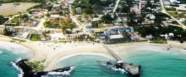
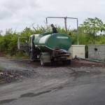
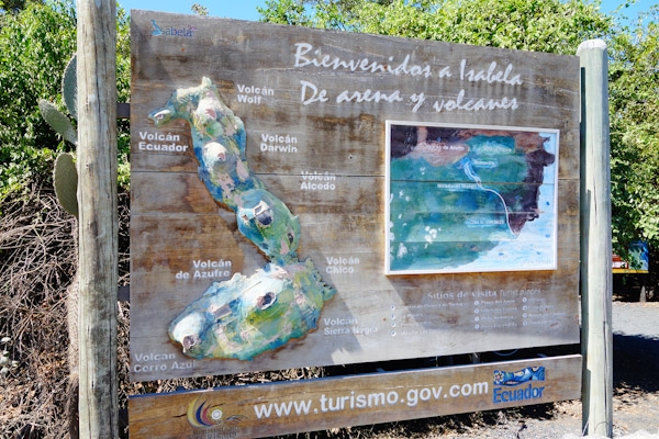
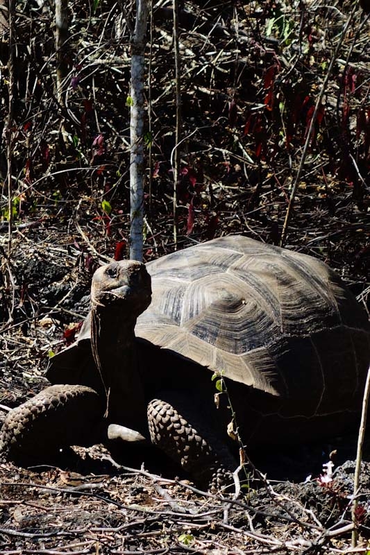
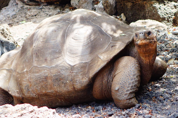
Puerto Villamil, with its 3,000 or so people, in a district roughly ten blocks deep and the equivalent of maybe twenty blocks long, is the only town on Isabela, the largest island in the Galapagos. Tourism is the World Tortoise, or Atlas, supporting its economy. Restaurants, small hotels and guest houses, dive trips, boat and land tours,  a farmer’s market for seasonal produce from the few farms on the slopes of the volcano, some kind of fishing, and a good number of tourists in for the day from their excursion boats, are what make the wheels turn here. It’s a pleasant low-keyed place where we stayed a week or two in July, when the ocean currents bring cool water and mandate wetsuits for swimming, at least for me. I was going to say it was our favorite island, but let’s just call it neck and neck. Each island we visited, Santa Cruz and San Cristobal being the others, had something to recommend it, and so much depends on the people you meet.

inside Catholic church local art palm trees tortoise stained glass bluefooted booby frigatebird Puerto Villamil post office


Acoustic Ecology

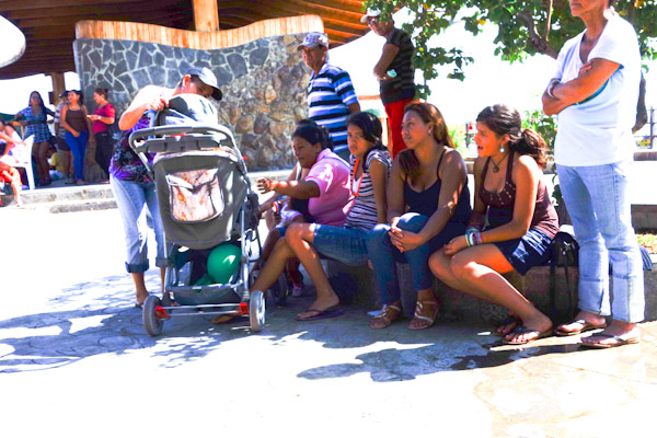
Among the people we met was a group of students from the University of Miami. They were under the supervision of a sound engineer, Colby Leider, (“he’s famous!” one student told us), and a former NY Times reporter, Joseph Treaster (“he’s famous too!”), and were learning to listen and record. An expensive liberal arts education, but useful things to know, don’t you think? Mr. Treaster’s students of cross-cultural communication were writing short pieces to be published at themiamiplanet.org. Last year’s students wrote about the nail parlor, and a local surfing contest,  for example.

I learned also that there’s more to making soundscapes than just dangling one’s smartphone into the tortoise corral as I had been doing. I was hoping to share with you the measured scrape of carapace over dry ground, but I got mainly little splashes of bird song; my target tortoise outlasted my phone battery. But Dr. Leider told me to persist- there is much that has been done with smartphone technology, he said.

Turns out I’ve been deaf to the uses of sound. Sound engineering (it’s in the music department) is full of fascinating projects.  For example, what level of urgency should the various alarms in a hospital convey? Acoustic documentary: what can be learned about the state of a forest by listening to insects after a logger invasion? It’s a meaty major compared to the one I chose, political science, which, too late, revealed itself to be mainly unappetizing gristle and fat. You can read more here about Dr. Leider and his work: http://ccs.miami.edu/?p=4369.
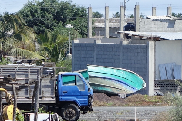
Boats and Harbor

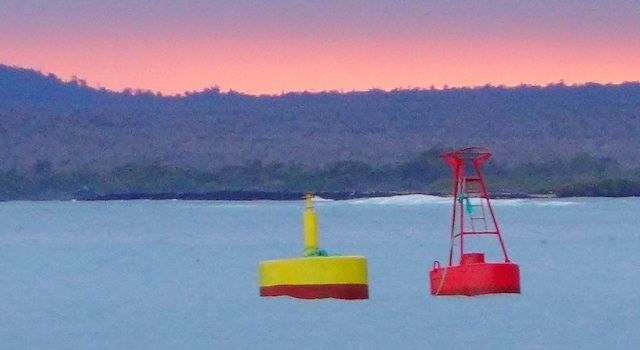
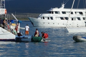
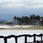
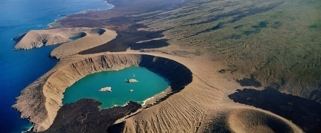
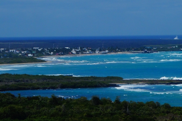
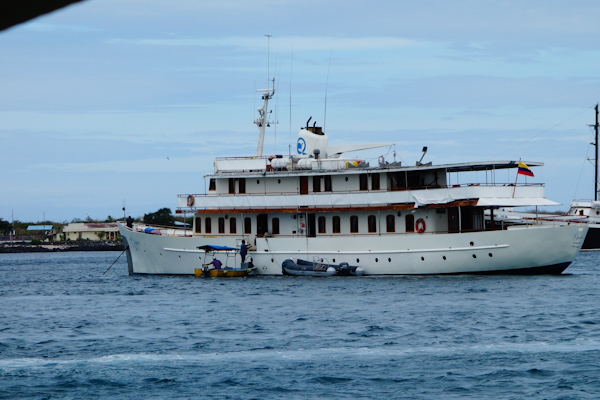
The small boat harbor, and the anchorage, are a fifteen-minute walk out of town, to the right in the aerial photo, from redmangrove.com’s blog, at the top of the post. For a while all entrance three buoys stood on the beach in freshly-painted splendor, but eventually, and  with great merriment, they were towed into position.
Isabela-130706-yellow red buoy croppedresized navy men riding freshpainted buoy


The approach to the anchorage is pretty straightforward, if you don’t try to go too far in, because there are some low-tide surprises. After that it’s a rather circuitous dinghy trip ashore, as the inner part of the harbor is full of  small reefs and sandbanks. You’re only seeing a small part of that here.

Isabela Anchorage excursion boats and rocks-130717-0320

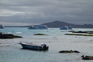
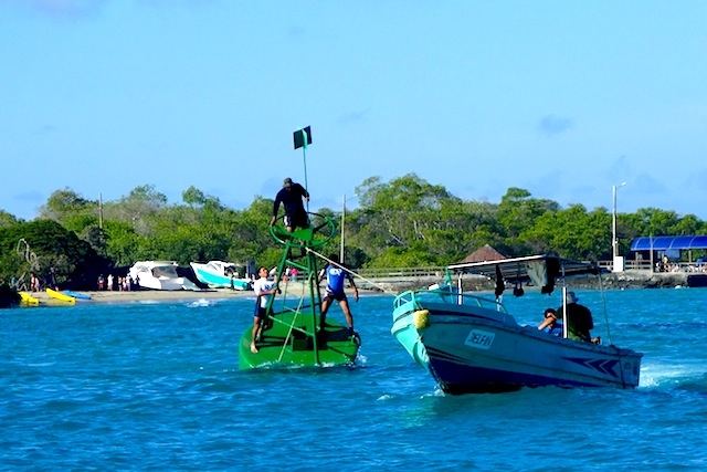
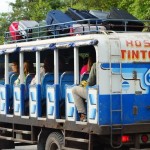
The tour excursion boats in the outer anchorage have done it so often they can do it in OUR sleep. We’d wake up in the morning with a “where did that come from” moment, or several. The inter-island boats, which look like sport-fishing boats about 40 feet long, outfitted with benches and lifejackets, took some astonishing shortcuts at mid-tide. I don’t think the water in the break in this reef is much more than 4 feet deep where this fellow is  barreling through, because I had been snorkelling nearby when I saw him coming and skedaddled!   ferry taking shortcut Isabela 130714 morning Isabela excursions getting underway


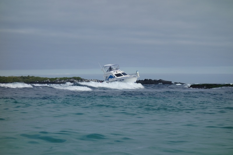
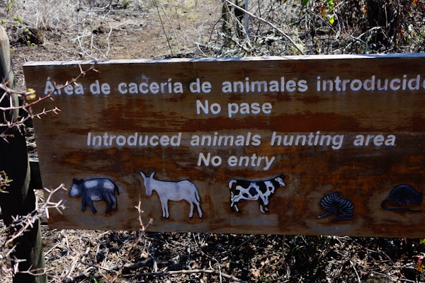
Solutions to conservation issues

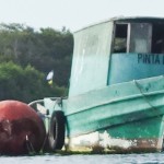
Among the most curious things we saw in Puerto Villamil were several cut-up fishing boats. Isabela is one of the places where there was direct, personal and heated conflict in the last decade between the Galapagos National Park people and the fishers whose activities were being monitored in the interests of conservation and sustainability. One confrontation involved the mayor of Isabela cutting down slow-growing old mangroves, then filling over them, to make a (potential) dock for the tourists to come to see the slow-growing old mangroves, their associated penguins etc.

Isabela 2-130717 cut up boat

The government and its agencies are supposed to be conserving Galapagonian resources, but often claim they have no resources of their own to devote to the cause. And of course opinions vary as to the best use of any resource, and some voices are louder than others. That’s politics! So sometimes the National Park is assisted by international government, aid, or conservation groups. For example, anyone familiar with the group Sea Shepherd will know them to be a kind of guerrilla activist marine wildlife conservation group. Apparently, one of their activities was to fund sniffer dogs on Isabela, which we saw and wondered about as they met water taxis at the dock. The dogs and their military handlers looked so incongruous in that setting. It’s a small operation, but I’d love to know what the effect of it has been. Maybe one of the Miami students could inquire….

The dogs  are supposed to detect illegally harvested wildlife items, sea cucumbers and shark fins for starters,  and prevent them from being smuggled out.  Since part of the definition of fisher is ‘boat of my own’, and rumor has it that the offending fishers camp on the far off and desolate shorelines, cutting mangrove to smoke and preserve their catch, I wonder how effective the dockside sniffer dogs are. But as usual, I don’t know a thing and would willingly stand corrected in all aspects. Who’s got the details out there?
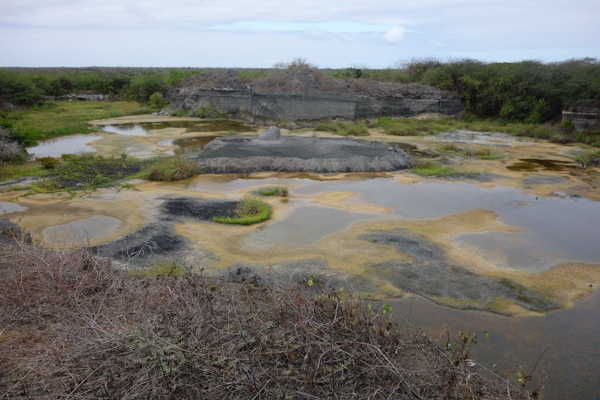
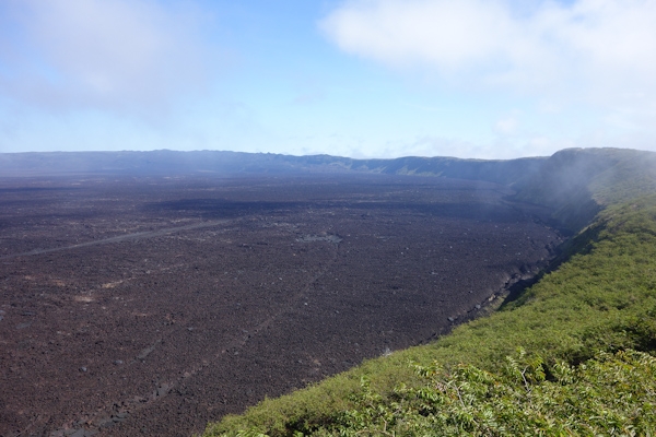
Lawns of  lava

Outer Puerto Villamil’s landscape is so different from the lawny, leafy Maryland exurbs I’m familiar with. Here your cinderblock house would rest on a lava lawn; the cinderblocks are fabricated just a few blocks away.

lava lawn and house Isabela-130711-0187

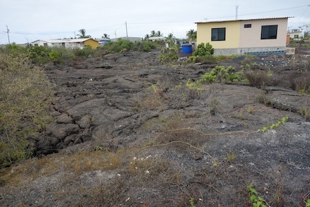
Diego Dueño (Harry Homeowner) doesn’t have to worry about mowing, or tree trimming. He can mark the boundaries with spray paint, and doesn’t worry about drainage much either. A bright sunny day would be awfully hot in a neighborhood like this, though, and any kind of ball game hard to sustain.
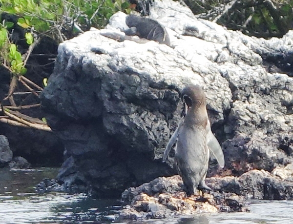
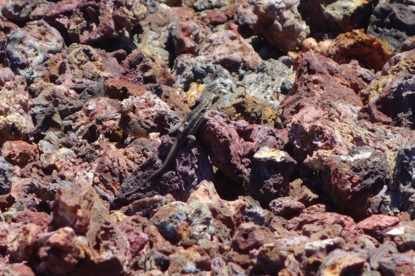
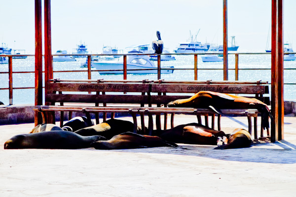
Marine Iguanas

Finally, what’s a blog post about the Galapagos without some endemic animals? Here are the special Galapagos marine iguanas. They were not particular favorites of Charles Darwin’s, who described them thus:

The black Lava rocks on the beach are frequented by large (2–3 ft [60–90 cm]), disgusting clumsy Lizards. They are as black as the porous rocks over which they crawl & seek their prey from the Sea. I call them ‘imps of darkness’. They assuredly well become the land they inhabit., as quoted in Wikipedia entry Marine Iguana.

marine iguanas basking
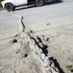
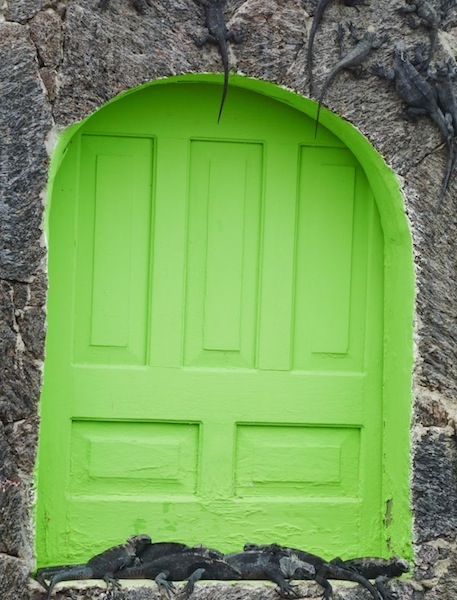
Being reptiles, they spend a lot of time basking in the sun, and they have some favorite places in Puerto Villamil, like on the sunny rock wall of this beach-front hostel at the western edge of Puerto Villamil. In their off hours, they sometimes go across the street (at the “iguana crossing” sign, where traffic is slowed for them by a rope hawser speed bump), to the mangroves at a nearby salt lagoon.

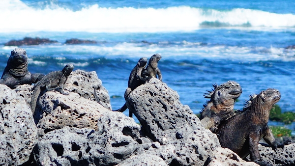
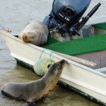
But mainly they go swimming in the ocean, to eat seaweed and algae off underwater rocks. They can stay submerged for 20 minutes. The early-arriving iguanas would not have survived the desolate landscape without this adaptation.

They do need to warm up afterwards, and while they’re doing so they often snort or sneeze to clear the salt out of their nostrils. It’s a disconcerting sound – I asked the park ranger if they were unwell; she assured me not. They also eat sea lion droppings.

I can’t say I find them very appealing myself, except maybe in this picture, where they look like they’re posing for a movie poster. I can’t think of a good caption for the show, but if you can, leave it in the comments!

Marine iguanas coming out of the ocean

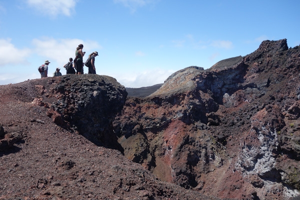
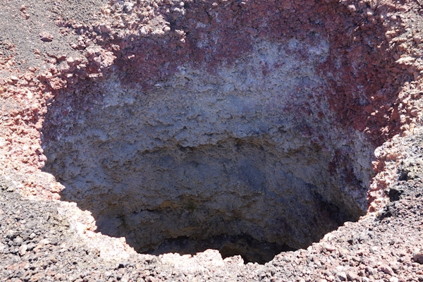
A few more pictures will close the Isabela chapter. Thanks again to redmangrove.com for the aerial photo at the top of the page. We ourselves are still in Panama, about to move north-ish (via the southwest-ish) but the next post will probably still be of Ecuador. Thanks for stopping by!

Isabela, Galapagos, around and about

Isabela, one of the newer islands of the Galapagos group far off the coast of Ecuador, was particularly intriguing to me, perhaps because of its remoteness, volcanoes and small population. From the sailing point of view, we liked its anchorage, because there were a few islets and some sheltering reef  between us and the open ocean, which is not always the case in the anchorages yachts are allowed to visit. Not that these were always sufficient protection against swell and quirky  currents, but they did offer some psychological comfort and a perch within binocular range for wildlife viewing.

penguin and iguana on rocks at Isabela anchorage
Penguin standing on rocks, iguana above, birds temporarily absent.

Like  other Galapagos islands we visited,  Isabela has volcanoes rising from a coastal plain. In Isabela’s case, there are half a dozen volcanoes that have melded to form a seahorse-shaped island 80 miles long. Isabela’s volcanoes are young and they’re active, so there are big areas of absolutely no vegetation. Talk about empty! Yet there are farms and fincas in the heights of the volcano closest to town, Sierra Negra. There is a mellow little town, Puerto Villamil,  of maybe two or three thousand people, and tourists too, including a good number of students on ‘summer abroad’ class trips.

20130706Galapagos Isabela-017-56


It’s a great place for touring on a beach-cruiser style bicycle. We unstowed our folding Dahon ‘bicicletas’ and went as far as our little legs could pedal us, which by this sign board is about two inches along the south coast west from Puerto Villamil and its harbor about midway across. The big cone in the middle of the southern part of the island is Sierra Negra, which we visit later, Negra/black perhaps because it’s active and the lava fresh and black and plentiful. And Alcedo is right in the middle, where you’d cinch your belt. The volcanoes up top, Darwin and Wolf, are visited, if at all, by people on the tour excursion boats, not by yachts.

A couple yachts passed through on their way to the Marquesas while we were there, but Isabela is best  for R&R, not for provisioning. The food there is mostly imported, and there is very little  water, or  fuel (unless the barge is in). Unlike the whaling-ship days, no one is loading tortoises for later consumption, although there are wildlife conservation issues aplenty.

Here is the Australian schooner Windjammer, bound for Easter Island and Chile. You can read about their trip here: http://www.sailblogs.com/member/schoonerwindjammer/

Isabela-130707 schooner Windjammer


Isabela has its attractions

Isabela-130709-0056

I’m not a surfer, or much of a beach-goer, but if I were, I could walk to a beach right in town with lots of waves, and lots of white sand, and enough reef to be interesting. It’s not always this rough.


Humedales or ‘wetlands’

Isabela-130711-0086

In town, and along the south coast to the west are a series of, I’ll call them water features, since they seem like various iterations on the theme of lava tunnels filled with sea water, or brackish lagoons near the coast. This network has lots of interesting birds and different types of vegetation, including several mangrove forests. The trails take you in areas you’d otherwise miss, and of course there’s lots more to see and wonder about when you can get close and watch from a strategically located platform or bench.

Trio of flamingos and their reflections

flamingo coming in for a landing, wings open


I never knew that a flamingo’s wings had a different color underneath. Or that they ate by shoveling their lower beak through the mud.


Wall of Tears

Further out of town  but still within bicycle distance is a perverse monument to man’s inhumanity to man in the form of a rock wall 100 meters long and 8 meters tall, known as the Wall of Tears. There was a penal colony here from 1945-1959 and the prisoners were made to build this wall, tear it down and build it again, over and over. ‘Weak men die and strong men cry’ said the reader board. It was July, a cooler season, when we were there, baking in a bright blue noonday sun. It must have been misery, even for ‘criminals’ who maybe made other people miserable, or maybe were just poor, but the pointlessness of the task is what particularly distressed me.

Isabela-130709-0093

The penal colony was built upon the remains of  a US radar station from WWII. Even before that the area had been overrun with introduced species, leading to this sign:Isabela-130709-0097

The pig, the donkey, the cow, cat and rat, you could shoot them all, maybe on the same day, once you gained entry to the zone! All non-native invaders, all highly disruptive to the local flora and fauna.

Tortoise hatchery

It seems each island we visited has a tortoise hatchery. The one on Isabela also served as a refuge for a subspecies rescued from a lava flow that they couldn’t move away from fast enough. Not sure about the breeding and hatching part, but keeping a corral of tortoises is as easy as building a stone wall. The movement towards more ‘natural’ habitat for enclosed animals hasn’t gone far for these tortoises, but it doesn’t have far to go either!

Isabela Galapagos tortoise in the wild

I’ve been reading recently that the intelligence of reptiles has been underrated; might be true! I keep thinking I’m seeing a spark of curiosity in the eyes of the tortoises that peer at us peering at them.  Or maybe they just think we’re bringing leaves. The difference between tortoises and turtles, by the way, is that while they are both reptiles in the family Testudines, tortoises are land-based, and turtles are water-based, with flatter, more streamlined carapaces. Swimming in the high-domed capacious carapace of a Galapagos tortoise would be like a Victorian-era woman bathing in hoop and bustle.

Here’s the first and only tortoise we saw in the wild, big as a hassock maybe, and most likely a graduate of the Isabela hatchery. I got close and s/he scrambled away, which they can’t do at the crianza.

Sierra Negra

We got on the open-sided, wooden-cabin truck-bed ‘bus’ with a trample of tourists for our excursion to view the freshly-lava-spread caldera of the Sierra Negra volcano. It’s surprising how cool and moist  the air becomes ascending 1124 meters (3700 feet), but the cool does burn off as the day wears on. Horseback-riding tours are an option, popular with folks from the Galapagos excursion boats;  I’m not sure who was more miserable, some of the panicked non-equestrian tourists, or the cranky horses. The horses have been doing it so long they’ve got parts of the trail washboarded.

Horses in fog

Isabela washboard trail made by horses

Here’s the Sierra Negra caldera we came to look at, arriving just as the clouds lifted, as promised by the guides.

Sierra Negra caldera

Way in the back you might be able to see the source of the most recent lava flow. I only pretended that I could. The straight lines that look like paths or roads in the  caldera are not, they’re just ‘formations’. It’s a big caldera, 9 km across maybe, and not very deep compared to others, but the most interesting thing about it is that almost all the vegetation growing down the sides (there’s lots more on the southern walls)  and around the top is  Guava (Psidium guajava), one of my favorite fruits. Here it’s a weed, which as we know, is just a plant growing in the wrong place, or worse, as here, a terrible invasive. Guava is displacing all the local flora and upsetting what was the natural balance. I’m so used to associating leafy and green with healthy that the idea of this almost lush spread of guavas being toxic came as a shock to me.

According to galapagospark.org: Guava, which is characterized by a high rate of germination and regeneration, spreads rapidly on the fertile plains and areas of Scalesia spp. This weed is slowly covering the plains of the Sierra Negra and Cerro Azul Volcanoes.

But once guava was kept behind the fence at the mountaintop plantation. The scalesia, one of several species being crowded out, is in the aster family, with flowers like daisies, but 12 species are shrubs, and 3 are trees, quite unusual, except in the Galapagos.

Guava orchard on the outer slopes of Sierra Negra
Before people knew how it might end, guavas were planted as orchards.


scalesia
A mixed-age scalesia forest, recovering after an El Niño year, courtesy of gallery.lb.nagasaki-u.ac.jp/


Then we marched ourselves over to a smaller caldera for a closer look at more volcanic features. The bright spot is a sulphur fumarole or something like it, not sun through cloud.

I love the colors and textures of the lava


And I like how so much of volcano vocabulary, like the types of lava, pahoehoe and aa (aa is the clinker-like one that it hurts to walk on, ah-ah), are Hawaiian in origin.

Here are some closer views:

Engineered by Mother Nature


Animal life even here

Yup, it's a big hole alrgight
Yup, it’s a big hole alright
Animal life even here

Can't get close enough to the edge to see if there's a bottom
Can’t get myself close enough to the edge to see if there’s a bottom

You could call this landscape lunar, but I wouldn’t – there’s ocean visible just beyond, and some plants gaining a toehold, a couple insects and a lizard. And no trash – our guide, the excellent Edgar Daniel,  was fierce on this point, reminding us to hold on to every bit of our lunch and its packaging. But this lava field is the tabula rasa, barely formed and almost pristine, of the next Galapagos, which probably won’t be much like the former one. I’d like to make a special trip back to see how it turns out.

Romantic?

I’ve been puzzling over my curiosity about places like Isabela, and I’ve decided that it’s the romance of the place, or better said, my idea or vision of the place, that intrigues me. The dictionary informs me that romantic may indeed be defined as ‘an idealized view of reality’. I plead guilty! In that case, nothing says it better than this 1984 photo by Frans Lanting of  tortoises in the crater of the Alcedo volcano.


He describes his photo so:

In a geologic sense, the islands are young, yet they appear ancient. The largest animals native to this archipelago are giant tortoises, which can live for more than a century. These are the creatures that provided Darwin with the flash of imagination that led to his theory of evolution. ..Immutable as the tortoises seem, they were utterly vulnerable to the buccaneers and whalers who took them by the thousands in the last two centuries. But one population eluded them. Inside the Alcedo volcano on Isabela Island, an earlier era lingers. This caldera is sealed off from the outside world by steep lava slopes that rise to 3,860 feet on the equator. It was not until 1965 that an Ecuadorian biologist found a way down inside and discovered a world where giant tortoises roamed in primordial abundance. This group had presumably never seen humans. ..They hadn’t seen many more when I entered the time capsule of the caldera. For one memorable week, I lived among the tortoises of Alcedo. Photography one morning was one of those precious experiences where I could be part of a scene rather than a distant observer. The tortoises were resting in a pond as soft mist mingled with sulfur steam from nearby fumaroles and dust from an erupting volcano to the west, and I was able to create an image that evokes the era when reptiles dominated life on land."..- Frans Lanting.

In case the watermark doesn’t show up, the featured image at the top of this post should also be credited to Frans Lanting, and is available at

franslanting.photoshelter.com


I’m not sure if these tortoises survived the spread of feral goats to the area, but I have read that the tortoise population outside the crater is beginning to recover following a massive, as in perhaps 80,000 goats, eradication program conducted with land hunters, shooters from New Zealand in helicopters, sterile female “Judas Goats’, a full and costly array of attempted extinction.

Here’s a bit about it from http://www.galapagos.org/conservation/project-isabela/

The giant tortoises on Alcedo Volcano provided the catalyst for Project Isabela. In the 1970s the feral goats present on southern Isabela finally crossed the hostile terrain of the Perry Isthmus and arrived at the lower southern slopes of Alcedo Volcano. It would take another 10 to 15 years for the goat population to explode causing massive ecosystem degradation. The destruction was most evident on the southern rim of Alcedo, a gathering place for giant tortoises during the cool, dry, garúa season. The dense forests on the rim created shade and the critical drip pools where tortoises congregated. The thick garúa mists drifting up the outer slopes of the volcano became trapped in the many epiphytes living in the forest and then dripped to the pools below. But the goats arrived like bulldozers, destroying the forest and thus the tortoise shade and water supply. Other native and endemic species, including birds, insects, and plants, were also negatively impacted by the destructive goats, whose population continued to expand to the more northern volcanoes, Darwin and Wolf. Their arrival at each new portion of Isabela resulted in pristine forests and shrubby vegetation being transformed into barren grasslands and in massive erosion of the steep volcanic slopes.

Now, how romantic is that? And then, reading comments on stories about the goat eradication program, you’ll learn that many commenters feel that  the “Darwin hand” should be played out to its logical conclusion. Don’t kill the poor innocent creatures, just let whatever is going to happen, happen, they say. Sounds more like a tragedy to me. But I’m not a goat (so far as I know), just a curious romantic, easily intrigued.

San Cristobal Interpretation Center, Natural and Social History

We’ll start our tour of San Cristobal, the Galapagos island closest to the continente, at the Interpretation Center, but make a few diversions and finish with a bibliography, just like at school. 


This facility, a gift from Spain,  is about half a dozen years old and is devoted mainly to natural history and the human history of the islands. 

It’s pretty well done and worth the visit. I “read” it cover to cover. 

Apparently there was more going on in the Galapagos in the last 500 years than in the last 5? million, and plenty just in this century.

Geologically the Galapagos islands are unusual, being volcanic in origin, currently active, and located at  the junction of three different tectonic plates riding over one another. The islands have arisen in the west and are sinking below the sea in the east. 
The newest island is Fernandina, a fresh shield volcano of 500,000 years, whose lava continues to leak from a hot spot beneath part of the Nazca plate into a bay close to western Isabela, the most western island. 
The oldest islands are the eastern ones, Espanola and San Cristobal,  and they are expected to eventually subside below the sea.

At the same time, ocean currents swirl around, five of them in an intricate dance to the rhythm of the prevailing trade winds – no wonder water temps and sea conditions are so variable in the Galapagos. The nutrient-rich Humboldt Current originates in Antarctic waters so it’s cold enough to cool the air, leading to the odd sensation of sleeping under blankets near the Equator. A fine mist, the garua, forms at higher altitudes, but the arid zones are less affected.  I’m told that from January into April, when northeasterly trade winds prevail, the Humboldt loses its grip so the weather is hot and it rains many afternoons, unlike the temperate conditions we experienced during July. Then there are the El Niño years when ‘normal’ is turned upside down.

The Galapagos are of course noted for the large number of endemic species, known nowhere else in the world, that developed in its isolated location.  


The famous ones are the tortoises and iguanas, which probably drifted in on logs from South American rivers but survived because there was no competition from mammals (tortoises) or adapted (the marine iguanas learned to swim and dive to the bottom). 

Several birds are special: the penguins, the flightless cormorant. Others, like the albatross, simply thrive in the isolation. The finches developed differently on each island from a common ancestor; Charles Darwin was  able to adapt or diversify his observations of them into a successful new theory.


The most notable mammal is the Galapagos sea lion. I like to think of this image as having persisted for umpty-thousands of years. 


Behind my back, though, are youths with surfboards, sunbathers, tourists with cameras, all new in the last century. I wonder what the sea lions make of it.


There may have been some human travel to these islands from around Manta area on the Ecuador coast, from whence we ourselves came in Galivant, for us a trip of five daysIn a reed raft back in the first millennium, it would have seemed hard work with uncertain prospects to travel in either direction. That culture is now extinct and known only by their pottery shards.


The earliest known Europeans to find themselves here were in 1535, in a ship transporting a Spanish Dominican friar Tomas de Berlanga from Panama to Peru, where he was to mediate a dispute between the Spanish conquerors there. 

Carried by the currents beyond sight of the continent, the ship eventually drifted into the Galapagos, out of water, horses dying, etc. Eventually they found water, but were otherwise unimpressed, not bothering to take possession of the islands or to name them. Other voyagers drifted through but none stayed, or were able to return, that we know of,  until the end of the 1500s.

Then it was pirates and buccaneers  and later smugglers, passing through the islands, attracted by fresh tortoise meat, and the sometimes possibilities of water. But the heavy, some say rapacious, human activity really began with the whalers in the late 1700 and 1800s. They took sperm whales, but also fur seals, sea turtles and fish, tortoises and iguanas, fresh water and firewood. And they left behind goats and other domestic animals.


 When Darwin sailed on the Beagle he was in his 20s (in the photo from the SC Navy Museum, he was 45). He was often severely seasick, and when he got back to England, he stayed put. He took decades to publish On the Origin of Species, and perhaps to grow the great white beard he’s so often represented with.

Ecuador took possession of the islands in 1832, under the urging of General José Villamil. He went to Isla Floreana and established a rather utopian-sounding colony primarily composed of prisoners. He banished liquor, and

“with the colony free of this mortal enemy of man, I have the satisfaction of noting everyday better order, more harmony, more civility, more decency…these are the same people now that I removed, for the most part, from the jails of the State” Jose Villamil 12 Oct 1833


Villamil also introduced and released livestock as a ‘good investment’ never imagining the damage that would result from donkeys, goats, pigs and cattle, and associated rats, cockroaches, etc. When Darwin visited Floreana, he was visiting an active town, where residents could show him around.  After Villamil left, his happy little colony degenerated and eventually nearly disappeared.

There are other stories about people who settled in the islands and traded with the mainland in tortoise oil (used in street lighting), salted fish and cattle hides, but few precise details now exist, only the remains of thousands and thousands of harvested tortoises. 

One, Jose Valdizan, attempted to recolonize Floreana, again using convicts, and was eventually killed by one of his workers.

The same fate later met Manuel J. Cobos (left), who bought all of San Cristobal and planted sugar cane in the highlands. Later, either he or his son also began a coffee plantation which still exists today, a lovely spot under tall trees, and the coffee is delicious! However, he too used convict labor, (the Interpretive Center called it a concentration camp) ruling it with an iron hand, and was also murdered by one of his workers.

You can learn more about San Cristobal in the late 1800s on this cruiser’s blog:

http://blog.mailasail.com/beezneez/1955.
Cobos is on April 7, 2013, in case you get lost on this very prolific blog. Thank you, Pepe.


The  frisky blond-headed children were part of a Norwegian contingent  which came to the islands in the mid 1920s, hoping to make a fish cannery. But conditions were not as they expected and most of them soon left. 

In the 1930s more ‘utopians’, Dr. Frederick Ritter and his ‘disciple’,  Dore Strauch, established themselves on Floreana, as did the Wittmers, a German family. Not long after, an Austrian Baroness (as she styled herself) and her two, or was it three, lovers arrived in Floreana, stirred things up, then mysteriously disappeared two years later. 

And so the population of the Galapagos islands ebbed and flowed. Then, in 1978, the United Nations designated the Galapagos islands as the first World Heritage site, and the race was really on.

Ecuadorans from other parts of the country settle in the Galapagos. They are not motivated by love of tortoises or marine iguanas – they just want a better life in a comfortable climate.

 I’ve read that the Galapagos Province has the highest per capita income of any province in Ecuador. The fishermen from the mainland want to make full use of what had been abundant resources, while the National Park wants to ensure there is enough ‘nature’ left to keep attracting tourists. Things have settled down in the ten years since the incidents of fishermen storming national park and research center offices, but there are, as you would expect, conflicting views about what is best for the population, and for the islands. It all depends on who is calling the shots, and with what goal in mind. Of course, the buzz words are ‘equitable and sustainable growth’.


“Until recently, the future of humans depended on the islands. Now the future of the islands depends on humans.”


This is how the Interpretation Center introduces its section on current issues. Some of the issues confronting the present population, which has grown rapidly to over 30,000 people:

  • the population itself, 
  • overfishing and other resource conflicts such as how to develop agricultural land and 
  • lack of water,
  •  invasive species, 
  • tourism.


A growing population of residents and tourists needs more supplies, more imports, and produces more trash. So, add trash disposal, energy production, risk of oil spills.
The invasive species are particularly devastating to the local ecosystem, and hard to control. Just off the top of my head: feral dogs and pigs eat tortoise eggs while cattle and goats in addition eat the vegetation upon which the tortoises rely, wasps eat caterpillars the birds depend on (and sting tourists!), the rampant spread of guava trees and blackberry bushes overwhelms native plants. This photo may be from the Charles Darwin Center on Santa Cruz.


Ecuador is a producer of oil, and the subsidized price of gasoline and diesel is just over a dollar a gallon for Ecuadorans (yachts pay more!). So is this street mural from San Cristobal about energy sovereignty, or pollution? I am not sure that I understand the message, but I like the illustration.


El Niño is a phenomenon with great effects on life in the Galapagos, warm years favoring the land life, cooler years favoring the marine life, but with great extremes of drought or deluge each way.


And then there is tourism, the major engine of the economy.  Another ‘invasive species’?

 This sign indicates why we had to pay so much to come here, and were not allowed to go anywhere on our own. Is it Disneyfication? Control firmly in the hands of politically-connected tour operators? A victory for the now-Galapagonian Ecuadorans who want to make full use of their resources? Or the only way to prevent the place from being loved to death? Similar issues face US National Parks, Yosemite a prime example, as I’ve read recently in the NY Times.


So, there’s a lot to be curious about in the Galapagos. If you’re interested, here is more:


A Galapagos bibliography


    http://www.lundh.no/jacob/galapagos/pg05.htm This is the best single, non-touristic, source I found for a Galapagos overview. Jacob Lundh is (was?) a Norwegian who spent his life in and around the Galapagos and wrote a thorough and readable ‘document’ which is published and downloadable as a 248-page PDF.


    Wikipedia, http://en.wikipedia.org/wiki/Galápagos_Islands The condensed version (19-page PDF), with pictures.


    Wildlife of the Galapagos (Princeton Pocket Guides), Julian Fitter. If you’re interested in the wildlife, this is the guidebook for you, pocket sized and thorough without being pedantic.


    http://blog.galapagosecolodge.net/  has nice photos and useful information about  the ‘nature’ side of things.


    A Galapagos Affair by John Trehorne, published in 1983, details the lives of the three German-speaking households at Floreana in the early 1930s. I was surprised that these happenings were publicized in newspapers around the world at the time. And I was surprised at the number of yachts that called at Floreana, and often left items very valuable to the settlers. What yacht carries a wheelbarrow, or a spare stove, I wondered? So I Googled them by name. These were YACHTS writ large: like Velero III, (Allan Hancock in an elegant 100-foot motor yacht, scientific research by day, chamber music by night),  Nourmahal (Vincent Astor, 263′ motor yacht, also doing some science),and  Phillips Lord, sponsored by Frigidaire and broadcasting a radio program aboard the 4-masted schooner Seth Parker. A reminder that it’s all been around before.

Galapagos at the Crossroads by Carol Ann Basset “depicts a deadly collision of economics, politics, and the environment that may destroy one of the world’s last Edens” “A up-close personal account of the difficulty in balancing what’s best for these spectacular, fragile threatened islands and/or what’s best for people–fishermen, tourism industry” say the Amazon reviews of this $12.99 Kindle download, and I concur.  It’s always interesting to peek behind the curtain. Published in 2009, from, I think, some older material, and sometimes repetitive; it would be nice to read her  version of the current situation, and how the issues have evolved under the current administration of Ecuador’s president, Rafael Correa.


    Battle at the End of Eden, a 99-cent Kindle Single by Amanda R. Martinez and The Atlantic Books(Dec 23, 2012) How exactly does one go about ridding a tropical island of  invasive species, such as goats, and what are the politics of eradication? An interesting discussion especially considering Basset’s description of the goat eradication efforts at Isabela. Martinez starts out with the story of a Galapagos fisherman setting a goat ashore as blackmail, but moves beyond the Galapagos in her discussion.


    http://whc.unesco.org/en/list/1The Galapagos Islands are a World Heritage site; here are some reasons why. Good for a quick overview, references and photos


    http://www.galapagos.to/BOOKS.PHP is a site full of links to other Galapagos information.


Well, I thought I could cut this post into two or more parts, but it’s too complicated. To paraphrase Blaise Pascal, who is becoming a favorite of mine: “I made this post very long, because I did not have the leisure to make it shorter.”
Nor the leisure to fix all the formatting errors. Sorry, folks.

Galapagos Arrival San Cristobal

Here we are in the Galapagos, the easternmost island of San Cristobal to be precise, after an expeditious five-day on-the-wind* passage from Bahia de Caraquez, Ecuador, on the continente.
 

And here’s a cheesecake shot of the new ‘poster boy’ of Isla San Cristobal, the giant Galapagos tortoise known as Pepe. (The famous Lonesome George-Solitario Jorge, died in 2012. He’s being taxidermic for his next posting, to the American Museum of Natural History.) Pepe, a middle-aged hunk who measures  four feet or more (a guess) and  weighs in the hundreds of pounds,  is spending his days posing for photos inside a rock-walled enclosure at the Interpretation Center near Puerto Baquerizo Moreno. A native of San Cristobal, he is said to be active in the breeding program for his subspecies – a true patriarch! He keeps a sharp, even intelligent, eye on the corner of the enclosure where all the tourists approach.

Pepe and I came into this world in the ~same year, according to his reader board bio, and are coming to share other certain features as well. With a potential lifespan of  twice mine **, he’ll get good service from the tougher carapace he received, even if it is scratched around the edges.

The mere words Islas Galapagos conjure up so many images: ideas in natural history thanks to Charles Darwin of course, but also history, geography, vulcanology, even romance. Herman Melville called them ‘enchanted’; but he meant in the ‘bewitched’ even accursed sense, not  pastel Disney-style of enchantment.

Melville’s vivid description sticks in the mind: “Take five-and-twenty heaps of cinders dumped here and there in an outside city lot; imagine some of them magnified into mountains, and the vacant lot the sea, and you will have a fit idea of the general aspect of the ‘Enchanted Isles’…it is to be doubted whether any  spot of earth can, in its desolateness, furnish a parallel with this group.” Darwin was a little more positive, merely comparing the land to the cultivated areas of the Infernal regions.

A photo of the diorama in the San Cristobal Interpretation Center, with Isabela in the foreground, Santa Cruz the most populated island to the east, and San Cristobal out of sight further east.

Coming upon these islands as we did on a dark night, lit only by star shine and not much of it, one does have a ‘present at creation’ feeling. The silhouette is bleak, perhaps cloud-draped, and you can imagine, if not actually hear, the perpetual crash of the southwesterly swell on the lava-sharp coastline and offlying rocks and islands, while you imagine being set upon them by unpredictable currents. Desolate indeed! You can actually hear, and feel, as you pass through disturbed patches of what we call ‘devil water’

We have real paper charts, and it’s a good thing too, because details that you could count upon the British Admiralty charting services for, are entirely absent from some of the electronic charts. X marks the rock, or maybe a speck of tan, but is it awash, submerged, or 50 feet tall? It’s irrelevant to the folks at C-Map, but not to me! Also some of the charts are off, so not the place for first time night arrival.

So the reality of the capital of the Galapagos province,  Puerto Baquirizo Moreno on San Cristobal, comes as a surprise. It’s anything but desolate. Ashore is an everyday all-Ecuadoran town with nice sidewalk and street paving, which, absent the jokey BlueBooby t-shirts and last-minute specials posted in front of  the dive shops, could be anywhere in the country.

I like this tee shirt better than the Blue Booby ones anyhow.

There is a lot  of new masonry construction,  even a building crane or two. The airport is a ten-minute walk over the hill. The harbor is full of boats, 15 feet to 150 meters. Yellow water taxis and tourist boat ‘lanchas‘ circulate constantly. Cargo is  ferried ashore in lighters, since there’s not sufficient depth for freighters at the docks.

Residents and tourists stroll the Malecon, shops line the streets heading inland, and a few blocks further the neighborhoods turn residential. There are hibiscus and banana trees, cats and dogs (not so many as on the ‘continente’ though, and healthier), bicycles, motor scooters and lots of pickup trucks, nice late-model Toyotas which also function as taxis. Melville never mentioned vegetation! And the whalers he was traveling with didn’t look like this.

The only thing a little odd is the welcoming committee.


Sea lions are everywhere, dozing on the docks, draped over the park benches, sleeping on the sidewalks. There may be more sea lions than Galapagonians! Wikipedia thinks so. They are cute, and fun to watch as they twitch and rustle in their dreams. But they reminded me of Canada geese, in the sense that you don’t want to see them in this way or quite so close. If you’re curious, I can report that sea lion droppings are about like those of a healthy German shepherd, only whiter (from fish bones?), and sometimes with a runny ‘gravy’. Better than geese (all ‘gravy’) in this respect. Someone must go thru the waterfront early  with a fire hose to give each day a fresh start.

Sea lions also have a fondness for the steps on the backside of catamarans, and dinghies on the beach or in the water, which contributed to our decision to just use the water taxis, $1 per person each way, and some social benefits. Someone told me that if a sea lion spends the day lounging on your cockpit cushions, you’ll be throwing them away. That sounds a little extreme to me!

Our actual welcoming committee consisted of our agent, Bolivar Pesantes of the Naugala agency, and representatives of the port captain and the environmental department. They like banana bread, but didn’t want to drink our water, which is not bottled. The environment man put on his disposable gloves and picked through our trash can of paper and plastic (we keep biodegradables and cans/bottles separate but he didn’t ask for those). He informed me that neither used Kleenex, nor the stuff I swept off the floor could be recycled and should not be in that can. Yes sir!  What was I thinking?

We paid fees for reception services(?), inspection and quarantine, national park ($100 per person), local government, photocopies and transportation of the authorities, trash, and the agent, who got almost half of our total $840 investment. We knew ahead of time about how expensive it would be but figured we’d not be likely be passing this way again. Plus, They Say it’s going up again next year. They can’t hear us screaming in Quito and Guayaquil yet.

We know a number of boats who bypass these islands and head straight to the Marquesas because of the expense. I think the authorities prefer it that way too. You the tourist would be much easier to track and manage if you would stay on one of the handful of populated islands and make day trips from your hotel or hostel. And that would be a feasible approach. However tourism in these islands seems to be set up in particular for the tour boats and their operators.

Don’t know a thing about the Grace, but for looks alone, this is a tour boat I’d check into, classic-style-wise. UPDATE
Among other things, Aristotle Onassis’ wedding gift to Prince Rainier and Grace Kelly.  In the $6K range for 7 nights, per person.

 
National Geographic runs a big cruise ship (96 passengers) that dwarfs the competition and maybe some islands too. Otherwise there is diversity in the fleet: a number of ‘steel box’ power cats and mega-power-yachts, a few smaller sailing boats,  perfectly adequate to the job but lower on ‘ambiance’.

You’d fly in to Santa Cruz or San Cristobal, board your 3- or 4- or 8- night cruise, be ferried around to various islands by night, and to a variety of activities by day, and then you’d be gone. There is a certain logic to this, and as we see the boats moving around, we can see that the passengers are being kept busy, really busy, and they’re seeing a lot, including destinations and sights we are going to miss, mainly because we’re only allowed the three main islands, and only the main port on each.

I like how even the inflatable dinghies wear nice rope fendering on the bow.

  But despite the limitations on our movements, I think we’re getting the gist of the Galapagos.

Playa de Oro, just across the street from the Galapagos Science Center, outpost of the University of North Carolina and University of San Francisco-Quito, a modern new facility where local and overseas semester -abroad students study. That’s Galivant in the top right corner, and Grace top left.

And our view of them. Wish we could have gotten their wifi signal!

As for the natural sciences, the history, romance, etc, a good place to start is at the Interpretation Center, just a short walk around the bay. 

 We’re heading there now. Stay tuned!

*”on-the wind” meaning bumpier and less comfortable than might have been desirable

**About Pepe and his brethren, Wikipedia informs us: The Galápagos tortoise or Galápagos giant tortoise (Chelonoidis nigra) is the largest living species of tortoise and 10th-heaviest living reptile, reaching weights of over 400 kg (880 lb) and lengths of over 1.8 meters (5.9 ft). With life spans in the wild of over 100 years, it is one of the longest-lived vertebrates. A captive individual lived at least 170 years.
The tortoise is native to seven of the Galápagos Islands, a volcanic archipelago about 1,000 km (620 mi) west of the Ecuadorianmainland. Spanish explorers, who discovered the islands in the 16th century, named them after the Spanish galápago, meaningtortoise.
Shell size and shape vary between populations. On islands with humid highlands, the tortoises are larger, with domed shells and short necks – on islands with dry lowlands, the tortoises are smaller, with “saddleback” shells and long necks. Charles Darwin’sobservations of these differences on the second voyage of the Beagle in 1835, contributed to the development of his theory of evolution.
Tortoise numbers declined from over 250,000 in the 16th century to a low of around 3,000 in the 1970s. This decline was caused by exploitation of the species for meat and oil, habitat clearance for agriculture, and introduction of non-native animals to the islands, such as rats, goats, and pigs. Ten subspecies of the original fifteen survive in the wild; an eleventh subspecies (C. n. abingdoni) had only a single known living individual, kept in captivity and nicknamed Lonesome George until his death in June 2012. Conservation efforts, beginning in the 20th century, have resulted in thousands of captive-bred juveniles being released onto their ancestral home islands, and it is estimated that the total number of the species exceeded 19,000 at the start of the 21st century. Despite this rebound, the species as a whole is classified as “vulnerable” by the International Union for Conservation of Nature (IUCN).

Oh, and I almost forgot to mention: a very readable new ebook now available at Amazon. It´s a  “best-of” digest from the Caribbean Compass, a cruiser´s newspaper based in the Eastern Caribbean. There are some great articles in there, and I say that not just because two of them are mine! You can check it out at:
http://www.amazon.com/Cruising-Life-Stories-Caribbean-ebook/dp/B00DO8PHJ4/ref=sr_1_1?ie=UTF8&qid=1372851986&sr=8-1&keywords=caribbean+compass+the+cruising+life.

Equator Ecuador Mitad del Mundo

The Southern Hemisphere (I think!) as seen from Mitad del Mundo

Middle of the World, that´s what they call the Equator here in Ecuador, a country itself named for that world-dividing line. This spot, owned by the district or province, has been designated as ´´official´´ and it is one of the main tourist attractions of the Quito area. So one Sunday we got on the bus and made our way out to Mitad del Mundo to see what it was all about.


Well, it´s mainly about Tourists having their pictures made on the line, of course. French tourists holding their flag, little kids trying to balance on the yellow line, blase young backpackers shoving each other back and forth. Half a dozen people tried to get the monument pinched just so between their fingers or balanced on their palms while being harangued by their official photographers.

The site is developed with a 100-foot tower topped by a globe. There´s an ethnographic museum inside.  There are several subsidiary small museums on the premises (one containing what might be the world’s largest cockroach) as well as restaurants and snack bars, first aid facilities, llamas, and did I somehow neglect to mention the shopping opportunities?

There is  even a church, with a yellow line running right up the center aisle. With, apparently, a service in progress, I hesitated to see just how how far the middle-line went. In the next section a band wearing hats and ponchos was warming up. 

It’s all kind of fun, part of the experience of Ecuador on a sunny Sunday.

Trouble is, this attraction is apparently in the wrong place,
0.0022 S, and 78.4558 W, off from the true equator  by a couple hundred meters. Oh well.

I was thinking that whoever built the monument, first in the 1930s and then with bigger stones about 1980, must be thinking ‘Let’s pretend everything’s fine. Just keep smiling!’ But in fact, my Wikipedia friends offer a better reason:

” In the modern datum of the World Geodetic System (WGS84), which is used in GPS systems and computer mapping products like Google Earth, the equator is placed about 240 meters north of the marked line. This discrepancy is partially due to increased accuracy but primarily due to a different choice of mapping datum. Similarly, the line marking the Prime Meridian at the Royal Observatory, Greenwich in England is roughly 100 meters from the exact zero of longitude as indicated by GPS receivers.”


WGS84 is what we (that is, our trusty Furuno GPS) use to navigate with as well. We’re thrilled, mostly, to have a mere 250-meter error. 

So, there is an alternate attraction, the privately owned Inti Ray Solar Museum, around the corner and up a dusty road, where the equator´s location has been ´’verified by GPS’. According to my iPhone, this one isn´t quite right either, but let´s not quibble!

Best to call it an amusement park. In addition to the various statues, totems and reproductions of Amazonian villages, even a real shrunken head,  there are a few location-specific ‘educational exhibits’.

The gold-painted sink was my favorite. A bucket of water poured straight down the drain illustrates that exactly on the equator there is no swirl of the Coriolus effect.Water goes straight down the drain. Lo and behold, a mere ten feet to either side, our guide Adriana could make that drain swirl its leaves clockwise or counterclockwise to make her point. Do you think it had anything to do with which corner of the sink she emptied the bucket in?

She´s a fun girl. She can also balance an egg on a nail, only on the actual equator of course, and walk the line exactly with her eyes shut, despite her muscles, or balance,  being debilitated by ‘special gravitational effects’ at the equator. We tourists could not perform either task, not even for an official certificate.

From there we headed for one of the many Sunday eating places (a shade tent and plastic furniture do not a restaurant make) that had appeared along the highway and were serving a smokey ‘mixed grill’. There were half a dozen places all serving the same thing, all in a row, but this girl put her heart into attracting customers and she got Doug and me.

And that’s what’s happening in the middle of our world. How about you?


Which should make this the view of the Northern Hemisphere

To tell the truth, I´ve gotten a little confused about which panorama is which. We´ve been travelling away from the boat for a month and a half, and I´ve lost lots of photos to the demons of SD card viruses and write errors in internet cafes, plus there are no photo editing programs I understand. There are things that just can’t be done on an iPhone, no matter what They say.

PS I found it interesting that the point on earth furthest from the center is also here in Ecuador. Wikipedia reports:

With a peak elevation of 6,268 metres (20,564 ft), Chimborazo is the highest mountain in Ecuador. …While Chimborazo is not the highest mountain by elevation above sea level, its location along the equatorial bulge makes its summit the farthest point on the Earth’s surface from the Earth’s center.