Passage to Ecuador


We stepped out into the wider Pacific last week.  All the way to Ecuador from the Perlas islands in Panama the wind not only blew moderately but stayed behind us, and the seas did too. The moving sidewalk of current  beneath us was pretty much in our favor as well. At times the speed log was showing above nine knots. A person could get spoiled moving as expeditiously as this!

So it was a fast trip, up until four nights later when we met with either the Humboldt current or one of its eddies at the equator, about 35 miles offshore. We crossed the equator about 10 pm. It was quite dark, the sky thick with clouds threatening precipitation,  the moon not yet up, misty and jacket-cool, and we were pitching uncomfortably as the wind (not much) met the current (3 or maybe 4 knots against us).

On the motor! And break out the Bailey’s Liqueur – the equator demands an obligatory tot for King Neptune and one for the crew! Make that two! Then I went back to bed to freshen up for my date in the cockpit at 1 AM.

Maybe we had been going too fast to catch any fish with our trusty pink-and-white squid trolling lure. Or maybe it was because we sometimes forgot to put it out! No fish died at our hands on this passage; we were still eating those we’d caught in the Perlas. But we heard on the radio net from friends who hooked three marlin. Luckily, for both them and the marlin, each time the fish managed to spit the hook. It was a big Rapalla spoon that knew how to lure those fish.

The fleet of about 15 boats bound west and south for the Galapagos was also having generally good conditions and favorable winds, despite the occasional spinnaker wrap or hole with no wind in it. I am as always impressed by the way people in this community help each other along,  and especially by the family boats who have children as well as boats to manage,  the parents like nautical Ginger Rogers, doing it in in high heels, and backwards! I’ll miss the radio reports from people we’ve met, and from those we’ve never seen,  as they move through the Galapagos and into French Polynesia while we head for the Andes.

We wanted to close the coast of Ecuador to get out of the current, but fear of fishnets kept us in deeper water through the night. On my watch, we steered over the tip of an underwater peninsula about 300 feet deep. A mile or so away (just guessing) a fishing boat turned on his light. Then another, further away. Then, horrors, another light appeared behind me, quite near our track. I hate that! I’d almost rather not know how close I came to hitting something than to have evidence that, yes, there are things to hit out here! And think of the fright I might have given the poor fishermen.

When we eventually got to the town and looked at the fishing boats, here’s what we saw.

You’ll notice the net heaped in the boat under the black tarp, the foam mattresses and the umbrella for long hours of waiting, and the paint can on a small floatable platform.


This, apparently, is the light. So, did they not see us until we passed, or were they looking for the matches?

To enter the Rio Chone from the Bahia de Caraquez, we need a high tide, and a pilot. So we had to do some dawdling and anchoring to wait for the tide at 5:58 PM on the Saturday before Easter. The tide was 9 1/2 feet that night, and the least water I saw on the sounder as we went in was 9.1 feet. I gather, however, that the currents and tidal rips can be a larger issue than the water level. The pilot, Pedro, stood behind Doug at the helm and waved his hand around, faster, slower, left, right. There is an old light tower standing in the shoreline shoals, offering no information that wasn’t already obvious; no other marks, no ranges,  and not much margin for error. I was happy to pay the pilot’s $30 fee.

Then Pedro helped us tie up, fore and aft, to buoys in the small mooring field that will be our home for the next while. Anchor-up to mooring ball cleated off, we were snuggly settled in in less than 4 1/2 half days, after roughly 555 miles. So much for the bald-arrow weather forecasts.

A health inspector arrived  to look us over. He looked over our groceries too, not to confiscate but wanting a list of items to pad out his form (leche, huevos, carne, banana) , then wrote it out again by hand as our receipt, and skedaddled away for Saturday night elsewhere. I had been just about to ask him: “Does anyone ever say ‘Yes, I am carrying psychotic drugs, lots of them'”?

Our passports and copies of our documents went ashore; we would pay various fees later, but we would also get everything back on Tuesday morning and in the meantime we were free to enjoy ourselves ashore: a shower and dinner out were what the health officer recommended. Welcome to Ecuador!


Here is what Bahia the town, off the Bahia de Caraquez,  looks like.
Maybe you can zoom in to see us  in the Rio Chone close to the bridge at the top left.

Panama Pacific Equinox

P1150631
You could say we got out of Panama City just in time but, actually, we got out a bit too late. There was a nice wind opportunity, another of those North American cold fronts with a long tail trailing over the Isthmus of Panama, enough to blow the palm fronds sideways. But we weren’t done with town stuff like chasing down parts and supplies until the last day of that weather, so only got as far as the Perlas islands.

Now, for the last fortnight, the GRIB files, computer renderings of predicted winds, show big blanks all along our route to Ecuador. What wind arrows there are lie featherless (less than two knots) and scattered  every which-way. There are by now probably a couple dozen boats in the various Las Perlas anchorages hoping for that first breath of wind comes before they use up all their trans-Pacific groceries. There’s at least one Galapagos-bound boat (heard him on the radio) who has been happily drifting with the current for a week now, and reports sighting sea lions and sleeping whales.
Image
We celebrated the first day of spring anchored south of the main island of Contadora. Although dreaming of daffodils and dogwoods, I made do with a faint haze of flowers on the few trees that aren’t deciduous and/or desiccated now at the end of the dry season. The Intertropical Convergence Zone shifts around us, making for interesting skies; they sometimes look watery but aren’t, yet. At times there has been even been mist and dew, enough to wipe out the horizon, and cover the deck, a free-fresh-water wipe down. At other times, the ITCZ is ‘indiscernible’.
P1150645
After the serious work of getting the city grit off the boat, we took a dinghy cruise/fish troll over to the island of Mogo Mogo in search of a lime tree we’d heard about. Instead, we got waved off and whistled away by people shouting ‘Survivor Island, Survivor Island.’ It seems that a Russian edition of Survivor is being filmed right now. There’s a line of yellow caution tape strung along the shrubbery as far as the eye can see, and some structures around on the south side beach. Someone really desperate could probably flag a passing fisherman or even one of the yachts anchored at Chapera.

We also took a walk around Contadora, and found a lovely beach on the east end with a beached ferry boat and a semi-derelict resort.
P1150657

Not sure about the ferry, but the resort developer reportedly died, and his wife was apparently unable to pull together all the building liens and financing to complete the project. Someone is working on part of it now though, and it looks like the Survivor people have a little ‘studio’ round back.

P1150671

We’ve been calling Panama City the Big Smoke because it’s a charming phrase we once read in a Pidgin language dictionary, referring to cities in general. But these days in Panama it’s not really a joke. We had been getting bits of ash landing on the boat from hillsides being burned. In fact, Panama City lost its electric power a couple weeks ago when farmers lit a cane field that happened to be right under one of the  country’s three main transmission pylons.

This time though, the smoke wafting through the anchorage smelled like man-made substances burning. Turned out it was the always busy Allbrook Mall, the largest mall in the country, which serves as the main bus terminal for provincial buses besides. The Madison/Conway store was badly damaged, and 60 neighboring stores were closed for smoke damage. Either there are no sprinklers installed in the mail, or they did not work. But no injuries or deaths were reported.IMG 5018
A day or two later  the Diablo Rojo (Red Devil) buses were, as scheduled, taken off the road, leaving the entire city, as planned, reliant on the fancy new Metro buses.  It’s part of Panama’s design to become a player in the World-Class City tournament. The Diablo Rojos are recycled US school buses, often exuberantly painted. You can fit three people in the seats on the left, two on the right, which makes maybe seventy sitting down and maybe not that many, but lots, standing up. Watching them unload is sometimes like watching the clowns piling out of the VW at the circus – how many more can there be?The fare is 25 cents, and the buses are usually full especially during rush hour. But they are old, uncomfortable, often poorly maintained, and considered to be dangerous.

The nice shiny new Metrobuses carry about 35 sitting, and I think I’ve read 60 standing. You need a preloaded magnetic card to pay; the fare except on certain express routes is still 25 cents. I’ve read that 300 Metro buses replaced 700 Diablo Rojos, but some of the coverage degenerates into remarks about corruption and cronyism so it’s hard to say what’s really going on.  The construction of the subway which has so many roads torn up or closed down is another headache and it is rumored that the subway opening has been postponed from October until next February. Panamanians are generally patient people, habituated to spending hours in lines, even for the simplest store checkout, but they want to get home at the end of the day! After a week, the transit people urged patience and announced plans to put signs indicating where the various buses were headed in heavily traveled zones like Cinco de Maio.
Cerropatacon 1 150 100Plus there’s a another fire now, this time at a large landfill, wafting toxic fumes over the city, closing schools and sending folks to the hospital. Friends in the anchorage report that half the skyline is obliterated at times. They have some kind of foam fire stopper coming in from the US and also are using explosives to tame the flames. I read it online! Photo courtesy of newsroompanama.com

Googling around, I also found that none of these stories are new – big fire at the Mall back in 2009, riot police have been called in the past for bus problems, and the trash fires are a recurring phenomenon. The economy may be booming here with GDP running near ten percent, and of course the estimated five billion dollars being spent on the new Panama Canal locks and associated upgrades. Still, it seems there’s a lot of catching up to do before Panama can claim world-class status, or achieve half of what their role model, Singapore, has managed.P1150495
In our smaller world, now relocated in the clean clear air of the Perlas islands, the boat projects continue. I ‘m aware that a lot of these maintenance issues we’ve foisted upon ourselves by not leading simpler lives, but so far the balance is still in favor of the amenities!  We’re getting really experienced at taking the water maker out as we chase down a pesky leak on the high pressure side. Some new engine parts arrived and have been applied with, so far, good results.
.Doug in forepeak
Lubricating the anchor windlass is not one of  Doug’s favorite chores.
Getting city-fertilized growth off the bottom and the propellor is more pleasant now that the water has warmed some. Big splurge on a new aluminum-bottomed dingy (more appropriate for dragging across beaches in this land of double-digit tides,) but it needed an intricate fitted cover (‘chaps’), the making of which ate almost a week of my life. Software and computer issues spring eternal. Pressure canning ‘Meals Ready to Eat’ like beef stew, chicken soup, pre-cooked beans, and what may be a lifetime supply of kimchi.
Plus my brother Curt came and we got to be tourists and entertain the locals for a little while. Here Curt makes his own raspado ice drink.
P1150518
And we really enjoyed our visit to the Panama Canal Museum at the Miraflores Locks, especially the simulation from the bridge of a ship passing thru. I can’t upload that video, so here instead is the bulk carrier Rosalia D’Amato, presently enroute from California to Tianjin Xingang, at an average speed of 12.2 knots,  according to marine traffic.com. I wish I knew how to find out what Bulk they’re carrying.
IMG 5246
So here we are, waiting for that light northerly wind predicted for the end of the week. Surely there’s one more northerly weather system left in the season! Then we’ll be moving towards Puerto Amistad, Bahia de Caraquez, Ecuador, 35 miles south of the equator, at an average speed of – well, we would hope for 5 or 6 knots, and the chance to travel there in a straight line, but neither is guaranteed, or maybe even probable.
P1150698
In the meantime, there are nice rocks on the beaches, which I photograph instead of taking them home like I used to do!
P1150715
And we’re catching some fish which I photograph, then eat.
That’s the report from Panama on the cusp of the season. The Pacific is living up to its name.

Las Perlas of Panama

A lowish tide on Contadora, and more people than you usually see in the
other islands of the Las Perlas group.

Las Perlas, an archipelago thirty-some miles southeast of the city, is a great change of pace from Panama City. So far it’s been curiously, blissfully, quiet out here.  With some fancy groceries from Riba Smith, enough wind and sun for decent power generation, a few friends passing through, and even, in the northern part of the group, a tolerable internet connection, I could sit out here for weeks!

That’s us, near one of those islands near the middle
of the Golfo de Panama, Archipelago de las Perlas.

But first a comment about the weather. Since the middle of January we have been cool – actually sleeping under sheets, stuffing dish towels in the dorades (air-scooping ventilators), and starting the day in sleeves. One day last week-bam- the water temperature dropped ten degrees, to about 70 – one anchorage reported 63!  It’s been like the Chesapeake on a fine autumn day, even down to the partially-leafed trees, with squadrons of pelicans and boobies replacing flocks of geese.

This time of year, the InterTropicalConvergenceZone, that band of weather around the equator where the northerly and southerly trade winds meet, well,  the monsoon, as some call it,  retreats  from 8-10 degrees North latitude down to an area closer to the equator. Northerly-quarter trade winds fill in as they do in the Caribbean. The effect is to blow the warm  clear tropical water out of the bay. In its place comes an upwelling of cool, plankton-laden water, and later on, in places, red-tide algae growths. We get cooler water, cooler air and not much chance of rain. These conditions, I gather, may persist through March.

The currents also increase, and given that the tidal range in the last spring tide was 16 feet*, there’s a lot of water being stirred around. Visibility through the plankton is down to about ten feet. So it’s definitely not diving weather, and swims are abbreviated. Considering that our tank water on the boat is the same temperature as the water we float it, even showers are feeling brisk, unless we help them along with some extra heated water. On the plus side, such bioluminescence means that the light show in the toilet bowl at night is very nice. 

Surprising how pretty the skin of a fish,
this one a mackerel, can be.

Sailing over, we even saw a pair of whales, or maybe they were whale sharks, and literally dozens of rays flying out of the water and landing with a splat. And we broke our fish-less spell with a nice pair of mackerel (sierra they’re called here) in the six-pound range. Not everyone is lucky enough to get a fish-weighing scale for Christmas!

Now, the pearls of Las Perlas. Something about this place favors, no,  make that, used to favor, oysters growing pearls. When Vasco Nunez de Balboa came here in 1513 he took pearls away by the basketful. The natives only valued the meat, and within two years they (they natives) were wiped out, not in a nice way. Then, according to the brief histories in Wikipedia, slaves were brought in to continue the harvest. One of these slaves, in the 1600s, found one of the largest (55 carats), perfectly symmetrical, pear-shaped pearls in the world, known as La Peregrina. He gave it to the Spanish governor and was freed, or so the story goes. 
The first owner thereafter was the Tudor Queen Mary. Then it passed through the Spanish royal family for a couple centuries. Richard Burton bought at auction for  $37,000 and gave it to Elizabeth Taylor as a Valentine’s gift (good bidding, Richard!). Last year Sotheby’s sold the  necklace from which it dangles for $11 million in a sale of her  ‘effects’ ( rarely has that word seemed so appropriate!)
photo courtesy Goldsteinjewelers.com

There are no pearls to speak of here now. There aren’t enough oyster shells for buttons, a companion industry, and there’s no oyster meat industry. It seems that what might have recovered after heavy harvesting was wiped out in some kind of ‘blight’ earlier in the 20th century. Maybe that’s why there’s no commercial pearl-culture industry either. The more questions I come up with, the less I know!

photo courtesy Wikipedia Sub Marine Explorer

Then, there is the mysterious submarine mentioned in the local bible, the Cruising Guide to Panama by Eric Bauhaus, which can be seen on the beach at Isla San Telmo. It was once thought to have originated in World War II, but the real story is more interesting. It was a Civil War-era submarine, built by Julius Kroehl, specifically for pearl diving. It went down to around 100 feet, and was pumped full enough of air so that two hatches on the bottom could be opened for harvesting the oysters. 

Unfortunately, there was insufficient understanding of how high atmospheric pressure might affect people. Or, as Wikipedia tells the story (Sub Marine Explorer):

After construction, the Sub Marine Explorer was partially disassembled and transported to Panama in December 1866, where she was reassembled to harvest oysters and pearls in the Pearl Islands. Experimental dives with the Sub Marine Explorer in the Bay of Panama ended in September 1867 when Kroehl died of “fever.” The craft languished on the beach until 1869, when a new engineer and crew took it the Pearl Islands to harvest oyster shells and pearls. The 1869 dives, with known depths and dive profiles that would have inevitably led to decompression sickness, laid the entire crew down with “fever”, and the craft was laid up in a cove on the shores of the island of San Telmo.

Read all about it here at http://en.wikipedia.org/wiki/Sub_Marine_Explorer
By the way, Galivant is just about the same length and width as this submarine, just a little less dense!

The Panamanians who can afford the very nice, pricey facilities at the yacht clubs and marinas in Panama City generally own fancy sport-fishing boats, not sailboats. Why so many? Why here? Turns out that we are in a special area, with lots of bait fish and lots of ‘sport’ fish in the convergence areas between the currents and the seamounts. Some black marlin approach 2000 pounds and a long-standing world record was a black marlin of 1560 pounds. To set a record, the person in the fighting chair must be the only person who works the fish, no handing it off for a trip to the toilet, or for any other reason. I’m told the 2000-pounders have been verified because they show up as by-catch in fishing nets. Personally, I don’t get it about sport fishing, and I’d like the fish to stay unthreatened. But it’s big business around here.

photo courtesy Tropic Star Lodge

 Some of the Survivor shows were filmed in the Las Perlas islands. I don’t know much about the show, except it seems that they don’t wear many clothes, so I guess it wasn’t filmed on one of the islands noted for no-see-ums (biting midges). Another of life’s little mysteries is why these bugs thrive on some islands and not on others.

The most developed island, Contadora, has, by right of its convenient location, airstrip, and a bit of upscale development, been used for South and Central American summit conferences. The south side has a number of private moorings and seems to get busy on weekends. There are a few hotels, and restaurants, good roads for the golf carts, a small grocery, some nice houses behind gates and walls, and the beach is lovely.

The rest of the islands are pretty empty and low key, a few small villages and a few fancy houses here and there, but very little development. How long can that last? Work started on a pair of marinas at Pedro Gonzalez. Continuing rumors about a ‘new Contadora’ with houses, condos and ‘community amenities’ on Viveros. A big island, San Jose, (‘bigger than five nations’ said the ad) was for sale for $311 million dollars in 2011, a world record at the time. But for now the Perlas islands are the epitome of tranquility – just the spot for fishing, boat projects, reading. I like it here!

*that’s 16 feet of difference between high and low in the space of six hours. Watch where you’re going and how you anchor!
For my oyster- (and pearl-)loving friends, here’s interesting three pages (with pictures!)  about the evolution of the trade: http://spo.nwr.noaa.gov/mfr612/mfr6122.pdf

A Pacific New Year 2013 with Canal Transit

SEE UPDATE REGARDING FEES after paragraph five
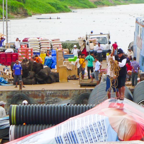
On either side of the canal it’s easy to recognize boats about
to change sides, because of the dozen or so car tires wrapped in plastic
stacked on the dock or deck. This time it was our turn.

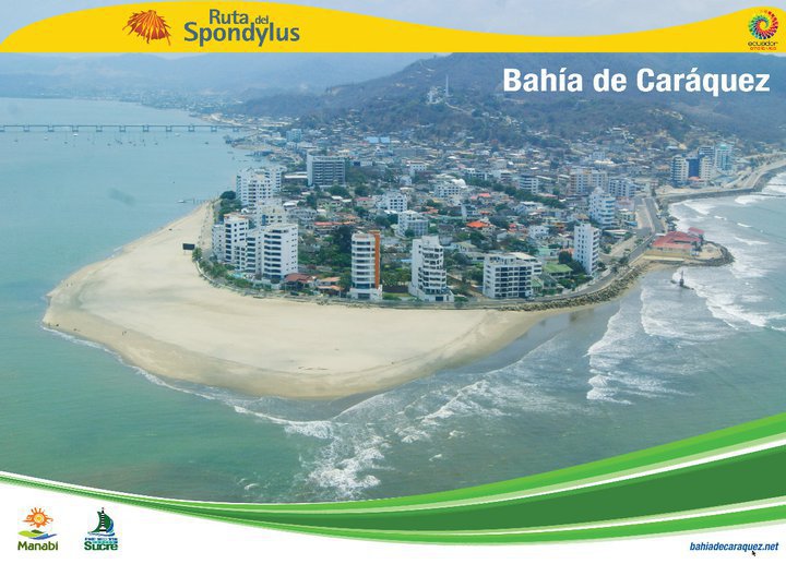
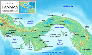
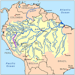
Yes, it’s official. We transited the Panama Canal, all fifty miles of it, from Atlantic (north) side to Pacific (south) side, this past weekend. Although we spent New Year’s Eve as many people do,  not even resolving to stay up late,  it’s hard to avoid a new 2013 mindset to go with the new 2013 location. Still, we haven’t formulated any real plans other than casting an eye towards Ecuador and the Galapagos.

A canal transit agent can make all the arrangements for those who care to pay his fee – about $350 for a boat our size. But we were traveling not in the busiest transit season (that would be February, March and April, when the Polynesia-bound boats generally move.) And we had good instructions, from the SSCA Bulletin of June 2011 (thanks Ainia). So we made the arrangements ourselves.

Basically it required two visits to town, the first to the Signal Station to arrange to be measured, and the second to pay the fee, in cash, at a particular bank in a safe area across from the Port Captain’s office. (It takes special wardrobe functions to get all those bills out of one’s underwear in a public place!) Then there were a couple phone calls to the Scheduler’s Office. For us, it went like clockwork.

The measurer and his tape measure came to the marina, filled out the forms, made sure we could provide a toilet and fresh water (preferably bottled!) to the advisor, and that the boat could go fast enough to make the trip. The fee, for boats whose total measure (including the part of the anchor that sticks out the front, and the steering gear, or davits etc at the other end) is less than 50 feet, is $1875, up $375 from this time last year. An as yet undetermined amount of that was our ‘buffer’ fee and will be refunded, I hope. The main advantage of the agent, as I see it, is that he covers the buffer fee for his clients, and provides lines and fenders.

UPDATE: about a month from when we paid, we had an email from the Canal Authority indicating that our US bank would not accept the funds being wire-transferred to them: “the beneficiary account has restrictions” and upon further investigation “Panama is on a restricted list”(aimed at money laundering?). So we arranged to pick up a check for $866 at the Panama Canal Authority, meaning that our transit would cost basically $1000 (credit for the wire transfer, plus tire rental $2 to receive $1 to discharge, per tire. We also rented four 125′ 7/8″ lines for $60. We could have used our own lines, long enough,  but they are only 3/4” and we didn’t want to chance being dinged by a faceless bureaucrat. In retrospect, we should have used our own lines.

Here’s a great note I received from a friend about his two canal transits:

After reading your comments on your canal transit, I couldn’t help but think of the fees we had to pay for the two transits we made. The fee for the one in 1971 in our 30 ft Seawind Ketch was a bank-breaking $18 dollars. In those days we had to pay based on the same formula for tankers, freighters etc . It was based on a boat’s cargo holding capacity. The second transit in 1998, this time in our Valiant 40 Tamure, the fee was $118.

So, here follows a photo journey thru the Panama Canal. And, if you’re curious about the story of the present canal, which is in fact full of cultural, political and social as well as historical interest, a book I’d recommend is Panama Fever, by Matthew Parker. Also, loads of factoids at http://panamacanalmuseum.org/index.php/history/interesting_facts

Kim and Steve and their son Tim came along as line-handlers.
It’s good practice before coming through on your own boat.

PHOTO BRAZILIAN REEFER KIM STEVE
We locked through the ‘uphill’ three locks lashed to the port side of another sailboat a wee bit larger than Galivant, trying to stay in the center of the lock. Ahead of us was a ship, the Brazilian Reefer, behind us a tugboat tied to the wall. Between the turbulence as the lock fills, salt water mixing with fresher water, the ship’s propellors and the tugboat’s smoky exhaust, plus a little inattention aboard the boat to which we were yoked,  and activity in the neighboring lock, the first lock was a little exciting.

PHOTO LINE THROWERS
The men with the monkey’s fists do a very neat little maneuver as they heave their lines towards us (we covered the solar panels with our cockpit cushions, just in case!). We tie their line through the loop on ours (‘You do remember the becket bend, don’t you’, says Doug) and they haul it back, drop it over a bollard and then disappear as the lock fills. They send our line back to us, but walk us, along with the messenger line, to the next lock, and so it goes through the three locks which raise us over 80 feet.

PHOTO OUT LOCK GATE 2
It’s quite an odd feeling to look down at the Caribbean waters ( hard to see but I can assure you they’re there, stepping down in the distance) as the lock gate closes behind you!

PHOTO LOCK AT SUNSET
It was getting pretty dark by the time we finished with the uphill locks and were let loose in Gatun Lake, less than a mile above the dam from where we had stayed in the Rio Chagres. It would be wonderful to spend a couple days in the lake poking around, but that is strictly forbidden, although you could go in a kayak!

Photo by Kim Watford

We were expected to, and did,  spend the night tied to this ship mooring. Luckily the weather was still and there were only five us, to share the two moorings – sometimes there are half a dozen boats all on the same ‘hook’! Can’t anchor because of ‘lots of trees underwater.’ And by no means should we swim, because of crocodiles. In fact, we saw a croc about 8 feet long floating in one of the locks, but he was dead.

Sunday morning 6:30 found us motoring through the lovely mountaintop lakes for our special date at 11:15 at the Pedro Miguel lock. Staff offered up coffee juice bacon eggs potatoes refried beans salsa and raisin toast. The captain drove. And Ricky, our advisor, cheerfully answered every question as we crept along the side of the channel.

Each boat is required to have an ‘advisor’, but these are not ‘pilots’ (the official pilots perhaps see the small boats as not quite worthy of their attention.) Rather,  the ‘advisors’  are drawn from the ranks of canal employees such as firemen and security officers, and are required to have a university degree and to speak English. Ricky’s other job is aboard a hydrographic vessel, but he says he likes this one better and has transited the canal about 70 times a year for four or five years now. When the yachts go through tied to each other, there may be a sort of pecking order discussions among the advisors, which can cause confusion. But we liked Ricky and were pleased when he joined us again on the second day.
PHOTO SATELLITE IMAGE (from 2005) OF PANAMA CANAL COURTESY eorc.jaxa.jp

These lakes are the reservoir for the copious quantities of water necessary each time the locks are filled. Some of the islands are built of fill from construction of the canal. The Smithsonian has a nice tropical research facility along here, as the lake coast is undeveloped and likely to stay that way.

With explosives and dredging, the bends and curves of the shipping channel are gradually being straightened and deepened for the arrival of the new generation of super-container ships being made possible by construction of new super-sized locks parallel to the ones we just came through.

PHOTO SHIP UNDER BRIDGE WITH TUGS

The downhill locks seem a little easier to negotiate; they were certainly less turbulent. It’s more interesting to see the lock structure being revealed than to see it covering up. I enjoyed contemplating that all of this was built a hundred years ago of a quality that endures, although not one of the ladders has every single one of its rungs intact.

PHOTO INSIDE DOWNHILL LOCK

This set of locks we shared with a boat-load of tea-drinking bare-chested Brits, and all hundred-odd spectators at the visitor center at Miraflores locks. There’s a web-cam too, but I don’t know anyone who watched it for us, and, thankfully, it wasn’t very exciting.
PHOTO OF YACHT RAFTUP IN LAST LOCK

And then we were out! The skyline of Panama City Panama is getting rather Miami-like; one of the most interesting features is this under-construction BioDiversity museum designed by Frank Gehry. Looks like it will be another couple years before it opens its doors, or should I say, has doors to open! Right now it reminds me of how the sea urchins we see on the reefs often manage to camouflage themselves with little bits of shell.
PHOTO GEHRY BIODIVERSITY MUSEUM CONSTRUCTION SKYLINE

May your own new year also be as pacific and tranquil as you like it, with just the right amount of biodiversity.
A few more photos here: Panama Canal Transit

Ucayali River trip towards Iquitos


The view from top bunk cabin 1 Tuky III

Reading the guidebooks as we motored down the Ucayali towards Iquitos, (or up, since we were going generally north!) I learned that more than half the land of Peru is spread out flat to the east of the Andes, and it contains more than ten percent of the entire “Amazon rain forest”. (Brazil has the most.)
 But only five percent of Peru’s population lives there.
It’s said to be an area of extreme biodiversity, with many species of birds, mammals, butterflies, orchids and more (all this via Wikipedia). I must have had some expectations about what I’d see in a rainforest jungle because I was surprised (and a little disappointed, silly me!) several times that the view from the Tuky III  wasn’t heavily wooded, with big trees full of monkeys and snakes. No butterflies or orchids visible from the river! Just muddy banks, scrubby cecropia (trees), and the illusion of something mysterious, perhaps,  beyond. Doug took a ‘float’ trip down the Mississippi one time, and reported something similar; that you’d look up at the banks and wonder what was beyond them!

Purple marks the Ucayali River; Iquitos is where
it joins the Amazon proper.

Looking out of our cabin, I learned a few more things. The land is not entirely flat, as illustrated by this chain of cloud-topped hills. In fact we were still 300 to 400 feet above sea level, said the iPhone’s GPS, and we were traveling with sometimes a knot or two of current. There are a lot more people living on this branch of the river than I had imagined. And plenty of logging is taking place – we saw several shore encampments and more logging barges by far than any other kind of boat on the river.


It’s not all either “jungle” or “river” either. There are big sandbanks  throughout. We were traveling at the end of the dry season. Low water uncovers beaches  which are used to grow food, squash, watermelons, tomatoes, and lots of rice. As the river was just beginning to rise with rains, it was time to harvest. Scattered solitary lean-to or tent-style shelters were inhabited by people looking after the crops, and trying to chase birds off, I was told. Or perhaps they were fishing, then drying or smoking their catch. Hard to imagine what it will be like with another 20 or 30 feet of water in a couple months from now.

Topiary is a popular art form in Contamana and elsewhere.

Between the hubs of Pucallpa and Iquitos, there are quite a number of settlements along the Ucayali. The big ones, Contamana and Requena, may have at least 10,000 people each, plus cell towers, schools, and hospitals or clinics. These towns have old Catholic missionary churches from colonial times (1800s), and other buildings from the rubber boom era (late 1800s) so some development isn’t recent. Settlements behind the bluff can be recognized by the river landing steps cut into the bank, and by the fact that Tuky nosed up to the shore and dozens of people would appear, or a  lancha would zoom out, at any hour of the day or night.

Also, at each settlement we came to, at least during daylight, we were met by vendors, usually women and children, selling consumables, like soda, breads and some fruits. Quickest (best)sellers were the fried fish, but there weren’t many sellers of those. And in one bigger place, people came aboard with a wireless phone-calling device I’d never seen before. But we usually got off the boat for a quick peek at wherever, so I missed the details on that technology.

More interesting to me was that no one I asked could really describe just where the people in these settlements did come from. They clearly weren’t indigenous people. Some were displaced by the Sendero Luminoso activity of the last generation, some displaced by poverty in their native areas; maybe it’s just a better place to live than where they were before. There are lots of pueblos called Nuevo Something.

We crossed paths with several other freight boats, and with carriers of ‘combustibles’. But what we saw even more of were these log carriers, by the dozen, not counting what passed  while I wasn’t awake and watching.  Several fellow passengers told us that this logging was illegal, and a big problem, that the trees came from far inland, three or four days by truck. Of course a road needs to be made for the truck, and they need machinery for loading. It’s a big issue – maybe I can address it later. Every Peruvian we were able to chat with repeated that “the trees are the lungs of the world”, a saying we also saw on several billboards throughout the country.

Every town had waterfront sawmills and big piles of sawdust and scrap.  And lots of wooden houses of course.

Tuky III at the dock at Contamara.

Tuky, by the way, is short for Toucan, third of the family. We met Tuky II at Iquitos – they came out to free Tuky III from a hard grounding (our second) just outside the Iquitos harbor entrance, but couldn’t. Eventually all the passengers, including us, but excluding those few with business and commerce items to look after, jumped ship. We went back to the dock later with a photo of the boat to give to the captain. They were gone three days later.

  There wasn’t much biodiversity aboard the Tuky III, but there was some! Here a woman carries a baby (something) monkey in her hair. We had a handful of hens, and a basket of roosters on the cargo deck for a couple days. And huge crates of oranges, the cargo of our neighbors in cabin 3.


There was a young man whose job it was to sweep  the boat continuously from end to end, and he did dispatch a large number of black beetles the size of a penny in the first day or two, but mostly he was after tracked-in dirt and food scraps.

I made sure to bring mosquito coils, but these were about the only insects I saw.

As you can see, most of the passengers made little compounds on the floor and in their hammocks.One smart woman had a carpet. The kids had a great time making friends, racing around and playing games. Sometimes they would come and stare at the gringos reading their books, or lying down.

The number of hammocks ebbed and flowed, but we never had more than one ‘layer’, and folks had room to sleep arms akimbo, which I gather is sometimes not true aboard other vessels. There is no other way to get to Iquitos save by boat or by plane (tickets were a bit more than $100 per person, I learned when we flew out of Iquitos back to Tarapoto) so that may account for the predominance of young families as passengers.

 
Still, I think we had it pretty good on the Tuky III compared to some of the other and larger and older vessels we saw. 

I cannot begin to list all of the things that were being carried aboard these river vessels. Everything. It all comes by sea, except in Iquitos where there is an airport and you can fly anything you can afford to, I guess.

This post is getting too long (again!) so I’ll cut the part about what you might like to know if you’re planning a similar trip, and post it shortly, with more photos. Stay tuned!