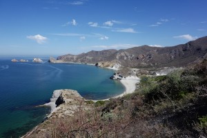
One of the nicest places we sailed to in 2015 is the bay called San Juanico on the Sea of Cortez. On the chart it’s also called Punta San Basilio and lies about 26 22 N, 111 25.7 W, halfway up the Baja California peninsula. This is not to be confused with San Juanico the surfer/fisherman town at Scorpion Bay on the Pacific side. Please see the Photo Gallery at the bottom of this post – more pictures than words this time!
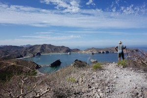
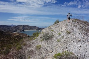
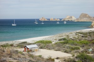
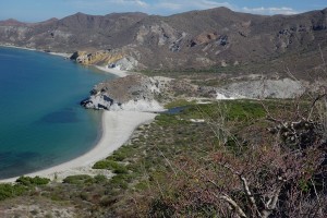
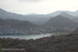
Looking north over San Juanico bay and anchorage from the ‘ridge trail’ above the south shore.
Squint or zoom and you’ll see a couple of empty houses on the far shore, fancy by some standards (swimming pool!) but realistic in terms of the ten or fifteen miles of dirt road that separate this spot from the highway, and the thirty or so beyond from Loreto, the nearest town.
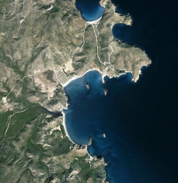
Here’s how it looks from the sky, courtesy of Google Earth.
San Juanico by Google Earth. The houses are where the dirt road comes in from the north. The main estuary comes in about 9 o’clock and the ranchito, a small estuary and the ridge trail about 6:30.
You might see a couple of RV or pickup truck campers on the beach. Only the relatively intrepid people make it this far. The smart ones come year after year and stay for weeks on end, driving out occasionally for water and supplies. It’s muuuuy tranquilo here.
But for the most part San Juanico is visited by boaters like us. It’s one of the better anchorages, with protection from the prevailing winter northwesterlies and the summer southerlies. Although, I can testify that an uncomfortable swell can and does roll in around that northeast point when the winter winds are up.
You can walk along the roads, or on some trails along the estuaries or atop one of the ridges. If you try to walk all the way to the highway (and don’t bake or desiccate first) you’ll pass a small encampment where a family sometimes has vegetables to sell. We also heard of a place with petroglyphs but never stumbled upon it. Maybe next time…
Between the hikes and the beaches and excursions by dinghy for fishing and whale-watching, you won’t even notice that there’s no word from the outside world. It’s as distant as the occasional con-trail overhead.
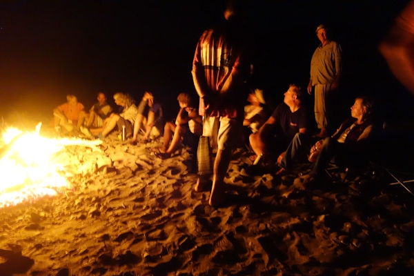
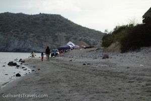
Our second visit coincided with Easter week, Semana Santa. The handful of RV people had gone back north. They were replaced by Mexican families, from Loreto and beyond, celebrating what must be the biggest holiday week of the year. Fishing, popup sleeping tents, shade tents, kids playing in the sand, it was all great to see.
By the end of the week they too were gone.The beach again belonged to the seagulls, the bay to the yachts moving north toward their summer homes.
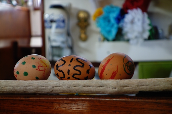
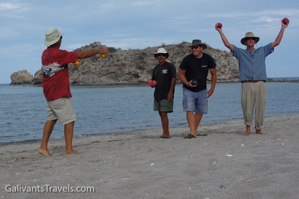
Easter eve beach campfire.The cardon cactus has a wood-like frame, and stands in for driftwood.The Easter Chicken visited Galivant.The bocce champions.
San Juanico Photo Gallery
So without further ado, let’s look at some pictures of the bay and the land around it.
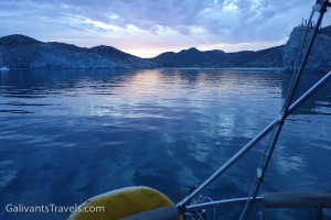
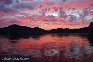
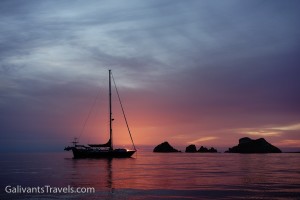
Sunsets have endless variety. Cool…
to vivid.
Sunrises also nice.
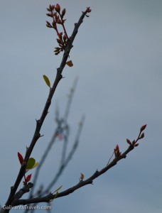
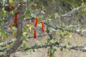
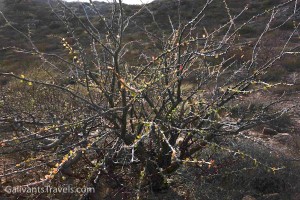
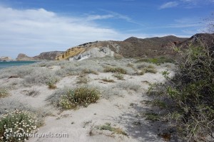
Flowers in surprising places.
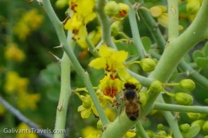
Honeybees love this yellow flower.
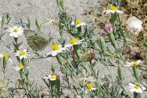
It’s a picture of the butterfly, but aren’t the flowers nice too?
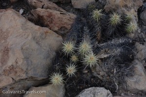
Portrait-worthy still lives everywhere.
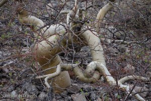
It’s a tree, a cool looking tree, with a name. But I don’t know it.
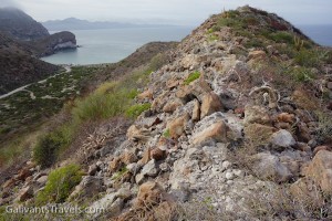
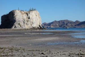
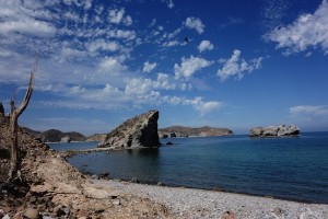
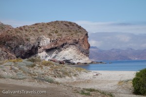
A rocky ridge overlooking Playa Ramada, Punta Pulpito on the horizon.
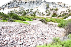
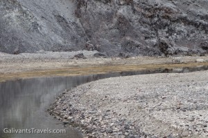
Behind the south side beach, the arroyo is stony with a small wet pool and a bright white cliff. Here we saw a long skinny snake chasing a gecko, until they saw us and both vanished.
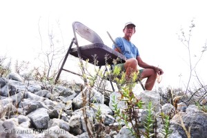
Mirador Rober even has seating. My chair is empty because after several attempts at self-portraiture, I realized I still had titanium dioxide on my nose and lips.
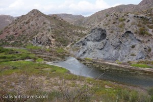
Estuary goes further inland than we went.
An brackish estuary behind the beach.
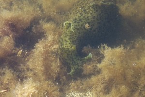
Whatever this is (?sea cucumber family?) lives in the estuary and grazes on the vegetation with enthusiasm.
The estuary again.
Low tide, Galivant in the background
Looking north over San Juanico bay and anchorage from the ‘ridge trail.
A spot on the ridge trail where something has fallen away. We started a new trail about ten feel inland
South side.
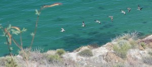
A line of pelicans coming in for a landing.
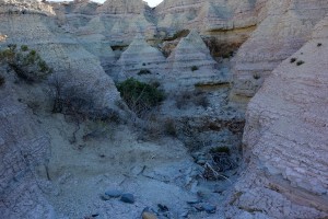
A small eroded hill on the edge of an arroyo
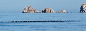
Raft of, I think, eared grebes. We saw the dark shape of this shoal of birds from up on the hill as it shifted around. The formation always stay tight, but the color would shift as they dove en masse. Back down in the dinghy we went to check them out.
I always let Doug go first to roust up the rattlesnakes, if any.
Better without a caption!!
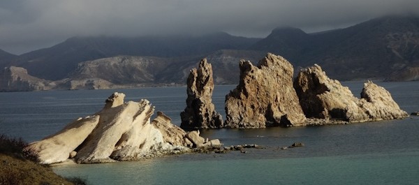
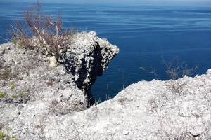
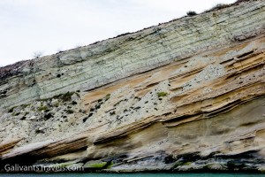
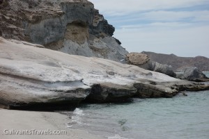
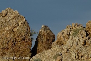
A lot of geologic movement has taken place on this coast over the eons.
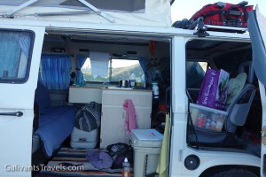
Inside a VW camper.
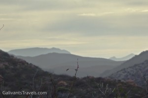
Mountains upon mountains into the sunset. Hard to imagine that anyone has ever been to some of them.
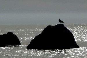
Seagull in silhouette.
Rock strata and erosion piles.
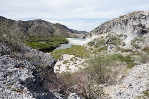
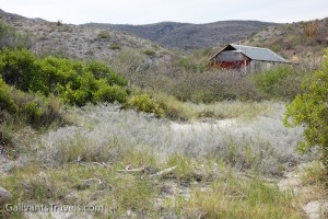
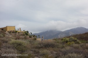
Ranchito Santa Ana and the south-side anchorage
What a nice sign! The shells are nailed into the ?sandstone. Making use of the materials at hand.
Along the dunes at Ranchito Santa Ana
Ranchito Santa Ana
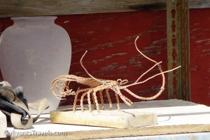
Wire lobster on the shelf outside the ranchito.
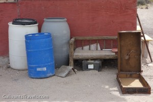
The essentials of life off the grid.
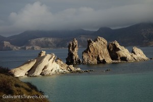
Rock formations redux.
The headland on one side of Playa Ramada.
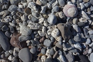
No sand on this beach, just stones, plus some old coral from a previous geologic age, eroded down from one of the many curious layers.
The smaller estuary and the arroyo beyond.
Newly graded road comes here. What next?
Ospreys nest on the pinnacles.
Semana Santa brings happy families to camp on the beach.
Looking roughly SW across the bay.
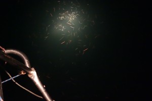
What we see in the water at night.
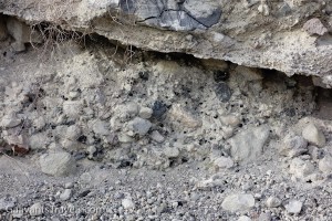
The little black dots are obsidian, very sharp volcanic glass, also known as Apache Tears.
Whoever might live here will really enjoy the ever-changing views.
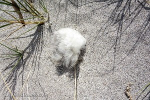
The skin and feathers of ?eared grebe. We saw several of these, no bones, no guts, just clean dry feathers and skin blowing along the beach. What eats the rest?
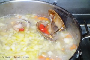
Chowder with fresh-caught ‘chocolate’ clams.
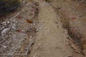
Rut Road! When it rains, it sometimes rains torrentially. When these roads become impassable, they stay that way for a while.


Hola Amigos! We are right behind you. In La Paz heading north. See you in Guaymas later?
scott and connie