Sweet Water

We turned our backs to the sea and headed up the Rio Dulce through the outskirts of Livingston, admiring the houses mostly built directly on the river, some on stilts, and some only a foot or two above the water, all with boat-ports in lieu of car-ports or garages. No roads, remember? And no traffic noise.

Then I realized that we were on a highway after all, but the other vehicles were mainly cayugas, paddling or fishing under the overhanging branches. When I say cayuga, I mean dugout canoes with freeboard measured in single-digit inches. They move surprisingly fast, up the shaded edges.

Every so often a bus would roar past – lanchas loaded with people, sometimes tourists (pink!), taking the ride from Livingston to Fronteras. The lanchas are long lean outboard-powered fiberglass, up to 30 feet and they do the heavy work. They usually don’t leave much wake, but nothing seems to unsettle the cayugas.

When we got to the gorge part of the river, green and sometimes cliff-walled, hills of varying hues marching off beyond, we just kept saying Wow, this is neat, or some such mundane exclamations of surprise and pleasure, bend after bend. It wound on for five or six miles, mostly deep (50′) water, full of white herons and other birds.

After the cliff section, scattered houses appeared, many of them, despite their palm frond roofs, clearly not built for local residents. Sometimes the mouth of a stream,a small store, a restaurant, or pentecostal church (solid concrete).

Eventually we came to a shallower and wider ‘lake’, the Golfete, rimmed by mountains a bit farther off. It was absolutely still, beyond the sweet song of frogs and birds. I had the eerie sensation of having climbed to a plateau in the clouds, and can’t shake the feeling that I’m not at sea level any more. But we didn’t have that much current against us, and water seeks its own level, doesn’t it?

It’s such a different world that I can see why people (other than insurance agents) have no concern about hurricanes here. I hadn’t visualized the scale of the place – our destination was still another ten miles off, and beyond that lies a 30-mile long fresh water lake, Izabel, largest in Guatemala.

When people talk about the Rio Dulce, their comments are always prefaced by “You’ll love it. It’s so beautiful, and the people are so nice.” Spending the hurricane season here clearly won’t be a hardship!

Over the Bar


As I said, we’ve come to Guatemala to look for a place to hide during hurricane season. People do stay in the Caribbean through hurricane season, keeping an eye on the weather. But I don’t want to be looking over my shoulder all the time, especially when there’s new adventure to be had inland.

The mere idea of a commodious fresh water inland highway is plenty attractive and the reality doesn’t disappoint.

But of course, for this to be a good story, there must be some struggle or danger, so let me now mention the famous bar that runs across the mouth of the Rio Dulce. Its controlling depth is about five and a half feet, and there’s a tidal range of a foot and a half. So, pick the right time and our six feet,and beyond, can come in, if of course, we also pick the right place!

There is one sea buoy, which may or may not have been moved in the last decade. There are scraps of paper handed from boat to boat listing GPS waypoints that have worked for them. But the best advice we got was not to slow down too much or we’d find pushing through the mud more difficult. And it was nice to have a boat ahead of us, even if it was shallow draft, just for scale.

So we plowed on through, dodging fish trap floats made of soda and outboard oil bottles. Wood smoke, and the smell of drying fish, scented the air, and the binocular tour revealed a pleasantly ramshackle waterfront and a small town rising up the hill. There are cars here, but not many, since there isn’t a road to Livingston and all its business (mainly fishing and tourism by the looks of it) is done by lancha and cayuga.

Here, the customs, immigration, port captain, health, etc come aboard. There’s an agent, Raoul, who organizes it all, including the boat to bring them, so it’s quite expeditious. The health officer noted that we showed no signs of fever, vomiting or diarrhea. The customs officer was busy on his cell phone, and immigration wore high heels. The boatman noted that we did not have a courtesy flag, and undertook to provide us with one, for a fee, when we went ashore to pick up our papers. His English was good because he’d worked in a New York car wash, until he got deported.

The ‘Tribes’ of Belize

This country is one of the least densely populated in the Americas, with  only about 310,000 people on land about the size of Massachusetts.  It’s practically empty! But such a variety of people and such a complex mix of races, languages and backgrounds!
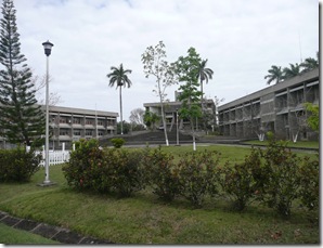
Belize Belmopan center of government


The capital, Belmopan, is barely a town of 12,000-15,000. Here’s the center of government as built by the British about 40 years ago, well inland, after yet another hurricane wreaked havoc on Belize City. But although the official seat of government moved, a lot of people prefer the funkier character of the coast. The British engineers were more interested in sturdy construction and good drains.
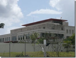
 Belize American embassy


And here’s the American Embassy, only a couple years old, built for $80 million dollars, including two stories underground. There’s more around back. Even sturdier construction and better drains, I’d say. Also a sign forbidding photographs.

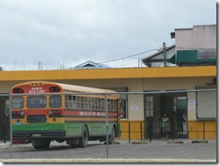
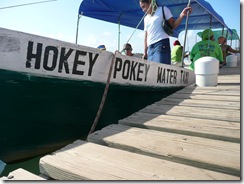
Wanting to go inland, we took the water taxi and public buses (BlueBird school buses) to Belmopan via the lovely Hummingbird Highway, one of four major paved roads in the country, then asked a taxi driver to show us the sights. These were: half a dozen embassies, the Chinese supermarkets, and the home of the richest man, whose fortune was based on telephone poles. We had lunch at the market across from the bus station and came back home.P1020268P1020418


The biggest groups are  Creole (“English”), descendants of slaves imported to work in the mahogany forests, ,  Mestizo (“Spanish” mixed Hispanic and Amerindian) ,  and Mayan, these days often refugees from Guatemala.  Unlike many former colonies, this one, ex-British Honduras, never had a large European population during colonial times.belize-flag-400
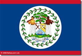
Finally found our Belize courtesy flag, whose coat of arms bears symbols of the mahogany industry which was the economy in the 18th and 19th centuries. It’s reminiscent of Maryland’s seal only instead of ‘strong deeds, soft words’ the Belize inscription means: In the shade, we thrive. The men are holding axes and saws, not fish and shovels. The picture is supposed to get bigger if you click on it.
We used to sew and paint our own courtesy flags, but this one, like Maryland, should be bought.

The Garifuna were originally from St. Vincent, descendants of African slaves with some intermarriage with Caribs, Arawaks and Europeans. As the Eastern Caribbean was exchanged between the British and French, they were in the way, and were shipped to Belize during the early 1800s. To this day, they have maintained their own cultural identity and account for about 7% of the population, and all the Rastas.
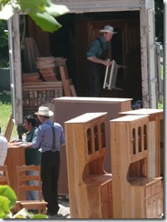
Belize Mennonite woodworkers

A small but distinct group are the Mennonites, who came en masse from Mexico in the late 1950s. “Mennonite farmers and businessmen are responsible for a major part of Belize food production. They produce a good portion of the country’s beef supply and most of the chicken, eggs, pasteurized milk and other dairy products. Mennonite farms also produce soybean for animal feed, red kidney beans, rice fruits and vegetables.” As they do elsewhere, they build furniture. They have been granted a certain autonomy in their communities, cannot vote and do not serve in the military. The same straw hats (not local!), the same black bonnets and overalls that they wear in Ohio, it appears.

You can read more here :http://www.reporter.bz/index.php?option=content&task=view&id=2607&Itemid=2.

Then there are East Indians, Arabs, and Chinese, who have come in greater numbers lately from Hong Kong and Taiwan and settled into a mercantile niche, particularly groceries and restaurants .

I feel like I’m writing a school report, but probably, on the subject of Belize, many people draw a blank. I continue because I was surprised at how different the feel of this ex-British Caribbean colony is from those of the Eastern Caribbean. There don’t seem to be such extremes of wealth, or the antipathies between groups that you sometimes see.  Although the rhetoric for recent local elections was hot enough!

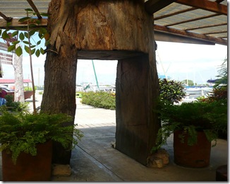
A good thing about this small population is the reduced pressure to deforest – Belize is trying hard to be an eco-tourist destination, and has apparently retained an impressive number of  the larger jungle animals like jaguar and tapir, and birds. This NY Times article is old but I thought interesting on the subject of sustainable forestry.  Belize Mahogany trunk  The gist of it is: Rainforest Action says       “Boycott Mahogany” but others say that if the forests aren’t valuable, there will be no reason to keep them. Belize is still covered with tropical forests and half of it is in preservation, so here’s an opportunity to provide economic incentive not to turn diverse forests into citrus groves.
http://query.nytimes.com/gst/fullpage.html?res=9F03EEDC1F39F937A35755C0A960958260&n=Top/News/World/Countries%20and%20Territories/Belize

Only This Place

We knew where we were as we sailed parallel to the outer reef near Tobacco Cay. We were smack dab in the middle, just south of the course for entering the pass. The sketch chart sounds showed 9 to 12 feet and the proper chart (150,000:1!) showed 2 meters in the vicinity.
So it happened that we were blowing downwind under the genoa ‘admiring’ the patches of turtle grass and shadow in the nice green water. We always watch the sounder – it’s like a sick fascination with those single digit numbers, but I was almost inured when: THUMP. Then:, thump, thump, THUMP. And we settled over to port, water lapping at the rubbing strake, hard aground, being set on, and not sure what we had hit, beyond the turtle grass we could clearly see all around us

Funny how you can just STOP like that. There’s a moment of silence, almost peace, while you’re taking in your situation. It was rapidly clear, though, that wait and see wasn’t our best option. So we unreefed and hoisted the main, sheeted and eased all sails in all combination, tried the Westerbeke fast and slow, with different rudders, for a good hour. All this moved us a little but not in a good way. Suddenly I understood what those weird bright white patches in the grass were – other keels have blazed this shoal before us.

The inflatable dinghy was collapsed and the kedge anchor buried deep in a locker, but we were getting them out when rescue appeared in the form of a local fishing boat (sistership shown below) and its crew of seven men and boys in Speedos, back from a morning of diving for conch.
We were a little dubious about what they could accomplish with a 40 hp outboard and a lightly built boat of wood and bamboo, but the captain seemed a careful boat handler and we had nothing to lose. “Where exactly is the deep water?” we asked. He waved everywhere. “Only this place.”

It took almost an hour but eventually we were freed. It cost us $25 (offered for gas), a bottle of rum (“we drink anything”), and mango squash (for the boys, I thought), my fresh-baked banana bread, and a strapless dive mask. They would have liked line they could use for a halyard, but we had nothing appropriate. It would be great thing to have aboard though, for just this eventuality.

The education? I’d like to say ‘priceless’. However I’m sure we’ll be a little sloppy again, and even more gun-shy in shallow water. One thing we did do that night was take apart the electric anchor windlass and test its manual operation for that day when kedging is the only way off.

Meantime, thanks again to the crew of the fishing vessel Rosa. Like I said, people are nice here. These guys spoke mainly Creole but we could see that they were careful and thoughtful, and we were grateful they’d take the time to help us.

Update:we’re using the third edition of the Cruising Guide to Belize and Mexico’s Caribbean Coast by Freya Rauscher. It turns out that the shoal we hit is very clearly marked, in the second edition, but was unaccountably left out of the third. That only makes me feel only slightly better though.

Out in the Islands


With business and maintenance finished, we headed out to the chain of islands that lies just inside the barrier reef. These islands are mostly mangrove – hard to tell if there’s any actual terra firma there unless there’s a fish camp built on it. There are a lot of fish camps, and a few lodges and small, low-key resorts, and some privately owned cays too.

Navigation is a challenge. The soundings change abruptly and not for any discernable reason. The charts aren’t much help either. The data is ancient, scale way big, graphics misleading . So it’s strictly eyeball and dead reckoning and keeping track of nearly indistinguishable clumps of mangrove. But the good news is that the air and water are pleasant temperatures, and you can find a different new anchorage often less than an hour away. And if the weather is fine, clear and not too windy, you can see a lot from a perch in the spreaders.

Our first stop, the Robinson Cays, was a boat building spot in the 19th century but in the 21st, there’s a fish farming operation. It looks well-capitalized. Rumor has it a Swedish group is involved, and that the fry are flown in from there with an 18-hour re-splash window. The fish are cobia, which in my fish book are on the same page as remoras and sharksuckers. They eat pellets made from other fish, so exactly what benefit accrues where, if any, is unclear. Our local informant says the meat is mighty nice, but they’re not allowed to take for themselves.

Our next stop featured a family of manatees feeding 150 feet from the boat, but when I went to visit them underwater I found it so churned up I had a hard time telling which way was up. It’s not easy to photograph a manatee either.

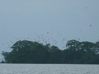
The Fly Range had flies, and the Mosquito Range had mosquitoes (but not many), and Man of War Cay is famous in aviary circles as a refuge for frigate birds. These large and generally solitary birds are known for rarely if ever landing, but I don’t think they can do the egg thing aloft. There are also Brown Boobies and White-Headed Pigeons using this island. How would you like to attend one of those parties!

A nearly universal rule of travel is: “This is very unusual weather for this time of year.” The fronts that traverse the US often drag tails through the Western Caribbean – the front dumping snow on the US East recently at once point extended from Nova Scotia to Colombia. “They” say it’s been very cool and rainy here this winter. I say it’s been coolish and cloudy, sometimes windy, and not from normal directions.