Random notes on Pacific Mexico


strong winds blow across the isthmus into the Gulf of Tehuantepec

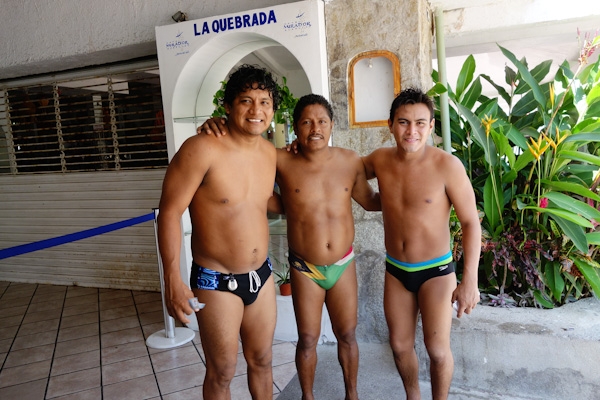
Weather is always on our minds

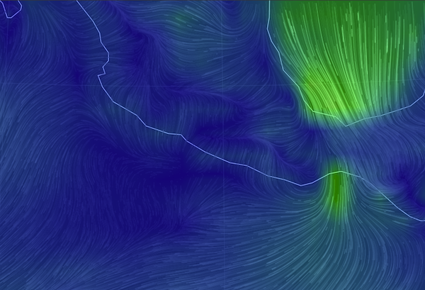
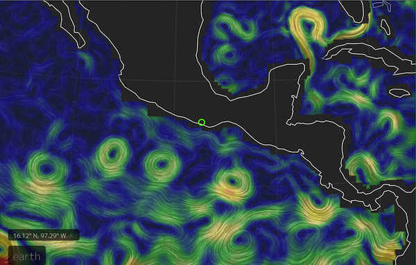
My new favorite weather website is this  earth.nullschool.net/#current/wind/surface/level/orthographic, a graphic representation of the actual winds being reported, available for the entire globe. In this picture of southern Mexico, the big green part is the tail end of a cold front passing through the US with a tail extending across the Caribbean. The small green is where those winds have funneled through the Chivela Pass across Mexico into the Gulf of Tehuantepec.

…especially Tehuantepeckers

The next day’s NOAA weather forecast for a 90-mile swathe of the golfo is INCLUDING GULF OF TEHUANTEPEC…N TO NE WINDS 30 TO 50 KT. SEAS 12 TO 17 FT. This kind of weather is a regular feature of the winter months. In fact, according to one of their blogs,  NOAA issues more gale and storm warnings for this area than for any other, except during hurricanes. They (the ‘fleet mind’) say small craft like us should negotiate the 240-mile crossing area around its edges, with “one foot on the beach”  or “close enough to hear the dogs bark”. But we were approaching this area at the end of its heavy season, had a four-day forecast for light winds, so we mainly motored straight across, and right into the marina in Huatulco to buy more diesel fuel.

And you can also see in the null school.net image, there’s not much wind elsewhere. That’s been the situation for most of our trip towards the Sea of Cortez and Baja California from Panama throughout the early spring of the year. (But not all of it: Too much wind, or not enough). Sometimes there’s an onshore breeze in the afternoon and offshore at night, but lots of lulls and opportunities to motor, against the current too.  Here is a picture of ocean currents, also from nullschool. I could watch  for hours; better than TV!
ocean currents off Mexico nullschool
We’ve had our new engine for four years now but we have put at least thirty percent of its hours on in the last six months. And we’re darned grateful to be able to motor, considering the alternatives.

Ship Traffic

When we’re underway we always have our VHF radio tuned to Channel 16. I heard a ship, the container-carrying Maersk Wolfsburg, call another ship on to ask what conditions he had seen in the Gulf of Tehuantepec. “Force 4, in advance of a much bigger blow being forecast” was the answer.  It’s the first time I’ve heard big ships talking with each other to exchange information not directly about course changes. I figured they just steamed through all weather no matter what.

Our computer keeps track of each ship it has seen, and doesn't delete them when they are no longer 'targets'.

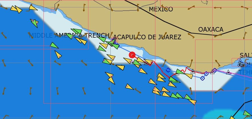
OpenCPN, our computer’s navigation program,  keeps track of each AIS ship it has seen, and doesn’t delete them when they are no longer ‘targets’, leaving the screen cluttered with ‘ghosts’. There’s more traffic than we would have known, but we never see more than one or two, if that, at a time.

Then a couple nights later, I heard my first Mayday. It was another container ship, reporting a man overboard, and giving the position. We were about 150 miles north and not in a position to do anything. Then it transpired that the MOB position was estimated, since the person had been missing for two hours. And then the Mexican Navy broke in and there were no further transmissions. Google tells me nothing more. For me it was a somber watch, dark and moonless,  on the edge of windy and rough for us in a 40-foot boat,  and for a man in his skin, well…..

What else could go wrong?

running man sign
Not the official warning sign, but the message is the same.


We were in a small bay outside Huatulco when we heard of the tsunami alert following the earthquake in Chile April 1. Thankfully, nothing materialized here, but we did get to think of what might happen and what we could do, not that we have any real answers to either question. Except, move to higher ground probably won’t be an option.

We also heard a report from a sailboat at anchor in Acapulco during one of  two recent  big earthquakes there, one a 7+. Anchor chain rattling and grumbling, palm trees swaying, a small rockslide or two is what you first notice, they say. That boat (sorry, I didn’t get the name) up-anchored and left immediately, fearing tsunamis. Probably I’d still be scratching my head!

But I did read a bit more about the earthquake warning system in place for Mexico City, which is situated on jelly-like landfill and has suffered greatly from past terremotos. http://www.economist.com/blogs/economist-explains/2014/04/economist-explains-14

Many of the earthquakes take place inland in Oaxaca along the intersection of the North American plate and the Cocos plate. Seismic waves move 7000 miles an hour, but the alarms are almost instantaneous, giving the folks in Mexico City at least a chance to get out of buildings.

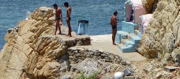
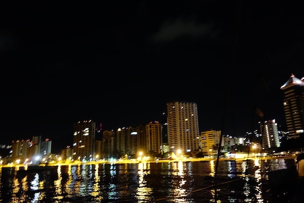
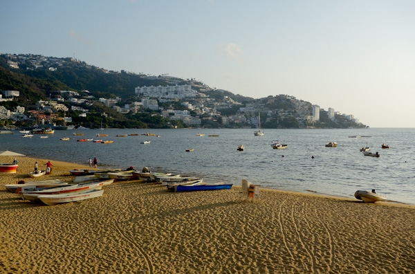
 Not all anchorages are good anchorages

In fact, there aren’t that many all-round good anchorages on this coast. The surf/swell/surge from all that open ocean to the southwest is a constant feature. You know it’s not going to be great when the most prominent comment is about the surf spots nearby. We like to be enclosed and protected, but we’re getting used to the open-ness and the rocks, sort of.

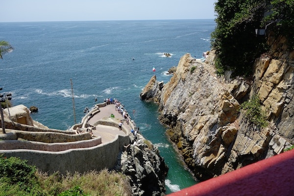
One night we shoe-horned ourselves into an anchorage in Puerto Angel, something we won’t be doing again unless the harbor is somehow enlarged or emptied. All night long we moved between the rocks on one side and the rocks on the other side, but managing to stay clear of the moored boat 20 feet away. There was a big surge  in the harbor, and a very steep beach, so as I peeped out the porthole I had the distinct feeling that I was already halfway down inside a vortex, ‘down the gurgler’ as the Kiwis say, and I didn’t like that!

The beach is very steep and the local boats motored and surfed their way up it.

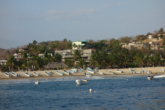
The local boats without  moorings just surfed a wave with their outboards full on until they hit the beach and, they hoped, kept going up.

And not all charts are good charts, except the iPad’s charts

We do carry some paper charts, although of course the electronic ones are a bit more convenient. Coastal charts like the one above with the AIS ghosts are off by a mile or more. By their offsets, we’re usually on the beach when anchored. I would have gagged on the words not too long ago, but I have to admit that our best charts and our most used close-to-shore navigation interface come from the iPad. The iNavX’s Navionics-based charts seem mainly accurate, and the charts from the top-notch Mexican cruising guides Pacific Mexico and Sea of Cortez (by Shawn Breeding and Heather Bansmer) can’t be beat.  These harbor charts can be downloaded thru the iNavX app (Blue Latitude Press), and the waypoints are also available as a separate download.

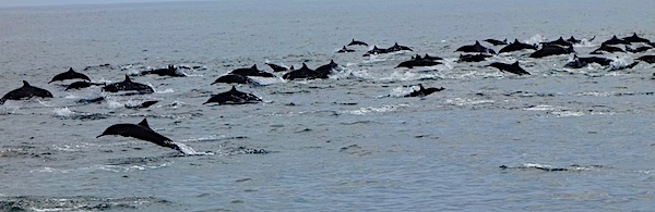
Dolphin Feeding Frenzy

Saving the best for last:  one day we saw this fantastic dolphin feeding frenzy, or party, or whatever it was. There were at least five hundred (guessing!) leaping, twirling, splashing, dolphins moving back and forth on both sides of us for twenty minutes, until a message came in from somewhere else and they moved on.

dolphins leaping


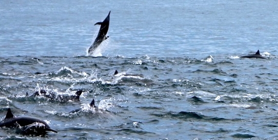
We were lucky to be part of the party as we sailed silently through. And if I’m lucky one of these days, I’ll be able to upload the video too.

Tourist Day in Acapulco

My parents vacationed in Acapulco in the 1950s. Their stories of the pink hotel  where each room had its own swimming pool fascinated me, as did the photos they brought home of men diving off a cliff into a tiny pool of surf. These were the famous Cliff Divers of Acapulco, los clavadistas, as they’re known locally. So it was hard to sail past without stopping.

The star cliff divers of the 1950s
The star cliff divers of the 1950s.

Acapulco is also famous for its beach – has been since before its days as a Jet Set destination in the 1950s. Not many cities can boast such an attractive setting on a large bay, six kilometers across, rimmed with sand, lapped by tropical waters and framed by rising ranks of jagged hills.

DSC01922 Fort flag highrises

Fast forward to the 21st century. And slow down for a stop in early April of 2014.

Acapulco in the 1930s, 1950s and 2011 - it's spread and grown a lot!
Acapulco in the 1930s, 1950s and 2011 – it’s spread and grown a lot!

The older original part of town has a market, square, cathedral, all the usual accoutrements. The tourist area however is a shadow of its former self, aside from the fort San Diego, now a nice museum. The action has moved along the beachfront towards the big hotels. If there were any action, I should say.

painted but dusty  statue of woman in toga
This slatternly statue decorated what once was a big seafood restaurant in the older part of town

It’s astonishing just how empty of tourists these big buildings are, as measured by lights at night.

City lights but empty waterfront high-rises.

The cab drivers and people we chat up on the street agree it’s pretty quiet lately. But they insist that every room will be filled during the Easter vacations, Semana Santa.

Economic wheels are still turning and there’s plenty of local traffic and activity on the roads. I am charmed by all the VW bugs being used as taxis. They were manufactured in Mexico until 2003, and I’ll bet it would be a great place to get parts if you had an VW to refurbish.

Blue-and-white VW bugs are taxis.
Lots of taxis are VW bugs, all at least ten years old.

Part of the problem has been an increase in violent crime in recent years, but there is general agreement (our main sources are taxi drivers and bartenders) that things are better now than they were five or six years ago. There may still be murders, but they’re ‘back there’ said one taxista, gesturing toward the interior, ‘poor people and gangs. Let them fight and kill themselves there.’ He told us there was a period where he was afraid to work at night, but, ‘it’s all better now.’ It takes a long time for a town’s reputation to recover though.

Galivant’s crew might have liked to rub elbows at the Acapulco Club de Yates, where the sailing events for the 1968 Summer Olympics were hosted, and the gardens have been well-tended ever since, not to mention the pool. I got to walk through, looking for a marine store. We would have looked a ridiculous  in our weathered little sailboat next to some of those glossy big motor yachts at the dock, and felt even worse counting out a couple hundred dollars, plus tax, plus electric, for a night’s dockage. So we went across the bay,  anchored near the navy base, and took the dinghy ashore,  to be looked after by Jorge  the jet-ski renter for the price of a couple beers each day.

Galivant anchored off the beach at the southern end of Acapulco Bay

And how empty the beach! Several miles out of the harbor we were noticing discolored water – clearly a ‘red tide’ event happening at the moment. They should actually be called algal blooms, since the toxic phytoplankton are not always red, and have nothing to do with the tide. But they’re not healthy on your skin or in your mollusks, in addition to being visually unappealing.

Where we left the dinghy on the beach, (near a bar called Pancho’s) there  were a few one-umbrella food and drink stands and something of a local community, with dogs,  who looked after things, including us. A near-toothless older  (I hope) gent  explained to me that those little jellyfish and plants would die and rot and fertilize the eggs of things that were growing in the sand and that “a different intelligence was at work than this one”, waving his hand dismissively toward the high-rises.  I thought he summed up the algal bloom versus development scenario pretty nicely. Also ‘they’ say that when the bloom is over, the water is super-clear and clean. Maybe the Semana Santa tourists will be blessed.

Mexican hairless dog is supposed to look like this.

Then we did our part for the local economy by  attending the clavadistas, and eating in the restaurant while doing so, mainly so we could sit in the shade. The divers have been on several ‘extreme sport’ shows, the Hotel Mirador featured in an Elvis Presley movie, and the celebrities of the Jet Set and more modern eras have made appearances throughout the years since the first dives in 1937. Or at least  PR people sent photos. Aside from Roy Rogers and Trigger both signing the wall, here’s the one I liked best.

Frank Sinatra looking young and cool and hip

And now, ladies and gentlemen, the divers.

They ‘commute’ to the job site by jumping into the water from the observation terrace, swimming across, and climbing up the rock face to the shrine. Some, not all, pay obeisance to the Virgen.

Before their dives, the divers have to swim across and climb the cliff

The top height, by the shrine, is 125 feet, and the average water depth is only 12 feet deep, so they wait for an incoming surge of water. And as you can see, the ‘out’ from the cliff is at least as important as the ‘down’.

Believe it or not, no diver has died, although there have been injuries mainly related to miscalculated approaches to the water. And we noticed that a diver always waited at the bottom, moving in several times to clear away bits of debris from the landing zone. Luckily the algal bloom wasn’t in this area, although a patch was visible offshore. We heard that there is a 12-year old girl starting to dive, but didn’t see her.

When they finish, the divers sell t-shirts and mingle with the visitors. I wish I had been better prepared financially when I found them waiting for us as we emerged from the restaurant.

Acapulco Cliff Divers, three of the five who performed.

There is one show during the day, and four in the evening, with flaming torches. I’m really glad I went, but I’ll probably wake up in the night feeling vertiginous!

Acapulco 04-0220140402

We walked down the hill to the old center, the Zocalo, where we found a nice church and a plaza under shady trees with a dozen shoe-shine booths spaced beneath them.

We probably should have taken a walk through the market with a very pleasant older man named Tony, but our next mission was the museum at the fort of San Diego.

It’s a well-done museum, (extra points for reader boards in English). Turns out Acapulco Bay has been a shelter and a destination ever since the Spanish first came here. Not such a surprise, really, since there are precious few good harbors along this coast, but I was unaware of the scope of Spain’s trade with the Philippines, in terms of ships, cargo and the hundreds of years it continued.

Spanish-era sailing ship on Philippines route

It took these ships nearly 100 days (departing for Manila in March or April) to go west, and 180 to return (departing July or August), for those that made it past the bad weather and pirate attacks.

Winding up our day, we walked back a ways along the beach-side road as it slowly turned into a seaside restaurant and shopping zone. A bonus was seeing a US chain that sold a brand of shampoo I like. Such are the smaller pleasures of travel.

I hope the friendly folks of Acapulco get lots of tourists for Semana Santa, and beyond, and I hope the visitors have as entertaining a time as we had there.

Look under the Mexican flag and a little to the right for the diver.