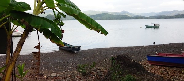
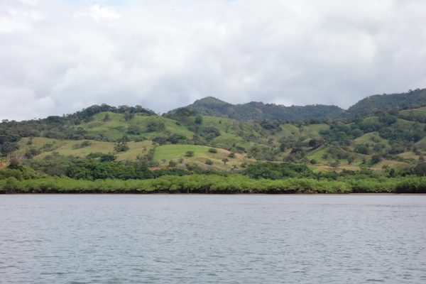
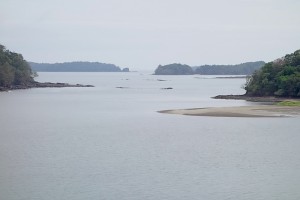
Once around Punta Mala and the Azuero peninsula, we found ourselves in the Golfo de Chiriqui, which runs to the Costa Rica border at Cabo Burica. The Gulf is about 130 miles across, and contains several islands and island groups, including two national parks.

For a backdrop to this pretty coastline, you get the province of Chiriqui, described as the most diverse province of the already diverse country of Panama. The seaside mangrove forests yield to the coastal plain, the foothills and then the mountains of the Cordillero Central, and Volcan Baru, highest in the country. A number of rivers run down from the rain forests, sometimes via whitewater rapids, to end between the little volcanic cones and other bits of geological crumple beyond the shores of the Golfo. Top it all with the blue skies and puffy white clouds of the dry season, add slanting equinoctal light at sunrise and sunset and you’ve got a lovely and very lightly travelled cruising area.
What’s on the mainland of Western Panama
We knew from our inland travels that the Panamerican Highway runs mainly along the foothills of the Cordillero. Highways turn off towards the cooler higher lands. The resort town, ‘outdoor adventure capital’, and coffee fincas of Boquete, and the vegetable and flower producing center of Cerro Punta, all lie in that direction. So does the Volcan Baru, highest point in Panama and home of the national bird, the amazing quetzal, plus a wealth of other birds, both rain forest natives and seasonal migrants. There’s a large national park, Amistad, which is shared with Costa Rica, full of hiking trails and wondrous sights. I’m a big fan of Western Panama’s Mountain Highlands, and in my birdwatching, bicycling, rafting and hiking incarnations hope to return there. But right now, we’re sailing, or motoring, as has lately been the case.
Along the shores of the Gulf, however, there are not many roads, or many towns, or many cruising boats either – we never saw another until we got to Boca Chica. A lot of the seaside is low-lying mangrove, split by rivers too shoaled or barred to be available to us unless the tide is just so. There are a few small towns, but the people who live here do so very quietly, it seems, getting around by cayuga and horseback, fishing and tending their crops. Here’s what it’s like a small way up the Rio Santa Lucia.
Out in the Golfo de Chiriqui
And then there are the islands in the Gulf of Chiriqui. The largest is Coiba, once a prison island. “Do not under any circumstances pick up people in the water, and take precautions when anchoring there or at nearby islands” says our Zydler Panama Cruising Guide from 2001, and the occasional incident proved they really meant it. I like the story, however apocryphal, that the guards locked themselves in at night. It was a feared and ill-reputed place.
Now it’s a national park and reserve, said to be eighty-some percent first growth native forest, and described in superlatives, unique location unaffected by El Niño conditions, rare and unknown species, healthy coral, etc. (http://en.wikipedia.org/wiki/Coiba). I’d have loved to visit, but we heard that park permits were a superlative $100 per day for the boat plus an undetermined amount per person per day, although some negotiation might be possible. So we went mainly to lesser bays and islands around the shoreline. Sport fishing boats and long-liners like to fish near Coiba’s protected waters. Coiba has several smaller attractive islands in its vicinity, also part of the park.
Other popular island groups are the Islas Paridas and the Islas Secas near Boca Chica. Some of these are also in a national park, but fees are lower. Sandy beaches, warm clear waters, palm trees, what’s not to like? At this time of year, the dry season months of January and February, and into March, the southwesterly swell is quiescent, and the strongest winds, if there are any, may be from the north, spilling over from the Caribbean. Anchorages that would be uncomfortable, or even untenable, in August or September, are available now, and bays open to the north might not be. It’s hard to know what to expect when there are surf spots right around the corner!
08 North, 082 West
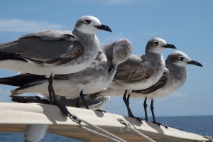
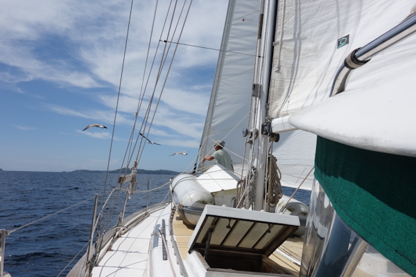 There are people in this world who try to visit, or otherwise collect, the geographic points where latitude and longitude lines intersect. This photo is for you, to be filed as what the world looks like at 8 degrees north of the equator, and 82 degrees west of the Greenwich meridian. Those are the Islas Secas rising ahead, and Doug on the foredeck trying to discourage a seagull gathering.
Instead the gulls moved practically into the cockpit, and fouled our rain collection awning.
Then there is Boca Chica
Boca Chica is one of the riverine gateways to the second largest city in Panama, which is David, itself the commercial gateway to the Mountain Highlands. David is well inland, on the Panamerica highway, and a normal person wouldn’t even think of approaching it from the water. But it is possible to weave your way through a tangle of sandbars, rocks and mangrove islands that, via several different channels, eventually leads to David’s small port town of Pedregal.
“I sure hope this chart is right” said Doug, as we were anchoring to wait for a higher tide, peering towards a bunch of rocks in a side channel which were about to disappear as the tide rose, that were not on our main chart. Of course, you know you wouldn’t be reading this if we hadn’t made it into Boca Chica totally uneventfully by following the red line in our cruising guide by the estimable Eric Bauhaus. We never saw less than 12 feet when there was just six feet of tide in, so we theoretically could have made it under most any circumstances. We don’t seem to have anchored atop the wreck of the sunken sailboat, and at the low tide the other day we located the four reefs we’d been visualizing ten feet under. We weren’t going on to Pedregal, so didn’t need to pass under the 60-foot nearly-invisible power line, or avoid the awash-at-low-tide clump of rocks cleaving the channel into a modest maelstrom just beyond.
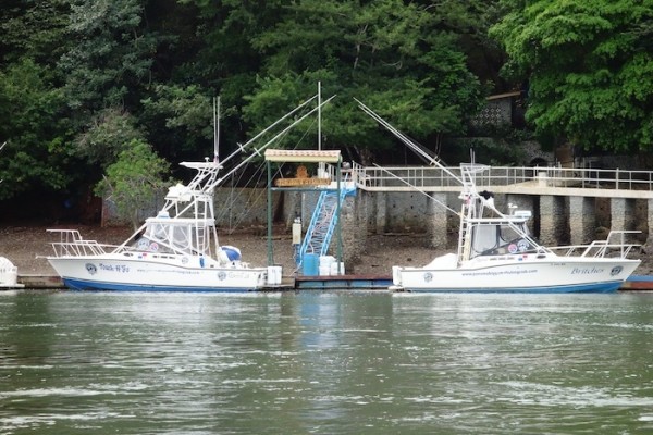
And so life could be kind of sweet in Boca Chica. There are a few hotels of character on the waterfront (Boca Brava, Seagull Lodge), along with a couple fishing establishments. Sport fishing seems to be the major form of tourism along this coast, and boats such as these will go out every morning40 or 50 miles to Coiba or another special spot.
Boca Chica the pueblo is pretty small: two docks, a tienda and a half, a school and a church or two, plus a smouldering land fill now containing a trash bag of ours. It connects by road to the Panamerican Highway and David an hour away. It connects to cell towers, Claro and Movistar, but not Digicel. In the plaza/park hung a handwritten notice signed by the mayor indicating that anyone found inebriated there over the Christmas holidays would be locked up overnight.
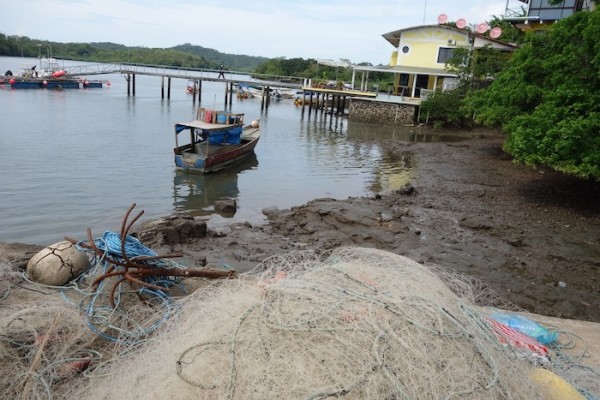 There is even a boat and storage yard, (this is not a photo of it, but rather of the Boca Chica waterfront) operated by Carlos Spragge. If you have your own trailer you can be hauled out there. Or you can take a mooring. Or dry out on a grid. This place is full of surprises.
Where the Surf Meets the Turf
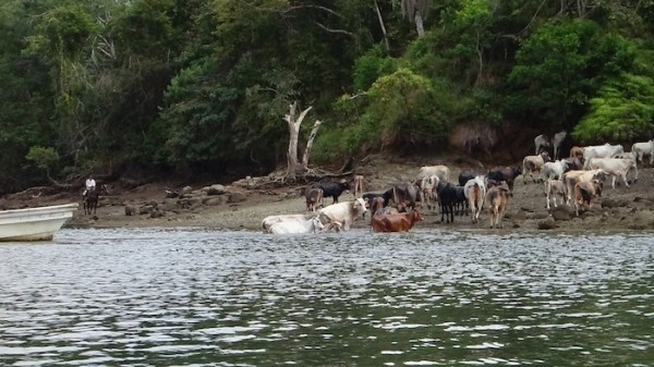
One of the most surprising things we ran into was a cattle swim. Fifty or so animals had been brought by truck to a holding pen on the mainland. They were about to be sent to the island across the way, Boca Brava. At slack low tide, vaqueros on the island herded three vacas into the water, and a lancha mostly running backwards, outboard motor toward the cows, ‘encouraged’ them towards the mainland. Those three were the ‘tourist guides’ for the animals who were being moved towards ‘better grass’ on the island. Together the entire herd was driven back into the water and swam across. The head honcho in one lancha swung his lariat while someone in the repurposed water taxi prodded with a pole to turn a reluctant participant. Cows can swim!
The jefe of the caballeros was a talkative and friendly chap. Later someone asked me if I had bought property from him. Seems like a rancher’s dream might be to sell some ‘appreciated’ land to someone whose dream would be living alone off the grid on an island facing the ocean. He’s seen it happen before. However, I already live that way, and when I weary of the view, my island (Galivant) can move. I did quite like the view in Western Panama, but it’s time to turn towards Costa Rica.
