The Friendly Whales of San Ignacio Lagoon

whale treading water looks at boatload of tourists with cameras

February and March are the height of the season for whales in Baja California. They are here, like us snowbirds, for the warmer water, but also (possibly unlike many snowbirds) for birthing and breeding.

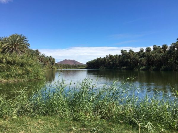
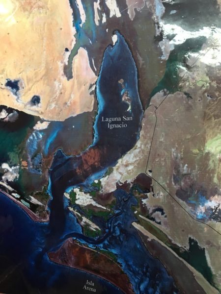
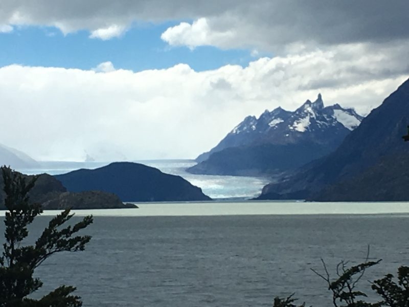
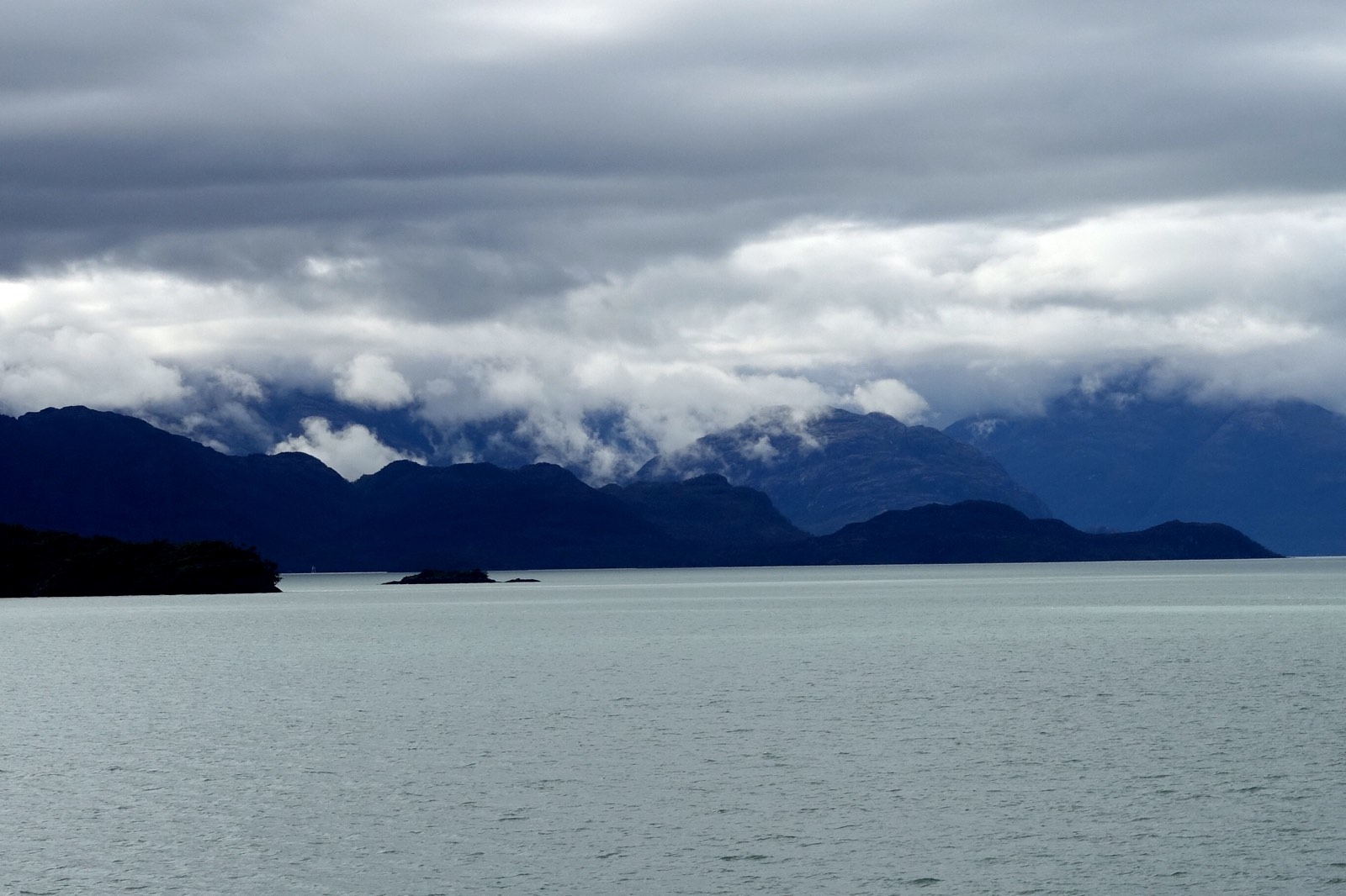
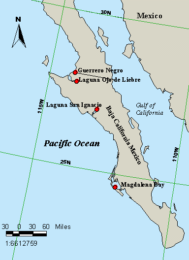
We see whales as we sail inside the Sea of Cortez. But the concentration is far greater in the lagoons of the Pacific coast of the Baja, such as Lopez Mateos, Magdalena Bay, Laguna Ojo de Liebre and Laguna San Ignacio. Grey whales in particular migrate to this area. So, taking advantage of a safe place to leave Galivant, on a mooring inside Puerto Escondido, we rented a car and drove off towards San Ignacio.

map of Baja California with 4 lagoons marked in red
The grey whales can migrate up to 10,000 miles from the Bering Straits to these lagoons, where they find conditions ideal for calving, nursing and mating. Where we drove from is on the coast near the dot on the i in Mexico.

Getting There

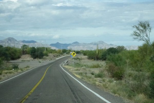
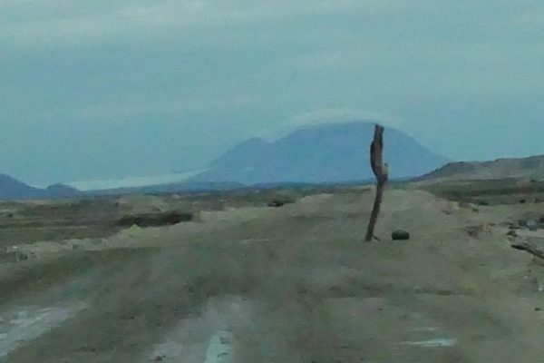
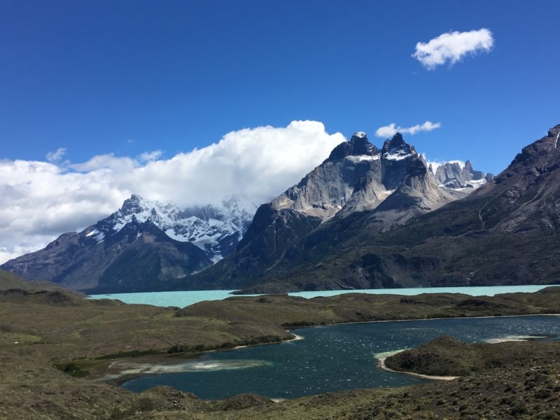
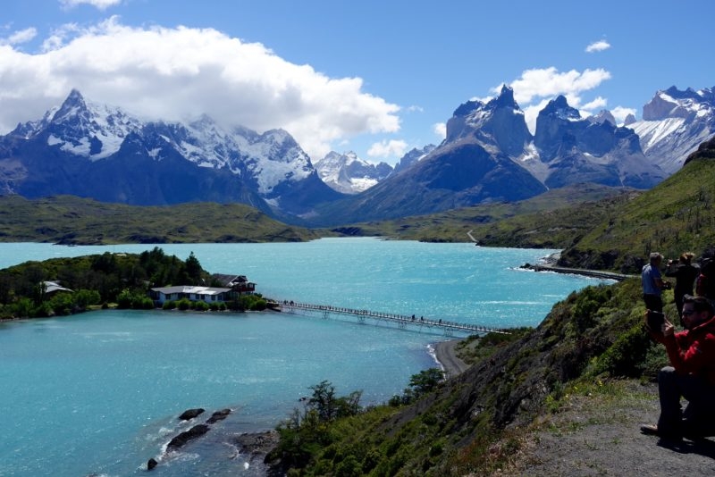
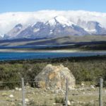
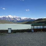
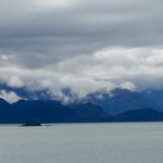
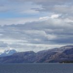
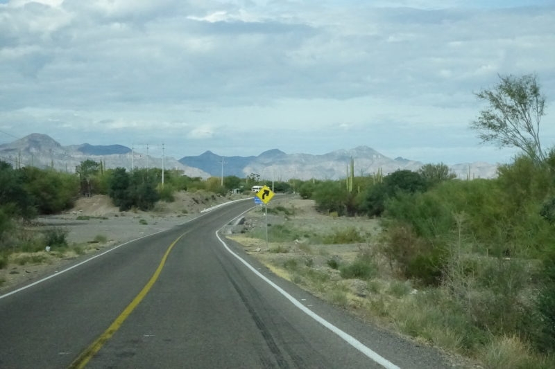
It’s more than the 3:07-hour trip to San Ignacio that the Google Map algorithm thinks it is, but it is a pleasant drive through Loreto, Mulege, and Santa Rosalia and across the mountains on a decent road with coastal and hilly scenery.  Know too that there is more road between the town and the lagoon; the last fifth (12 km) of that road is pretty good for a dirt washboard, but more comfortable at slower speeds.

2 land hi way, distant mountains
The roads are decent, but there’s not much shoulder for bicyclists and breakdowns. Night driving not recommended because of the possibility of livestock wandering across.

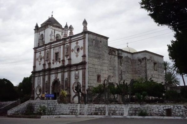
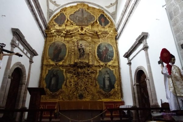
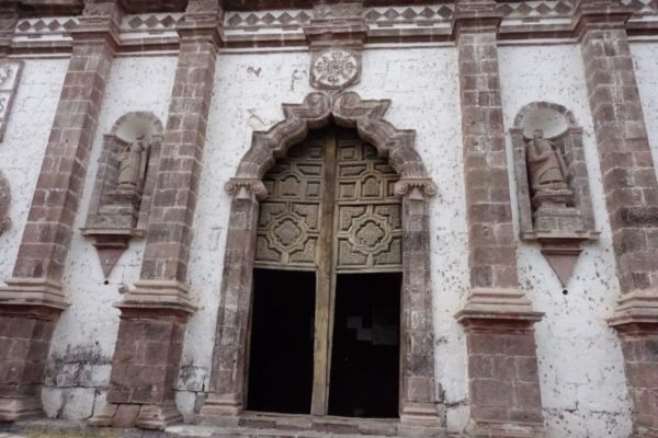
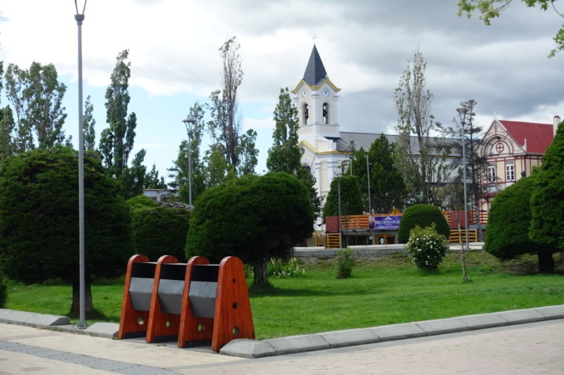
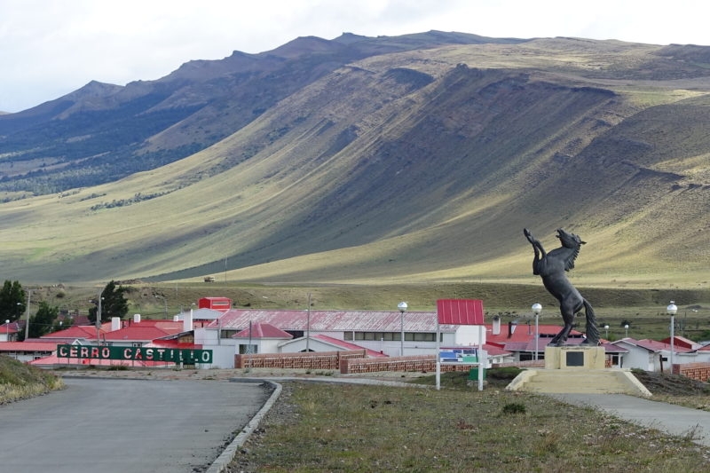
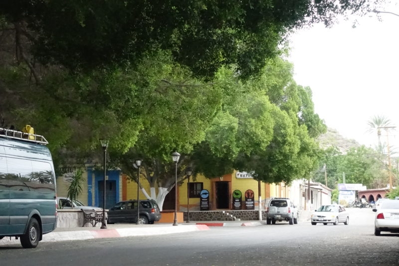
In San Ignacio itself you’ll find another of the Jesuit missions from the 1700s that run down the spine of the Baja. It is a pleasant small agricultural oasis town. Wikipedia reports a population of 677 souls in 2010.

San Ignacio Mission
The area was settled by the Spanish in around 1716, in an area already used by native peoples. This stone church wasn’t finished until around 1786, after epidemics over and over, volcanic eruptions, hurricanes, droughts, floods and the expulsion of the Jesuits.
Lagoon at the town of San Ignacio
San Ignacio has an oasis (a fertile spot in a desert where water is found), complete with date palms. A part of the smallest river in the Baja, it disappears in less than a mile, I’ve read. But dates, date bread, date pie, and other date products are easy to come by.

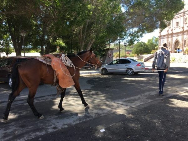
What a nice downtown square they have, big and shady.

Pleasant old town square in San Ignacio
The Kuyima tour office.
Tall glass case displaying books, with a sign saying, free, help yourself.
A free public library on the town square. A national program: Read to live better. Sí!

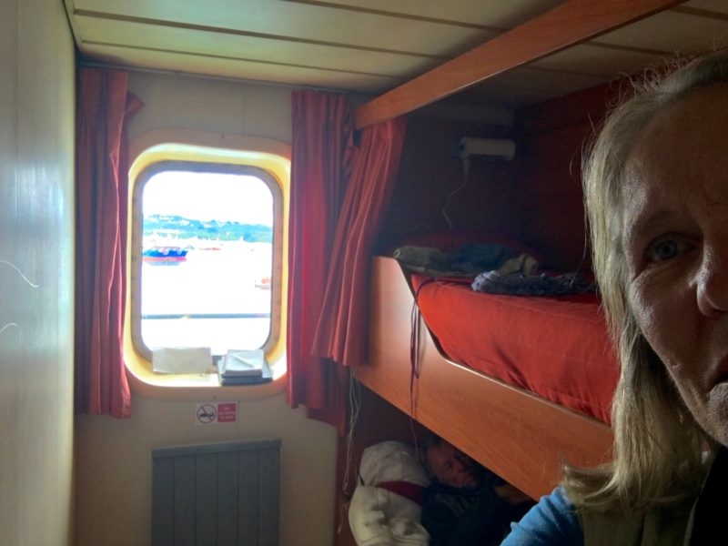
We had thought to sleep in town, but we also wanted to go out on the boat early in the morning, so we’d have time for the drive home.

The edges of the packed dirt road were occasionally undercut, so the dangers were marked with whatever came to hand. This is in the eastbound lane, on the way home.

When we heard how much more road there was between town and the lagoon, sleeping at the Kuyima camp started to sound like a good idea.

Tent on beach with wash and toilet facilities nearby.
Although there are slightly grander accommodations available to those who plan ahead and stay a couple days, this tent with a pair of cots and a tight-stretched floor was perfectly adequate to our needs. It is all solar power, low water use – muy tranquilo.

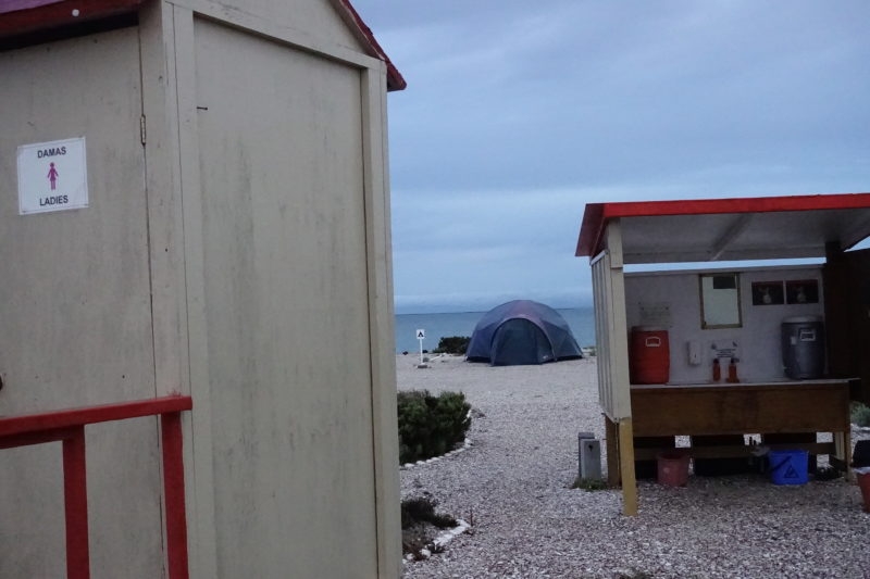
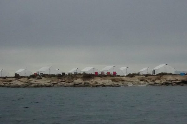
Luckily for us, a tent was available on the beach. We had an early breakfast with the staff and got going before ‘the big group’ that arrived. Sometimes no plan is a good plan.

Aerial view of the entire San Ignacio lagoon. It’s a big place, although the colors are hard to rationalize.

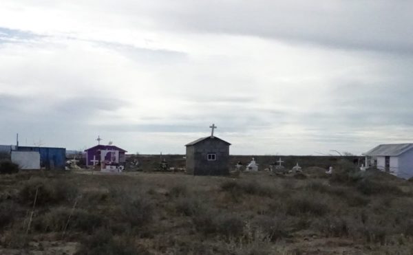
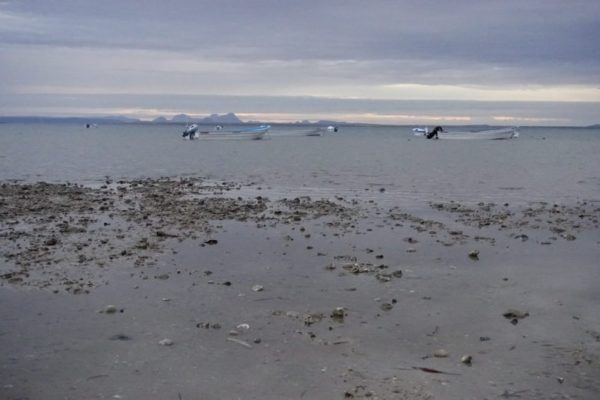
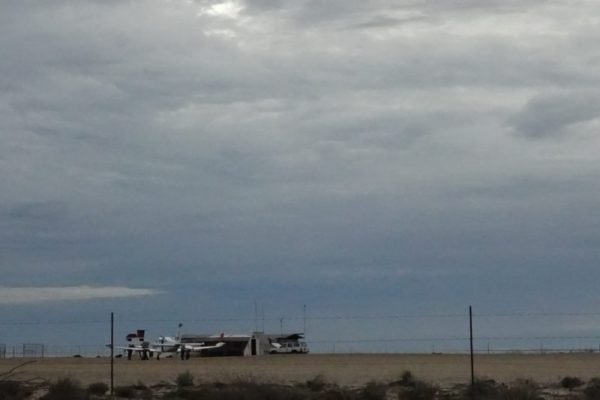
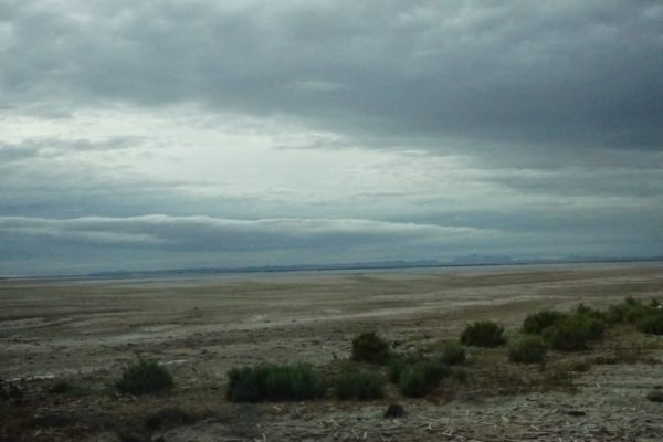
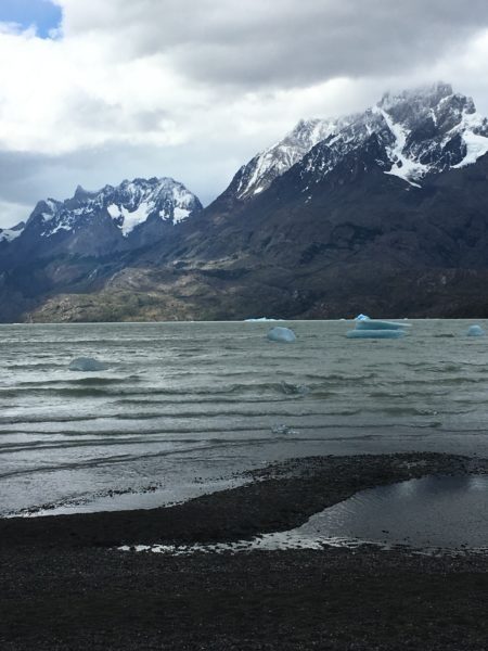
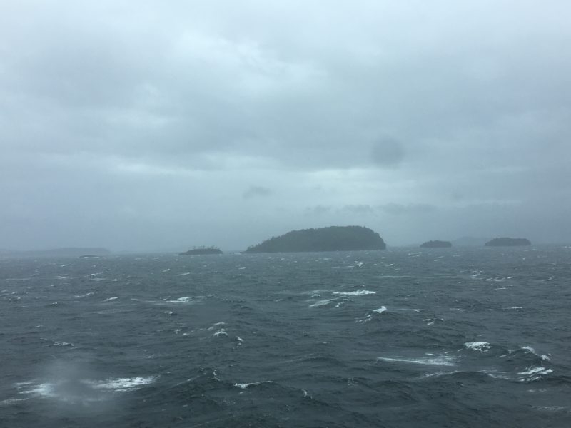
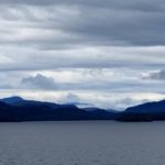
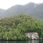
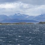
In the miles of beach, there are several other camps, more or less like this, well spaced, and there is a small, cobbled-together-looking area not built for tourists, with a church and cemetery, a place to buy beer and a small airfield. A mile or so inland, closer to the mountains, I was surprised to see lights at night, and I think that must be where the locals live – camp staff, fishing families, ranchers, far from the water’s edge. We see hurricanes tracking up this coast pretty regularly, and nothing on the waterfront would survive the winds, the seas, or even the rains. Everything along the beach has an impermanent appearance.

And now, the whales

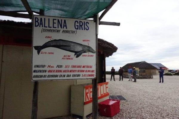
The gray whale (Eschrichtius robustus), also known as the grey whale, gray back whale, Pacific gray whale, or California gray whale is a baleen whale that migrates between feeding grounds like the Bering Straits and breeding grounds such as Baja California yearly. It reaches a length of 14.9 meters (49 ft), a weight of 36 tonnes (40 short tons), and lives between 55 and 70 years.[5] The common name of the whale comes from the gray patches and white mottling on its dark skin….The gray whale is the sole living species in the genus Eschrichtius. This mammal descended from filter-feeding whales that appeared at the beginning of the Oligocene, over 30 million years ago. So says Wikipedia.


These whales, in this place and in the other lagoons along the Pacific coast, were slaughtered in big numbers. Between 1846 and 1874 over 8000 whales were killed in these lagoons by American whalers, not to mention the calves left wounded or orphaned in the lagoons.

The whales fought back,  attacking whaleboats, maiming and killing whalers. The whalers called them ‘devil fish’. The fishery was abandoned when the whale numbers declined precipitously in less than a generation.

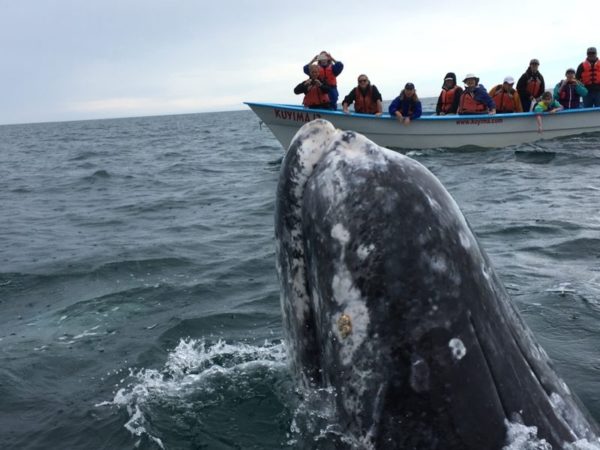
However,  present population is thought to be around 20,000, possibly the ‘optimum sustainable population in the present ocean ecosystem’, according to NOAA and Wikipedia. On the day of our visit in mid-February it was announced that about 168 whales had been counted in the lagoon on the most recent daily flyover. We could see them spouting all around.

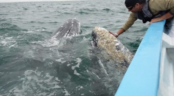
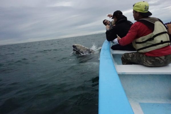
Given the bloody history it surprised me to see that the grey whales acted quite friendly. Why would they want to come anywhere near us? And it doesn’t seem right for us to mess with any wild animal.

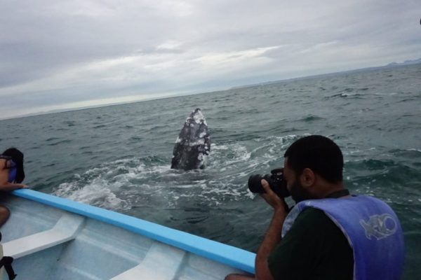
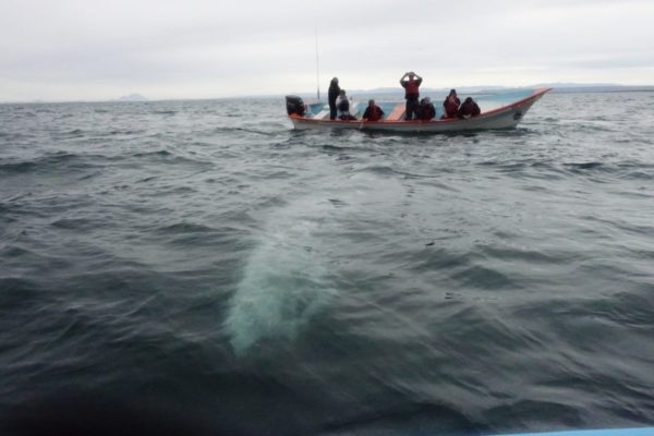
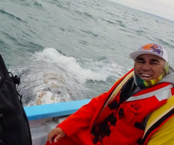
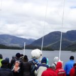
But I can’t deny that when the lancha came out to the designated area, the whales arrived straight away, looked us over, and came right alongside without hesitation, in fact, with alacrity. The launch drivers did nothing special to attract them. The whales seemed to welcome the touches they got, floated alongside and under the boat for minutes at a time, kept turning and coming back, and perhaps got as much from the experience as the boat passengers did. In fact, if the touching stopped, the whales went to another boat. And so it went for over an hour.

Boat driver grinning as whale approaches boat.
The panga drivers are fishermen in the off season, but ‘the whales are becoming the backbone of the economy’. And this man was just as happy as we were to have such a good day.

There are government-mandated rules of engagement, such as: no more than 16 boats in the entire designated watching area, no more boats than 2 per whale, no boats between two whales, no speeding, etc. According to one National Geographic article (link at bottom of page), the fishermen take their roles as protectors of the whale very seriously – ‘the well being of these whales is critical to the well being of the fishing community.’ And so it seemed.

The baby whales are a solid slate gray, clean and fresh looking. We did see a youngster with its mother at another boat and have read that mothers have been seen nudging the juniors towards the boat.

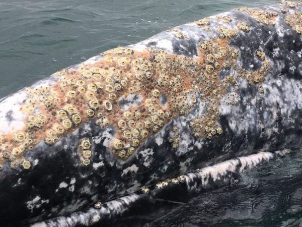
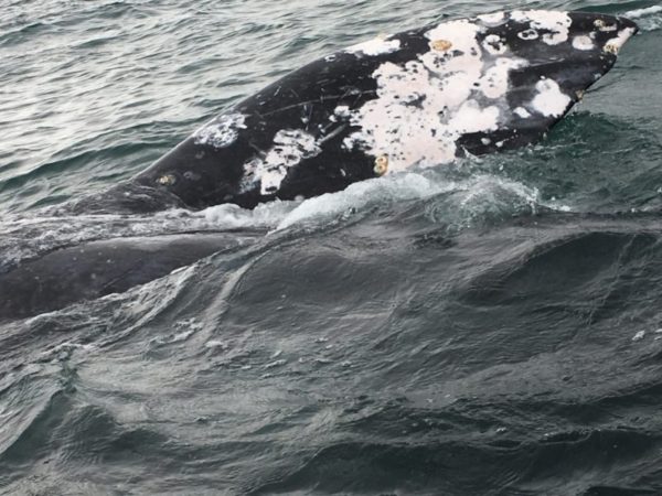
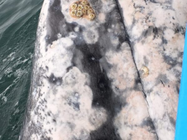
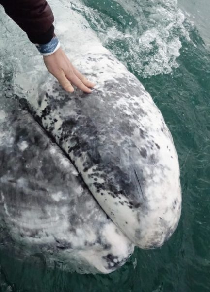
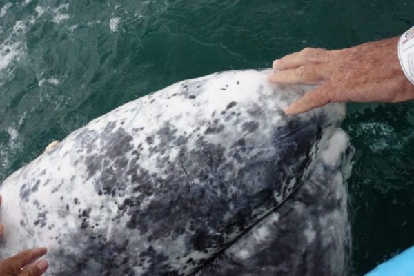
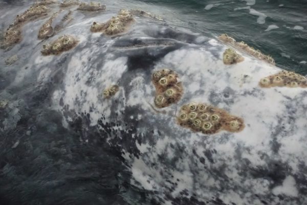
The older whales have  characteristic grey-white blotchy patterns said to be scars left by parasites which drop off in its cold feeding grounds. Our driver told us that the barnacles fell off when the animal was in Arctic waters. True? I’ve also read that barnacles are sometimes scraped off one side during baleen feeding close to the bottom, depending on whether the whale is right-mouthed, or left-mouthed. True? There sure are a lot of well-attached mature-looking barnacles.

Thinking of my own skin, the largest organ of my body, and how nice a good scratch can feel, I can believe that the whales might enjoy being rubbed and fondled by us, if that’s not too anthropomorphic a thought. I wonder if those barnacles are as annoying as I imagine them to be.

DSC07520 barnacle back
That’s the blowhole – really two slits – on top. In addition to barnacles, there are whale lice, one a species specific to this whale. It makes me itchy just to imagine.

Another point of interest I read somewhere is that these friendly whales are only this friendly in the lagoon. During their migrations, it’s all business. Also, the skin of whales, dolphins and other maritime mammals, atop their blubber, is thin and sensitive, particularly around the blowhole, genitals, mouth and flippers. They are capable of sensing changes in water pressure and turbulence. Gray or Grey? Both, inconsistently, everywhere!

So, it was a stellar experience – one I’d recommend, now that I can see how it is initiated by the whales.

More information

https://www.nationalgeographic.com/photography/proof/2017/08/gray-whales-baja-mexico/#close

NG has written the blog post I wish I could have written with the photos I wish I could have taken!

Kuyima.com is the whale watching tour operator we used and liked. And they have something to say about grey whales too, here: http://www.kuyima.com/whales/greywhales.html

The Saving of the Gray Whale (People, Politics and Conservation in Baja California) by Serge Dedina- one of several books in the dining area that I skimmed through, wishing I had time to read it all. Same could be said for Lagoon Time: Our Life and Times Among the Whales of Laguna San Ignacio by Steven Swartz. And of course, there’s the internet. These grey whales are very charismatic!


Photo Gallery San Ignacio

Ashore in Puerto Natales and Torres del Paine

Here not so much for the beauty of the sculpture, which is a religious figure grasping an indigenous figure, but for the setting along the shores of the fjord.

As we walked up the street into Puerto Natales at about nine in the morning after our extra night on the ferry, I had the odd feeling that we had come ashore in a ghost town. Even the dogs were mostly missing. As we climbed the slope toward our accommodations, we started to wonder – is there something we should know?

What we saw of Puerto Natales as the windy day closed. The ferry stayed further out in the fjord (named Ultima Esperanza, Last Hope by its earliest explorer) until the winds abated, and docked as we slept, so we didn’t get ashore until,early-ish the next morning.


Puerto Natales plaza central looking toawrds church and cultural center.
What we saw walking up the hill I didn’t reach into my camera pocket for, tho I should have! Rows of little wooden houses, or tin, picket fences, decorated for Christmas. The town plaza featured wind-proof trash cans, a small locomotive left behind from a defunct meat-packing plant, and incredibly densely branched trees. But there was hardly a soul in sight.

Eventually we reached our hostel, dumped our stuff and went to look for a way to visit Torres del Paine. Ever so slowly the town came to life, and revealed itself to be a pleasant enough gridded pueblo of small houses, pensiones and hostels, plus some larger hotels, and an interesting cemetery. There were a surprising number of outdoor outfitters and camping suppliers. Even the locals wore North Face and Marmot, while I was wishing for the same!

Turns out there was little need to be a morning person. With the December solstice bringing nearly 18 hours of daylight, people were sleeping in. Lots of stuff was just getting started in the slanting light of 9 pm and the supermarket didn’t close until 11.

18th and 19th century settlers found the grasslands of southern Chile and Argentina well-suited for raising sheep and did so on vast estancias, exporting the wool. As technological advances permitted, meat was also exported. At Puerto Natales, there had been a slaughterhouse and meat-packing facilities but that declined after World War II. Part of the plant has now been incorporated into a classy-looking hotel, a bit out of town – maybe next time?

Nowadays Natales is mainly the terminus to the ferry and the gateway to the Torres del Paine National Park. That’s pronounces Pi-nay, an indigenous word for, I think, blue. It’s got a glacier, blue- and green- colored lakes, silty melt rivers, a famous massif, climbing and hiking trails that can occupy visitors for a day, or a fortnight.

Torres del Paine was in the travel plans of just about everyone on the Navimag ferry, and of course we wanted to go too.  Could we rent a car to go look around? Nope, all booked. Could we rent camping gear and do one of the multi-day treks thru the park’s spectacular scenery? We vetoed that idea ourselves as we became aware of just how many other people there were competing for limited space, and just how variable the ‘summer’ weather could be. And, how complicated and expensive it would be to outfit ourselves from scratch for a week of camping.

So we settled for a mini-bus tour, which ended up being a maxi-bus tour, shuffling off and on at each of the miradors, except the one at the waterfall which was deemed too windy to be safe.

Village, flatlands rising to mountains, horse statue.
Cerro Castillo seems to be the only settlement on the two-hour ride between Puerto Natales and the Torres del Paine National Park.

The park is a two-hour drive away from Pto Natales through miles of estancia country, huge pieces of flat scrub? grass? land  rising gradually into much taller peaks. Surely TdP is the largest money-earner of all the Chilean national parks, since to drive through on our bus cost US$30 admission each, not including the bus. Foreigners  pay a premium and they are 60% of the 150,000 annual visitors (Wikipedia).

But, our destination having been named by National Geographic in the top five of the most beautiful places in the world, we couldn’t complain. And we’re not. Especially since, at the end of the day we came across some folks, Australians we had met aboard the ferry. They did get a car, and we got to ride back to TdP again with them the next day at a much more leisurely pace. Plus, we got to travel with them for another couple weeks. It was grand; so much easier to share the planning and expenses, especially with compatible seasoned travellers!

Here are a few shots from Torres del Paine.

I like this in particilar because of the lake and island and that’s a hostel on the island although we didn’t get to check it out. Colors as the camera and I saw them. What a place to wake up!
Flowers and snow together. i like the idea.
We were lucky, I gather, to have had such fine weather this day, but many folks just took pictures of themselves. What is with this selfie business anyhow?
My first glacier, zoomed.
Maybe not large enough to be icebergs, but nice and blue.
Guanaco are doing well in the national park where they don’t have to compete with sheep and cattle for food.

Something still not right with the Gallery, so I’ll just leave it small.

On the Navimag Ferry Evangelistas from Pto Montt to Pto Natales


Although we had happily been riding the excellent buses everywhere we went in Chile, we came to a place where going further south meant either flying or diverting into Argentina, there being nothing for the most part but rough tracks south along the glacier-strewn Chilean Andes.

Mirabile dictu! There is a passenger- and freight-carrying ferry weekly from Puerto Montt all the way to Puerto Natales. That’s the one, at the top of the page.

I imagined Patagonia’s weather to be like this much of the time, so I was secretly thrilled to see my prejudices justified on our first evening, looking out from my cozy cabin. But, also thrilled to see the sun breaking through the next morning.
I found the kaleidoscopic clouds and mountains fascinating.

One of the reasons we came to Chile was because of Patagonia. It has mystical status in my mind, like Timbuktu, or Kuala Lumpur. It turns out there is way more to the place, at least area-wise, than I knew. Patagonia is basically all the southern tip of South America, generally considered to include Tierra del Fuego. In Argentina, Patagonia is dry and flat, diametrically opposed to the steep, jagged, and damp Chilean coastline I had in mind from years of reading sailing yarns and history of the early explorers.*

However this isn’t a post about Patagonia per se, but about how we moved ourselves southward down the coast of Chile through the portion of the territory that falls under the Patagonia umbrella, on the Navimag ferry Evangelistas.

From my reading I carried an impression of Patagonia, Chile Deep South Section, as a fine-cut maze of rocky fjords and uncharted reefs islands and under a perpetual low pressure system that made the weather blustery, erratic and generally foul, in the 40-knot-with-gusts-higher-and-cold-rain kind of foul. In short, a miserable place to try to sail. The map below, from the iPhone app Tracks, that shows our track, gives just a tiny hint of the myriad compound indentions, and no hint at all of the weather.

Screen shot Navimag Ferry Pto Montt to Pto Natales.
I’m not sure we covered as many miles as the counter says, but the internet guesses of how long the trip is are all over the place too, but always shorter.

Hence the trip down the coast on the ferry, the Navimag Evangelistas in this case, sounded wonderful. Four days, three nights, somebody else’s boat, someone else’s responsibility. I could sleep through the night if I wanted, didn’t have to go out in the cold or rain if I didn’t want to. No reefing of sails or radar tweaking for me! No night watches, and all the cooking was outsourced. Yes, please!

Passengers climbing stairs to upper decks
We were brought by bus from downtown Pto. Montt to the dock a bit out of town and boarded by walking down the truck ramp. Nice young men offered to lug our luggage upstairs but not many of us accepted. We’re intrepidistas, remember?

Evangelistas carries trailers and other cargo (including at times live cattle in pens on the open deck) between Puerto Montt and Puerto Natales. And it takes passengers, maybe 250 max, if every single bunk including all those indented the thwartships passageways, were filled. On our trip Constanza, the lovely young guide in training, thought we had about 160, which seemed close to capacity for dining room seating.  A layout of the ship is shown in the Photo Gallery at the end of the post.

The open ocean part of the trip took place at night, with the wind mainly behind us, which made for such a comfortable ride that I slept through it all in my cozy top bunk. But Doug said, there and in the narrower channels,  that he sure was glad he wasn’t trying to go the other way under sail.

This I think was the pass where we timed our arrival for slack water, as it was a narrow dog-leg. I was impressed that a vessel like this approached the area so conservatively, and wondered if there was a back story.

The passengers were a mix of backpackers and silverbacks, which is to say, young and old. The mid-range strongbacks, in their 30s and 40s and not with us, were, I guess, still at work.

Several groups were heading towards Torres del Paine, a Chilean national park with a well-known super-scenic 5- to 10- day hiking trail. Some would turn east and then north towards the glaciers on the Chilean-Argentine border. And some, including us, wanted to see Ushuaia, the self-styled ‘Fin del Mundo’ end of the world city, (although not too much further south in Puerto Williams they disagree, in a thinner, piping voice!)

Girl with doll, both in hats
We did have this one little French girl, and her friend, for sheer cuteness.

The uniform was common to all – hiking clothes, clumpy boots, puffy jackets, hi tech windbreakers. There was a scattering of North Americans, but there were many more Germans, and French, and Swiss (or as we came to call them, the sharp-elbowed Swiss). And there were a dozen Chileans, who were either tourists like the rest of us, or truckdrivers.

How was the food, you ask? It was pretty good! There was only one option per meal, but the ingredients were straight, unprocessed, and well-prepared, and the portions were ample.Real potatoes, real fish, real mushrooms, and a salad for our first meal, plus a good soup.

We didn’t have a cruise director exactly, since it’s a ferry, not a cruise ship.  We did have a naturalist. Percy made presentations every day on matters of geology, vegetation, sea life and birds. He was a hard-working man who had to do everything in Spanish, then again in English, and he had a lot to say. He also relayed messages from the captain about expected sea conditions and how these would affect the route. So maybe he was a cruise director!

Percy, the on-board naturalist, spoke about what we might see en route and when we got ashore.

Things We Saw Underway

For us, at the summer solstice towards the end of December, there were some Minke whales pretty far away, some penguins, condors, maybe some birds that didn’t get announced, and at least 17 hours of daylight to see them in. Here is what I took notice of.

Apparently there is a pinnacle rock (named Cotopaxi after a volcano in Ecuador) right under this wreck. And apparently the captain hit it on purpose in an attempt to scuttle the boat and claim insurance. He was found out and sent to prison. The wreck has stood like this through all weather since 1963. A French yacht passing in fine weather went aboard and found a hull like lace and lush green grass on deck. A bit more info at wrecksite.com

Fish farming, a rant.

Fish farms. I was on the lookout for them on our route because of seeing tenders and supply boats in the harbor, as well as protest graffiti ashore. Puerto Montt is the epicenter of salmon boom, but also of bust, following disease among the fish, time and time again. The activity is concentrated in the bays around Puerto Montt, but I am sure that global agricultural industrialists are looking for places further afield and still ‘pristine’ where they can invisibly wreak havoc by  raising an inappropriate animal in an inappropriate location in an inappropriate manner. I guess you know how I feel about profit-motivated, large-scale, confined-animal farming! There’s more to say, but we’re passing by on a ferry boat here!

https://www.theguardian.com/environment/2016/mar/10/chiles-salmon-farms-lose-800m-as-algal-bloom-kills-millions-of-fish

http://www.foodsafetynews.com/2012/04/chilean-fish-farms-and-the-tragedy-of-the-commons/#.WKBBDOuEqK0

Snow-capped mountains and glaciers

We started seeing more bare rock mountains, and then, in the distance, glaciers, and even dusting of fresh snow. Exciting, at least to me, nature doing her thing. And just in time for me to see it.

Puerto Edén

Puerto Eden is on an island, and well west of several glaciers. The Navimag boats bring in diesel for generators, and propane, but the dock is not up to receiving Evangelistas, so everything is ferried to and fro in small boats.

Christmas Day was sunny and bright, at least for a while, coinciding with our stop at the little settlement of Puerto Eden. Googling around to find out what the place was even there for, I learned how lucky we were with the weather: “Villa Puerto Edén has an extremely wet subpolar oceanic climate (Köppen Cfc) and is widely reputed to be the place in the world with the highest frequency of rainfall,[2] though according to Guinness World Records the highest frequency of rain in a year occurred at Bahia Felix, a little further south, with only eighteen rainless days in the whole of 1916”. (1916??)

Furthermore, this Wikipedia article went on to say that there were no roads in Puerto Eden, only raised boardwalks, and that it was the home of the last Kawéshkar people, one of several indigenous groups no longer extant in Patagonia. In 2002 there were 175 people, but Percy told us it was less than a hundred now.

You can see what a beautiful Christmas Day it was in one of the rainiest places in the world.

As we were anchoring off Puerto Eden, I saw someone checking his cell phone. It was interesting to watch how news of a nearby tower spread through the passengers.  People who had been looking around were now looking down.

There was news from the world:  a 7.7 earthquake that morning on the coast of Chile, south of Puerto Montt in an area we had traversed less than two days before. With my own phone out, I heard about it by email from a friend, and got details on the Guardian newspaper’s website, then on usgs.gov, a wonderful site for the geologically inclined.

Up in the dining room, it turned out we really did have satellite TV, which had heretofore been silly white noise off in the corner, but now was showing a crack in the asphalt of a bridge on Chiloe Island.

TV news of an earthquake off Chiloe Island on Christmas Day reached us at Puerto Eden, but the main footage of damage was this highway crack.

Then they had a home video of someone’s lamp shaking. Those two items played for the rest of the day, and that was it as far as the big earthquake went.

Foredeck of ship crew anchoring
One man down the hatch, and one on deck, up comes the anchor in Puerto Edén.

A Windy Weather Event

As we made a few last turns towards Puerto Natales on a hard blue day, the wind began to pick up until it did become a little challenging to hold on to one’s hat, and the sharp-elbowed Swiss could be found already hunkered down in the cozy lee corners.

Seas were calm, but wind gusts sent passengers lurching unsteadily down the deck.

When we arrived at Pto Natales, the wind was reported at 60 knots, which was odd because the seas were so flat, although the boat did have a modest heel.

Mountains, blue skies, windblown seas.
The ferry could not dock in these winds, said to be 60 knots, so we went back out and anchored overnight. The wind blew but the sea state in these sheltered waters was negligible to a ship like this.

Percy made an announcement: the port had been closed and the ferry was going back out to a better anchorage. There would be no docking this afternoon, and probably not this night. So the kitchen made another good meal and we all went to bed.

This 2-berth B class cabin looks small, and it is. We took turns during wardrobe adjustments. The only thing you are not seeing is the closet behind me. But the beds were comfy and cozy, the reading lights  illuminating, and that radiator under the window could fry the proverbial egg, or at least steam it, and dry your  jacket too.

When I woke up at seven the next morning, we were tied to the dock and the trucks had already left. It was grand! After breakfast, the intrepidistas shouldered their bags and strode off toward Puerto Natales.

*one of the books I have really enjoyed about this area is by Dallas Murphy,  called Rounding the Horn. It blends history with modernity, perspective with adventure, in a conversational way. It’s as if we were meeting over a beer, not over a thesis interview.

Trouble editing the photo gallery – sorry, but moving on….


Valparaiso: Street Art meets UNESCO heritage

Beneath my tree-hugging, nature-gal exterior, there must be an urbanite yearning to break free. That could explain the excited buzz I felt in Valparaiso, Chile, one of the South Pacific’s most important ports. I liked everything about the place: the setting, the walkability, the new discoveries around every corner, the street scenes, most of the people I saw. What made it so?

Color! It’s everywhere: walls, doors, telephone poles and trash cans, stair risers and retaining walls, not to mention the big sky and sea so often visible.

It is still being built, but I'm looking forward to seeing how they domthe rooms and other details.
This is a hotel being build out of shipping containers. I’m looking forward to seeing how they do the rooms and other details.

Color!

Much of it is in the form of graffiti: writing or drawings scribbled, scratched, or sprayed illicitly on a wall or other surface in a public place, says an online dictionary.

It is easy to think of graffiti as a kind of vandalism. There’s a lot of graffiti I just hate to see. That bubble script and things that look like letters but can’t be read (failed fonts, I call them) signal a potentially fatal failure to connect the rising generation to their history, or maybe their culture’s failure to engage all its members. So, it’s not necessarily a good thing.

But in Valparaiso, they are learning to adapt. Perhaps the citizens and city government were bowing to the inevitable, or maybe they just learned how to channel ordinary graffiti into Street Art. Valparaiso has taken what might be considered a flaw, and made it into a feature. More than a feature even: an attraction.

I don’t know how it has been arranged between the owners of the walls, the aspiring artists, and the sensibilities of the public – wouldn’t it make an interesting study? However they’re doing it, I would say that a good number of the images that are painted on the structures of Valparaiso are attractive and intriguing, or at least more amusing than the blank/neutral canvases they replaced. The open-air art museum that is Valparaiso is a good part of what make the city so appealing to me.

Mind you, Valparaiso* is not Disneyland. It does feel like there’s hard living a few streets further back (or up), poverty and politicization for sure, and some of the hard and ramshackle that comes with port cities.

The nice thing about my pocket camera is that it lives in my pocket and slides out easily, and gets used alot. Here are a few favorites. In the gallery at the bottom of the post are dozens more snapshots.

We could see this tribute to Vincent van Gogh from our window.
We could see this tribute to Vincent van Gogh from our window. Remember, this is painted on a concrete wall, two stories high. When I went to look up a possible title, I realized just what a referential mish-mash of van Gogh-isms it is, but Wow!


Visible from a terrace several hundred feet away. The striped legs I recognize as a form of decoration once used by the now-extinguished indigenous people from Tierra del Fuego.
Viewed from a terrace several hundred feet away. The striped legs I recognize as a form of decoration once used by a no-longer extant indigenous people from Tierra del Fuego.


I just like the sense of wonder and trepidation that this ship in ice invokes.
I just like the sense of wonder and trepidation that this ship in ice evokes.

But first, about the city

With about 275,000 residents (and in the associated suburbs, a total of close to a million), the Valparaiso conurbation forms Chile’s second largest city and its main seaport, at about 33 degrees South, 71 degrees and a half West.  (You can tell I’ve been reading Wikipedia again, and Britannica too). UNESCO has named it a World Heritage Site for its history, setting, and architecture.

I heard people calling this building ugly, and maybe it is rather odd.But I appreciate how they worked with what was there to get something more functionally modern . It wouldn't work at all if the blue tinted glass didn't extend into the older part.
I heard people calling this building ugly, and maybe it is. But I appreciate how they worked with what was there to get something more functionally modern. And I’m glad they took the blue glass down onto the original windows.
In addition to being bright, there's a two-story van-Gogh on the side
In addition to being orange, there’s a two-story van-Gogh on the side wall. Correction: van Gogh is on the yellow hostel to the right of this one.

First of all, the setting is grand, a big amphitheater of a bay whose hills are sprinkled with bright-colored houses, or weathered and peeling ones, wood, metal, concrete, brick, in a cacophony of 19th century housing styles and textures; 20th and 21st centuries too, of course.

Container port, old town, new town, maybe Viña del Mar and points beyond
Container port, old town, new town, maybe Viña del Mar and points beyond.

There is an potent aura of history too. In the 1800s especially, when sailing vessels and steamships could get around Cape Horn, but needed a port to stop at afterward, Valparaiso was that place.

Valpo was perhaps at the peak of its strength in 1863' about to start building up the hill and out to sea.
Valpo was perhaps at the peak of its strength in 1863, about to start building up the hill and out to sea.

English, Germans, Italians, French, seamen, sheep herders, whalers, California-bound gold miners, they came from all over, and often they stayed and built, multiplied, and sometimes prospered.

Home of the world's oldest Spanish-speaking newspaper, this building used to be on the waterfront but there's been significant landfilling.
Home of the world’s oldest Spanish-speaking newspaper, this building used to be on the waterfront but there’s been significant landfilling and now it’s several blocks inland.

At first the town was built along the small coastal shelf, but as it grew it expanded, with landfill to seaward, and up the hill, aided by fifteen or twenty ascensors, a kind of elevator to make it easier to reach the ‘mezzanine’. These were each privately built and charged a toll. Some no longer operate, but most have now been taken over by the municipality, with an operative toll taker.

I think this one was under repair, but you get the idea. UNESCO likes the ascensores too.
I think this one was under repair, but you get the idea. UNESCO likes the ascensors too.
Concepcion and Alegre are two of the most-visited, and painted, of Valparaiso's districts.
Concepcion and Alegre are two of the most-visited, and painted, of Valparaiso’s districts.

We were there in December, the southern hemisphere summer in fact and demeanor. (It’s easy to fall in love in the summer.) At latitude 33 South, and strongly affected by the ocean and the Humboldt current, it’s generally sunny and pleasant (not hot). Winters are said to be mild, maybe rainy, maybe foggy.

So many dogs roam the streets. They look well fed - we see people putting out kibbles and tubs of water, and stepping patiently over the dog-mat into the store. But these dogs aren'r curb-trained, so mind yournstep.
So many dogs roam the streets. Compared to tropical  street dogs, these dogs seem less-diseased, better fed, and of a more noble lineage. We see people putting out kibbles and tubs of water, and stepping patiently over the dog-mat into the store. But they aren’t curb-trained, so watch your step.

Natural Disasters

I need to mention other natural disasters as well. Chile is a very seismically active place; earthquakes and tsunamis have both affected Valparaiso. In fact there was a major quake in 1906, just like in San Francisco, California, to which the geography and climate, and maybe even the general vibe of Valpo, is has been compared.

Forest fires have also caused problems (are causing them right now in other parts of the country) which are exacerbated by the hilly terrain, the steep and convoluted cobblestone roads, and wind flow in the bowl. A big fire this year after Christmas, south of the port, destroyed hundreds of homes.

Panama Canal Takes A Toll

Valparaiso’s boom times were dealt a strong blow when the Panama canal opened in 1914. But they kept improving the port and today it exports growing quantities of wine, copper, and fresh fruit. It’s also a (relatively) popular cruise ship stop, and may also host beyond Panamax-sized ships.

It's always a challenge to figure out the logistics of this operation, but entertaining.
It’s always a challenge to figure out the logistics of this operation, but entertaining.

With four universities (my dentist in Guaymas is a graduate of one) and offices of the Chilean Congress and several other government agencies, there is plenty of new blood coming into town. That would account for the clubs and bars and galleries and the general sense of life on the streets, even in my limited up-at-dawn, down-at-dusk time frame. The southern hemisphere summer allows plenty of dusk.

Photo Gallery of Street Art and Interesting Buildings

That’s more than enough of the dry bones of history. Here is a gallery of photos taken on various walks around town.

I’ve skipped a lot of captions and titles – sometimes it’s hard to chose a mere handful of descriptive words for some pretty fantastical paintings. Probably some duplicates too.

Leon Trotsky’s house at Coyoacán

The home-in-exile of the Russian communist notable Leon Trotsky is just a few blocks away from the Casa Azul so of course we had to drop in. I vaguely remembered Trotsky from my political science studies in school; with Josef Stalin and Vladimir Lenin, he was prominent in the Russian Revolution as it progressed through Bolshevism and into Communism and the Soviet Union. Trotsky was head of the Red Army.

While Frida Kahlo’s house is full of color and light and art, her neighbor and sometimes friend Leon Trotsky lived in a dimmer, dingier place. (There’s supposed to be a ‘featured image’  at the top of the post, but it seems not to be viewable in mobile devices, so maybe it will show up in the photo Gallery below). And someone in the peanut gallery is saying, well look at where they came from. No wonder her Mexican light is sunnier than his high-latitude somber.

Memorably, maybe from a Trivial Pursuits card, Trotsky was assassinated by being bashed in the head with an ice axe. That’s the event that took place in this house, and why, perhaps, it is still a public attraction. We were two of the five visitors in attendance.

But how and why did an exiled communist leader come to be living in Mexico City, and why was he finally assassinated so long after the tempest of the Russian Revolution? The Wikipedia entries on this subject are, I hate to say, more than I want to know.  The particulars about whether government would lead the people, or whether the workers should be empowered first caused everlasting infighting. These people disagreed about everything, it seems.

Suffice it (I hope) to say that Trotsky was an ally of Lenin. As head of the Red Army, he seemed an obvious choice to succeed Lenin, who suffered a series of strokes starting in 1922. However, when Lenin died in 1924, Trotsky was politically outmaneuvered by Joseph Stalin. Here I am quoting and paraphrasing from http://history1900s.about.com/od/people/p/trotsky.htm

From that point on, Trotsky was slowly but surely pushed out of important roles in the Soviet government. First he was exiled to the very remote Alma-Ata. Apparently that wasn’t far away enough, so in February 1929, Trotsky was banished from the entire Soviet Union.

Writing prolifically during his exile, Trotsky continued to criticize Stalin and his increasing bureaucratic grasp, from homes in Norway, Turkey and France. He came to Mexico in 1936 under the aegis of Diego Rivera and Frida Kahlo, and lived in the Casa Azul for a year or so.

Then there was some kind of disagreement, and eventually Trotsky moved to this house a few blocks away.

Stalin, meanwhile, named Trotsky as the major conspirator in a fabricated plot to remove Stalin from power. As part of the Great Purge, 1936-1938, 16 of Stalin’s rivals were charged with aiding Trotsky in this treasonous plot.

Stalin and the white light where Trotsky has been erased from the photo, on his was to being completely purged by Stalin
Stalin and the white light where Trotsky has been erased from the photo, as he was being completely written out of the public record by Stalin. PrePhotoshop too.

All 16 were found guilty and executed. Trotsky, condemned in absentia, was also on the execution list.

Photos of Stalin's enemies.
Each of these men was accused of blocking or betraying Stalin in some way, and each of them was executed.

On May 24, 1940, at 4 AM, Soviet agents broke in and machine-gunned Trotsky’s house in Coyohuacan. Although Trotsky and his wife and grandson were home asleep, all survived the attack. The tour guide carefully points out bullet holes in the wall just above the bed of Trotsky’s 8-years old grandson, and adds the comment that this attack failed because the would-be assassins were drunk.

Bedroom, bullet holes in wall.
The holes in the wall are said to be left from the machine gun attack in May 1940. The family all survived. The guide said it was because the attackers were drunk.

Trotsky knew that he would always be a target and had taken several security measures.

Trotsky house Mexico City floor plan
Security staff lived in the part of the house that’s in the shadow of the plan, but for some reason they were locked in the night of the machine gun attack.

Watch towers were built in the corners and the perimeter wall was raised.

Watch towers were built in the corners of the property and walls were raised

The lovely big windows still stand but the bottom portions on the perimeter are bricked in. And doorways were reduced to slow down an intruder.

After the machine gun episode, the doorways were reduced in size. Imagine being reminded of how endangered you are every time you walk in or out.
After the machine gun episode, doorways were reduced in size.

Imagine being so constantly reminded of how endangered your life might be! Trotsky was said to work hard on his writing and publications in opposition to Stalin’s brand of Communism. And in his spare time, he bred chickens – the coops, but not the chickens, are still there along a side wall.

On August 20, 1940, Trotsky was not so lucky. An insider, friend to Trotsky’s secretary, and Mexican Communist named Ramon Mercader, gained access to his study. As Trotsky was sitting at his desk in his study reading a document Mercader had brought  him for editing,  Mercader punctured Trotsky’s skull with a mountaineering ice pick.

Trotsky's desk remains as it was, or so they say. It looks quite tidy to me, not at all like any desk I've ever had.
Trotsky’s desk remains as it was, or so they say. It looks quite tidy to me, not at all like any desk I’ve ever had.

Trotsky was cogent enough to indicate that Mercader should be held rather than be shot by the guards, but died of his injuries the next day. Mercader served twenty years in Mexican prison, was decorated by the Soviet Union after his release, and died in Cuba in 1978.

I was surprised, a bit appalled to see that this photo of the dying man had been published in the newspaper. It was 1940. And I'm not too appalled to reproduce it here, so...
I was surprised, and a bit appalled, to see that this photo of the dying man had been published in the newspaper. It was 1940. And I’m not too appalled to reproduce it here, so…

so, that’s the history of Leon Trotsky’s death in Mexico City as gleaned by an interested observer visiting the museum that has taken over his house. Hope it kept you awake, perhaps contemplating how and why these same ‘interventions’ are managed these days in the Soviet Union. (And elsewhere, perhaps)