Tourist Day in Acapulco

My parents vacationed in Acapulco in the 1950s. Their stories of the pink hotel  where each room had its own swimming pool fascinated me, as did the photos they brought home of men diving off a cliff into a tiny pool of surf. These were the famous Cliff Divers of Acapulco, los clavadistas, as they’re known locally. So it was hard to sail past without stopping.

The star cliff divers of the 1950s
The star cliff divers of the 1950s.

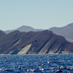
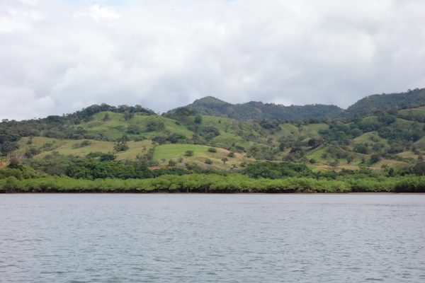
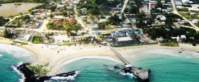
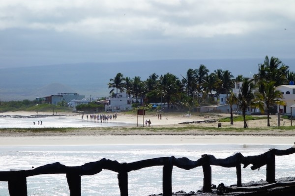
Acapulco is also famous for its beach – has been since before its days as a Jet Set destination in the 1950s. Not many cities can boast such an attractive setting on a large bay, six kilometers across, rimmed with sand, lapped by tropical waters and framed by rising ranks of jagged hills.

DSC01922 Fort flag highrises

Fast forward to the 21st century. And slow down for a stop in early April of 2014.

Acapulco in the 1930s, 1950s and 2011 - it's spread and grown a lot!
Acapulco in the 1930s, 1950s and 2011 – it’s spread and grown a lot!

The older original part of town has a market, square, cathedral, all the usual accoutrements. The tourist area however is a shadow of its former self, aside from the fort San Diego, now a nice museum. The action has moved along the beachfront towards the big hotels. If there were any action, I should say.

painted but dusty  statue of woman in toga
This slatternly statue decorated what once was a big seafood restaurant in the older part of town

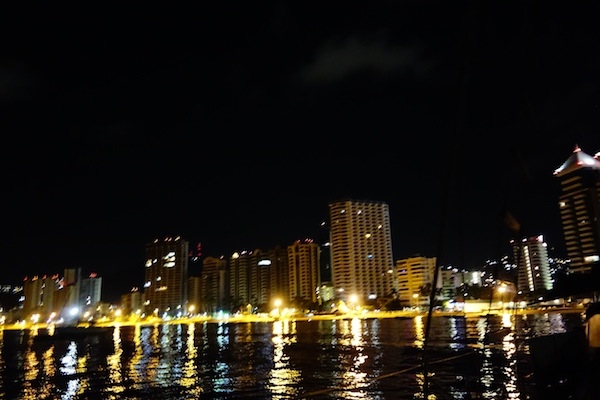
It’s astonishing just how empty of tourists these big buildings are, as measured by lights at night.

City lights but empty waterfront high-rises.

The cab drivers and people we chat up on the street agree it’s pretty quiet lately. But they insist that every room will be filled during the Easter vacations, Semana Santa.

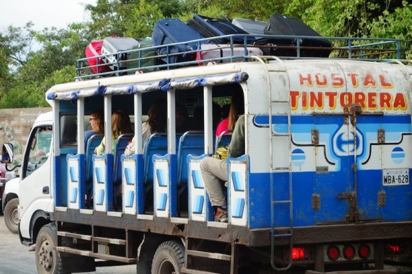
Economic wheels are still turning and there’s plenty of local traffic and activity on the roads. I am charmed by all the VW bugs being used as taxis. They were manufactured in Mexico until 2003, and I’ll bet it would be a great place to get parts if you had an VW to refurbish.

Blue-and-white VW bugs are taxis.
Lots of taxis are VW bugs, all at least ten years old.

Part of the problem has been an increase in violent crime in recent years, but there is general agreement (our main sources are taxi drivers and bartenders) that things are better now than they were five or six years ago. There may still be murders, but they’re ‘back there’ said one taxista, gesturing toward the interior, ‘poor people and gangs. Let them fight and kill themselves there.’ He told us there was a period where he was afraid to work at night, but, ‘it’s all better now.’ It takes a long time for a town’s reputation to recover though.

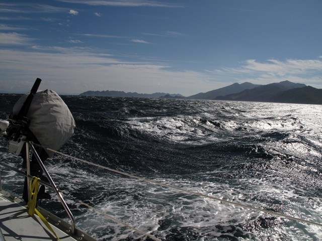
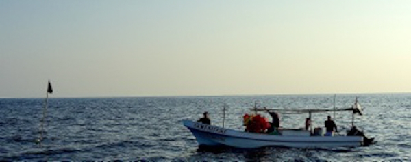
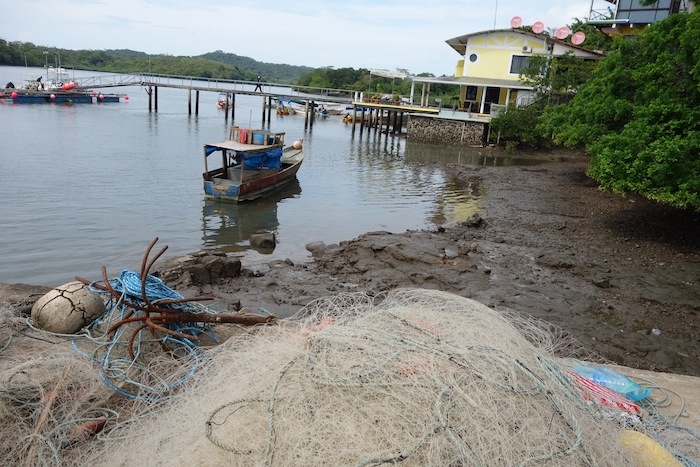
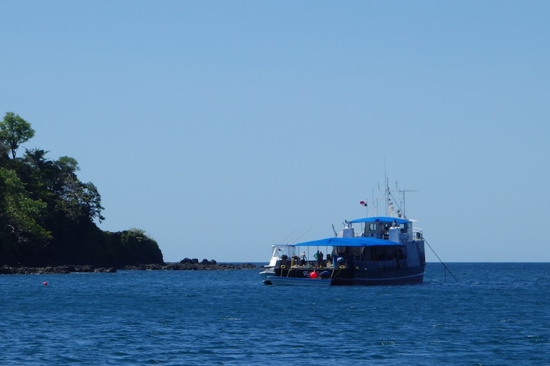
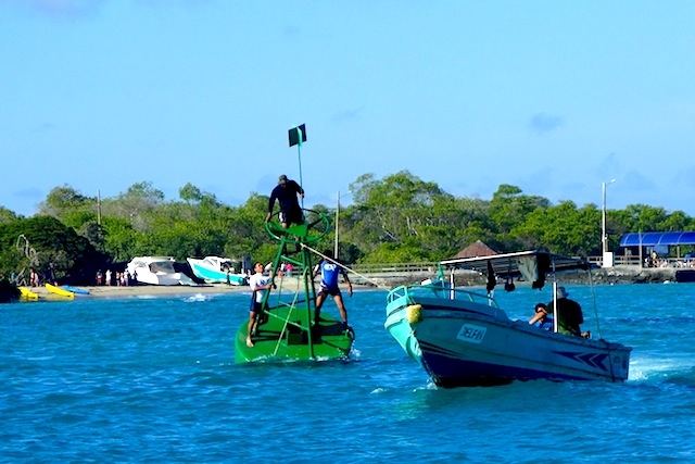
Galivant’s crew might have liked to rub elbows at the Acapulco Club de Yates, where the sailing events for the 1968 Summer Olympics were hosted, and the gardens have been well-tended ever since, not to mention the pool. I got to walk through, looking for a marine store. We would have looked a ridiculous  in our weathered little sailboat next to some of those glossy big motor yachts at the dock, and felt even worse counting out a couple hundred dollars, plus tax, plus electric, for a night’s dockage. So we went across the bay,  anchored near the navy base, and took the dinghy ashore,  to be looked after by Jorge  the jet-ski renter for the price of a couple beers each day.

Galivant anchored off the beach at the southern end of Acapulco Bay

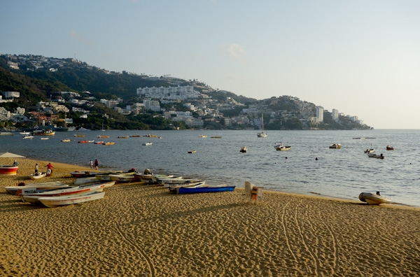
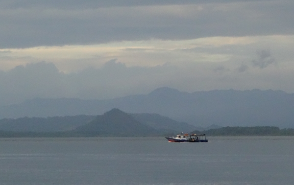
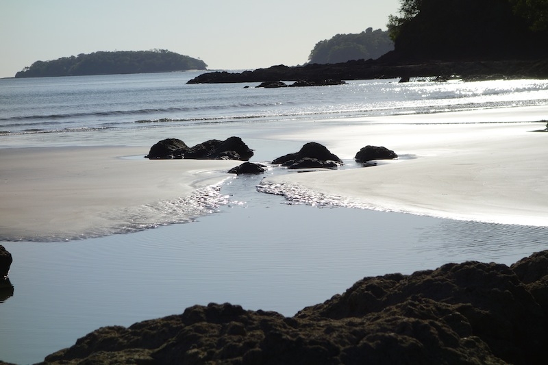
And how empty the beach! Several miles out of the harbor we were noticing discolored water – clearly a ‘red tide’ event happening at the moment. They should actually be called algal blooms, since the toxic phytoplankton are not always red, and have nothing to do with the tide. But they’re not healthy on your skin or in your mollusks, in addition to being visually unappealing.

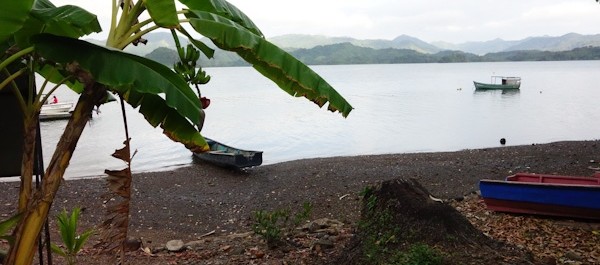
Where we left the dinghy on the beach, (near a bar called Pancho’s) there  were a few one-umbrella food and drink stands and something of a local community, with dogs,  who looked after things, including us. A near-toothless older  (I hope) gent  explained to me that those little jellyfish and plants would die and rot and fertilize the eggs of things that were growing in the sand and that “a different intelligence was at work than this one”, waving his hand dismissively toward the high-rises.  I thought he summed up the algal bloom versus development scenario pretty nicely. Also ‘they’ say that when the bloom is over, the water is super-clear and clean. Maybe the Semana Santa tourists will be blessed.

Mexican hairless dog is supposed to look like this.

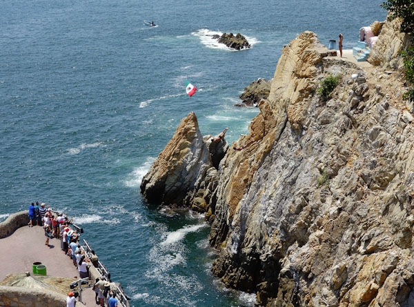
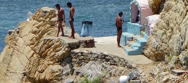
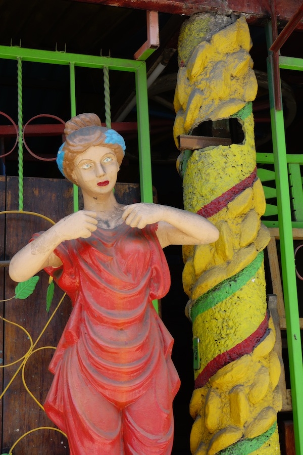
Then we did our part for the local economy by  attending the clavadistas, and eating in the restaurant while doing so, mainly so we could sit in the shade. The divers have been on several ‘extreme sport’ shows, the Hotel Mirador featured in an Elvis Presley movie, and the celebrities of the Jet Set and more modern eras have made appearances throughout the years since the first dives in 1937. Or at least  PR people sent photos. Aside from Roy Rogers and Trigger both signing the wall, here’s the one I liked best.

Frank Sinatra looking young and cool and hip

And now, ladies and gentlemen, the divers.

They ‘commute’ to the job site by jumping into the water from the observation terrace, swimming across, and climbing up the rock face to the shrine. Some, not all, pay obeisance to the Virgen.

Before their dives, the divers have to swim across and climb the cliff

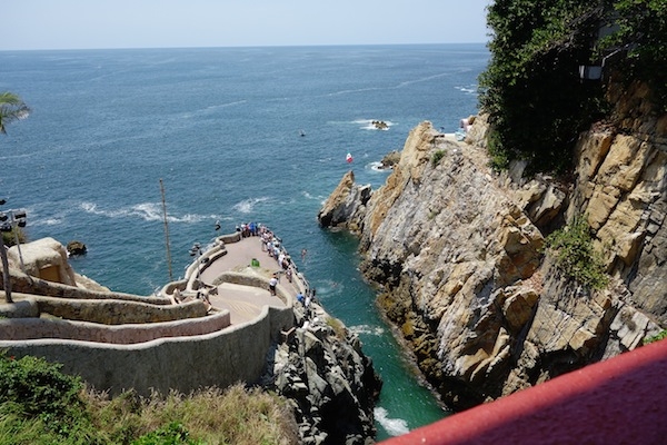
The top height, by the shrine, is 125 feet, and the average water depth is only 12 feet deep, so they wait for an incoming surge of water. And as you can see, the ‘out’ from the cliff is at least as important as the ‘down’.

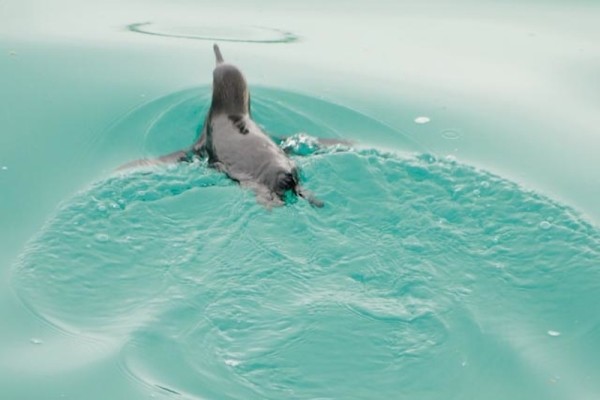
Believe it or not, no diver has died, although there have been injuries mainly related to miscalculated approaches to the water. And we noticed that a diver always waited at the bottom, moving in several times to clear away bits of debris from the landing zone. Luckily the algal bloom wasn’t in this area, although a patch was visible offshore. We heard that there is a 12-year old girl starting to dive, but didn’t see her.

When they finish, the divers sell t-shirts and mingle with the visitors. I wish I had been better prepared financially when I found them waiting for us as we emerged from the restaurant.

Acapulco Cliff Divers, three of the five who performed.

There is one show during the day, and four in the evening, with flaming torches. I’m really glad I went, but I’ll probably wake up in the night feeling vertiginous!

Acapulco 04-0220140402

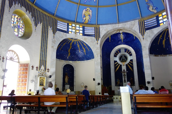
We walked down the hill to the old center, the Zocalo, where we found a nice church and a plaza under shady trees with a dozen shoe-shine booths spaced beneath them.

We probably should have taken a walk through the market with a very pleasant older man named Tony, but our next mission was the museum at the fort of San Diego.

It’s a well-done museum, (extra points for reader boards in English). Turns out Acapulco Bay has been a shelter and a destination ever since the Spanish first came here. Not such a surprise, really, since there are precious few good harbors along this coast, but I was unaware of the scope of Spain’s trade with the Philippines, in terms of ships, cargo and the hundreds of years it continued.

Spanish-era sailing ship on Philippines route

It took these ships nearly 100 days (departing for Manila in March or April) to go west, and 180 to return (departing July or August), for those that made it past the bad weather and pirate attacks.

Winding up our day, we walked back a ways along the beach-side road as it slowly turned into a seaside restaurant and shopping zone. A bonus was seeing a US chain that sold a brand of shampoo I like. Such are the smaller pleasures of travel.

I hope the friendly folks of Acapulco get lots of tourists for Semana Santa, and beyond, and I hope the visitors have as entertaining a time as we had there.

Look under the Mexican flag and a little to the right for the diver.

Too much wind, or not enough

We did a fair bit of motoring in south and central Costa Rica because there was just no wind. Then we got to the north end of the country where, at this time of the year, they often have too much wind. The Papagayos, as they’re called, arrive from the northeast thru gaps in the mountains of the isthmus downstream from the western Caribbean, which gets them from the frontal systems that bring eastern North America their winter storms. See, it really is all connected!

paorama Bahia Santa ElenaSo there we were in the snug shelter of Bahia Santa Elena, a national park, all checked out of Costa Rica and on our way to Nicaragua when the proverbial weather window opened. But wait, a hike to a waterfall with some new friends? The answer is always yes. In this case, the land looks pretty dry and it was puzzling that there could even be enough water for a bathtub in the dry stream bed that is the start of the path to the waterfall.

dry stream bed Santa Elena

But the water gradually filled in, and at the end, eureka, a modest water feature in a refreshing little pool.

Santa Elena waterfall

Our friends were going south, we were going north, and the Papagayos were supposed to start building the next day, but when? One of us was going to have a nice day.

southbound in the Papagayos This photo, courtesy of Pat on Always and Forever, is what our friends got; they ended up blowing downwind in 30-plus knots with no sails up at all. Our end of the stick was a little messier, because we were going where the wind and seas were coming from. Doug steered up into every lull, but it soon became apparent that we would be unable to lay Bahia San Juan del Sur, Nicaragua, our intended destination. Luckily, 7 or 8 miles further on, there was another bay, Pie de Gigante (Foot of the Giant), which we did manage to get close enough to to enter, and with a gigantic sigh of relief we stayed put until conditions moderated a day and a half later.

That gave us time to investigate  small losses in the engine’s fresh water cooling system. Eventually, rather than take the chance of doing damage, we decided to head straight for Mexico without dawdling in Nicaragua, El Salvador or Guatemala, and without using the motor. Thus began a trip that could theoretically be done by us on four good days, but took us more than twice that time, especially after we left the Papagayo wind zone.

It is easy to think of hours spent becalmed, rendered motionless by lack of wind, as hours wasted. In my opinion, the hours I wasted were the ones trying to make the boat move on zephyrs. You get to think a lot about the mariners of yore trying to make their way through these waters in heavier and more awkward vessels, without a stack of books to read. Too hot to cook, and we’re at the bottom of the propane tank anyhow. The fridge is turned off, and reveals itself to be the consumer of two-thirds of the power we use each day. Ships pass by on their way to Puerto Quetzal, or Acajutla or Corinto; the AIS tells us even when they’re too far off to see. Tick, tick, tick.

sailed route along Central American Pacific coast
In our 8-plus day, 440 mile trip, we had a day’s run of 28 miles, another of 40, and lots of tacking. Don’t worry about the Man Overboard icon though. That was a slip of the finger not a slip of the foot.

The glassy seas reveal more turtles than I’ve ever seen in a patch of ocean. Some of them had sea birds sitting on their backs. There was a wealth of dolphins, and, always at a distance, leaping dorados. No trash on this stretch of sea, thank goodness. Seabirds look us over, and some start to land and settle in.

Doug poked him with the boat hook and chucked buckets of water at him, but the booby wanted to stay, and did.


Maybe these are pink-footed shearwaters. They made about fifty passes before their successful landing on deck. But when one left, they all left, except the one who had wandered off under the dinghy, found the open hatch, and went down into the cabin. It sat calmly on the companionway steps, until I finally covered it with a towel and delivered it back to the open skies.
Maybe these are pink-footed shearwaters. They made about fifty passes before their successful landing on deck. But when one left, they all left, except the one who had wandered off under the dinghy. That bird found the open hatch, and went down into the cabin. It sat calmly on the companionway steps, until I finally covered it with a towel and delivered it back to the open skies.

Just so you don’t visualize all torpor and sloth, there were several adrenalin-filled spells as well. The most prosaic was the squall,  at 4am, under a dark cloud that first paralyzed us by stealing our wind, and then, like a spider waiting for the poison to take effect, pounced to shake us up. With heat lightning bright enough to read by in the clouds, but enough forks coming straight down to keep us sitting bolt upright below, not touching anything metal, it was a long half hour. Good thing we had plenty of sea room, being 40 miles offshore.

At least we thought we were alone. But the next night there was a little twinkle of light on the horizon, and then a minute later another, maybe not so imaginary after all, and maybe not so far away either. Peering into the dim as we ghosted along, we decided that the tiny flickers marked fishermen sound asleep or, more likely, their apparatus. It was nerve-wracking trying to steer around something we could only see once a minute, and a great relief at daybreak to not see anything at all.

Then, up from nowhere zoomed a lancha, come to inform us of their floating polypropylene line (holding up a sample!) in the water in front of us, and to show us which way we could go to get around it. In the next couple miles, 44 miles from shore, there were three more ‘fields’ of isolated floats and poles, not one with a light, and that’s the last we saw of fishing, that we knew of.

40 miles offshore, these fishermen came to steer us around their long lines.

The third excitement was the visit from the whale.  It’s a real thrill to see something so big and ‘charismatic’, to see the blow and watch the power of its movement. But, it’s close to frightening when all of that is nearly as big as we are, and a mere sixty feet away. I felt like this was a young and curious whale. I say young because its skin was clean and dark, not like the barnacled ones I’ve seen in photos, and curious because it circled us a couple times at close range and dove under the bow like a dolphin, before it lost interest and  vanished. I  tried to take a video, but this was not the time for learning how. Better to sit and absorb the ‘whale-ness’ of the moment, then to breathe a sigh, regret mixed with relief , when it was over.

And another sigh of relief as we ‘becalmed’ ourselves to a marina dock in Puerto Chiapas, Mexico. Our cooling problem was not a blown head gasket, or anything drastic, just a leaking o-ring and a loose fitting. And of course, we’re both better people for facing the wind, both kinds, unmediated by the convenience of ‘el motor’.

Gulf of Chiriqui and Western Panama

Bahia Honda's view of the mainland of Western Panama

Once around Punta Mala and the Azuero peninsula, we found ourselves in the Golfo de Chiriqui, which runs to the Costa Rica border at Cabo Burica. The Gulf is about 130 miles across, and contains several islands and island groups, including two national parks.

map of the Gulf of Chiriqui and Chiriqui Province Panama
Gulf of Chiriqui and Chiriqui Province Panama from Punta Burica to the Azuero Peninsula

Map western Panama and Golfo de Chiriqui Google

For a backdrop to this pretty coastline, you get the province of Chiriqui, described as the most diverse province of the already diverse country of Panama. The seaside mangrove forests yield to the coastal plain, the foothills and then the mountains of the Cordillero Central, and Volcan Baru, highest in the country. A number of rivers run down from the rain forests, sometimes via whitewater rapids, to end between the little volcanic cones and other bits of geological crumple beyond the shores of the Golfo. Top it all with the blue skies and puffy white clouds of the dry season, add slanting equinoctal light at sunrise and sunset and you’ve got a lovely and very lightly travelled cruising area.

What’s on the mainland of Western Panama

We knew from our inland travels that the Panamerican Highway runs mainly along the foothills of the Cordillero. Highways turn off towards the cooler higher lands. The resort town, ‘outdoor adventure capital’,  and coffee fincas of Boquete, and the vegetable and flower producing center of Cerro Punta, all lie in that direction. So does  the Volcan Baru, highest point in Panama and home of the  national bird, the amazing quetzal, plus a wealth of other birds, both rain forest natives and seasonal migrants. There’s a large national park, Amistad, which is shared with Costa Rica, full of hiking trails and wondrous sights. I’m a big fan of Western Panama’s Mountain Highlands, and in my birdwatching, bicycling, rafting and hiking incarnations hope to return there. But right now, we’re sailing, or motoring, as has lately been the case.

Along the shores of the Gulf, however, there are not many roads, or many towns, or many cruising boats either – we never saw another until we got to Boca Chica. A lot of the seaside is low-lying mangrove, split by rivers too shoaled or barred to be available to us unless the tide is just so. There are a few small towns, but the people who live here do so very quietly, it seems, getting around by cayuga and horseback, fishing and tending their crops. Here’s what it’s like a small way up the Rio Santa Lucia.

20140102 cleared land Rio Santa Lucia

Out in the Golfo de Chiriqui

And then there are the islands in the Gulf of Chiriqui. The largest is Coiba, once a prison island. “Do not under any circumstances pick up people in the water, and take precautions when anchoring there or at nearby islands” says our Zydler Panama Cruising Guide from  2001, and the occasional incident proved they really meant it. I like the story, however apocryphal, that the guards locked themselves in at night. It was a feared and ill-reputed place.

Now it’s a national park and reserve, said to be eighty-some percent first growth native forest, and described in superlatives, unique location unaffected by El Niño conditions, rare and unknown species, healthy coral, etc. (http://en.wikipedia.org/wiki/Coiba). I’d have loved to visit, but we heard that park permits were a superlative $100 per day for the boat plus an undetermined amount per person per day,  although some negotiation might be possible. So we went mainly to lesser bays and islands around the shoreline. Sport fishing boats and long-liners like to fish near Coiba’s protected waters. Coiba has several smaller attractive islands in its vicinity, also part of the park.

Other popular island groups are the Islas Paridas and the Islas Secas near Boca Chica. Some of these are also in a national park, but fees are lower. Sandy beaches, warm clear waters, palm trees, what’s not to like? At this time of year, the dry season months of January and February, and into March, the southwesterly swell is quiescent, and the strongest winds, if there are any, may be from the north, spilling over from the Caribbean. Anchorages that would be uncomfortable, or even untenable, in August or September, are available now, and bays open to the north might not be. It’s hard to know what to expect when there are surf spots right around the corner!

08 North, 082 West

Go away, seagulls, and take your droppings with youThere are people in this world who try to visit, or otherwise collect, the geographic points where latitude and longitude lines intersect. This photo is for you, to be filed as what the world looks like at  8 degrees north of the equator, and 82 degrees west of the Greenwich meridian. Those are the Islas Secas rising ahead, and Doug on the foredeck trying to discourage a seagull gathering.

Instead the gulls moved practically into the cockpit, and fouled our rain collection awning.

4 seagulls in quarter profile

Then there is Boca Chica

Boca Chica is one of the riverine gateways to the second largest city in Panama, which is David, itself the commercial gateway to the Mountain Highlands. David is well inland, on the Panamerica highway, and a normal person wouldn’t even think of approaching it from the water. But it is possible to weave your way through a tangle of sandbars, rocks and mangrove islands that, via several different channels, eventually leads to David’s small port town of Pedregal.

Boca Chica entry channel at low tide viewed from Boca Bravo restaurant

“I sure hope this chart is right” said Doug, as we were anchoring to wait for a higher tide, peering towards a bunch of rocks in a side channel which were about to disappear as the tide rose,  that were not on our main chart. Of course, you  know you wouldn’t be reading this if we hadn’t made it into Boca Chica totally uneventfully by following the red line in our cruising guide by the estimable Eric Bauhaus. We never saw less than 12 feet when there was just six feet of tide in, so we theoretically could have made it under most any circumstances. We don’t seem to have anchored atop the wreck of the sunken sailboat, and at the low tide the other day we located the four reefs we’d been visualizing ten feet under. We weren’t going on to Pedregal, so didn’t need to pass under the 60-foot nearly-invisible power line, or avoid the awash-at-low-tide clump of rocks cleaving the channel into a modest maelstrom just beyond.

And so life could be kind of sweet in Boca Chica. There are a few hotels of character on the waterfront (Boca Brava, Seagull Lodge), along with a couple fishing establishments. Sport fishing seems to be the major form of tourism along this coast, and boats such as these will go out every morning40 or 50 miles to Coiba or another special spot.

2 sport fishing boats at the weighing station Boca Chica Panama

Boca Chica the pueblo is pretty small: two docks,  a tienda and a half, a school and a church or two, plus a smouldering land fill now containing a trash bag of ours. It connects by road to the Panamerican Highway and David an hour away. It connects to cell towers, Claro and Movistar, but not Digicel. In the plaza/park hung a handwritten notice signed by the mayor indicating that anyone found inebriated there over the Christmas holidays would be locked up overnight.

DSC08406There is even a boat and storage yard, (this is not a photo of it, but rather of the Boca Chica waterfront) operated by Carlos Spragge. If you have your own trailer you can be hauled out there. Or you can take a mooring. Or dry out on a grid. This place is full of surprises.

Where the Surf Meets the Turf

One of the most surprising things we ran into was a cattle swim. Fifty or so animals had been brought by truck to a holding pen on the mainland. They were about to be sent to the island across the way, Boca Brava. At slack low tide, vaqueros on the island herded three vacas into the water, and a lancha mostly running backwards, outboard motor toward the cows, ‘encouraged’ them towards the mainland. Those three were the ‘tourist guides’ for the animals who were being moved towards ‘better grass’ on the island. Together the entire herd was driven back into the water and swam across. The head honcho in one lancha swung his lariat while someone in the repurposed water taxi prodded  with a pole to turn a reluctant participant. Cows can swim!

cattle herded across river to Boca Brava

The jefe of the caballeros was a talkative and friendly chap. Later someone asked me if  I had bought property from him. Seems like a rancher’s dream might be to sell some ‘appreciated’ land to someone whose dream would be living alone off the grid on an island facing the ocean. He’s seen it happen before. However, I already live that way, and when I weary of the view, my island (Galivant) can move. I did quite like the view in Western Panama, but it’s time to turn towards Costa Rica.

Stars for Christmas at Punta Mala and Cebaco, Panama

Open CPN chart of track around Punta Mala Panama

While much of the world was awash in Christmas wrapping paper and the rest snarled in daily routine, the two souls aboard Galivant were at sea, making their way around Punta Mala, Panama, moving towards Costa Rica from Las Perlas, a trip of about 175 nautical miles which took us a day, a night and a day, basically, of sailing. Our track is the one going off the page to the west (left); the other is our inbound route from the Galapagos back in August.

As you might guess by the name of it -Bad Point, Evil Point- there are some issues.The winds can be accelerated to a howl there and the seas contrary, and short and steep, while the tidal current will most likely turn on you at some point during the trip. Add a lot of shipping traffic bound to and from the Panama Canal, plus seemingly-oblivious fishing boats, and you’ll be on high alert during this particular passage.

Rounding Punta Mala

However, we had a pretty good time of it. There was just enough wind, and it was on the quarter, which is our best point of sail both in terms of speed and comfort. Within an hour of leaving we had the gift of a “just-right-sized” mahi mahi in the fridge, caught on a sparkly lime green plastic squid that looked much like the mahi herself. The dry season in Panama seems to have begun, so those piles of clouds overhead for months, (the dark ones spewing lightening and rain) were nowhere in evidence.

Our Christmas day was glorious and bright, and the night even better, so, so, SO many stars, and brilliant constellations strewn on carpets of them. Then, for a different perspective, the heavens offered up “half a moon for half a night”. All in all, it was a fine way to spend the holiday.

In the wee hours of Boxing Day though, someplace off Punta Piedra, the next point around from Punta Mala, we did run into a patch of ‘devil water’ with rude and unsynchronized seas tossing us about. It didn’t last that long, thankfully. Sturgeron, my favorite seasickness remedy, also serves as a magic placebo and calmative.

What shipping lanes?

We passed probably two dozen ships in the vicinity of the point. We couldn’t guess how far in or out we should be to avoid them and there seems to be no traffic separation scheme. As a sailboat sailing, we supposedly have the right of way, but our 13-meter little peanut shell, even at eight knots of speed, would be as nothing to a class A 500-foot steel box laden with thousands of shipping containers and moving at twenty knots. We try not to lose sight of that essential fact.

So we just maintained our course and speed, and kept our eyes peeled, with both of us in the cockpit much of the night ready to change course or slow down. At one point we had a ship 2 miles to port and another 3 miles to starboard, which sounds farther than it looks from the deck of a small boat! But thanks to the technological marvel that is AIS we could see that the starboard ship had actually altered his course 12 degrees and would clear us easily.

AIS, The Automatic Identification System (AIS) is an automatic tracking system used on ships and by vessel traffic services (VTS) for identifying and locating vessels by electronically exchanging data with other nearby ships, AIS base stations, and satellites. So says Wikipedia.

The information comes to us via a VHF antenna hooked to an AIS receiver and display unit. We can usually see the vessels’s name, course and speed, destination, the closest calculated point and time of approach, and monitor their changes. That sure takes some of the worry out of being close!

The fishing fleet around here is distinctive. They don’t appear as AIS targets because they are not required to (less than 300 tons and not carrying passengers); but they do flicker and sparkle sometimes, as if they are carrying blue party lights in the air behind them. We always assume that the fishing boats are fishing, not watching, but this close to so much shipping I’ll bet even they keep their eyes open.

Isla Cebaco, Western Panama

With the excitement over, but the weather still clean and sparkling, if a bit scarce of wind by sunrise, we continued on around the third point of the peninsula, Punta Mariato, and into an anchorage on the southwest end of a big, seemingly empty but conveniently located island called Cebaco.
Cebaco sunset with gulls on mooring
Right where you would chose to anchor there are about a dozen moorings. When the world sees the wisdom of making Doug its emperor, there will be no more of this kind of thing, I can assure you. Not knowing anything about the moorings, we can’t use them, with no one on them, they’re just a waste/inconvenience/hazard, and they make it hard for any but the cognoscenti to find a sheltered spot to stop. Hard, but in this case not impossible – there is good bottom and enough room in these conditions (northerly winds, no southwesterly swell) to anchor to shoreward of them and that’s what we did.

Sportfishing Club

Cebaco Bay Sportfishing Club fuel and party boat Then, as if to confirm that the solstice, or the holiday season, or the close of the calendar year, really does include the start of the dry season,  the next morning the fuel barge arrived. After a brief chat with the captain we learned that this part of the bay is owned by the Cebaco Bay Sportfishing Club, and this their vessel provides re-fueling for sportfishing boats traveling between Panama City and Costa Rica. They rent out the moorings, provide accommodation aboard for 14 people, and have a bar and kitchen both on board and ashore.They will be there until November; their busiest time is around Holy Week. Sounds like they might like to expand the operation to include more facilities ashore, while keeping the land ‘natural’, but the signs for the environmental impact statements date from 2010, so there’s no rush!

Cebaco Clearing the water collection filter
Here’s Doug cleaning the strainer upstream of the little waterfall. There were tiny tadpoles and crayfish too, appropriate to the size of the reservoir

‘You’re welcome to walk around ashore, go to the waterfall, help yourselves’ he said, and so of course we did. A very small waterfall but it was enough to overflow their storage tanks down the hill, so we took a nice outdoor shower, walked the beach, checked out the property, and smelled the evocative springtime aroma of newly flowering trees. It’s nice to be in Western Panama! dead starfish dancing across sand beach low tide Cebaco

Puerto Villamil, Isabela, Galapagos

aerial view Puerto Villamil courtesy redmangrove.com

Puerto Villamil, with its 3,000 or so people, in a district roughly ten blocks deep and the equivalent of maybe twenty blocks long, is the only town on Isabela, the largest island in the Galapagos. Tourism is the World Tortoise, or Atlas, supporting its economy. Restaurants, small hotels and guest houses, dive trips, boat and land tours,  a farmer’s market for seasonal produce from the few farms on the slopes of the volcano, some kind of fishing, and a good number of tourists in for the day from their excursion boats, are what make the wheels turn here. It’s a pleasant low-keyed place where we stayed a week or two in July, when the ocean currents bring cool water and mandate wetsuits for swimming, at least for me. I was going to say it was our favorite island, but let’s just call it neck and neck. Each island we visited, Santa Cruz and San Cristobal being the others, had something to recommend it, and so much depends on the people you meet.

inside Catholic church local art palm trees tortoise stained glass bluefooted booby frigatebird Puerto Villamil post office


Acoustic Ecology

Among the people we met was a group of students from the University of Miami. They were under the supervision of a sound engineer, Colby Leider, (“he’s famous!” one student told us), and a former NY Times reporter, Joseph Treaster (“he’s famous too!”), and were learning to listen and record. An expensive liberal arts education, but useful things to know, don’t you think? Mr. Treaster’s students of cross-cultural communication were writing short pieces to be published at themiamiplanet.org. Last year’s students wrote about the nail parlor, and a local surfing contest,  for example.

I learned also that there’s more to making soundscapes than just dangling one’s smartphone into the tortoise corral as I had been doing. I was hoping to share with you the measured scrape of carapace over dry ground, but I got mainly little splashes of bird song; my target tortoise outlasted my phone battery. But Dr. Leider told me to persist- there is much that has been done with smartphone technology, he said.

Turns out I’ve been deaf to the uses of sound. Sound engineering (it’s in the music department) is full of fascinating projects.  For example, what level of urgency should the various alarms in a hospital convey? Acoustic documentary: what can be learned about the state of a forest by listening to insects after a logger invasion? It’s a meaty major compared to the one I chose, political science, which, too late, revealed itself to be mainly unappetizing gristle and fat. You can read more here about Dr. Leider and his work: http://ccs.miami.edu/?p=4369.

Boats and Harbor

The small boat harbor, and the anchorage, are a fifteen-minute walk out of town, to the right in the aerial photo, from redmangrove.com’s blog, at the top of the post. For a while all entrance three buoys stood on the beach in freshly-painted splendor, but eventually, and  with great merriment, they were towed into position.
Isabela-130706-yellow red buoy croppedresized navy men riding freshpainted buoy


The approach to the anchorage is pretty straightforward, if you don’t try to go too far in, because there are some low-tide surprises. After that it’s a rather circuitous dinghy trip ashore, as the inner part of the harbor is full of  small reefs and sandbanks. You’re only seeing a small part of that here.

Isabela Anchorage excursion boats and rocks-130717-0320

The tour excursion boats in the outer anchorage have done it so often they can do it in OUR sleep. We’d wake up in the morning with a “where did that come from” moment, or several. The inter-island boats, which look like sport-fishing boats about 40 feet long, outfitted with benches and lifejackets, took some astonishing shortcuts at mid-tide. I don’t think the water in the break in this reef is much more than 4 feet deep where this fellow is  barreling through, because I had been snorkelling nearby when I saw him coming and skedaddled!   ferry taking shortcut Isabela 130714 morning Isabela excursions getting underway


Solutions to conservation issues

Among the most curious things we saw in Puerto Villamil were several cut-up fishing boats. Isabela is one of the places where there was direct, personal and heated conflict in the last decade between the Galapagos National Park people and the fishers whose activities were being monitored in the interests of conservation and sustainability. One confrontation involved the mayor of Isabela cutting down slow-growing old mangroves, then filling over them, to make a (potential) dock for the tourists to come to see the slow-growing old mangroves, their associated penguins etc.

Isabela 2-130717 cut up boat

The government and its agencies are supposed to be conserving Galapagonian resources, but often claim they have no resources of their own to devote to the cause. And of course opinions vary as to the best use of any resource, and some voices are louder than others. That’s politics! So sometimes the National Park is assisted by international government, aid, or conservation groups. For example, anyone familiar with the group Sea Shepherd will know them to be a kind of guerrilla activist marine wildlife conservation group. Apparently, one of their activities was to fund sniffer dogs on Isabela, which we saw and wondered about as they met water taxis at the dock. The dogs and their military handlers looked so incongruous in that setting. It’s a small operation, but I’d love to know what the effect of it has been. Maybe one of the Miami students could inquire….

The dogs  are supposed to detect illegally harvested wildlife items, sea cucumbers and shark fins for starters,  and prevent them from being smuggled out.  Since part of the definition of fisher is ‘boat of my own’, and rumor has it that the offending fishers camp on the far off and desolate shorelines, cutting mangrove to smoke and preserve their catch, I wonder how effective the dockside sniffer dogs are. But as usual, I don’t know a thing and would willingly stand corrected in all aspects. Who’s got the details out there?

Lawns of  lava

Outer Puerto Villamil’s landscape is so different from the lawny, leafy Maryland exurbs I’m familiar with. Here your cinderblock house would rest on a lava lawn; the cinderblocks are fabricated just a few blocks away.

lava lawn and house Isabela-130711-0187

Diego Dueño (Harry Homeowner) doesn’t have to worry about mowing, or tree trimming. He can mark the boundaries with spray paint, and doesn’t worry about drainage much either. A bright sunny day would be awfully hot in a neighborhood like this, though, and any kind of ball game hard to sustain.

Marine Iguanas

Finally, what’s a blog post about the Galapagos without some endemic animals? Here are the special Galapagos marine iguanas. They were not particular favorites of Charles Darwin’s, who described them thus:

The black Lava rocks on the beach are frequented by large (2–3 ft [60–90 cm]), disgusting clumsy Lizards. They are as black as the porous rocks over which they crawl & seek their prey from the Sea. I call them ‘imps of darkness’. They assuredly well become the land they inhabit., as quoted in Wikipedia entry Marine Iguana.

marine iguanas baskingBeing reptiles, they spend a lot of time basking in the sun, and they have some favorite places in Puerto Villamil, like on the sunny rock wall of this beach-front hostel at the western edge of Puerto Villamil. In their off hours, they sometimes go across the street (at the “iguana crossing” sign, where traffic is slowed for them by a rope hawser speed bump), to the mangroves at a nearby salt lagoon.

But mainly they go swimming in the ocean, to eat seaweed and algae off underwater rocks. They can stay submerged for 20 minutes. The early-arriving iguanas would not have survived the desolate landscape without this adaptation.

They do need to warm up afterwards, and while they’re doing so they often snort or sneeze to clear the salt out of their nostrils. It’s a disconcerting sound – I asked the park ranger if they were unwell; she assured me not. They also eat sea lion droppings.

I can’t say I find them very appealing myself, except maybe in this picture, where they look like they’re posing for a movie poster. I can’t think of a good caption for the show, but if you can, leave it in the comments!

Marine iguanas coming out of the ocean

A few more pictures will close the Isabela chapter. Thanks again to redmangrove.com for the aerial photo at the top of the page. We ourselves are still in Panama, about to move north-ish (via the southwest-ish) but the next post will probably still be of Ecuador. Thanks for stopping by!